Novato Creek

Last updated
Novato Creek
Novato Creek 5.jpg
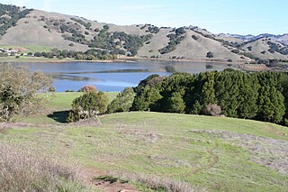
Novato Creek in summer 2016
Relief map of California.png
Red pog.svg
Location of the mouth within California
Native name Spanish: Cañada de Novato [1]
Location
Country United States
State California
Region Marin County
Cities Novato, Bel Marin Keys
Physical characteristics
SourceNortheastern Marin County
 - locationabove Novato, California
 - coordinates 38°8′36″N122°38′33″W / 38.14333°N 122.64250°W / 38.14333; -122.64250 [2]
 - elevation1,100 ft (340 m)
Mouth  
 - coordinates
38°5′43″N122°29′18″W / 38.09528°N 122.48833°W / 38.09528; -122.48833 Coordinates: 38°5′43″N122°29′18″W / 38.09528°N 122.48833°W / 38.09528; -122.48833 [2]
 - elevation
0 ft (0 m)
Basin features
Tributaries 
 - leftBowman Canyon Creek
 - rightVineyard Creek, Arroyo Avichi, Arroyo San Jose

Novato Creek is a stream in eastern Marin County, California, United States. It originates in highlands between Red Hill and Mount Burdell above the city of Novato, California, and flows 17 miles (27 km) before emptying into San Pablo Bay south of Petaluma Point.

Stream A body of surface water flowing down a channel

A stream is a body of water with surface water flowing within the bed and banks of a channel. The stream encompasses surface and groundwater fluxes that respond to geological, geomorphological, hydrological and biotic controls.

Marin County, California County in California, United States

Marin County is a county located in the San Francisco Bay Area of the U.S. state of California. As of the 2010 census, the population was 252,409. Its county seat is San Rafael. Marin County is included in the San Francisco-Oakland-Hayward, CA Metropolitan Statistical Area across the Golden Gate Bridge from San Francisco.

United States Federal republic in North America

The United States of America (USA), commonly known as the United States or America, is a country comprising 50 states, a federal district, five major self-governing territories, and various possessions. At 3.8 million square miles, the United States is the world's third or fourth largest country by total area and is slightly smaller than the entire continent of Europe's 3.9 million square miles. With a population of over 327 million people, the U.S. is the third most populous country. The capital is Washington, D.C., and the largest city by population is New York City. Forty-eight states and the capital's federal district are contiguous in North America between Canada and Mexico. The State of Alaska is in the northwest corner of North America, bordered by Canada to the east and across the Bering Strait from Russia to the west. The State of Hawaii is an archipelago in the mid-Pacific Ocean. The U.S. territories are scattered about the Pacific Ocean and the Caribbean Sea, stretching across nine official time zones. The extremely diverse geography, climate, and wildlife of the United States make it one of the world's 17 megadiverse countries.

Contents

History

Miwok and Pomo people were the earliest residents of the watershed. Olompali, the site of a significant Miwok village, is located at the southern base of Mt. Burdell. In 1839 Mexican land grants established Rancho Novato. Grazing brought a host of invasive annual grassland plants that eventually dominated the deep-rooted native perennial grasses and altered runoff rates.

Miwok

The Miwok are members of four linguistically related Native American groups indigenous to what is now Northern California, who traditionally spoke one of the Miwok languages in the Utian family. The word Miwok means people in the Miwok language.

Pomo indigenous people of California

The Pomo are an indigenous people of California. The historic Pomo territory in northern California was large, bordered by the Pacific Coast to the west, extending inland to Clear Lake, and mainly between Cleone and Duncans Point. One small group, the Northeastern Pomo of the Stonyford vicinity of Colusa County, was separated from the core Pomo area by lands inhabited by Yuki and Wintuan speakers.

By 1856 extensive apple orchards occupied the valley floor and many of the creeks had been channelized for irrigation. The tidal marshlands had also been diked and drained for agriculture (primarily oat-hay production) by the middle of the nineteenth century. In the 1880s the creek was dredged to make way for schooners bound for San Francisco.

Novato, one of the four townships in existence when Marin County formed in 1850, was incorporated in 1960. Ground was broken for Hamilton Air Force Base in 1932 and dedicated in 1935 (the base was decommissioned in 1974, and designated as a historic district in 1988). [3]

Land use changes have increased sediment supply and decreased sediment transport, causing the lower reaches of Novato Creek to become shallower. In addition, the construction of Stafford Dam (starting in 1952 [4] ) increased its drainage area by 5.2 square miles (13 km2). [5]

Sediment Particulate solid matter that is deposited on the surface of land

Sediment is a naturally occurring material that is broken down by processes of weathering and erosion, and is subsequently transported by the action of wind, water, or ice or by the force of gravity acting on the particles. For example, sand and silt can be carried in suspension in river water and on reaching the sea bed deposited by sedimentation and if buried, may eventually become sandstone and siltstone.

Sediment transport The movement of solid particles, typically by gravity and fluid entrainment

Sediment transport is the movement of solid particles (sediment), typically due to a combination of gravity acting on the sediment, and/or the movement of the fluid in which the sediment is entrained. Sediment transport occurs in natural systems where the particles are clastic rocks, mud, or clay; the fluid is air, water, or ice; and the force of gravity acts to move the particles along the sloping surface on which they are resting. Sediment transport due to fluid motion occurs in rivers, oceans, lakes, seas, and other bodies of water due to currents and tides. Transport is also caused by glaciers as they flow, and on terrestrial surfaces under the influence of wind. Sediment transport due only to gravity can occur on sloping surfaces in general, including hillslopes, scarps, cliffs, and the continental shelf—continental slope boundary.

Aggradation The increase in land elevation due to the deposition of sediment

Aggradation is the term used in geology for the increase in land elevation, typically in a river system, due to the deposition of sediment. Aggradation occurs in areas in which the supply of sediment is greater than the amount of material that the system is able to transport. The mass balance between sediment being transported and sediment in the bed is described by the Exner equation.

Watershed and course

Novato Creek in summer 2016 Novato Creek 3.jpg
Novato Creek in summer 2016

The Novato Creek watershed basin is 45 square miles (120 km2). Novato Creek is joined (heading downstream) by six major tributaries along its 17-mile (27 km) length: Leveroni, Bowman Canyon, Warner, Vineyard Creek, Arroyo Avichi, Arroyo de San Jose, and Simmonds Slough. [3] Arroyo San Jose itself has two tributaries. It is joined on the left by Ignacio Creek and on the right by Pacheco Creek (at Pacheco Pond) just before entering Novato Creek. Novato Creek and its tributaries are often eroded, incised channels. It is one of the driest watersheds in Marin County.

Novato Creek begins to the west of Mount Burdell and initially descends to the west. However, it soon turns south, then east to feed into Stafford Lake. It descends through the city of Novato. East of Novato it crosses under U.S. Route 101 and State Route 37 before flowing through Bel Marin Keys and entering the northwest corner of San Pablo Bay.

Stafford Lake County Park

Stafford Lake County Park is a park in the Marin County, California parks system, managed by the Marin County Department of Parks and Open Space. The 139 acres (0.56 km2) park is located in Novato, 33 miles (53 km) north of San Francisco California and is in a classic northern California valley among grazing farmland.

Novato, California City in California, United States

Novato is a city in northern Marin County, in the North Bay region of the San Francisco Bay Area, in the U.S. state of California. As of the 2010 United States Census, its population was 51,904. Novato is located about 10 miles (16 km) northwest of San Rafael and about 30 miles (48 km) north of San Francisco on U.S. 101. Novato has been called one of the best places to live in the U.S.

California State Route 37 highway in California

State Route 37 is a state highway in the northern part of California that runs 21 miles (34 km) along the northern shore of San Pablo Bay. It is built from U.S. Route 101 in Novato and runs through the southern tip of Sonoma and Solano Counties to Interstate 80 in Vallejo. It serves as a vital connection between the four counties of the North Bay Area, north of San Francisco; Sonoma Raceway and Six Flags Discovery Kingdom are accessible from Route 37.

Just before entering the Bay, Novato Creek flows along Bel Marin Keys, an affluent community on the creek and a series of adjacent lagoons, at an elevation of 10 feet (3.0 m) above sea level.

Ecology

Salmonids (steelhead trout (Oncorhynchus mykiss) and Chinook salmon (Oncorhynchus tshawytscha)) are also found within the Novato Creek watershed. The Novato Creek watershed is known to support 10 extant fish species (6 native and 4 introduced). Native species include California roach, Sacramento pikeminnow, Sacramento sucker, steelhead, threespine stickleback, and Prickly sculpin. Introduced species include rainwater killifish, western mosquitofish, striped bass, and green sunfish. [3] Fawcett (2000 and 2006) also noted the presence of non-native bluegill, largemouth bass, brown bullhead, chameleon goby, and inland silverside. Historically, the watershed supported native tidewater goby; the last collection occurred in 1945. [6]

Wetland-adapted species occur along Rush Creek and the lower Novato Creek wetlands. Noteworthy species include San Pablo song sparrow, California black rail, saltmarsh common yellowthroat, and California clapper rail. Western pond turtles and naturalized bullfrogs are known to occur in Novato Creek. [3]

Bridges

The Redwood Boulevard bridge over Novato Creek Novato Creek 2.jpg
The Redwood Boulevard bridge over Novato Creek

Novato Creek is spanned by many bridges, including: [7]

See also

Related Research Articles

Arroyo Hondo (Santa Clara County, California) river in the United States of America

Arroyo Hondo is a northwestward-flowing 13.0-mile-long (20.9 km) river in Santa Clara County, California, United States, that lies east of Milpitas. The area is privately owned by the San Francisco Water Department and is closed to public access because of its usage as drinking water. Bounded to the east by Oak Ridge and to the west by Poverty Ridge, Arroyo Hondo empties into the Calaveras Reservoir where it joins Calaveras Creek. It is formed by the confluence of Smith Creek and Isabel Creek which drain the west and east slopes of Mount Hamilton, respectively.

Stevens Creek (California) river in the United States of America

Stevens Creek is a creek in Santa Clara County, California. The creek originates in the Santa Cruz Mountains on the western flank of Black Mountain in the Monte Bello Open Space Preserve near the terminus of Page Mill Road at Skyline Boulevard. It flows southeasterly through the Stevens Creek County Park before turning northeast into Stevens Creek Reservoir. It then continues north for 12.5 miles through Cupertino, Los Altos, Sunnyvale and Mountain View before emptying into the San Francisco Bay at the Whisman Slough, near Google's main campus.

Petaluma River river in California

The Petaluma River is a river in the California counties of Sonoma and Marin that becomes a tidal slough for the majority of its length. The headwaters are in the area southwest of Cotati. The flow is generally southward through Petaluma's old town, where the waterway becomes navigable, and then flows another 10 mi (16 km) through tidal marshes before emptying into the northwest corner of San Pablo Bay.

Lagunitas Creek river in the United States of America

Lagunitas Creek is a 24 miles (39 km)-long northward-flowing stream in Marin County, California. It is critically important to the largest spawning runs of endangered coho salmon in the Central California Coast Coho salmon Evolutionary Significant Unit. The stream's headwaters begin on the northern slopes of Mt. Tamalpais in the Coast Range and terminate in southeast Tomales Bay, 1.5 miles (2.4 km) northwest of Point Reyes Station, California. Lagunitas Creek feeds several reservoirs on Mt. Tamalpais that supply a major portion of the county's drinking water.
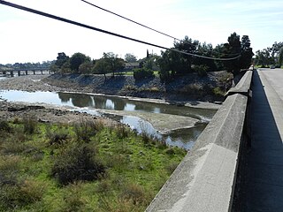
Alameda Creek river in the United States of America

Alameda Creek is a large perennial stream in the San Francisco Bay Area. The creek runs for 45 miles (72 km) from a lake northeast of Packard Ridge to the eastern shore of San Francisco Bay by way of Niles Canyon and a flood control channel.

Olompali State Historic Park place in California listed on National Register of Historic Places

Olompali State Historic Park is a 700-acre (2.8 km2) park in Marin County, California, 3.5 miles (5.6 km) north of Novato, California, overlooking the Petaluma River and San Pablo Bay. In 1977 the State of California purchased Rancho Olompali and made it into a state historic park. The foundations of two early adobe brick houses are preserved in the park. The Burdell two-story frame house, built in the 1870s serves as the ranger station. Associated ranch buildings include barns, a blacksmith shop, a saltbox house and a ranch superintendent's house.

Laguna de Santa Rosa wetland in Sonoma County, California, USA

The Laguna de Santa Rosa is a 22-mile-long (35 km) wetland complex that drains a 254-square-mile (660 km2) watershed encompassing most of the Santa Rosa Plain in Sonoma County, California, United States.

Redwood Creek (Marin County) river in United States of America

Redwood Creek is a short but significant stream in Marin County, California. 4.7 miles (7.6 km) long, it drains a 7-square-mile (18 km2) watershed which includes the Muir Woods National Monument, and reaches the Pacific Ocean north of the Golden Gate at Muir Beach.

Arroyo Corte Madera del Presidio river in the United States of America

Arroyo Corte Madera del Presidio is a 4.1-mile-long (6.6 km) year-round stream in southern Marin County, California, United States. This watercourse is also known as Corte Madera Creek, although the actual stream of that name flows into San Francisco Bay further north at Point San Quentin. This watercourse has a catchment basin of about 8 square miles (21 km2) and drains the south-eastern slopes of Mount Tamalpais and much of the area in and around the town of Mill Valley; this stream discharges to Richardson Bay.

Redwood Creek (San Mateo County) creek in Redwood City to the San Francisco Bay

Redwood Creek is a 9.5-mile-long (15.3 km) perennial stream located in San Mateo County, California, United States which discharges into South San Francisco Bay. The Port of Redwood City, the largest deepwater port in South San Francisco Bay, is situated on the east bank of Redwood Creek near its mouth, where the creek becomes a natural deepwater channel.

Wildcat Creek (California) river in the United States of America

Wildcat Creek is a 13.4-mile-long (21.6 km) creek which flows through Wildcat Canyon situated between the Berkeley Hills and the San Pablo Ridge, emptying into San Pablo Bay in Contra Costa County, northern California.

Nicasio Creek river in the United States of America

Nicasio Creek is an 11.9-mile-long (19.2 km) stream in Marin County, California, United States and is the primary tributary of Lagunitas Creek, which flows, in turn, into Tomales Bay, and the Pacific Ocean. The Nicasio Reservoir, formed in 1961 by Seeger Dam, is located on this stream.

San Gregorio Creek river in the United States of America

San Gregorio Creek is a river in San Mateo County, California. Its tributaries originate on the western ridges of the Santa Cruz Mountains whence it courses southwest through steep forested canyons. The San Gregorio Creek mainstem begins at the confluence of Alpine and La Honda Creeks, whence it flows 12 miles (19 km) through rolling grasslands and pasturelands until it meets the Pacific Ocean at San Gregorio State Beach. It traverses the small unincorporated communities of La Honda, San Gregorio, Redwood Terrace and Sky Londa.

Upper Penitencia Creek is actually one of two creeks by the name Penitencia Creek in the northeastern Santa Clara Valley of Santa Clara County, California. They are both tributaries of Coyote Creek. The upper creek was diverted southwestward, connecting it directly to Coyote Creek ca. 1850 by a farmer to irrigate his fields, permanently splitting Upper Penitencia Creek from Lower Penitencia Creek. Upper Penitencia Creek drains the western slopes of Mount Hamilton of the Diablo Range, and passes through Alum Rock Park, before ending at its confluence with Coyote Creek at Berryessa Road. In December 2018, the San Francisco Estuary Institute published a report commissioned by the Santa Clara Valley Water District to establish a vision for Upper Penitencia Creek's lower four miles focusing on ways "to expand flow conveyance and flood water storage from the Coyote Creek confluence upstream to the Dorel Drive bridge in a manner that works with the existing landscape features and supports habitats for native species".

San Antonio Creek is a northward then eastward-flowing stream in the California, United States, counties of Marin and Sonoma that forms part of the boundary between those counties. It empties into the tidal portion of the Petaluma River.

Estero de San Antonio stream in the counties of Marin and Sonoma in California

Estero de San Antonio is a stream in the northern California counties of Marin and Sonoma which empties into Bodega Bay.

Miller Creek (Marin County, California) river in the United States of America

Miller Creek is a 7.6-mile-long (12.2 km) stream in eastern Marin County, California, United States. It originates on Big Rock Ridge and empties into San Pablo Bay east of Marinwood. A middle school called Miller Creek Middle School was named after the creek and is home to 6th, 7th, and 8th graders.
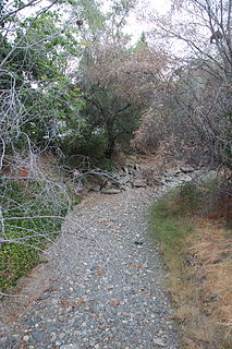
Saratoga Creek river in the United States of America

Saratoga Creek is a north-northeast flowing creek in Santa Clara County, California.

Corte Madera Creek (Marin County, California) river in United States of America

Corte Madera Creek is a short stream which flows southeast for 4.5 miles (7.2 km) in Marin County, California. Corte Madera Creek is formed by the confluence of San Anselmo Creek and Ross Creek in Ross and entering a tidal marsh at Kentfield before connecting to San Francisco Bay near Corte Madera.
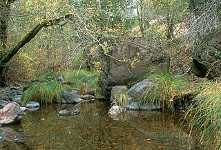
San Anselmo Creek river in the United States of America

San Anselmo Creek is an eastward-flowing stream that begins on the eastern flank of Pine Mountain in the Marin Hills of Marin County, California. At its confluence with Ross Creek, it becomes Corte Madera Creek.

References

  1. Gudde, Erwin G (2010). California Place Names: A Geographical Dictionary. Berkeley, California: University of California Press. p. 264.
  2. 1 2 U.S. Geological Survey Geographic Names Information System: Novato Creek
  3. 1 2 3 4 "Novato Creek Watershed". Marin County. Retrieved 2010-08-31.
  4. "Novato History Museum". Archived from the original on 2007-12-26. Retrieved 2008-01-17.
  5. "Geomorphic Studies by Laurel Collins" . Retrieved 2008-01-17.
  6. Robert A. Leidy (2007). Ecology, Assemblage Structure, Distribution, and Status of Fishes in Streams Tributary to the San Francisco Estuary, California (Report). San Francisco Estuary Institute. Retrieved 2010-08-31.
  7. "National Bridge Inventory Database".