Marin County is located in the northwestern part of the San Francisco Bay Area of the U.S. state of California. As of the 2020 census, the population was 262,231. Its county seat and largest city is San Rafael. Marin County is across the Golden Gate Bridge from San Francisco, and is included in the San Francisco–Oakland–Berkeley, CA Metropolitan Statistical Area.
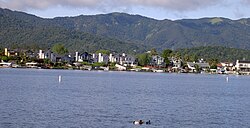
Novato is a city in Marin County, California, United States, situated in the North Bay region of the Bay Area. At the 2020 census, Novato had a population of 53,225.

Point Pinole Regional Shoreline is a regional park on the shores of the San Pablo Bay, California, in the United States. It is approximately 2,315 acres (9.37 km2) in area, and is operated by the East Bay Regional Park District. It includes the Dotson Family Marsh and the Point Pinole Lagoon and hosts the North Richmond Shoreline Festival.
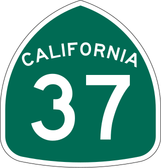
State Route 37 is a state highway in the U.S. state of California that runs 21 miles (34 km) along the northern shore of San Pablo Bay. It serves as a vital connection in the North Bay region of the San Francisco Bay Area, running from U.S. Route 101 in Novato, through northeastern Marin County, and the southern tips of both Sonoma and Solano Counties to Interstate 80 in Vallejo. Sonoma Raceway and Six Flags Discovery Kingdom are accessible from Highway 37.

Nicasio is an unincorporated community and census-designated place in Marin County, California, United States. It is located 8 miles (13 km) west-southwest of Novato, at an elevation of 194 feet (59 m). As of the 2020 census the CDP population was 81, while population estimates for the surrounding area range from about 600 to about 900 people.
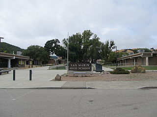
San Marin High School is a public high school located in Novato, California, in the United States.

The California State Coastal Conservancy is a non-regulatory state agency in California established in 1976 to enhance coastal resources and public access to the coast. The CSCC is a department of the California Natural Resources Agency. The agency's work is conducted along the entirety of the California coast, including the interior San Francisco Bay and is responsible for the planning and coordination of federal land sales to acquire into state land as well as award grant funding for improvement projects. The Board of Directors for the agency is made up of seven members who are appointed by the Governor of California and approved by the California Legislature, members of the California State Assembly and California State Senate engage and provide oversight within their legislative capacity.

Ballona Wetlands Ecological Reserve is a protected area that once served as the natural estuary for neighboring Ballona Creek. The 577-acre (2.34 km2) site is located in Los Angeles County, California, just south of Marina del Rey. Ballona—the second-largest open space within the city limits of Los Angeles, behind Griffith Park—is owned by the state of California and managed by the California Department of Fish and Wildlife. The preserve is bisected generally east-west by the Ballona Creek channel and bordered by the 90 Marina freeway to the east.

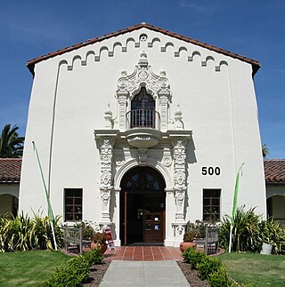
The College of Marin is a public community college in Marin County, California, with two campuses, one in Kentfield, and the second in Novato. It is the only institution operated by the Marin Community College District.
Greenbrae is a small unincorporated community in Marin County, California. It is located 1.5 miles (2 km) south-southeast of downtown San Rafael, at an elevation of 33 feet, and adjacent to U.S. Route 101 at the opening of the Ross Valley. Part of Greenbrae is an unincorporated community of the county while the remaining area is inside the city limits of Larkspur. The ZIP code is 94904, and is shared with the neighboring Census-designated place (CDP) of Kentfield. The community is in area codes 415 and 628.
San Quentin is a small unincorporated community in Marin County, California, United States. It is located west of Point San Quentin, at an elevation of 30 feet.

Lagunitas is an unincorporated community in Marin County, California. It is located 10 miles (16 km) southwest of Novato, at an elevation of 217 feet. Lagunitas is aggregated with Forest Knolls by the U.S. Census into the census-designated place (CDP) Lagunitas-Forest Knolls.

The Hamilton Wetland Restoration Project, now known as the Hamilton/Bel Marin Keys Wetlands Restoration, is a wetlands habitat restoration project at the former Hamilton Air Force Base—Hamilton Army Airfield (1930−1988) site and adjacent Bel Marin Keys shoreline, in Marin County, California.

Marin Transit is a public bus agency in Marin County, California, in the United States. Originally formed in 1964 as Marin County Transit District (MCTD). Marin Transit was re-branded on 30 July 2007 and now provides a variety of fixed-route and demand-response services using contractors. In 2023, the system had a ridership of 2,814,700, or about 8,800 per weekday as of the fourth quarter of 2023.

Paradise Cay, also known as County Service Area No. 29, is an unincorporated enclave, surrounded by the town of Tiburon in Marin County, California, United States, located 2 miles (3 km) south of Point San Quentin at an elevation of 23 feet. The waterfront community lies at the foot of the Tiburon Peninsula south of Corte Madera Creek along the San Francisco Bay. The community is in ZIP code 94920 and area code 415.

Novato Creek is a stream in eastern Marin County, California, United States. It originates in highlands between Red Hill and Mount Burdell above the city of Novato, California, and flows 17 miles (27 km) before emptying into San Pablo Bay south of Petaluma Point.
Chelsea Wetlands is a riparian marsh on lower Pinole Creek and a tidal wetland at its mouth on San Pablo Bay, in Contra Costa County, northern California. It is located within the city of Hercules, in the East Bay region of the San Francisco Bay Area.
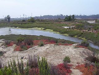
Whiteside Marsh is a coastal estuary marsh and wetlands on the northwestern shore of San Pablo Bay in northern Marin County, California. It is in and adjacent to the city of Novato and the Bel Marin Keys community, in the North Bay region of the San Francisco Bay Area.
Los Cerritos Wetlands is located in both Los Angeles County and Orange County in the cities of Long Beach, California, and Seal Beach, California. The San Gabriel River, historically and currently flows through the Los Cerritos Wetlands Complex.
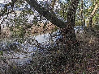
Rush Creek is a stream in eastern Marin County, California, United States. It originates on the north edge of Novato, California and flows 1.5 miles (2.4 km) northeasterly through wetlands into Black John Slough and then the Petaluma River. The name is associated with Peter Rush who bought land near Novato in 1862.