Geyserville, California

Last updated

Geyserville
GeyservilleStore.jpg
Geyserville, California
USA California location map.svg
Red pog.svg
Geyserville
Location within the state of California
Coordinates: 38°42′28″N122°54′9″W / 38.70778°N 122.90250°W / 38.70778; -122.90250
Country Flag of the United States (23px).png  United States
State Flag of California.svg  California
County Sonoma
Area
[1]
  Total4.588 sq mi (11.882 km2)
  Land4.588 sq mi (11.882 km2)
  Water0 sq mi (0 km2)  0%
Elevation
[2]
213 ft (65 m)
Population
 (2010) [3]
  Total862
  Density190/sq mi (73/km2)
Time zone UTC-8 (PST)
  Summer (DST) UTC-7 (PDT)
ZIP code
95441
Area code 707
FIPS code 06-29420
GNIS feature ID224138

Geyserville (formerly Clairville) is an unincorporated community and census-designated place (CDP) in Sonoma County, California, USA. Located in the Wine Country, Geyserville has a small selection of restaurants, bed and breakfasts, and wineries. Geyserville is located on California State Route 128, close to US Route 101. The population was 862 at the 2010 census.

Contents

History

Depot in Clairville (now Geyserville), 1885 Railroad depot in Clairville (now Geyserville), California (1885).jpg
Depot in Clairville (now Geyserville), 1885
Mural of Geyserville GeyservilleMural.jpg
Mural of Geyserville

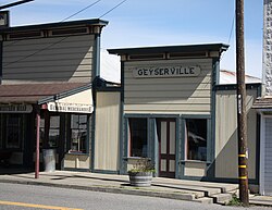
Geyserville, located on the Rancho Tzabaco Mexican land grant, owes its foundation to the discovery in 1847 of a series of hot springs, fumaroles, and steam vents in a gorge in the mountains of Sonoma County, California, between Calistoga and Cloverdale. This complex, which became known as The Geysers, soon became a tourist attraction, and a settlement grew up to provide accommodation and serve as a gateway to The Geysers. It was initially known as Clairville but subsequently renamed Geyserville. After the San Francisco and North Pacific Railroad was extended to Cloverdale in the 1870s, its trains stopped in Geyserville. [4]

Geography

According to the United States Census Bureau, the CDP covers an area of 4.6 square miles (11.9 km2), all of it land.

Demographics

Historical population
CensusPop.Note
1990 628
2010 862
2020 861−0.1%
2024 (est.)1,00316.5%
U.S. Decennial Census [5]

At the 2010 census Geyserville had a population of 862, although the official sign at the entrance to the town says "1,600" on August 8, 2014. The population density was 187.9 inhabitants per square mile (72.5/km2). The racial makeup of Geyserville was 609 (70.6%) White, 5 (0.6%) African American, 7 (0.8%) Native American, 14 (1.6%) Asian, 0 (0.01%) Pacific Islander, 192 (22.3%) from other races, and 35 (4.1%) from two or more races. Hispanic or Latino of any race were 328 people (38.1%). [6]

The census reported that 98.5% of the population lived in households and 1.5% lived in non-institutionalized group quarters.

There were 298 households, 108 (36.2%) had children under the age of 18 living in them, 169 (56.7%) were opposite-sex married couples living together, 26 (8.7%) had a female householder with no husband present, 22 (7.4%) had a male householder with no wife present. There were 22 (7.4%) unmarried opposite-sex partnerships, and 2 (0.7%) same-sex married couples or partnerships. 51 households (17.1%) were one person and 14 (4.7%) had someone living alone who was 65 or older. The average household size was 2.85. There were 217 families (72.8% of households); the average family size was 3.17.

The age distribution was 201 people (23.3%) under the age of 18, 71 people (8.2%) aged 18 to 24, 213 people (24.7%) aged 25 to 44, 293 people (34.0%) aged 45 to 64, and 84 people (9.7%) who were 65 or older. The median age was 39.9 years. For every 100 females, there were 116.0 males. For every 100 females age 18 and over, there were 122.6 males.

There were 325 housing units at an average density of 70.8 per square mile (27.3/km2), of which 58.4% were owner-occupied and 41.6% were occupied by renters. The homeowner vacancy rate was 1.7%; the rental vacancy rate was 0%. 55.7% of the population lived in owner-occupied housing units and 42.8% lived in rental housing units.

Transportation

Geyserville Avenue carries the designation of California State Route 128 until it routes along U.S. Route 101 to the north. The Northwestern Pacific right-of-way is expected to be reactivated for Sonoma–Marin Area Rail Transit service when the line is rebuilt to Cloverdale, but Geyserville is not planned to receive a stop.

See also

Related Research Articles

<span class="mw-page-title-main">Humboldt Hill, California</span> Census-designated place in Humboldt County, California, U.S.

Humboldt Hill is a census-designated place (CDP) in Humboldt County, California, United States. Humboldt Hill rises to an elevation of 636 feet (194 m). The population was 3,414 at the 2010 census, up from 3,246 at the 2000 census. The area is in the 95503 zip code and part of unincorporated Eureka.

<span class="mw-page-title-main">Tomales, California</span> Census-designated place in California, United States

Tomales is a census-designated place (CDP) on State Route 1 in Marin County, California, United States. The population was 187 at the 2020 census.

<span class="mw-page-title-main">Lockeford, California</span> Census-designated place in California, United States

Lockeford is an unincorporated community in San Joaquin County, California, United States. For statistical purposes, the United States Census Bureau has defined Lockeford as a census-designated place (CDP). The census definition of the area may not precisely correspond to local understanding of the area with the same name. The population was 3,521 at the 2020 census, up from 3,233 at the 2010 census.

<span class="mw-page-title-main">Cloverdale, California</span> City in California, United States

Cloverdale is a city in Sonoma County, California, United States; it is both the westernmost and the northernmost city in the San Francisco Bay Area. The San Francisco and North Pacific Railroad reached Cloverdale in 1872. The Cloverdale Rancheria of Pomo Indians of California is headquartered there. The population was 8,618 at the 2010 census.

<span class="mw-page-title-main">El Verano, California</span> Census-designated place in California, United States

El Verano is a census-designated place (CDP) in Sonoma Valley, Sonoma County, California, United States. The population was 4,123 at the 2010 census, falling to 3,867 at the 2020 census.

<span class="mw-page-title-main">Eldridge, California</span> Census-designated place in California, United States

Eldridge is a census-designated place (CDP) in Sonoma County, California, United States. The population was 1,233 at the 2010 census. It is notably the home to the Sonoma Developmental Center, the largest facility serving the needs of persons with developmental disabilities in the state.

<span class="mw-page-title-main">Fetters Hot Springs-Agua Caliente, California</span> Census-designated place in California, United States

Fetters Hot Springs-Agua Caliente is a census-designated place (CDP) in Sonoma Valley, Sonoma County, California, in the United States. As of the 2010 census, the CDP population was 4,144. The name Agua Caliente translates into English, from Spanish, as hot water, referring to the hot springs historically found in the area.

<span class="mw-page-title-main">Forestville, California</span> Census-designated place in California, United States

Forestville is a census-designated place (CDP) in Sonoma County, California, United States. It was settled during the late 1860s and was originally spelled Forrestville after one of its founders. The spelling long ago became standardized with one "r". The population was 3,293 at the 2010 census, an increase of nearly 1,000 since the 2000 census.

<span class="mw-page-title-main">Glen Ellen, California</span> Census designated place in California, United States

Glen Ellen is a census-designated place (CDP) in Sonoma Valley, Sonoma County, California, United States. The population was 784 at the 2010 census, down from 992 at the 2000 census. Glen Ellen is the location of Jack London State Historic Park, Sonoma Valley Regional Park, and a former home of Hunter S. Thompson.

<span class="mw-page-title-main">Graton, California</span> Census-designated place in California, United States

Graton is an unincorporated town and census-designated place (CDP) in west Sonoma County, California, United States. The population was 1,707 at the 2010 census. Graton's ZIP code is 95444. The town also has a culinary reputation attributed to two restaurants in the area.

<span class="mw-page-title-main">Monte Rio, California</span> Census-designated place in California, United States

Monte Rio is a census-designated place (CDP) in Sonoma County, California along the Russian River near the Pacific Ocean. The town of Guerneville lies northeast of Monte Rio, and Jenner is to the west. The population was 1,152 at the 2010 census, up from 1,104 at the 2000 census. Bohemian Grove is located in Monte Rio.

<span class="mw-page-title-main">Roseland, California</span> Place in California, United States

Roseland is a neighborhood in Santa Rosa, California. As of the 2010 census, the population was 6,325. Roseland was an unincorporated enclave within the City of Santa Rosa until the area was annexed by Santa Rosa on November 1, 2017.

<span class="mw-page-title-main">Temelec, California</span> Census-designated place in California, United States

Temelec is a census-designated place (CDP) in Sonoma County, California, United States. The population was 1,441 at the 2010 census.

<span class="mw-page-title-main">Larkfield-Wikiup, California</span> Census-designated place in California, United States

Larkfield-Wikiup is a census-designated place unincorporated area in Sonoma County, California, United States. The population was 8,884 at the 2010 census, up from 7,479 at the 2000 census. It comprises the Mark West area between Santa Rosa, Windsor (north), Calistoga (east), and Fulton (west). There are at least four schools within the limits of the CDP, including Cardinal Newman High School, John B. Riebli Elementary School, Mark West Elementary, and San Miguel Elementary schools.

Cloverdale is a census-designated place (CDP) in southern Botetourt County, Virginia, United States. The population was 3,410 at the 2020 census. The community is located along State Route 654. It is part of the Roanoke Metropolitan Statistical Area.

<span class="mw-page-title-main">Boonville, California</span> Census-designated place in California, United States

Boonville is a census-designated place (CDP) in Mendocino County, California, United States. It is located 12.5 miles (20 km) southwest of Ukiah, at an elevation of 381 feet. The population was 1,018 at the 2020 census.

<span class="mw-page-title-main">Jenner, California</span> Census-designated place in California, United States

Jenner, also known as Jenner-by-the-Sea, is a small coastal town and census-designated place (CDP) in Sonoma County, California, U.S. with a population of about 122 per the 2020 census. It is located on the Pacific coast near the mouth of the Russian River. State Route 1 runs through the town and State Route 116 runs nearby, along the Russian River. Immediately south of Jenner is Goat Rock Beach, a unit within the Sonoma Coast State Beach.

<span class="mw-page-title-main">Cazadero, California</span> Unincorporated community in California, United States

Cazadero is an unincorporated community and census-designated place (CDP) in western Sonoma County, California, United States with a population of 354 in 2010. The downtown of Cazadero consists of two churches, a general store, a post office, a hardware store, an auto repair garage, private office space, and the Cazadero Volunteer Fire Department.

Valley Ford is an unincorporated community and census-designated place (CDP) in western Sonoma County, California, United States. It is located on State Route 1 north of San Francisco. Like all of Sonoma County, Valley Ford is included in both the San Francisco Bay Area and the Redwood Empire.

Salmon Creek is an unincorporated community settlement and census-designated place (CDP) in Sonoma County, California, U.S. It is located on the Pacific coast about 90 minutes drive north of San Francisco, between the towns of Jenner and Bodega Bay, California. The population was 86 at the 2010 census.

References

  1. U.S. Census Archived 2012-01-25 at the Wayback Machine
  2. "Geyserville". Geographic Names Information System . United States Geological Survey, United States Department of the Interior.
  3. "Census 2010: Table 3A — Total Population by Race (Hispanic exclusive) and Hispanic or Latino: 2010". California Department of Finance. Archived from the original (Excel) on November 24, 2011. Retrieved March 22, 2010.
  4. Draper, Prudence and Lloyd (2004). Images of America: Cotati. Arcadia Publishing. ISBN   0-7385-2873-0.
  5. "Census of Population and Housing". Census.gov. Retrieved June 4, 2016.
  6. "2010 Census Interactive Population Search: CA - Geyserville CDP". U.S. Census Bureau. Archived from the original on July 15, 2014. Retrieved July 12, 2014.