Dublin, California

Last updated

Dublin
City of Dublin
Dublin,CAPublicLibrary11-26-04.jpg
Public library in Dublin
Flag of Dublin, California.gif
Seal of Dublin, California.svg
Alameda County California Incorporated and Unincorporated areas Dublin Highlighted.svg
Location of Dublin in Alameda County, California
USA California location map.svg
Red pog.svg
Dublin
Location in California
Usa edcp location map.svg
Red pog.svg
Dublin
Dublin (the United States)
Coordinates: 37°42′08″N121°56′09″W / 37.70222°N 121.93583°W / 37.70222; -121.93583
Country Flag of the United States (23px).png  United States
State Flag of California.svg  California
County Alameda
Incorporated February 1, 1982 [1]
Government
  MayorMelissa Hernandez Strah [2]
   State Senate Steve Glazer (D) [3]
   State Assembly Rebecca Bauer-Kahan (D) [4]
   U. S. Congress Kevin Mullin (D) [5]
Area
[6]
  Total15.23 sq mi (39.44 km2)
  Land15.23 sq mi (39.44 km2)
  Water0.00 sq mi (0.00 km2)  0.03%
Elevation
[7]
367 ft (112 m)
Population
 (2020)
  Total72,589
  Density4,766.50/sq mi (1,840.36/km2)
Time zone UTC−8 (PST)
  Summer (DST) UTC−7 (PDT)
ZIP Code
94568
Area code 925
FIPS code 06-20018
GNIS feature IDs 1655980, 2410362
Website dublin.ca.gov

Dublin (formerly, Amador and Dougherty's Station) is a suburban city of the East Bay in California, United States. It is located within the Amador Valley of Alameda County's Tri-Valley region. It is located along the north side of Interstate 580 at the intersection with Interstate 680, roughly 35 miles (56 km) east of downtown San Francisco, 23 miles (37 km) east of downtown Oakland, and 31 miles (50 km) north of downtown San Jose.

Contents

It was referred to as "Dublin" in reference to the city of Dublin, Ireland, because of the large number of Irish who lived there. [8] The post office formally adopted the name in the 1890s. [8]

The population was 72,589 as of the 2020 census, which had grown from 46,063 in 2010. [9] In 2013, Dublin was the second fastest-growing city in the state of California, behind only Santa Clarita. [10] In 2019, census data showed Dublin as one of the fastest-growing cities in the country. [11]

History

Dublin was originally part of Rancho San Ramon, granted in 1834 to Jose Maria Amador, a Californio miner and ranchero. The area was known as Amador until the name was changed to Dublin. Jose Maria Amador (cropped).jpg
Dublin was originally part of Rancho San Ramón, granted in 1834 to José María Amador, a Californio miner and ranchero. The area was known as Amador until the name was changed to Dublin.
The Murray Schoolhouse was built in 1856 and moved twice to its present location in the Dublin Heritage Center. Murray Schoolhouse, 1856, Dublin, CA.jpg
The Murray Schoolhouse was built in 1856 and moved twice to its present location in the Dublin Heritage Center.
Historic Green's Store is now used as a church. 2009-0724-CA-Dublin-GreensStore.jpg
Historic Green's Store is now used as a church.

In 1835, José María Amador was granted 16,500 acres for his service as a Mexican soldier and in Mission San Jose where he was an administrator in the valley which was named Amador Valley after him. In 1850, Irish settlers bought land from Amador and founded a town.

Several historical sites are preserved and located where Dublin Boulevard is crossed by Donlon Way, itself formerly the northernmost segment of the main road to Sunol and Niles Canyon (present-day Foothill Road):

Dublin Boulevard, a generally east–west road running just north of Interstate 580, was a part of the Lincoln Highway and later U.S. Route 50. The street formerly curved southward near today's Hansen Drive to follow present-day Dublin Canyon Road toward Hayward.

In 1960, the first housing tracts were built in West Dublin, transforming the formerly rural community into a suburb. It grew steadily from the early 1960s onward as both a residential and retail center. The City became incorporated in February 1982.

Although a post office operated from 1860 to 1908 in Dougherty, which broke off from Dublin, Dublin's first post office was opened in 1963, and is still in operation today. [12]

MythBusters cannonball incident

On December 6, 2011, during shooting for an episode of MythBusters at Camp Parks, a cannonball went skyward and zoomed through a nearby residence, coming to rest in a car. Many residents were shaken and the community was shocked, but nobody was injured. MythBusters cast members Adam Savage and Kari Byron hosted a student engineering event at Dublin High School, a move to express gratitude to the community of Dublin for the access to Camp Parks as a shooting location. The Dublin Film Commission declared December 6 "Victory in the battle for Dublin", poking at the rogue cannonball incident, and announced plans to host a film festival every December 6 to honor Dublin's fallen cannonball. On December 6, 2012, Tri-Valley Film Coalition President Morgan Finley King hosted a film festival at the Dublin Library, in which winners of each category were awarded a "Golden Cannonball Award". [13]

Measure M

In 2000, following a conflict with Mayor Guy Houston and developers of the West Dublin Hills, Morgan King and David Bewley began a ballot initiative known as Measure M. The objective of the measure was to prevent the Dublin Hills from becoming overwhelmed with housing that had been promised to voters and that the housing would not be built on preserved open space. [14] [15] Measure M won in every precinct in Dublin and on the absentee ballots. [16]

Geography

According to the United States Census Bureau, the city has a total area of 14.9 square miles (40 km2) of which 0.03% is water.

Neighborhoods

Wallis Ranch is a subdivision developed by Trumark Communities with approximately 816 units which opened its first phase in September 2016. Trumark divided the project into eight neighborhoods, selling seven of them to other homebuilders including Warmington Residential, PulteGroup, Taylor Morrison, KB Home and D.R. Horton. Architects KTGY Architecture + Planning, Dahlin Group and Gates & Associates were the master plan architects. Teichert Construction built the infrastructure. [17]

Tassajara Hills is another subdivision built by Toll Brothers, approximately 370 detached homes. [18] Transit-oriented development around the city's two BART stations continues with the Aster and Valor Crossing developments. Valor Crossing is an affordable housing project specifically designed for veterans and their families. Avalon Dublin Station is another recently completed luxury rental development by AvalonBay Communities.

Demographics

Historical population
CensusPop.Note
1970 13,641
1980 13,496−1.1%
1990 23,22972.1%
2000 29,97329.0%
2010 46,03653.6%
2020 72,58957.7%
2021 (est.)71,674 [19] −1.3%
U.S. Decennial Census [20]

2010

The 2010 United States Census [21] reported that Dublin had a population of 46,036, which grew over 57,000 as of 2016, and nearly 65,000 in 2018. [22] It has been one of the fastest-growing cities in California, with its population nearly doubling during the past decade. Once the building of homes is finished in East Dublin, the city will have a capacity for over 75,000 citizens. The population density in 2010 was 3,087.1 people per square mile (1,192.0/km2). The racial makeup of Dublin was 23,634 (51.3%) White, 4,347 (9.4%) African American, 246 (0.5%) Native American, 12,321 (26.8%) Asian, 287 (0.6%) Pacific Islander, 2,458 (5.3%) from other races, and 2,743 (6.0%) from two or more races. Hispanic or Latino of any race were 6,663 persons (14.5%).

The Census reported that 40,262 people (87.5% of the population) lived in households, 92 (0.2%) lived in non-institutionalized group quarters, and 5,682 (12.3%) were institutionalized.

There were 14,913 households, out of which 5,897 (39.5%) had children under the age of 18 living in them, 8,615 (57.8%) were opposite-sex married couples living together, 1,383 (9.3%) had a female householder with no husband present, 615 (4.1%) had a male householder with no wife present. There were 775 (5.2%) unmarried opposite-sex partnerships, and 142 (1.0%) same-sex married couples or partnerships. 3,201 households (21.5%) were made up of individuals, and 578 (3.9%) had someone living alone who was 65 years of age or older. The average household size was 2.70. There were 10,613 families (71.2% of all households); the average family size was 3.19.

The population was spread out, with 10,297 people (22.4%) under the age of 18, 3,703 people (8.0%) aged 18 to 24, 17,587 people (38.2%) aged 25 to 44, 11,092 people (24.1%) aged 45 to 64, and 3,357 people (7.3%) who were 65 years of age or older. The median age was 35.3 years. For every 100 females, there were 108.8 males. For every 100 females age 18 and over, there were 109.4 males.

There were 15,782 housing units at an average density of 1,058.3 per square mile (408.6/km2), of which 14,913 were occupied, of which 9,425 (63.2%) were owner-occupied, and 5,488 (36.8%) were occupied by renters. The homeowner vacancy rate was 2.5%; the rental vacancy rate was 5.0%. 26,954 people (58.5% of the population) lived in owner-occupied housing units and 13,308 people (28.9%) lived in rental housing units.

The median income for a household in the city was $114,699, and the median income for a family was $128,737. The per capita income for the city was $44,679.

Demographic profile [23] 2010
Total Population46,036 - 100.0%
One Race43,293 - 94.0%
Not Hispanic or Latino39,373 - 85.5%
White alone20,380 - 44.3%
Black or African American alone4,214 - 9.2%
American Indian and Alaska Native alone164 - 0.4%
Asian alone12,170 - 26.4%
Native Hawaiian and Other Pacific Islander alone277 - 0.6%
Some other race alone141 - 0.3%
Two or more races alone2,027 - 4.4%
Hispanic or Latino (of any race)6,663 - 14.5%

2000

In 2000, there were 9,325 households and 6,508 families residing in the city. The population density was 3,232.9 inhabitants per square mile (1,248.2/km2). There are about 9,872 housing units at an average density of 784.3 per square mile (302.8/km2).

There were 9,325 households, out of which 35.4% had children under the age of 18 living with them, 56.9% were married couples living together, 9.1% had a female householder with no husband present, and 30.2% were non-families. 21.3% of all households were made up of individuals, and 2.8% had someone living alone who was 65  years of age or older. The average household size was 2.65 and the average family size was 3.13.

In the city, the population was 21.0% under the age of 18, 9.3% from 18 to 24, 44.1% from 25 to 44, 21.0% from 45 to 64, and 4.6% who were 65 years of age or older. The median age was 34 years. For every 100 females, there were 111.2 males. For every 100 females age 18 and over, there were 112.4 males. The average income for a household in the city is $101,550. [24] Males had a median income of $77,605 versus $48,116 for females. The per capita income for the city was $29,451. About 1.9% of families and 2.9% of the population were below the poverty line, including 3.2% of those under age 18 and 3.2% of those age 65 or over.

Economy

Dublin has also undergone significant remodeling and expansion, with almost every shopping center in Dublin being remodeled while new shopping centers continued to be built. [25] Dublin Place and Dublin Retail Center were followed by Hacienda Crossings, [26] The Shops at Waterford, The Shops at Tralee Village, Grafton Station, Fallon Gateway, and Persimmon Place. [27]

Dublin is the site of Santa Rita Jail, the principal jail for Alameda County. The third largest jail in California and the fifth largest in the United States, Santa Rita Jail is considered a "mega-jail", specified to hold 4,000 prisoners at any one time, making it as large as, or larger than, many of California's state prisons. It was completed at a cost of $172 million in 1983. [28] Dublin also hosts the Federal Correctional Institution, Dublin, one of five federal prisons for women in the United States. Designed to house 250 inmates, FCI Dublin currently houses 1,077 as of April 11, 2013. [29] There are 3 areas at FCI Dublin: Low security, Minimum security and the Federal Detention Center.

The Parks Reserve Forces Training Area (PRFTA), historically known as Camp Parks, is located in Dublin. A sub-installation of Fort Hunter Liggett, Camp Parks is the only training facility within a short drive for the 11,000-plus reservists in the San Francisco Bay Area. Firing ranges and a wide variety of training facilities are available. The post is home to the Regional Training Site-Intelligence, Regional Training Site-Medical and the 91st DIV Battle Projection Center. Growth is on the horizon as new facilities have been built and more are programmed for construction in the near future. [30]

Dublin was formerly home to the headquarters of Sybase, Inc (now part of SAP SE) and is currently home to the headquarters for CallidusCloud, Patelco Credit Union, Ross Stores, TriNet, Medley Health, [31] Challenge Dairy and Arlen Ness.

Top employers

According to the city's 2020 Comprehensive Annual Financial Report, [32] the top employers in the city are:

#Employer# of Employees
1United States Government
(including Federal Correctional Institution, Dublin)
1,400
2 County of Alameda 1,165
3 Dublin Unified School District 1,115
4 Ross Stores 1,100
5 Kaiser Permanente 510
6 Zeiss Meditec 450
7 TriNet 400
8 Target 380
9 Patelco Credit Union 380
10City of Dublin332

Arts and culture

The annual Saint Patrick's Day celebration includes a 5K Fun Run and Walk, a pancake breakfast, a two-day festival, and a parade. [33] The parade is popular with residents and visitors from outside Dublin alike and has been growing in popularity each year. It is sponsored by the Dublin Host Lions Club and features bands and colorful floats. [34] The Dublin firefighters sponsor the pancake breakfast, [34] and tours of the firehouse are popular with children. The festival continues all weekend and features food, games, kiddie rides, arts & crafts, and information about local organizations. The festival had been held near the end of the parade route in Shamrock Village on Amador Valley Blvd but was relocated to the Civic Center on Dublin Blvd in 2007, moving it closer to the growing population in the eastern part of Dublin.

Parks and recreation

Dublin has two dog parks: Dougherty Hills Dog Park, which comprises an area for large dogs and another area for small dogs [35] and a dog run at Bray Commons. [36]

Dublin opened Fallon Sports Park [37] in East Dublin in 2010. The first phase of the Fallon Sports Park includes two adult softball fields, two little league baseball fields, two synthetic turf soccer fields, four lighted basketball courts, four lighted tennis courts, and a rough grade BMX bike facility. The second lower extension was completed in March of 2018. The extension added two fully lit turf soccer fields, a 90-foot baseball diamond, tanbark playground, additional restrooms, family picnic tables, and four bocce ball courts. In October of 2022, the upper third expansion was completed, closest to the Dublin Fire Station 18. This extension added a cricket field, four sand volleyball courts, two Little League fields, and multi-sport batting cages. [38]

Emerald Glen Park is the largest community park in Dublin. On Memorial Day weekend 2017, the City opened The Wave at Emerald Glen Park, a 31,000-square foot facility which is anchored by an indoor pool for year-round swimming lessons, exercise programs, and recreational use.

Government

Local

The City of Dublin is a general law city operating under a City Council / City Manager form of local government. This form of government combines an elected mayor and council and an appointed local government administrator. The City Council elections are nonpartisan. The Mayor serves a two-year term, and Council members serve four-year terms.

The Mayor and City Council, as a collegial body, are responsible for setting policy, setting / prioritizing goals and objectives, and approving the budget. The Mayor, with confirmation by the City Council, makes appointments to the city's advisory commissions and committees.

The Council appoints the City Manager, who is responsible for the day-to-day administrative operation of the city, including:

As of December 2021, the Council consisted of Mayor Melissa Hernandez, Vice Mayor Jean Josey, Shawn Kumagai, Sherry Hu, and Michael McCorriston. [39]

Additionally, Dublin has introduced the Youth Committee, where teens aged 13–18 can apply for a committee position and meet with the rest of the board.

State and federal

In the House of Representatives, Dublin is part of California's 15th congressional district, represented by Democrat Eric Swalwell. In the State Assembly, it is in the 16th Assembly District , represented by Democrat Rebecca Bauer-Kahan, and in the 7th Senate District , represented by Democrat Steve Glazer. [40]

Dublin has 28,798 registered voters with 12,071 (41.9%) registered as Democrats, 5,044 (17.5%) registered as Republicans, and 10,505 (36.5%) decline to state voters. [41]

Education

Dublin Unified School District operates the public schools, including seven elementary schools (Amador, Dougherty, Dublin, Frederiksen, John Green, Kolb, and Murray), one k-8 school (Cottonwood), two middle schools (Wells and Fallon), one alternative high school (Valley), and the one following comprehensive high school.

Dublin is also home to the following private schools:

A second comprehensive high school is currently under construction in eastern Dublin and was planned to open during the Fall of 2022. The name "Emerald High School" was unanimously chosen as the name of the school by the DUSD Board on August 18, 2022, but is not expected to meet the deadline. [47]

Infrastructure

Transportation

Public Transit

Dublin is served by BART with two rail stations, Dublin/Pleasanton [48] and West Dublin/Pleasanton, [49] The West Dublin station began construction in 2007. The project cost $80 million and opened in March 2011. [50] The West Dublin/Pleasanton station includes a hotel, restaurant, 210 apartments, and 170,000 sq ft (16,000 m2). of office space.

Local bus service is provided by WHEELS. [51]

Roads

Dublin is situated at the intersection of Interstate 580 and Interstate 680. No US Routes or major California State Highways run directly through Dublin, though California State Route 84 orbits Dublin and surrounding cities from its south to its east.

Airports

Dublin's closest airport is Livermore Municipal Airport, though the airport is a general aviation airport with no regularly-scheduled commercial service. Through BART, Dublin is accessible to all three major San Francisco Bay Area airports; distance-wise, it is closest to Oakland International Airport.

Law enforcement

There are full-time 911 emergency services. Police services are contracted to and provided by the Alameda County Sheriff's Office. Fire services and emergency medical services are provided by the city. [52]

The California Highway Patrol (CHP) Dublin Office is located off of Gleason Drive. The CHP provides safety, service, and security to the public on freeways/unincorporated highways and on state property.

Notable people

Twin city

Dublin is twinned with Bray, County Wicklow in Ireland. [56]

See also

Related Research Articles

<span class="mw-page-title-main">Alameda County, California</span> County in California, United States

Alameda County is a county located in the U.S. state of California. As of the 2020 census, the population was 1,682,353, making it the 7th-most populous county in the state and 21st most populous nationally. The county seat is Oakland. Alameda County is in the San Francisco Bay Area, occupying much of the East Bay region.

<span class="mw-page-title-main">Menlo Park, California</span> City in California, United States

Menlo Park is a city at the eastern edge of San Mateo County within the San Francisco Bay Area of California in the United States. It is bordered by San Francisco Bay on the north and east; East Palo Alto, Palo Alto, and Stanford to the south; and Atherton, North Fair Oaks, and Redwood City to the west. It had 33,780 residents at the 2020 United States census. It is home to the corporate headquarters of Meta, and is where Google, Roblox Corporation and Round Table Pizza were founded. The train station holds the record as the oldest continually operating train station in California. It is one of the most educated cities in California and the United States; nearly 70% of residents over 25 have earned a bachelor's degree or higher.

<span class="mw-page-title-main">Castro Valley, California</span> CDP in California, United States

Castro Valley is a census-designated place (CDP) in Alameda County, California, United States. At the 2010 census, it was the fifth most populous unincorporated area in California. The population was 66,441 at the 2020 census.

<span class="mw-page-title-main">Hayward, California</span> City in California, United States

Hayward is a city located in Alameda County, California, United States, in the East Bay subregion of the San Francisco Bay Area. With a population of 162,954 as of 2020, Hayward is the sixth largest city in the Bay Area, and the third largest in Alameda County. Hayward was ranked as the 34th most populous municipality in California. It is included in the San Francisco–Oakland–San Jose Metropolitan Statistical Area by the US Census. It is located primarily between Castro Valley, San Leandro and Union City, and lies at the eastern terminus of the San Mateo–Hayward Bridge. The city was devastated early in its history by the 1868 Hayward earthquake. From the early 20th century until the beginning of the 1980s, Hayward's economy was dominated by its now defunct food canning and salt production industries.

<span class="mw-page-title-main">Livermore, California</span> City in California, United States

Livermore is a city in Alameda County, California. With a 2020 population of 87,955, Livermore is the most populous city in the Tri-Valley, giving its name to the Livermore Valley. It is located on the eastern edge of California's San Francisco Bay Area, making it the easternmost city in the area. The current mayor is John Marchand.

<span class="mw-page-title-main">Pleasanton, California</span> City in the San Francisco Bay Area

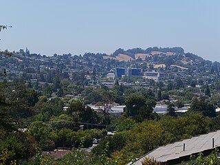
Pleasanton is a city in Alameda County, California, United States. Located in the Amador Valley, it is a suburb in the East Bay region of the San Francisco Bay Area. The population was 79,871 at the 2020 census. In 2005 and 2007, Pleasanton was ranked the wealthiest middle-sized city in the United States by the Census Bureau. Pleasanton is home to the headquarters of Safeway, Workday, Ellie Mae, Roche Molecular Diagnostics, Blackhawk Network Holdings, Veeva Systems, and Simpson Manufacturing Company. Other major employers include Kaiser Permanente, Oracle and Macy's. Although Oakland is the Alameda County seat, a few county offices are located in Pleasanton. The Alameda County Fairgrounds are located in Pleasanton, where the county fair is held during the last week of June and the first week of July. Pleasanton Ridge Regional Park is located on the west side of town.

<span class="mw-page-title-main">Sunol, California</span> Census-designated place in California, United States

Sunol is an unincorporated area and census-designated place in Alameda County, California. Located in the Sunol Valley of the East Bay, the population was 913 at the 2010 census. It is best known as the location of the Sunol Water Temple and for its historic tourist railroad system, the Niles Canyon Railway.

<span class="mw-page-title-main">Amador City, California</span> City in California, United States

Amador City is a city in Amador County, California, United States. The population was 200 as of the 2020 Census, up from 185 in 2010, making it the least populous incorporated city in California. Amador City is also noted for being the smallest city in California by area.

<span class="mw-page-title-main">San Pablo, California</span> City in California, United States

San Pablo is an enclave city in Contra Costa County, California, United States. The city of Richmond surrounds nearly the whole city. The population was 32,127 at the 2020 census. The current Mayor is Abel Pineda. Currently, the City Council consists of Abel Pineda, Patricia Ponce, Arturo Cruz, Elizabeth Pabon-Alvarado, and Rita Xavier. Ponce is the Vice Mayor, and Cruz, Pabon-Alvarado, and Xavier are Council Members. Dorothy Gantt is the city Clerk. Viviana Toledo is the city Treasurer.

<span class="mw-page-title-main">San Ramon, California</span> City in California, United States

San Ramon is a city in Contra Costa County, California, United States, located within the San Ramon Valley, and 34 miles (55 km) east of San Francisco. San Ramon's population was 84,605 per the 2020 census, making it the 4th largest city in Contra Costa County, behind Richmond, Concord and Antioch.

<span class="mw-page-title-main">Orange Cove, California</span> City in California, United States

Orange Cove is a city in Fresno County, California, United States. The population was 9,078 at the 2010 census, up from 7,722 at the 2000 census.

<span class="mw-page-title-main">Millbrae, California</span> City in California, United States

Millbrae is a city located in northern San Mateo County, California, United States. To the northeast is San Francisco International Airport; San Bruno is to the northwest, and Burlingame is to the southeast. It is bordered by San Andreas Lake to the southwest. The population was 23,216 at the 2020 census.

<span class="mw-page-title-main">Patterson, California</span> City in California, United States

Patterson is a city in Stanislaus County, California, United States, located off Interstate 5. It is 27 miles (43 km) southeast of Tracy and is part of the Modesto Metropolitan Statistical Area. Patterson is known as the "Apricot Capital of the World"; the town holds an annual Apricot Fiesta to celebrate with many drinks, food, desserts and games. The population was 20,413 at the 2010 Census.

<span class="mw-page-title-main">Sonora, California</span> City in California, United States

Sonora is the county seat of Tuolumne County, California, United States. Founded during the California Gold Rush by Mexican miners from Sonora, the city population was 5,121 during the 2020 Census, an increase from the 4,903 counted during the 2010 Census.

<span class="mw-page-title-main">Tri-Valley</span> Area of the East Bay

The Tri-Valley area is grouping of three valleys in the East Bay region of California's Bay Area. The three valleys are Amador Valley, San Ramon Valley, and Livermore Valley. The Tri-Valley encompasses the cities of Dublin, Livermore, Pleasanton and San Ramon, the town of Danville and the CDPs of Alamo, Blackhawk and Diablo. The area is known for its Mediterranean climate, wineries, and nature. It is primarily suburban in character. The United States Census Bureau defines an urban area centered in the cities of Livermore, Pleasanton, and Dublin with a 2020 population of 240,381, ranked 167th in the United States in terms of population. The total population of the area is estimated to be 361,000. It offers more affordable living accommodations than the cities of San Francisco and San Jose.

<span class="mw-page-title-main">Wheels (California)</span>

Wheels is a public bus service in the Tri-Valley region (southeast Alameda County) of the San Francisco Bay Area in California, United States. It is operated by the Livermore Amador Valley Transit Authority (LAVTA). Wheels operates local and limited-stop service in Dublin, Pleasanton, and Livermore, with limited service into Contra Costa County along Interstate 680. The LAVTA was formed in 1985; service began in Dublin and Pleasanton in 1986. In 1987, it took over the 1978-opened Rideo service in Livermore. In 2022, the system had a ridership of 1,019,400, or about 4,500 per weekday as of the third quarter of 2023.

<span class="mw-page-title-main">Menifee, California</span> City in California, United States

Menifee is a city in Riverside County, California, United States, and is part of the Inland Empire. Named after a local miner, Luther Menifee Wilson, it was settled in the 19th century, and established as an independent city in 2008. Since then, Menifee has become one of the fastest growing cities in California and the United States.

<span class="mw-page-title-main">Pleasanton Unified School District</span> School district in California, United States

The Pleasanton Unified School District (PUSD) is a public primary and secondary education school district located in Pleasanton, California, United States, a suburban town east of San Francisco. It consists of nine elementary schools, three middle schools, two comprehensive high schools, and one alternative high school.

The East Bay Athletic League (EBAL) is a high school sports league in the North Coast Section of the California Interscholastic Federation. The league was created in 1964; previously teams competed in the "East Bay Division" (EBD) of the Diablo Valley Athletic League (DVAL). Its member institutions are located in the eastern region of the San Francisco Bay Area, in the cities of Concord, Danville, San Ramon, Dublin, Pleasanton, and Livermore. In the fall of 2016 the E.B.A.L. expanded to a 10 team league by adding Dublin High School, and Dougherty Valley High School. De La Salle stopped competing in EBAL Football in 2012-13 and competed as an Independent school in football. In 2018, De La Salle was re-admitted back into the EBAL Football League and now competes again for the league title. Also in 2018, the EBAL split its Football League into two "Divisions"; the Mountain Division and the "Valley Division". In 2020, Foothill moved to the Valley Division and in 2021, Amador Valley moved to the Mountain Division. In the fall of 2019 the E.B.A.L. expanded to a 11 team league by adding Clayton Valley High School to the league, competing in the Mountain Division in football.

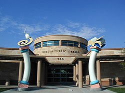
The Dublin Unified School District (DUSD) serves over 12,900 students, from preschool through adult education, in a diverse suburban environment. The district operates seven elementary schools, two middle schools, one K-8 school, one continuation high school, and one comprehensive high school. Dublin is a suburban city in the East Bay Area and Tri-Valley regions of Alameda County, California. The city, with a population of approximately 65,716, is located along the north side of the Interstate 580/680 intersection. As of 2018, the graduation rate was 98%.

References

  1. "California Cities by Incorporation Date". California Association of Local Agency Formation Commissions. Archived from the original (Word) on November 3, 2014. Retrieved March 27, 2013.
  2. "Mayor/City Council". Dublin, CA. Retrieved December 2, 2014.
  3. "Senators". State of California. Retrieved March 18, 2013.
  4. "Members Assembly". State of California. Retrieved March 18, 2013.
  5. "California's 15th Congressional District - Representatives & District Map". Civic Impulse, LLC. Retrieved March 14, 2013.
  6. "2020 U.S. Gazetteer Files". United States Census Bureau. Retrieved October 30, 2021.
  7. "Dublin". Geographic Names Information System . United States Geological Survey, United States Department of the Interior.
  8. 1 2 Capace, Nancy (1999). Encyclopedia of California. Somerset Publishers, Incorporated. p. 230. ISBN   9780403093182.
  9. "U.S. Census Bureau QuickFacts, Dublin city, California". United States Census Bureau. Retrieved September 26, 2021.
  10. Mills, David (May 2, 2013). "Dublin Is The Second Fastest Growing City In California". Dublin Patch. Retrieved March 27, 2015.
  11. Veklerov, Kimberly (May 23, 2019). "Dublin is once again California's fastest-growing city - SFChronicle.com". www.sfchronicle.com. Retrieved May 24, 2019.
  12. Durham, David L. (1998). California's Geographic Names: A Gazetteer of Historic and Modern Names of the State. Clovis, Calif.: Word Dancer Press. p. 626. ISBN   1-884995-14-4.
  13. Bulwa, Demian; Lee, Henry K. (January 6, 2012). "'Mythbusters' cannonball hits Dublin home, minivan". San Francisco Chronicle .
  14. "City of Dublin Annexation of Doolan Canyon, Measure T (November 2014)". Ballotpedia.
  15. "Dublin ballot measure would create growth restrictions on east side". January 31, 2014.
  16. City Council Minutes March 19, 2001
  17. $1 billion East Bay housing project opens first homes, 800 planned
  18. "Dublin City General Plan Report".
  19. "Dublin city, California". United States Censys Bureau. Retrieved February 18, 2023.
  20. "Census of Population and Housing". Census.gov. Retrieved June 4, 2016.
  21. "2010 Census Interactive Population Search: CA - Dublin city". U.S. Census Bureau. Archived from the original on October 23, 2014. Retrieved July 12, 2014.
  22. "Dublin is once again California's fastest-growing city - SFChronicle.com". www.sfchronicle.com. May 27, 2019. Retrieved July 1, 2019.
  23. "Bay Area Census". www.bayareacensus.ca.gov.
  24. "The City of Dublin, California - Demographic Information". Archived from the original on September 9, 2005.
  25. "Shopping | Dublin, CA - Official Website". September 14, 2016. Archived from the original on September 14, 2016. Retrieved June 7, 2019.
  26. "Hacienda Crossings Shopping Center - Shops,Services,Restaurants". www.hacienda-crossings.com. Retrieved June 7, 2019.
  27. "Persimmon Place, Dublin, CA 94568 – Retail Space | Regency Centers". www.regencycenters.com. Retrieved June 7, 2019.
  28. ""Santa Rita Jail", Alameda County Sheriff's Office".
  29. "BOP: Statistics". www.bop.gov.
  30. "Camp Parks Reserve Forces Training Area (PRFTA)". www.globalsecurity.org.
  31. "Medley Health".
  32. Comprehensive Annual Financial Report 2020
  33. "Local Event: CANCELED: St. Patrick's Day Festival, Parade 2020: Dublin". Dublin, CA Patch. February 19, 2020. Retrieved February 9, 2021.
  34. 1 2 "Cancelled: Dublin's St. Patrick's Day 2020: Parade, Festival, Run". Dublin, CA Patch. February 25, 2020. Retrieved February 9, 2021.
  35. "Dougherty Hills Dog Park". Dublin. Retrieved June 7, 2019.
  36. "Bray Commons". Dublin. Retrieved June 7, 2019.
  37. "Fallon Sports Park". Dublin. Retrieved June 7, 2019.
  38. "Fallon Sports Park". Dublin. Retrieved November 28, 2023.
  39. "Mayor / City Council | Dublin, CA - Official Website". dublin.ca.gov.
  40. "Other Elected Officials | Dublin, CA - Official Website". dublin.ca.gov.
  41. https://elections.cdn.sos.ca.gov/ror/ror-odd-year-2019/politicalsub.pdf [ bare URL PDF ]
  42. "Search for Public Schools - School Detail for Dublin High". nces.ed.gov. Retrieved July 1, 2019.
  43. "Dublin High School 2011 API, STAR and CHASEE Results". August 31, 2011.
  44. Morehead, James (January 16, 2010). "Dublin High Renewal (or, $120M of your tax dollars in action)".
  45. Morehead, James (January 17, 2010). "Dublin High – One of America's Top Public High Schools (Newsweek)". Onedublin.org.
  46. "The Quarry Lane School Offers Tri-Valley's First International Baccalaureate (IB) Program". Dublin Patch. September 30, 2010. Archived from the original on July 15, 2011.
  47. Schena, Susan (August 20, 2020). "It's Official: 'Emerald High School' Will Be Dublin's New School". Patch. Retrieved February 10, 2021.
  48. "Dublin / Pleasanton | bart.gov". www.bart.gov. Retrieved February 25, 2020.
  49. "West Dublin / Pleasanton | bart.gov". www.bart.gov. Retrieved February 25, 2020.
  50. "BART - Projects, West Dublin/Plesanton". Archived from the original on July 6, 2008.
  51. "Livermore Amador Valley Transit Authority : About Us" . Retrieved February 25, 2020.
  52. "Police Services | Dublin, CA - Official Website". www.ci.dublin.ca.us. Retrieved May 25, 2016.
  53. "Dublin's Peelle Excited by Opportunity to Play for 49ers". DublinPatch.com. September 16, 2011.
  54. "Dublin High School Alumni Eric Swalwell Defeats 40-Year Congressman Pete Stark". OneDublin.org. November 7, 2012.
  55. "Dublin High School Attends Royals Spring Training, Hosted by Yost (photos 3 and 4)". The Kansas City Star.
  56. "Twinned with Dublin". bray.ie. Retrieved April 13, 2017.