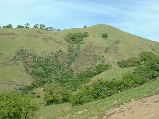
The Sunol Regional Wilderness is a regional park in Alameda County, the eastern San Francisco Bay Area, Northern California. It is located near the town of Sunol, south of Pleasanton and east of Fremont.
Sunol Valley is located in Alameda County, California, United States. The small town of Sunol lies in the valley. It is largely rural, but is in proximity to the highly populated Bay Area suburbs of Fremont, Pleasanton, and Livermore. Interstate 680 runs through the valley. The historic Sunol Water Temple is situated in the Sunol Valley. Historically steelhead have run as high as the Sunol Valley via Alameda Creek, and restoration plans are underway to restore such anadromous fish runs. These restoration plans by the San Francisco Public Utilities Commission include the planned modification of a Pacific Gas and Electric pipeline that has blocked fish migration in Alameda Creek.

Founded in 1891, Livermore High School is a public high school located in the city of Livermore, California, United States. It is part of the Livermore Valley Joint Unified School District (LVJUSD). In 2007, it was chosen as one in four schools in Alameda County to receive the California Distinguished School award.
Trevarno, California is a section of Livermore, Alameda County, California, built by a Cornish company, based at Trevarno, near Helston, manufacturing safety fuses. It is between First Street and the railroad and lies at an elevation of 535 feet. Trevarno is Cornish and means "farm/settlement of Varno." For more information, see Cornish surnames. Officials of Coast Manufacturing and Supply Company in Livermore named the area after George Bickford's home in Cornwall. The company made safety fuses invented by William Bickford, George's father.
The Mocho Subbasin is the largest of the groundwater subbasins in the Livermore Valley watershed in Northern California. This subbasin is bounded to the west by the Livermore Fault Zone and to the east by the Tesla Fault. Some groundwater flow occurs across these fault boundaries, but flows are discontinuous below a depth of fifty feet across the Tesla Fault and south of the Arroyo Mocho channel across the Livermore Fault. Surface watercourses in this unit include Arroyo Valle and Arroyo Seco.
The Bernal Subbasin is an aquifer located in the southwestern corner of Livermore Valley Groundwater Basin, Alameda County, California, United States. All of the groundwater in Livermore Valley moves toward the Bernal Subbasin, which is bounded on the east by Pleasanton Fault, on the north by the Park Fault, and on the west by the Calaveras Fault.(Earth Metrics, 1989) All the streams draining the Livermore Valley merge above the Bernal formation and exit this subbasin and Livermore Amador Valley via the Arroyo de la Laguna.
Livermore Valley Joint Unified School District (LVJUSD) is a public school district located in Livermore, California, United States. It is located in Alameda County. Since May 2010, the Superintendent has been Kelly Bowers.
The Niles Cone is a groundwater basin in Alameda County, California, United States which is the source of drinking water for a sizeable human urban population in the East Bay. The land area corresponding to this groundwater basin is approximately 103 square miles; the Niles Cone Basin is bounded on the east by the Diablo Range and on the west by San Francisco Bay. Surface runoff in the Alameda Creek catchment basin accounts for much of the recharge of the Niles Cone. The Alameda County Water District is responsible for management of the Niles Cone aquifer and has developed water treatment plants and pipelines for the conveyance of its waters to urban users. The Alameda County Water District also performs water quality monitoring of the Niles Cone Basin for total dissolved solids and other parameters.

The Livermore-Pleasanton Fire Department (LPFD) provides fire suppression and emergency medical services to the neighboring cities of Livermore and Pleasanton, California. The organization uses a joint powers authority (JPA) model with essential support services provided by both cities. This partnership promotes more efficient administration and effective delivery of services.

Mountain House was a historic waystop for forty-niners halfway from San Francisco to the Sierra Nevada gold country. Today it is an unincorporated community in Alameda County, California, United States. It is located 12 miles (19 km) east-northeast of Livermore, and 6 miles (9.7 km) east of the Altamont Pass, historically the Livermore Pass, at an altitude of 207 feet (63 m), between the California Aqueduct and the Delta-Mendota Canal. San Joaquin County's Mountain House borrowed the name of the historic Mountain House and is located two miles (3 km) to the northeast further downstream on Mountain House Creek.

Elliot is a former settlement in Alameda County, California. It was located on the Southern Pacific Railroad 4 miles (6.4 km) west of Livermore, at an elevation of 374 feet. It still appeared on maps as of 1906.
Greenville is a former settlement in Alameda County, California. It was located 2.5 miles (4.0 km) southwest of Altamont, at an elevation of 584 feet. The name is in honor of John Green, first store owner here.
Mendenhall Springs is an unincorporated community in Alameda County, California. It is located 9 miles (14 km) southeast of Livermore, at an elevation of 1818 feet.
Merienda is a former settlement in Niles Canyon, in Alameda County, California. It lay at an elevation of 112 feet. It still appeared on maps as of 1906. In 1917, the people moved to Alston, which in turn became Dresser.
Remillard is a former settlement in Alameda County, California, 5 miles (8 km) west of Livermore. It lay at an elevation of 371 feet. It was the site of a brick works owned by the Remillard Brothers from 1889 to 1935.
Ulmar is a former unincorporated community now annexed to Livermore in Alameda County, California. It lies at an elevation of 554 feet.
Amador Valley is a valley in eastern Alameda County, California and is the location of the cities of Dublin and Pleasanton. The valley is bounded by the foothills of the Diablo Range on the north and south, Pleasanton Ridge to the west, and Livermore Valley to the east.
Rancho Las Positas was a 8,880-acre (35.9 km2) Mexican land grant in present-day Alameda County, California given in 1839 by governor Juan Alvarado to Robert Livermore and Jose Noriega. Las Positas means "little watering holes" in Spanish. The rancho included the present-day city of Livermore.
Crane Ridge is a 6 mile long ridge of the Diablo Range in Alameda County, California. Crane Ridge runs southeast from the Livermore Valley toward Mount Wallace. Its highest point is at 2,939 feet / 895.8 meters.


