This article needs additional citations for verification .(August 2024) |
Livermore Valley is an American Viticultural Area (AVA) in Alameda County, California, centered around the city of Livermore in the Tri-Valley region which is composed of Amador, San Ramon, and Livermore valleys. The valley was named by Robert Livermore, an 18th century landowner whose holdings encompassed the area who planted the first grapevines in the region. The 96,000 acres (150 sq mi) AVA was established on September 1, 1982 by the Bureau of Alcohol, Tobacco and Firearms (ATF), Treasury after reviewing the petition submitted by fifteen Livermore Valley vintners and growers to establish a viticultural area in Alameda County named "Livermore Valley." [2] [6]
Livermore Valley's viticultural history began with the planting of vines during the Mission Period (1796-1833). However, at the time, the Valley, part of the Rancho Valle de San José, was more famous for horses than viticulture. The Spanish family names of Bernal, Amador, Pico and Noriega were noted in horse racing circles as far as Mexico City. In 1834, Robert Livermore, an English sailor who deserted ship in 1822, settled in Alta California, became a local businessman and later married a Spanish heiress of the Bernal family. [7] He was a grantee of the Rancho Las Positas in partnership with José Noriega. While Noriega raised horses, Livermore built a large house, planted olives, pears, wheat and the first vines in the valley. He also named the valley after himself. [6]
Wine pioneers arrived in the valley in the late 1860's. By the end of the 1880's the district contained many small, profitable vineyards. The owners, with their diverse backgrounds representing English, German, Irish, Italian, French and Spanish cultures, contributed many viticulture philosophies to the rapidly growing industry. All were attracted by the excellent growing conditions for wine grapes. In 1884, Louis Mel fell in love with the area and purchased land for him and his wife. He built a gravity flow winery into the hillside and planted a vineyard with cuttings from the famed French estates Château d'Yquem and Chateau Margaux. The petitioners claim that emphasis on sauternes began during this period, although there were, and continue to be, many premium red wines from the valley. The resemblance of the area to the Graves District of France was, and is still, a favorite topic for wine writers. At the peak of plantings in the valley, there were approximately 15,000 acres (6,070 ha) of vineyards and over two dozen wineries. The number of both dropped dramatically with the approach and enactment of Prohibition. Two of the wineries that survived Prohibition, producing sacramental wine, have been in continuous operation, by the same families, since 1883. [3] Louis Mel sold his property to his friend, Ernest Wente in 1940 and the property has been part of the Wente family’s estate ever since. As of 2024, there are 17 vineyards cultivating approximately 4,355 acres (1,762 ha) and over 50 wineries. [5] [8]
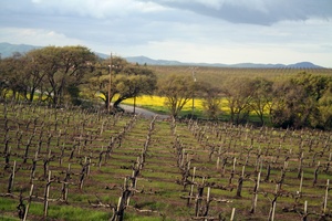
Livermore Valley is one of the coastal intermountain valleys that surround the San Francisco Bay depression. The valley floor is approximately 15 by 10 miles (24 km × 16 km). Starting in the east, the watershed area of Livermore Valley is bounded by the Altamont Hills and Crane Ridge, to the south by Cedar Mountain Ridge and Rocky Ridge, in the west by the Pleasanton Ridge, and in the north by the Black Hills. The valley's geographic location is generally the area covered by the political boundaries of Murray and Pleasanton townships. The elevation where the vineyards are cultivated starts at 650–800 ft (198–244 m) above sea level and slopes toward the valley floor to about 450 ft (137 m) above sea level. The main streams in the valley are the Arroyo Mocho, Arroyo Del Valle, and the Arroyo Las Positas which are formed by the watershed run-off of the previously named ridges. The drainage pattern is well developed with the streams flowing in a westerly direction. These streams converge about one mile west of the town of Pleasanton and form the Arroyo de la Laguna. This stream in turn joins Alameda Creek and empties into San Francisco Bay. Livermore Valley possesses a predominately gravel based soil and lies on a unique east-west orientation, unlike many other winegrowing valleys. [1]
Livermore Valley has a moderate coastal climate which is conducive to the growing of grapes, especially the sauterne type grapes and several premium red varieties. The moderate climate is a result of its proximity to the San Francisco Bay and the Pacific Ocean. The cool marine winds and the morning fog are important factors in temperature control during the growing season and in keeping the area relatively frost free during the early spring. The wine grapes grown in Livermore Valley thrive on the cool nights and warmer days. The greatest part of the vineyard acreage is in Region III as classified by the University of California at Davis system of heat summation by degree-days. A small portion of the area within Livermore Valley is classified as Region II. Due to a reliable onshore afternoon/evening breeze off of the San Francisco Bay a wide fluctuation in temperature between sites and a large diurnal temperature swing occur. Livermore Valley is considered a Winkler Region III grape growing zone with temperatures comparable to northern Napa Valley appellations such as St. Helena and Calistoga. [1]
The average rainfall is 14.45 in (367.03 mm). The rain falls mainly during the winter and early spring. There is little or no precipitation during the summer months. With the large increase in population in the Livermore Valley over the past twenty years, the water table has been lowered to a point where the vines no longer are able to depend on a constant water supply from that source. Since the completion of the Del Valle Dam and the filling of the Del Valle Reservoir, both the Arroyo Mocho and Arroyo Del Valle contain water released from the reservoir almost year-round where formerly they were dry by early summer. The South Bay Aqueduct, completed in 1967, provides overhead sprinkler irrigation for some of the vineyards. This type of irrigation is also used for heat suppression and frost protection as well as supplemental watering. The temperature of Livermore Valley is moderate during the winter and moderately high in the summer. The average high is 72.9 °F (22.7 °C) and the average low is 45.3 °F (7.4 °C). Temperatures in the summer have exceeded 100 °F (38 °C) and the lowest temperature recorded in the winter was 19 °F (−7 °C). The extremes rarely last more than a few days before the marine air asserts its normal pattern. The growing season, March through early November, is long enough to assure crop maturity. The average number of growing days is 254. After evaluating the petition and comment, ATF has determined that due to the topographic and climatic features of Livermore Valley, it is distinguishable from the surrounding areas. [1]
Soils are a distinguishing feature of the Livermore Valley viticultural area. The main soil type is the Yolo-Pleasanton associations with the Livermore gravelly and very gravelly series being prominent in the southern portion of the valley. The expansion area encompasses a geographical area significantly larger than the current Livermore Valley viticultural area; for both areas, the underlying geologic formations and the geological factors in soil formation are the same. Thus, the soils in the expansion area are consistent with those of the original viticultural area. The original Livermore Valley viticultural area and the expansion area developed on the same geologic formations. Those formations include Pleistocene, alluvial, mostly nonmarine terrace deposits on the basin floor; Pleistocene, Pliocene, Miocene, and Cretaceous sandstone, shale, gravel, and conglomerate in the northern, eastern, and western hills; and Franciscan Complex fragmented and sheared sandstone in the southern hills. The geological forces that formed the topography and soils in the expansion of the Livermore Valley viticultural area are the same as those that formed the topography and soils of the original Livermore Valley viticultural area. Uplift and subsidence along several earthquake faults (among them, the Calaveras and Pleasanton faults to the west, the Greenwood fault to the east, and the Livermore and Tesla faults in the center of the valley) have shaped the region’s topography. Erosion and weathering of base material on the slopes and deposition of sediment carried in runoff onto the valley floor have, over long periods of time, formed the soils of the region. [3]
A portion of the Livermore Valley floor within the current viticultural area also includes the Positas-Perkins association (shallow gravelly loam on terraces) and the Clear Lake-Sunnyvale association (shallow clay in basins and on terraces). Soils on the slopes of the current viticultural area and recorded in the survey include the Millsholm-Los Gatos-Los Osos association (well drained to excessively drained soils that have low fertility, on moderately sloping to very steep slopes), the Altamont-Diablo association (well drained to excessively drained, clayey soils that have moderate or high fertility, on rolling to steep slopes), and the Vallecitos-Parris association (well drained to excessively drained, shallow loam and gravelly loam on steep or very steep slopes). The ‘‘Soil Survey of Alameda Area, California’’ and the ‘‘Soil Survey of Contra Costa County, California,’’ by the United States Department of Agriculture, Soil Conservation Service, published in 1977, both record that the same soils were mapped in the expansion area and in the current viticultural area. Although the Altamont-Diablo and Clearlake-Sunnyvale associations in Alameda County and the Altamont-Diablo-Fontana and Clearlake-Cropley associations in Contra Costa County were mapped along the boundary of the two soil survey areas, the soils are virtually identical. The differences in soil names are the result of improvements in the classification of the soils, particularly modifications or refinements in soil series concepts. Regarding vineyards, the soils in the expanded Livermore Valley viticultural area are different from those in surrounding areas to the north and east; they are on the only sites where vineyards are suited in the immediate vicinity because of steep terrain, population density, and other limiting factors. To the north and east of the boundary, the soils transition into the Brentwood-Rincon-Zamora association (level, well drained clay and silty clay loam on alluvial fans) and the Marcuse-Solan-Pescadero association (nearly level, poorly drained clay, loam, and clay loam on basin rims). Although suited to vineyards, these soils differ from those in the current Livermore Valley viticultural area and the expansion area. [3]
Viticulture in Livermore Valley has flourished since the 19th century, with the Cresta Blanca Winery, founded in 1882, being one of the earliest, and well-respected vintner, being the first California wine to win an international competition with its initial 1884 vintage awarded the Grand Prix medal at the 1889 Paris Exposition. However, most valley vineyards were shuttered or ripped out during Prohibition except for the Concannon and Wente Vineyards who were limited to produce only sacramental wine. [6]
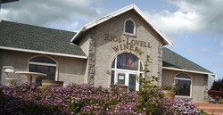
By the early 1960s, Livermore Valley cultivated the same amount of wine grapes as Napa Valley. Its viticulture achievements remained relatively unknown until Napa Valley gained international prominence at the Paris Wine Tasting of 1976 where California vintages were received top honors in the red and white wine categories by French judges. The unprecedented publicity highlighted Californian viticulture not only in the San Francisco Bay Area, but in Monterey, San Luis Obispo and Santa Barbara counties. Wente Vineyards has long been the largest producer in the Livermore Valley, making around 700,000 cases of wine annually with wholesale, tasting room and export sales. Established in 1883, it's now the oldest family owned winery in the United States. The other valley winery, Concannon Vineyard, was also established in 1883 and their vintages are nationally marketed with a tasting room for direct sales.
The relatively obscure Petite Sirah grape produced Livermore's best historically known red wine, although the climate also produces interesting dessert wines as well as excellent Cabernet Sauvignon, Merlot, Sangiovese, and Rhone varieties. The original plantings of Sémillon and Sauvignon blanc were cuttings originated from Château d'Yquem, and those grapes still produce fine wine in the Livermore area. There is also a move afoot among the wineries in Livermore to specialize in Cabernet Franc, Chardonnay, Sauvignon Blanc, Merlot, Cabernet Sauvignon, and some other mostly Bordeaux varieties. Wine made from grapes grown in the Livermore Valley is eligible for the Livermore Valley AVA, San Francisco Bay AVA, and Central Coast AVA appellation of origin designations. [6]
Carmel Valley is an American Viticultural Area (AVA) located in Monterey County, California, southeast of Carmel-by-the-Sea and it is one of the ten AVAs in the county. Approximately 100 miles (161 km) south of San Francisco, the AVA was recognized by the Bureau of Alcohol, Tobacco and Firearms (ATF), Treasury on January 13, 1983 after reviewing the petition submitted by Mr. David Armanasco, General Manager of Durney Vineyard, located in Carmel, to propose a viticultural area named “Carmel Valley.”
Arroyo Seco is an American Viticultural Area (AVA) in Monterey County, California, southeast of Monterey Bay. The state's 15th appellation was established on May 16,1983 by the Bureau of Alcohol, Tobacco and Firearms (ATF), Treasury after reviewing the petition submitted by the Arroyo Seco Winegrowers and Vintners, an association composed of grape growers and vintners with vineyards, to establish a viticultural area within Monterey County known as "Arroyo Seco."
Chalone identifies the first American Viticultural Area (AVA) established in Monterey County, California straddling its border with San Benito County where it is the second established AVA. Chalone viticultural area is located in the Gabilan Mountains east of Soledad. It was recognized by the Bureau of Alcohol, Tobacco and Firearms (ATF) effective on July 14, 1982 after reviewing the petition submitted by the Gavilan Vineyards, Inc. to establish a viticultural area in Monterey and San Benito counties to be named "The Pinnacles." The area encompasses 8,640 acres (14 sq mi) and the proposed name was recognition of the nearby Chalone peaks.
Washington wine is a wine produced from grape varieties grown in the U.S. state of Washington. Washington ranks second in the United States in the production of wine. By 2017, the state had over 55,000 acres (220 km2) of vineyards, a harvest of 229,000 short tons (208,000 t) of grapes, and exports going to over 40 countries around the world from the 940+ wineries located in the state. While there are some viticultural activities in the cooler, wetter western half of the state, the majority (99.9%) of wine grape production takes place in the shrub-steppe eastern half. The rain shadow of the Cascade Range leaves the Columbia River Basin with around 8 inches (200 mm) of annual rain fall, making irrigation and water rights of paramount interest to the Washington wine industry. Viticulture in the state is also influenced by long sunlight hours and consistent temperatures.
Red Mountain is an American Viticultural Area (AVA) that encompasses the local region surrounding Red Mountain in Benton County, Washington. The viticultural area was formally recognized on June 11, 2001 by the Bureau of Alcohol, Tobacco and Firearms (ATF), Treasury after reviewing the petition submitted by Lorne Jacobson of Hedges Cellars to establish an area known as "Red Mountain." It lies entirely within the Yakima Valley and vast Columbia Valley appellations and is a small AVA in the state at only 4,040 acres (6.31 sq mi) in area and lies between Benton City and the City of West Richland. The area has more than 2,225 acres (900 ha) under cultivation of primarily red varietals including Cabernet Sauvignon, Merlot, Sangiovese, Cabernet Franc and Syrah. The reputation of the area's wines has brought Red Mountain worldwide attention and acclaim for producing some of the most desired Washington State vintage wines.
Horse Heaven Hills is an American Viticultural Area (AVA) in southeastern Washington lying in portions of Klickitat, Yakima, and Benton counties, north and west of the Columbia River and south of the Yakima Valley and lies within the vast Columbia Valley appellation. Horse Heaven Hills was established by the Alcohol and Tobacco Tax and Trade Bureau {TTB), Treasury on June 30, 2005 after reviewing the petition filed by Paul D. Lucas on behalf of regional wine grape growers. Horse Heaven Hills viticultural area is about 60 miles (97 km) long and 22 miles (35 km) wide located 115 miles (185 km) east from Vancouver, Washington. The appellation encompasses 570,000 acres (891 sq mi) with about 6,400 acres (2,590 ha) under vine.
Santa Maria Valley is an American Viticultural Area (AVA) which straddles the boundary of Santa Barbara and San Luis Obispo counties in California's multi-county Central Coast AVA. It was established on August 5, 1981, by the Bureau of Alcohol, Tobacco, Firearms and Explosives (ATF) as California's second oldest AVA. A portion of the AVA crosses the Cuyama River into the southernmost corner of San Luis Obispo County. The east-west orientation of the 152.3 square miles with a wide, open valley and rolling hills means cool winds and fog flow in freely from the Pacific Ocean, settling most noticeably in lower-lying areas. The result is a mild Mediterranean climate that lengthens the growing season and contributes to the eventual sugar/acid balance in the grapes from Santa Maria Valley's 7,500 acres (3,000 ha) cultivated vineyards. On January 28, 2011, the AVA was granted a 29.4 square miles expansion to its southern boundary.
Temecula Valley is an American Viticultural Area (AVA) in the Temecula Valley, located in southwestern Riverside County, California against the eastern slopes of the Santa Ana Mountains. It was initially established by the Bureau of Alcohol, Tobacco and Firearms (ATF), Treasury as "Temecula" on October 23, 1984 based on submitted petitions from by the Rancho Califomia/Temecula Winegrowers Association and Callaway Vineyard and Winery, Temecula, California in 1982. It was renamed "Temecula Valley" by the Alcohol and Tobacco Tax and Trade Bureau (TTB) in 2004, approving the 2001 petition by Temecula Valley Winegrowers Association. The petition stated the name change would provide a more accurate description of the Temecula geography and greater clarity as to its location for wine consumers and the public. The petition did not request any change to the established AVA boundaries. This was the first American Viticultural Area to change its name after the initial approval. Temecula Valley encompasses 33,000 acres (52 sq mi) and 5,000 acres (8 sq mi) is located in a "protected" area referred to as the Citrus/Vineyard Zone. This area is generally located in and around the Rancho California Road area with Riverside County. County guidelines strictly enforce the number of acres needed to build a winery, lodging and other limited housing and commercial ventures.
North Fork of Roanoke is an American Viticultural Area (AVA) located on the eastern slopes of the Allegheny Mountains in the Roanoke and Montgomery counties of Virginia just west of the city of Roanoke. The appellation area was established by the Treasury's, Bureau of Alcohol, Tobacco and Firearms (ATF) on May 16, 1983. The North Fork valley stretches 22 miles (35 km) along the Roanoke River with surrounding hillsides where vineyards reside between 1,200 to 2,200 feet (366–671 m) above sea level. The approximately 1,200 acres (1.9 sq mi) area is named for its position on the North Fork river, before it converges with the South Fork to form the Roanoke River. Many of North Fork's 49 acres (20 ha) of vineyards are located on the Allegheny slopes which are part of the larger Blue Ridge mountain range that stretches south into North Carolina. The North Fork AVA weather is characterized by cool, foggy summer mornings and prevailing westerly winds. Karl and Myra Hereford of MJC Vineyard in Blacksburg, Virginia, petitioned the ATF in October 1981 to establish the viticulture area named "North Fork of Roanoke.”
Arroyo Grande Valley is an American Viticultural Area (AVA) located in San Luis Obispo County, California approximately 12 miles (19 km) southeast of the county seat San Luis Obispo. Arroyo Grande Valley was recognized on February 5, 1990 by the Bureau of Alcohol, Tobacco, Firearms and Explosives (ATF) as the state's 60th AVA based on the petition filed in 1987 by Don Talley of Talley Vineyards and William S. Greenough of Saucelito Canyon Vineyard for the establishment of the "Arroyo Grande Valley" viticultural area in San Luis Obispo County. The 16 miles (26 km) long, approximately 67 square miles valley appellation benefits from its east-northeast orientation allowing the breeze from the Pacific Ocean to moderate the climate of the area. The valley is divided by a fog line produced by the cool maritime layer where Zinfandel, Petite Sirah and Rhône varietals are grown on the higher elevations near Lopez Lake and the cooler mid-valley vineyards being home to Chardonnay and Pinot noir. On April 8, 2022, the Alcohol and Tobacco Tax and Trade Bureau (TTB) approved the designation of the expansive San Luis Obispo (SLO) Coast AVA overlapping the boundaries of Edna Valley and Arroyo Grande Valley viticultural areas because they share common features. However, these two previously established areas still have unique characteristics to retain their viticultural area distinctions within SLO Coast. Edna Valley lies immediately to the northwest, the Los Padres National Forest straddles the north leg boundary, the Santa Maria Valley AVA lies to the southeast of Arroyo Grande Valley, and the Pacific Ocean communities of Oceano, Grover City and Arroyo Grande abut its southwestern border.
The Chiles Valley is an American Viticultural Area (AVA) located in Napa County, California and a sub-region within Napa Valley AVA. It was established as California's 81st AVA by the Bureau of Alcohol, Tobacco and Firearms (ATF) on April 19, 1999 after the ATF received the petition from Mr. Volker Eisele, owner of the Volker Eisele Vineyard and Winery proposing a new viticultural area in Napa County to be known as "Chiles Valley District".
Lake County wine designates wine made from grapes grown mostly in Lake County, California. The region is located north of Napa County and east of Mendocino County. Although each region within Lake County has unique viticultural attributes, many are influenced by Clear Lake, the largest inland body of water in California.
Monterey is an American Viticultural Area (AVA) located in eastern Monterey County, California. It was recognized on July 16, 1984 by the Bureau of Alcohol, Tobacco and Firearms (ATF), Treasury after reviewing the petition submitted by the Monterey Winegrowers Council to establish the "Monterey" viticultural area. The designated area within the multi-county Central Coast AVA expands almost the entire length of the county from the Monterey Bay southern shoreline to the Salinas river valley framed by the Santa Lucia, Sierra de Salinas and Gabilan Ranges stretching north-south for about 100 miles (160 km) from Watsonville to its southern point, abutting the town of Paso Robles in San Luis Obispo County. Monterey AVA expands approximately 360,000 acres (560 sq mi) with about 40,000 acres (16,000 ha) of cultivated vineyards. The AVA includes parts of the Carmel and the Salinas valleys containing five smaller American viticultural areas: Arroyo Seco, Hames Valley, San Bernabe, San Lucas and Santa Lucia Highlands. The northern portion is a cool growing region with a very long growing season. Daytime temperatures rarely exceed 75 °F (24 °C) in most parts of the region, although the southern segments of the AVA can measure 100 °F (38 °C) at times. The soil is sandy loam and most regions require irrigation from the Salinas River.
Hames Valley is an American Viticultural Area (AVA) in Monterey County, California a few miles from its southern border with San Luis Obispo (SLO) County. The state's 67th appellation was established on April 15,1994 by the Bureau of Alcohol, Tobacco and Firearms (ATF), Treasury after reviewing the petition submitted by Mr. Barry C. Jackson of the Harmony Wine Company on behalf of Valley Farm Management, Soledad, California, and Mr. Bob Denney & Associates, Visalia, California to establish a viticultural area within Monterey County known as "Hames Valley."
Santa Lucia Highlands is an American Viticultural Area (AVA) located in central Monterey County, California and lies within the boundaries of the larger, elongated Monterey viticultural area. It was recognized by the Bureau of Alcohol, Tobacco and Firearms {ATF}, Treasury on June 15, 1992 after reviewing the petition from Mr. Barry Jackson of the Harmony Wine Company proposing a viticultural area to be known as "Santa Lucia Highlands."
Squaw Valley-Miramonte is an American Viticultural Area (AVA) and a unique grape-growing region in Fresno County, California surrounding the towns of Yokuts Valley and Miramonte approximately 40 miles (64 km) east of the city of Fresno. The AVA was established on August 7, 2015 by the U.S. Department of Treasury’s Alcohol and Tobacco Tax and Trade Bureau (TTB). It is largely a rural region located entirely within the foothills of the Sierra Nevada mountains and does not overlap any established AVAs. To the northwest, west, and south is the San Joaquin Valley while the Sequoia National Forest is adjacent to its northern and eastern boundaries. The scenic highway U.S. 180 bisects the region eastward from the Valley to the Big Trees in Kings Canyon and Sequoia National Parks. The AVA stretches over 44,690 acres (70 sq mi) with five commercially-producing vineyards cultivating about 7.5 acres (3.04 ha) and three bonded wineries. The USDA plant hardiness zone for the AVA is 9b.
Los Olivos District AVA is an American Viticultural Area located in Santa Barbara County, California established on January 20, 2016, by the Alcohol and Tobacco Tax and Trade Bureau (TTB). It straddles the Santa Ynez Valley, formed by the Santa Ynez River, between the Purisima Hills above Solvang. The area encompasses the townships of Los Olivos, Ballard, Santa Ynez and Solvang. State Route 154, known locally as the San Marcos Pass Road or Chumash Highway, bisects the region accessing many of the wineries and vineyards as it traverses toward its destination in Santa Barbara.
Monterey County wine is a appellation that designates wine made from grapes grown in Monterey County, California which lies entirely within the expansive multi-county Central Coast viticultural area. County names in the United States automatically qualify as legal appellations of origin for wine produced from grapes grown in that county and do not require registration with the Alcohol and Tobacco Tax and Trade Bureau (TTB). TTB was created in January 2003, when the Bureau of Alcohol, Tobacco and Firearms, or ATF, was extensively reorganized under the provisions of the Homeland Security Act of 2002.
Gabilan Mountains is an American Viticultural Area (AVA) located in the mountainous region on the border in Monterey and San Benito Counties in California. It is the tenth and newest AVA established in Monterey County by the Alcohol and Tobacco Tax and Trade Bureau (TTB) on September 14, 2022, becoming the state's 147th official AVA after the TTB reviewed the petition from Parker Allen of Coastview Vineyards, proposing to establish the "Gabilan Mountains" viticultural area. Gabilan Mountains encompasses about 98,000 acres (153 sq mi) including the established Mt. Harlan and Chalone AVAs, and resident to 4 wineries and 6 commercial vineyards cultivating approximately 436 acres (176 ha). The average elevation within the region is 2,370 feet (722 m) placing it above the heavy fog and marine layer. As a result, Gabilan Mountains AVA has a cool air climate without the humidity from the fog and low-lying clouds.
Goose Gap is the 19th American Viticultural Area (AVA) in Washington, United States. It encompasses the local region surrounding Goose Mountain in Benton County between Kiona to the west, and Richland along the Columbia River to the east. The viticultural area was formally established on August 2, 2021, by the Alcohol and Tobacco Tax and Trade Bureau (TTB), Treasury after reviewing the petition submitted by geologist/vintner, Alan Busacca, on behalf of the Goose Gap Wine Grower's Association, proposing the viticultural area "Goose Gap". The area is a sub-appellation entirely within the Yakima Valley and the expansive Columbia Valley AVAs sandwiched on a northwest–southeast axis between neighboring viticultural areas Red Mountain and the minute Candy Mountain.