Novato, California

Last updated

City of Novato
Hamilton AFB HQ.jpg
Novato3 (cropped).jpg
Novato6.jpg
Unity In Marin, Hamilton Field, Novato, California USA (cropped) (cropped).jpg
Clockwise from left: Marin Museum of Contemporary Art; City Hall; Unity Church; Downtown Novato. Motto: “The place to be”
Nickname: 
Valley of No Regrets
Marin County California Incorporated and Unincorporated areas Novato Highlighted.svg
Location in Marin County and California
Usa edcp relief location map.png
Red pog.svg
City of Novato
Location in the United States
Coordinates: 38°06′27″N122°34′11″W / 38.10750°N 122.56972°W / 38.10750; -122.56972 [1]
Country United States
State California
County Marin
Incorporated January 20, 1960 [2]
Government
   Mayor Mark Milberg [3]
   County Board Districts 5 & 4
Eric Lucan
Dennis Rodoni [4]
   State Senator Mike McGuire (D) [5]
   Assemblymember Damon Connolly (D) [5]
   U. S. Rep. Jared Huffman (D) [6]
Area
[7]
  Total27.99 sq mi (72.48 km2)
  Land27.48 sq mi (71.16 km2)
  Water0.51 sq mi (1.32 km2)  1.85%
Elevation
[1]
30 ft (9 m)
Population
 (2020) [8]
  Total53,225
  Density1,900/sq mi (730/km2)
   Demonym
Novatan
Time zone UTC−8 (Pacific)
  Summer (DST) UTC−7 (PDT)
ZIP codes
94945, 94947–94949, 94998
Area codes 415/628
FIPS code 06-52582
GNIS feature IDs 277612, 2411283
Website novato.org

Novato (Spanish for "Novatus") is a city in Marin County, California, United States, situated in the North Bay region of the Bay Area. At the 2020 census, Novato had a population of 53,225.

Contents

History

What is now Novato was originally the site of several Coast Miwok villages: Chokecherry, near downtown Novato; Puyuku, near Ignacio; and Olómpali, at the present-day Olompali State Historic Park. [9]

Mexican era

Rancho Olompali was granted in 1834 by Governor Manuel Micheltorena to Miwok ranchero Camilo Ynitia. Olompali State Park Burdell Barn 9 30 2012 (4).JPG
Rancho Olómpali was granted in 1834 by Governor Manuel Micheltorena to Miwok ranchero Camilo Ynitia.

In 1839, the Mexican government granted the 8,876-acre (35.92 km2) Rancho Novato to Fernando Feliz. The rancho was named after a local Miwok leader who had probably been given the name of Saint Novatus at his baptism. [10] Subsequently, four additional land grants were made in the area: Rancho Corte Madera de Novato, to John Martin in 1839; Rancho San Jose, to Ignacio Pacheco in 1840; Rancho Olómpali, awarded in 1843 to Camilo Ynitia, son of a Coast Miwok chief; and Rancho Nicasio, by far the largest at 56,621 acres (229.1 km2), awarded to Pablo de la Guerra and John B.R. Cooper in 1844. [11]

Post-Conquest era

Following the American Conquest of California and the Treaty of Guadalupe Hidalgo, Novato, along with the rest of California, became part of the United States on February 2, 1848. Early pioneers included Joseph Sweetser and Francis De Long who bought 15,000 acres (61 km2) in the mid-1850s and planted orchards and vineyards. [12]

The first post office at Novato opened in 1856; it closed in 1860, and a new post office opened in 1891. [13]

The first school was built in 1859, at the corner of Grant Avenue and what is today Redwood Boulevard.

California Churrigueresque architecture at Hamilton Airfield; 1936. Hamilton Field, CA Squad Barracks 5 AUG 1936 (2825155892).jpg
California Churrigueresque architecture at Hamilton Airfield; 1936.

The original town was located around Novato Creek at what is now South Novato Boulevard. A railroad was built in 1879, connecting Novato to Sonoma County and San Rafael. The area around the train depot became known as New Town, and forms the edge of what today is Old Town Novato. The Novato Flatiron Building was built in 1908.

Modern era

The Great Depression of the 1930s had a marked effect on the area, as many farmers lost their land. After World War II, Novato grew quickly with the construction of tract homes and a freeway. As the area was unincorporated, much of the growth was unplanned and uncontrolled.

Novato was finally incorporated as a city in 1960. [14] One of the most important venues of the time (1960 to 1965) was "Western Weekend". Beard-growing contests, sponsored by Bob's Barber Shop, and many other odd activities helped to bring this community together.

Geography

Aerial view of the Hamilton Wetland Restoration Project. Hamilton Air Force aerial view.jpg
Aerial view of the Hamilton Wetland Restoration Project.

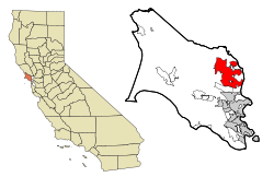
According to the United States Census Bureau, Novato has a total area of 28.0 square miles (73 km2) and is the largest city in area in Marin County. A total of 27.4 square miles (71 km2) is land and 0.5 square miles (1.3 km2) (1.85%) is water.

Major geographical features nearby include Mount Burdell and Mount Burdell Open Space Preserve to the north and Big Rock Ridge to the southwest. Stafford Lake to the west is a secondary water supply for Novato, with the Russian River in Sonoma County to the north supplying most of the city's water.

Novato includes ten Marin County Open Space District preserves: Mount Burdell, Rush Creek, Little Mountain, Verissimo Hills, Indian Tree, Deer Island, Indian Valley, Ignacio Valley, Loma Verde, and Pacheco Valle. Although Novato is located on the water, access to the water is blocked by expansive farmland and wetlands.

Climate

Hamilton Amphitheater Park. Amphitheater Park on Hamilton Field, Novato, California.jpg
Hamilton Amphitheater Park.

Official weather observations were taken at Hamilton Air Force Base through 1964. Average January temperatures were a maximum of 53.6 °F (12.0 °C) and a minimum of 38.7 °F (3.7 °C). Average July temperatures were a maximum of 79.9 °F (26.6 °C) and a minimum of 52.0 °F (11.1 °C). There were an average of 12.4 days with highs of 90 °F (32 °C) or higher and an average of 12.5 days with lows of 32 °F (0 °C) or lower. The record high temperature was 111 °F (44 °C) on September 5, 2022. [15] The record low temperature was 16 °F (−9 °C) in December 2013. Average annual precipitation was 25.49 inches (64.7 cm). The wettest year was 1940 with 46.63 inches (118.4 cm) and the driest year was 2015 with 6.35 inches (16.1 cm). The most rainfall in one month was 18.87 inches (47.9 cm) in December 1955. The most rainfall in 24 hours was 10.55 inches (26.8 cm) between December 10, 2014 – December 11, 2014. [16]

Flooding in Northeastern Novato Flooded Pastures in Northeastern Novato.jpg
Flooding in Northeastern Novato

Today, the nearest National Weather Service cooperative weather station is in San Rafael, where records date back to 1894. Compared to records from Hamilton Air Force Base, San Rafael is generally several degrees warmer than Novato and has an average of about 10 inches (25 cm) more rainfall. The record high temperature in San Rafael was 110 °F (43 °C) on September 7, 1904, and June 14, 1961. The record low temperature was 20 °F (−7 °C) on December 26, 1967. [17]

According to the Köppen Climate Classification system, Novato has a warm-summer mediterranean climate, abbreviated "Csb" on climate maps. This means that Summers are Hot, but Winters are rainy and can be mild to chilly. Precipitation occurs in the colder seasons, but there are a number of clear sunny days even during the wetter seasons, except during spells of seasonal tule fog, when it can be quite chilly for many days.

Novato has a history of flooding due to its low-lying position, as well as the fact that much of the city used to be marshland. Due to the system of levees in Eastern Novato, flooding is quite common in that area, both from excessive rain and levee breaches. [18] [19]

Government

Novato City Hall. Novato2 (cropped).jpg
Novato City Hall.

Novato is governed by a city council of five members. All five councilmembers are elected by city council districts to staggered four-year terms. The city council elects a mayor and mayor pro tem each year from its membership. The current councilmembers are: [20]

In the United States House of Representatives, Novato is in California's 2nd congressional district , represented by Democrat Jared Huffman. [6] From 2008 to 2012, Huffman represented Marin County in the California State Assembly.

In the California State Legislature, Novato is in:

According to the California Secretary of State, as of February 10, 2019, Novato had 31,544 registered voters. Of those, 15,794 (50.1%) were registered Democrats, 6,048 (19.2%) were registered Republicans, and 8,188 (26%) declined to state a political party. [22]

Demographics

Historical population
CensusPop.Note
1960 17,881
1970 31,00673.4%
1980 43,91641.6%
1990 47,5858.4%
2000 47,6300.1%
2010 51,9049.0%
2020 53,2252.5%
U.S. Decennial Census [23]

2020

At the 2020 census Novato had a population of 52,225. The population density was 1,900 inhabitants per square mile (730/km2). The racial makeup of Novato was 32,509 (62.2%) White, 1,435 (2.7%) African American, 961 (1.8%) Native American, 3,966 (7.6%) Asian, 108 (0.2%) Pacific Islander, 7,099 (13.6%) from other races, and 7,147 (13.7%) from two or more races. [24]

2010

Spanish Colonial Revival homes at Hamilton Army Airfield. Vacant, Condemned Housing on Hamilton Field.jpg
Spanish Colonial Revival homes at Hamilton Army Airfield.

At the 2010 census Novato had a population of 51,904. The population density was 1,856.6 inhabitants per square mile (716.8/km2). The racial makeup of Novato was 39,443 (76.0%) White, 1,419 (2.7%) African American, 286 (0.6%) Native American, 3,428 (6.6%) Asian, 117 (0.2%) Pacific Islander, 4,693 (9.0%) from other races, and 2,518 (4.9%) from two or more races. There were 11,046 Hispanic or Latino residents (21.3%) of any race. [25]

The census reported that 51,278 people (98.8% of the population) lived in households, 449 (0.9%) lived in non-institutionalized group quarters, and 177 (0.3%) were institutionalized.

There were 21,279 households, 6,679 (32.9%) had children under the age of 18 living in them, 10,393 (51.3%) were opposite-sex married couples living together, 2,237 (11.0%) had a female householder with no husband present, 854 (4.2%) had a male householder with no wife present. There were 1,010 (5.0%) unmarried opposite-sex partnerships, and 195 (1.0%) same-sex married couples or partnerships. 5,358 households (26.4%) were one person and 2,415 (11.9%) had someone living alone who was 65 or older. The average household size was 2.53. There were 13,484 families (66.5% of households); the average family size was 3.04.

The age distribution was 11,769 people (22.7%) under the age of 18, 3,355 people (6.5%) aged 18 to 24, 12,743 people (24.6%) aged 25 to 44, 15,914 people (30.7%) aged 45 to 64, and 8,123 people (15.7%) who were 65 or older. The median age was 42.6 years. For every 100 females, there were 93.6 males. For every 100 females age 18 and over, there were 90.1 males.

There were 21,158 housing units at an average density of 756.8 per square mile, of the occupied units 13,591 (67.0%) were owner-occupied and 6,688 (33.0%) were rented. The homeowner vacancy rate was 1.0%; the rental vacancy rate was 4.7%. 33,252 people (64.1% of the population) lived in owner-occupied housing units and 18,026 people (34.7%) lived in rental housing units.

2000

Marin Museum of Contemporary Art. Marin Museum of Contemporary Art (MOCA) with metal sculpture.jpg
Marin Museum of Contemporary Art.

At the 2000 census there were 47,630 people in 18,524 households, including 12,411 families, in the city. The population density was 1,719.2 inhabitants per square mile (663.8/km2). There were 18,994 housing units at an average density of 685.6 per square mile (264.7/km2). The racial makeup of the city in 2010 was 65.8% non-Hispanic White American, 2.5% non-Hispanic Black American, 0.2% Native American, 6.5% Asian, 0.2% Pacific Islander, 0.3% from other races, and 3.2% from two or more races. Hispanic or Latino residents of any race were 21.3%. [26]

Of the 18,524 households 32.1% had children under the age of 18 living with them, 52.7% were married couples living together, 10.3% had a female householder with no husband present, and 33.0% were non-families. 25.2% of households were one person and 9.3% were one person aged 65 or older. The average household size was 2.52 and the average family size was 3.01.

The age distribution was 23.1% under the age of 18, 6.4% from 18 to 24, 29.9% from 25 to 44, 27.5% from 45 to 64, and 13.0% 65 or older. The median age was 40 years. For every 100 females, there were 93.6 males. For every 100 females age 18 and over, there were 90.3 males.

The median household income was $63,453 and the median family income was $74,434 (these figures had risen to $78,895 and $91,890 respectively as of a 2007 estimate). [27] Males had a median income of $55,822 versus $40,287 for females. The per capita income for the city was $32,402. About 3.1% of families and 5.6% of the population were below the poverty line, including 6.1% of those under age 18 and 4.0% of those age 65 or over.

Economy

The Buck Institute for Research on Aging is a world leader on aging-associated diseases research. Buck Institute for Research on Aging, Novato, California -- campus, as seen from Hwy 101.jpg
The Buck Institute for Research on Aging is a world leader on aging-associated diseases research.
The historic Hamilton Theatre. The old theater on Hamilton Field (cropped).jpg
The historic Hamilton Theatre.
Doctor Insomniac's Coffee, a Historic Landmark on Grant Avenue Fashion Shop 800 Grant Ave Novato CA 3-21-2010 5-50-37 PM.JPG
Doctor Insomniac's Coffee, a Historic Landmark on Grant Avenue

The city is home to the Buck Institute for Research on Aging, and several biotech firms, such as Biosearch Technologies, BioMarin Pharmaceutical and Ultragenyx. [29] Several small technology companies are also based in Novato, such as 2K, Radiant Logic, Toys For Bob, One Legal, International Genetics Incorporated, Channel Management Solutions, Enwisen, Sonic Solutions and DriveSavers.

The former Hamilton Air Force Base is also located in Novato, but was decommissioned in 1974 and designated a Historic District in 1998. After lying stagnant for many years, major renovations were pushed through by then-mayor Michael DiGiorgio. As of 2008 the base has largely been redeveloped into single-family homes. The former hangar buildings were gutted and redeveloped into two-story office buildings; tenants include 2K Sports, Sony Imageworks, Visual Concepts, The Republic of Tea, Toys For Bob, and Birkenstock Distribution USA.

From 1983 to 1998, the iconic [30] developer of video games, Brøderbund Software, was headquartered in Novato, known through games Choplifter , Lode Runner , Karateka , and Prince of Persia , and others. [31] From the 1982 until 2015, Novato was headquarters for Fireman's Fund Insurance Company, which was Marin County's largest employer at one time, with 2,400 employees as of 2000. By 2015, the company had laid off or transferred most its employees and relocated its remaining employees to a smaller headquarters in nearby Petaluma. [32]

In Eastern Novato, north of Hamilton, there are several hayfields contributing to the local economy, but they are diminishing as more and more of them are restored to wetlands.

Top employers
The Villas at Hamilton. Villas at Hamilton apartments.jpg
The Villas at Hamilton.

As of 201819 the city's principal employers were: [33]

#Employer# of Employees% of Total City Employed
1 BioMarin Pharmaceutical 10053.56%
2 Novato Unified School District 8032.85%
3 2K/Visual Concepts 6602.34%
4Bradley Electric3421.21%
5 Costco Wholesale 3161.12%
6Novato Community Hospital3041.08%
7City of Novato2901.03%
8 Ultragenyx 2750.98%
9 Safeway Stores 2500.89%
10Novato Healthcare Center2330.83%

Recreation

Novato is a destination for outdoor enthusiasts, with its many parks and open space preserves providing ample hiking trails, biking trails, picnic spots, and playgrounds. Parks and open space preserves featuring hiking trails include:

Buck Gulch Falls (also known as the Fairway Waterfall) [34] is located in the Ignacio Valley Preserve, and can be accessed from the trailhead at the end of Fairway Drive. There is also a waterfall in the Indian Valley Open Space Preserve, along the Ken Harth Waterfall Trail, and another in the Pacheco Valle Preserve, at the end of Pacheco Creek Drive. These waterfalls are seasonal, flowing in winter and spring, but slowing to a trickle or drying up completely in the summer and fall.

Popular parks featuring playgrounds in Novato include Miwok Park, Josef Hoog Park, South Hamilton Park, and Pioneer Park. The playground at Pioneer Park was rebuilt in 2023 and is the first fully accessible and inclusive playground in Marin County. [35]

Scottsdale Pond is a small pond suitable for fishing. The pathway around the pond displays signs created by artist Emma Oyle that highlight the wildlife seen in the area. [36]

Novato operates the Hamilton Community Pool, open seasonally. [37]

The Stafford Lake Bike Park at Stafford Lake County Park offers 17 acres of terrain for bikers of all skill levels. [38]

Culture

Hamilton Field History Museum. Hamilton Field History Museum (cropped).jpg
Hamilton Field History Museum.

Prominent museums in Novato include:

In the summer, Novato's Parks and Recreation Department hosts a summer concert series, featuring eight free concerts at the Hamilton Amphitheater and the Novato Civic Green. [39] Each June, Novato produces the Novato Art Wine & Music Festival, [40] featuring two music stages, 200 arts and crafts booths, wine and beer booths, and a kids section with games. Other popular Novato events include Rock the Block, a series of concerts on Grant Avenue in the summer, Safe Trick or Treat [41] each Halloween, the annual Christmas Tree Lighting on Sherman Avenue, [42] and the annual Bouncy Ball New Year on Machin Avenue, [43] where 24,000 bouncy balls are dropped from a fire engine ladder for children to catch.

Education

Novato is served by the Novato Unified School District. The public high schools are Novato High School and San Marin High School. These schools offer two specialized programs. Students from Marin County and surrounding counties may apply for acceptance to the Marin School of the Arts, [44] on the Novato High School campus, or STEM Marin, [45] on the San Marin High School campus. Novato Charter School is a charter school in Novato. Novato is also home to the Indian Valley Campus of College of Marin.

Transportation

Novato Downtown station is served by Sonoma-Marin Area Rail Transit. Southbound train at Novato Downtown station (2), November 2019.JPG
Novato Downtown station is served by Sonoma–Marin Area Rail Transit.

Major highways in Novato include U.S. Route 101 and California State Route 37, and major roads in Novato include Atherton Avenue, Novato Boulevard, San Marin Drive, and Ignacio Boulevard.

Sonoma–Marin Area Rail Transit (SMART) operates three commuter rail stations in Novato: San Marin / Atherton station, Hamilton station, and Novato Downtown station. Novato is also served by several bus routes of Golden Gate Transit and Marin Transit, with a transit center in the downtown area, which serves 2 Golden Gate Transit routes and 6 Marin Transit routes. [46]

Notable people

Cherry Blossoms bloom on Grant Street in Novato, California Cherry Blossoms bloom on Grant Street in Novato, California.jpg
Cherry Blossoms bloom on Grant Street in Novato, California

Sister cities

Related Research Articles

<span class="mw-page-title-main">Marin County, California</span> County in California, United States

Marin County is located in the northwestern part of the San Francisco Bay Area of the U.S. state of California. As of the 2020 census, the population was 262,231. Its county seat and largest city is San Rafael. Marin County is across the Golden Gate Bridge from San Francisco, and is included in the San Francisco–Oakland–Berkeley, CA Metropolitan Statistical Area.

<span class="mw-page-title-main">Black Point-Green Point, California</span> Census-designated place in California, United States

Black Point-Green Point is a census-designated place (CDP) in Marin County, California, United States. It is unincorporated, sitting between the city of Novato to the southwest and the Petaluma River and San Pablo Bay to the northeast. The population was 1,431 at the 2020 census.

<span class="mw-page-title-main">Mill Valley, California</span> City in California, United States

Mill Valley is a city in Marin County, California, United States, located about 14 miles (23 km) north of San Francisco via the Golden Gate Bridge and 52 miles (84 km) from Napa Valley. The population was 14,231 at the 2020 census.

<span class="mw-page-title-main">San Rafael, California</span> City in California, United States

San Rafael is a city and the county seat of Marin County, California, United States. The city is located in the North Bay region of the San Francisco Bay Area. As of the 2020 U.S. census, the city's population was 61,271, up from 57,713 in 2010.

<span class="mw-page-title-main">Tomales, California</span> Census-designated place in California, United States

Tomales is a census-designated place (CDP) on State Route 1 in Marin County, California, United States. The population was 187 at the 2020 census.

<span class="mw-page-title-main">Chino, California</span> City in California, United States

Chino is a city in the western end of San Bernardino County, California, United States, with Los Angeles County to its west and Orange County to its south in the Southern California region. Chino is adjacent to the more affluent Chino Hills. Chino's surroundings have long been a center of agriculture and dairy farming, providing milk products in Southern California and much of the southwestern United States. Chino's agricultural history dates back to the Spanish land grant forming Rancho Santa Ana del Chino. The area specialized in fruit orchards, row crops, and dairy.

<span class="mw-page-title-main">Buellton, California</span> City in California, United States

Buellton is a small city in Santa Barbara County, California, United States. It is located in the Santa Ynez Valley, 3 miles (4.8 km) west of Solvang. The population was 5,161 at the 2020 census, up from 4,828 at the 2010 census.

<span class="mw-page-title-main">Cloverdale, California</span> City in California, United States

Cloverdale is a city in Sonoma County, California, United States; it is both the westernmost and the northernmost city in the San Francisco Bay Area. The San Francisco and North Pacific Railroad reached Cloverdale in 1872. The Cloverdale Rancheria of Pomo Indians of California is headquartered there. The population was 8,618 at the 2010 census.

<span class="mw-page-title-main">Cotati, California</span> City in California, United States

Cotati is an incorporated city in Sonoma County, California, United States, located approximately 45 mi (70 km) north of San Francisco in the 101 corridor between Rohnert Park and Petaluma. Cotati's population as of the 2020 Census was 7,584, making it the smallest incorporated community in Sonoma County.

<span class="mw-page-title-main">Healdsburg, California</span> Town in Sonoma County, California, United States

Healdsburg is a city located in Sonoma County, California, United States. At the 2010 census, the city had a population of 11,254.

<span class="mw-page-title-main">Petaluma, California</span> City in Northern California, United States

Petaluma is a city in Sonoma County, California, located in the North Bay region of the San Francisco Bay Area. Its population was 59,776 according to the 2020 census.

<span class="mw-page-title-main">Rohnert Park, California</span> City in California, United States

Rohnert Park is a city in Sonoma County, California, United States, located approximately 50 miles (80 km) north of San Francisco. The population at the 2020 United States Census was 44,390. It is an early planned city and is the sister city of Hashimoto in Japan. Sonoma State University, part of the California State University system, is located nearby.

<span class="mw-page-title-main">Coast Miwok</span> Tribe of Native American people

Coast Miwok are Indigenous people of California that were the second-largest tribe of the Miwok people. Coast Miwok inhabited the general area of modern Marin County and southern Sonoma County in Northern California, from the Golden Gate north to Duncans Point and eastward to Sonoma Creek. Coast Miwok included the Bodega Bay Miwok, or Olamentko (Olamentke), from authenticated Miwok villages around Bodega Bay, the Marin Miwok, or Hookooeko (Huukuiko), and Southern Sonoma Miwok, or Lekahtewutko (Lekatuit). While they did not have an overarching name for themselves, the Coast Miwok word for people, Micha-ko, was suggested by A. L. Kroeber as a possible endonym, keeping with a common practice among tribal groups and the ethnographers studying them in the early 20th Century and with the term Miwok itself, which is the Central Sierra Miwok word for people.

<span class="mw-page-title-main">Olompali State Historic Park</span> 700-acre State park in Marin County, California

Olompali State Historic Park is a 700-acre (2.8 km2) California State Park in Marin County, California. It is constituted of the former Rancho Olómpali and was the site of the famed Battle of Olómpali during the Bear Flag Revolt. Rancho Olómpali was purchased by the Californian government in 1977, which turned it into a public park.

Camilo Ynitia was born in 1803, in Marin County, southern Marin, of the Huiman tribe near Sausalito. They likely traveled up to Olompali, where his father had built an adobe brick home. Camilo was a notable leader of the Coast Miwok, a Native American people. Camilo was known as the last Hoipu (headman) of the Miwok community living at Olompali and the Coast Miwoks of the Southern Marin Band. Camilo was also the only Native American on the northern frontier of Alta California to secure and keep a large Mexican-era land grant: In 1843 Governor Manuel Micheltorena of Alta California deeded him the Rancho Olompali, a large tract of land that is between present-day Novato and Petaluma, California. A part of this land now comprises the Olompali State Historic Park.

<span class="mw-page-title-main">Ignacio, California</span> Unincorporated community in Marin County, California, US

Ignacio is an unincorporated community in Marin County, California. It is located 3 miles (4.8 km) southeast of downtown Novato, at an elevation of 30 feet.

<span class="mw-page-title-main">Novato Creek</span> River in California, United States

Novato Creek is a stream in eastern Marin County, California, United States. It originates in highlands between Red Hill and Mount Burdell above the city of Novato, California, and flows 17 miles (27 km) before emptying into San Pablo Bay south of Petaluma Point.

<span class="mw-page-title-main">Rancho Olómpali</span>

Rancho Olómpali was a 8,877-acre (35.92 km2) Mexican land grant in present-day Marin County, California given in 1834 by governor Manuel Micheltorena to Camilo Ynitia, son of a Coast Miwok chief. The name Olómpali comes from the Coast Miwok language and likely means southern village or southern people. The land grant is between present-day Novato and Petaluma. A part of this land now comprises the Olompali State Historic Park.

Rancho Nicasio was a Mexican land grant of 56,807 acres (230 km2) granted to the Coast Miwok indigenous people in 1835, located in the present-day Marin County, California, a tract of land that stretched from San Geronimo to Tomales Bay. Today, Nicasio, California is at the heart of this location.

Olompali is a former Native American settlement in Marin County, California. It was located 5 miles (8 km) south of Petaluma.

References

  1. 1 2 "Novato". Geographic Names Information System . United States Geological Survey, United States Department of the Interior.
  2. "California Cities by Incorporation Date". California Association of Local Agency Formation Commissions. Archived from the original (Word) on February 21, 2013. Retrieved August 25, 2014.
  3. "Council Members". City of Novato. Retrieved January 8, 2024.
  4. "County of Marin District 4 webpage". County of Marin . Retrieved February 7, 2020.
  5. 1 2 "Statewide Database". UC Regents. Archived from the original on February 1, 2015. Retrieved December 5, 2014.
  6. 1 2 "California's 2nd Congressional District - Representatives & District Map". Civic Impulse, LLC. Retrieved March 1, 2013.
  7. "2019 U.S. Gazetteer Files". United States Census Bureau. Retrieved July 1, 2020.
  8. "Novato (city) QuickFacts". United States Census Bureau . Retrieved February 26, 2021.
  9. Peterson, Bonnie J. (1976). Dawn of the World: Coast Miwok Myths. ISBN   0-912908-04-1
  10. Bright, William (1998) (November 30, 1998). 1500 California Place Names. University of California Press. ISBN   978-0-520-21271-8.{{cite book}}: CS1 maint: numeric names: authors list (link)
  11. Marin County Ranchos Archived November 14, 2008, at the Wayback Machine
  12. "Novato 1838-1899: Land Grants and Farming | NOVATO HISTORICAL GUILD" . Retrieved November 12, 2019.
  13. Durham, David L. (1998). California's Geographic Names: A Gazetteer of Historic and Modern Names of the State. Clovis, Calif.: Word Dancer Press. p. 673. ISBN   1-884995-14-4.
  14. "Early Novato Area History". Archived from the original on November 23, 2007. Retrieved December 6, 2007.
  15. "Novato, CA September 05, 2022. weather.com". Archived from the original on September 5, 2022.
  16. http://rainfall.weatherdb.com/l/18987/Novato-California%5B%5D
  17. "SAN RAFAEL CIVIC CTR, CALIFORNIA - Climate Summary".
  18. "Flood Information | City of Novato, CA". www.novato.org. Retrieved May 18, 2023.
  19. SFGATE, Michelle Robertson; Ioannou, Filipa (February 14, 2019). "Two levee breaches reported near Highway 37 in Novato as rains pound North Bay". SFGATE. Retrieved May 18, 2023.
  20. "City Council | City of Novato, CA". www.novato.org. Retrieved January 8, 2024.
  21. "Members Assembly".
  22. "CA Secretary of State – Report of Registration – February 10, 2019" (PDF). ca.gov. Retrieved March 12, 2019.
  23. "Census of Population and Housing". Census.gov. Retrieved June 4, 2015.
  24. "Explore Census Data". data.census.gov. Retrieved December 12, 2023.
  25. "2010 Census Interactive Population Search: CA - Novato city". U.S. Census Bureau. Archived from the original on July 15, 2014. Retrieved July 12, 2014.
  26. "U.S. Census website". United States Census Bureau . Retrieved January 31, 2008.
  27. FactFinder
  28. "National Register Digital Assets – Fashion Shop and Stephen Porcella House". Archived from the original on October 20, 2016. Retrieved October 20, 2016.
  29. Bloomberg: Biotechnology Company Overview of Ultragenyx Pharmaceutical Inc.
  30. Time : The 10 Greatest Games for the Apple II
  31. Brøderbund Software, Inc. Company History
  32. Halstead, Richard (June 15, 2015). "Fireman's Fund to move from Novato to Petaluma in November". Marin Independent Journal.
  33. "City of Novato, California: Comprehensive Annual Financial Report for the Year Ended June 30, 2019". City of Novato. p. 169. Retrieved January 27, 2022.
  34. "Take a Family Hike to the Fairway Waterfall in Novato". MarinMommies. Retrieved January 8, 2024.
  35. Houston, Will (March 19, 2023). "Novato to build Marin's first all-accessible playground". Marin Independent Journal.
  36. "Parks & Facilities". City of Novato. Retrieved January 8, 2024.
  37. "Aquatics Program - Hamilton Community Pool". City of Novato. Retrieved January 8, 2024.
  38. "17-acre Stafford Lake Bike Park offers exciting riding for all levels". Marin County Parks. Retrieved January 8, 2024.
  39. "Novato's Outdoor Concert Series Returns for Summer 2023". City of Novato. Retrieved January 8, 2024.
  40. "Novato Chamber Art Wine & Music Festival". Novato Chamber. Retrieved January 8, 2024.
  41. Schena, Susan C. "Trick-Or-Treating Halloween 2023: Downtown Novato". Patch.com. Retrieved January 8, 2024.
  42. "Annual Novato Holiday Tree Lighting" (PDF). Downtown Novato. Retrieved January 8, 2024.
  43. "Downtown Novato Business Association Presents Bouncy Ball New Year" (PDF). Downtown Novato. Retrieved January 8, 2024.
  44. "Marin School of the Arts". Marin School of the Arts. Retrieved January 8, 2024.
  45. "STEM Marin". STEM Marin. Retrieved January 8, 2024.
  46. "Novato Transit Center - Transit.Wiki". www.transit.wiki. Retrieved October 11, 2021.
  47. {https://www.marinij.com/2022/08/16/sacheen-littlefeather-gets-apology-for-abuse-by-john-wayne-others-at-1973-oscars-2/}
  48. Houston, Will (February 2, 2019). "Novato backs 'hometown hero' Jared Goff, Rams in Super Bowl". Marin Independent Journal. Retrieved September 30, 2021.
  49. Durso, Joseph (February 18, 1989). "Vernon (Lefty) Gomez, 80, Dies; Starred as a Pitcher for Yankees". The New York Times.
  50. 1 2 "Novato Proud". Novato.org. Retrieved April 12, 2017.
  51. "Emergency!" The Convention (TV Episode 1979) - IMDb , retrieved February 6, 2023