Black Point-Green Point, California

Last updated

Black Point-Green Point
Marin County California Incorporated and Unincorporated areas Black Point-Green Point Highlighted.svg
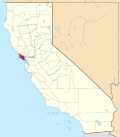
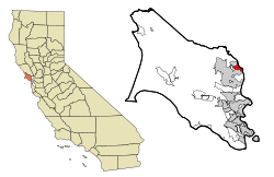
Location in Marin County and the state of California
Usa edcp location map.svg
Red pog.svg
Black Point-Green Point
Location in the United States
Coordinates: 38°6′35″N122°30′13″W / 38.10972°N 122.50361°W / 38.10972; -122.50361
Country Flag of the United States (23px).png  United States
State Flag of California.svg  California
County Marin
Government
   County Board District 5
Judy Arnold
   Assembly Stephanie Nguyen (D)
   U. S. Congress Jared Huffman (D) [1]
Area
[2]
  Total2.90 sq mi (7.50 km2)
  Land2.83 sq mi (7.32 km2)
  Water0.07 sq mi (0.18 km2)  0.44%
Elevation
13 ft (4 m)
Highest elevation
190 ft (57.9 m)
Lowest elevation
0 ft (0 m)
Population
 (2020) [3]
  Total1,431
  Density506.19/sq mi (195.44/km2)
Time zone UTC-8 (PST)
  Summer (DST) UTC-7 (PDT)
ZIP code
94945 (Novato)
Area codes 415/628
FIPS code 06-06982
GNIS feature IDs 2407857

Black Point-Green Point is a census-designated place (CDP) in Marin County, California, United States. It is unincorporated, sitting between the city of Novato to the southwest and the Petaluma River and San Pablo Bay to the northeast. The population was 1,431 at the 2020 census. [3]

Contents

History

Black Point was part of the Rancho de Novato land grant. The 1880 History of Marin County by Alley, Bowen and Co. mentions "a man by name of Day" who "settled on an island in Novato township which has since borne his name" in 1851. This island is still known as Day Island. According to the book, several more settlers moved into the area in 1853. Some of them owned land there, while others were squatters, a problem common across the county. Lumber that came from Black Point was used to build part of the USS Saginaw, a steamer built at the Mare Island Naval Shipyard. It served in the navy until 1870, when it ran aground on a reef not far from Ocean island. Deer Island, a former island east of Olive Avenue, actually was an island in the early 1900s. The house on the island, owned by Antonio DeBorba, whose shop on Grant Avenue is still intact, was completely encompassed by water, and his house was only accessible by boat. When both the county and the state refused to build a levee, he spent a small fortune deepening the creek and taking water out of the marsh. Once that was done, he donated the land that is now Highway 37. [4]

The first Black Point post office operated from 1865 to 1891. [5] The Grandview post office opened in 1905, changed its name to Black Point in 1944, and closed in 1952. [5] Black Point-Green Point is located along the Brazos Railroad Subdivision, with Northwestern Pacific running trains through twice a week. Trains passing through Black Point-Green Point cross the Black Point Railroad Bridge, built in 1911. [6] The fields to the south of Black Point were used for the location of the Black Point Communications Annex, an antenna array that was used to communicate with the Hamilton Air Force Base.

Geography

Black Point-Green Point is 4 miles (6 km) east of the center of Novato and 11 miles (18 km) north of San Rafael, the Marin county seat. The Petaluma River, which forms the northeast edge of the community, is the Sonoma County line.

According to the United States Census Bureau, the CDP has a total area of 2.9 square miles (7.5 km2), of which 0.07 square miles (0.18 km2), or 2.42%, are water. [2] Black Point-Green Point is also located near various public lands, such as the Rush Creek Open Space Preserve and the Vince Mulroy Wildlife Prerserve.

Commercial activity

There are several businesses in Black Point-Green Point, such as Rossi's Deli (an old gas station built in the 1930s), Penske Truck Rental, Kelleher Lumber, and two self-storages. There used to be an inn built during the 1890s, but it burned down in the spring of 1976. [4] Black Point also used to have a train station and a freight depot near the lumberyard. [7] Both the Northwestern Pacific Railroad and the Black Point Aggregates company used to operate a quarry in Black Point to produce ballast and fills for the railroad, as well as shipment abroad. [8] [9] The steep scars are still visible, although the flattened area is now part of the Stonetree Golf Course.

Demographics

Historical population
CensusPop.Note
2000 1,143
2010 1,30614.3%
2020 1,4319.6%
U.S. Decennial Census [10]

2010

The 2010 United States Census [11] reported that Black Point-Green Point had a population of 1,306. The population density was 484.0 inhabitants per square mile (186.9/km2). The racial makeup of Black Point-Green Point was 1,185 (90.7%) White, 7 (0.5%) African American, 6 (0.5%) Native American, 45 (3.4%) Asian, 0 (0.0%) Pacific Islander, 28 (2.1%) from other races, and 35 (2.7%) from two or more races. Hispanic or Latino of any race were 112 persons (8.6%).

The Census reported that 100% of the population lived in households.

There were 578 households, out of which 109 (18.9%) had children under the age of 18 living in them, 315 (54.5%) were opposite-sex married couples living together, 30 (5.2%) had a female householder with no husband present, 22 (3.8%) had a male householder with no wife present. There were 45 (7.8%) unmarried opposite-sex partnerships, and 9 (1.6%) same-sex married couples or partnerships. 148 households (25.6%) were made up of individuals, and 48 (8.3%) had someone living alone who was 65 years of age or older. The average household size was 2.26. There were 367 families (63.5% of all households); the average family size was 2.70.

The population was spread out, with 197 people (15.1%) under the age of 18, 69 people (5.3%) aged 18 to 24, 199 people (15.2%) aged 25 to 44, 550 people (42.1%) aged 45 to 64, and 291 people (22.3%) who were 65 years of age or older. The median age was 53.2 years. For every 100 females, there were 94.6 males. For every 100 females age 18 and over, there were 93.9 males.

There were 615 housing units at an average density of 227.9 per square mile (88.0/km2), of which 79.9% were owner-occupied and 20.1% were occupied by renters. The homeowner vacancy rate was 0.6%; the rental vacancy rate was 4.9%. 83.5% of the population lived in owner-occupied housing units and 16.5% lived in rental housing units.

2000

As of the census [12] of 2000, there were 1,143 people, 479 households, and 331 families residing in the CDP. The population density was 619.5 inhabitants per square mile (239.2/km2). There were 503 housing units at an average density of 272.6 per square mile (105.3/km2). The racial makeup of the CDP in 2010 was 85.5% non-Hispanic White, 0.5% non-Hispanic Black or African American, 0.3% Native American, 3.4% Asian, 0.2% from other races, and 1.6% from two or more races. 8.6% of the population were Hispanic or Latino of any race.

There were 479 households, out of which 22.3% had children under the age of 18 living with them, 60.1% were married couples living together, 7.1% had a female householder with no husband present, and 30.7% were non-families. 21.5% of all households were made up of individuals, and 5.8% had someone living alone who was 65 years of age or older. The average household size was 2.39 and the average family size was 2.77.

In the CDP, the population was spread out, with 18.2% under the age of 18, 3.4% from 18 to 24, 22.6% from 25 to 44, 41.6% from 45 to 64, and 14.2% who were 65 years of age or older. The median age was 47 years. For every 100 females, there were 89.6 males. For every 100 females age 18 and over, there were 94.4 males.

The median income for a household in the CDP was $92,729, and the median income for a family was $104,531. Males had a median income of $76,782 versus $50,769 for females. The per capita income for the CDP was $52,372. About 1.9% of families and 2.9% of the population were below the poverty line, including 6.5% of those under age 18 and none of those age 65 or over.

Related Research Articles

<span class="mw-page-title-main">Meridianville, Alabama</span> Census-designated place in Alabama, United States

Meridianville is an unincorporated community and census-designated place (CDP) in Madison County, Alabama, United States, and is included in the Huntsville-Decatur Combined Statistical Area. As of the 2020 census, the population of the CDP was 8,209.

<span class="mw-page-title-main">Moores Mill, Alabama</span> Census-designated place in Alabama, United States

Moores Mill is an unincorporated community and census-designated place (CDP) in Madison County, Alabama, United States, and is included in the Huntsville-Decatur Combined Statistical Area. The population was 6,729 at the 2020 census, up from 5,682 at the 2010 census.

<span class="mw-page-title-main">Summit, Arizona</span> CDP in Pima County, Arizona

Summit is a census-designated place (CDP) in Pima County, Arizona, United States. The population was 3,702 at the 2000 census.

<span class="mw-page-title-main">Riverdale, California</span> Census-designated place in California, United States

Riverdale is a census-designated place (CDP) in Fresno County, California, United States. The population was 3,153 at the 2010 census, up from 2,416 at the 2000 census. Riverdale is located 23 miles (37 km) south of Fresno, at an elevation of 223 ft (68 m).

<span class="mw-page-title-main">Mesa, California</span> Census-designated place in California, United States

Mesa is a census-designated place (CDP) in Inyo County, California, United States. The population was 251 at the 2010 census, up from 214 at the 2000 census.

<span class="mw-page-title-main">Kentfield, California</span> Census-designated place in California, United States

Kentfield is a census-designated place (CDP) in Marin County, California, United States, just north of San Francisco. Kentfield is located 2 miles (3 km) southwest of downtown San Rafael, at an elevation of 115 feet. The population was 6,808 at the 2020 census. The ZIP codes are 94904 for street addresses, and 94914 for PO boxes, and are shared with the neighboring community of Greenbrae.

<span class="mw-page-title-main">Lagunitas-Forest Knolls, California</span> Census-designated place in California, United States

Lagunitas-Forest Knolls is a census-designated place, composed of two unincorporated areas in the western half of the San Geronimo Valley in Marin County, California. It is located to the west of San Geronimo and Woodacre. The population was 1,924 at the 2020 census.

<span class="mw-page-title-main">Lucas Valley-Marinwood, California</span> Census-designated place in California, United States

Lucas Valley-Marinwood is a census-designated place (CDP) in Marin County, California, United States. It includes the neighborhoods of Lucas Valley and Marinwood. As of the 2020 census, the population was 6,259.

<span class="mw-page-title-main">Muir Beach, California</span> Census designated place in California, United States

Muir Beach is a census designated place (CDP), unincorporated community, and beach on the Pacific Ocean. The community is located 16.5 miles (26.6 km) northwest of San Francisco in western Marin County, California, United States. Unlike many other entities in the area, it is not named directly in honor of conservationist John Muir; instead, it was named after Muir Woods National Monument to capitalize on the latter's popularity. The population was 304 at the 2020 census. The community itself flanks the northwest side of the beach.

<span class="mw-page-title-main">San Geronimo, California</span> Census-designated place in California, United States

San Geronimo is a census-designated place (CDP) located in the San Geronimo Valley in Marin County, California in the United States. San Geronimo is bordered by Lagunitas-Forest Knolls to its west and Woodacre to its east. It is 8 miles (13 km) southwest of downtown Novato at an elevation of 292 feet (89 m). The population was 510 at the 2020 census.

<span class="mw-page-title-main">Strawberry, Marin County, California</span> Census-designated place in California, United States

Strawberry is a census-designated place (CDP) and an unincorporated district of Marin County, California, United States. It shares a ZIP code (94941) with Mill Valley and falls within its school districts; however, it is considered within the sphere of influence of the town of Tiburon. It is largely separated from Mill Valley by U.S. Route 101. Its population was 5,447 at the 2020 census.

<span class="mw-page-title-main">Tamalpais-Homestead Valley, California</span> Census-designated place in California, United States

Tamalpais-Homestead Valley is a census-designated place (CDP) in Marin County, California, United States. The population was 11,492 at the 2020 census.

<span class="mw-page-title-main">Woodacre, California</span> Census-designated place in California, United States

Woodacre is an unincorporated town and census-designated place (CDP) in Marin County, California, United States. The population was 1,410 at the 2020 census.

<span class="mw-page-title-main">Westbrook, Connecticut</span> Town in Connecticut, United States

Westbrook is a town in Middlesex County, Connecticut, United States. The town is part of the Lower Connecticut River Valley Planning Region. The population was 6,769 at the 2020 census. The town center is classified by the U.S. Census Bureau as a census-designated place (CDP).

<span class="mw-page-title-main">Paukaa, Hawaii</span> Census-designated place in Hawaii, U.S.

Paukaʻa is a census-designated place (CDP) in Hawaii County, Hawaii, United States. The population was 425 at the 2010 census, down from 495 at the 2000 census. The ZIP code is 96720.

<span class="mw-page-title-main">Kaʻaʻawa, Hawaii</span> Census-designated place in the United States

Kaʻaʻawa is a small community and census-designated place (CDP) located in the windward district of Koʻolauloa, City & County of Honolulu on the island of Oʻahu, Hawaiʻi, United States. As of the 2010 Census, the total population for Kaʻaʻawa was 1,379. In Hawaiian, kaʻaʻawa means "the wrasse (fish)". From the Hawaiian spelling Kaʻaʻawa it is seen that each a is pronounced separately and distinctly, set apart by the two ʻokinas: or.

<span class="mw-page-title-main">Saginaw Township South, Michigan</span> Place in Michigan, United States

Saginaw Township South is an unincorporated community and former census-designated place (CDP) in Saginaw County in the U.S. state of Michigan. The community is located within Saginaw Charter Township, and the CDP boundaries consisted of the southern portion of the township. Saginaw Township North is in the northern portion of the township.

<span class="mw-page-title-main">Village Green-Green Ridge, Pennsylvania</span> Census-designated place in Pennsylvania, United States

Village Green-Green Ridge is a census-designated place (CDP) in Delaware County, Pennsylvania, United States. The population was 7,822 at the 2010 census, down from 8,279 at the 2000 census.

<span class="mw-page-title-main">Valley Green, Pennsylvania</span> CDP in Pennsylvania, United States

Valley Green is a census-designated place (CDP) in York County, Pennsylvania, United States. The population was 3,429 at the 2010 census.

<span class="mw-page-title-main">Kapaʻa, Hawaii</span> Census-designated place in Hawaii, United States

Kapaʻa is an unincorporated community and census-designated place (CDP) in Kauaʻi County, Hawaiʻi, United States. It is the most populous town in the island of Kauai, with a population of 11,652 as of the 2020 census, up from 9,471 at the 2000 census.

References

  1. "California's 2nd Congressional District - Representatives & District Map". Civic Impulse, LLC. Retrieved March 8, 2013.
  2. 1 2 "2021 U.S. Gazetteer Files: California". United States Census Bureau. Retrieved July 6, 2022.
  3. 1 2 "P1. Race – Black Point-Green Point CDP, California: 2020 DEC Redistricting Data (PL 94-171)". U.S. Census Bureau. Retrieved July 6, 2022.
  4. 1 2 Ungemach, May Rodgers (1989). Novato Township - Land Grant to World War II. United States of America: Novato Historical Guild. pp. 109–114. ISBN   0-9619810-0-8.
  5. 1 2 Durham, David L. (1998). California's Geographic Names: A Gazetteer of Historic and Modern Names of the State. Clovis, Calif.: Word Dancer Press. p. 603. ISBN   1-884995-14-4.
  6. "Swinging for 100 Years". Novato, CA Patch. November 3, 2011. Retrieved February 5, 2022.
  7. Signor, John R. (1999). Southern Pacific Lines Pacific Lines Stations Volume 3. Southern Pacific Historical and Technical Society. pp. 61–62. ISBN   0965720861.
  8. "Marin County - List of Stone Quarries, Etc". quarriesandbeyond.org. Retrieved September 1, 2022.
  9. Trumbull, John A (April–June 2008). "Novato Underground: Mining in Novato" (PDF). The Novato Historian. 32 (2) via Novato Historical Guild Inc.
  10. "Census of Population and Housing". Census.gov. Retrieved June 4, 2016.
  11. "2010 Census Interactive Population Search: CA - Black Point-Green Point CDP". U.S. Census Bureau. Archived from the original on July 15, 2014. Retrieved July 12, 2014.
  12. "U.S. Census website". United States Census Bureau . Retrieved January 31, 2008.