Woodacre | |
---|---|
![]() Woodacre from the east | |
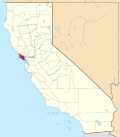
![]() Location in Marin County and the state of California | |
Coordinates: 38°00′46″N122°38′43″W / 38.01278°N 122.64528°W | |
Country | ![]() |
State | ![]() |
County | Marin |
Government | |
• County Board | District 4 Dennis Rodoni [1] |
• State Senate | Mike McGuire (D) |
• Assembly | Stephanie Nguyen (D) |
• U.S. Congress | Jared Huffman (D) [2] |
Area | |
• Total | 1.797 sq mi (4.653 km2) |
• Land | 1.797 sq mi (4.653 km2) |
• Water | 0 sq mi (0 km2) 0% |
Elevation | 364 ft (111 m) |
Population (2020) [5] | |
• Total | 1,410 |
• Density | 780/sq mi (300/km2) |
Time zone | UTC-8 (PST) |
• Summer (DST) | UTC-7 (PDT) |
ZIP code | 94973 |
Area codes | 415/628 |
FIPS code | 06-86216 |
GNIS feature ID | 1652657 |
Woodacre is an unincorporated town and census-designated place (CDP) in Marin County, California, United States. The population was 1,410 at the 2020 census. [5]
The community is located at 38°00′46″N122°38′43″W / 38.01278°N 122.64528°W [4] in the eastern half of the San Geronimo Valley of central Marin County. San Geronimo and Lagunitas-Forest Knolls are to its west. Woodacre is located 8 miles (13 km) south-southwest of Novato, [6] and 8 miles northwest of San Rafael; the nearest incorporated town is Fairfax, 4 miles (6 km) east-southeast. At 364 feet (111 m), Woodacre has the highest base elevation in Marin County. [4]
According to the United States Census Bureau, the CDP has a total area of 1.8 square miles (4.7 km2), all of it land. [3]
The community began when promoters subdivided the place in 1912. [6] In 1923, wildfires burned 35 of the 40 homes in Woodacre. [7] The first post office opened in 1925. [6]
The 2020 United States census reported that Woodacre had a population of 1,410. The population density was 784.6 inhabitants per square mile (302.9/km2). The racial makeup of Woodacre was 86.2% White, 0.3% African American, 0.6% Native American, 2.0% Asian, 0.0% Pacific Islander, 1.9% from other races, and 9.0% from two or more races. Hispanic or Latino of any race were 6.9% of the population. [8]
The whole population lived in households. There were 612 households, out of which 20.9% included children under the age of 18, 48.0% were married-couple households, 6.9% were cohabiting couple households, 23.9% had a female householder with no partner present, and 21.2% had a male householder with no partner present. 28.8% of households were one person, and 17.6% were one person aged 65 or older. The average household size was 2.3. [8] There were 386 families (63.1% of all households). [9]
The age distribution was 16.2% under the age of 18, 5.0% aged 18 to 24, 14.9% aged 25 to 44, 32.1% aged 45 to 64, and 31.8% who were 65 years of age or older. The median age was 52.9 years. For every 100 females, there were 94.2 males. [8]
There were 650 housing units at an average density of 361.7 units per square mile (139.7 units/km2), of which 612 (94.2%) were occupied. Of these, 75.8% were owner-occupied, and 24.2% were occupied by renters. [8]
In 2023, the US Census Bureau estimated that the median household income was $225,521, and the per capita income was $87,336. About 4.5% of families and 8.3% of the population were below the poverty line. [10]
Almost all of the community is in the Lagunitas Elementary School District while a small portion is in the Ross Valley Elementary School District. All of it is in the Tamalpais Union High School District. [11]