With most of Colma's land dedicated to cemeteries, the population of the dead—not specifically known but speculated to be around 1.5 million[8]—outnumbers that of the living by a ratio of nearly a thousand to one. This has led to Colma being called "the City of the Silent" and has given rise to a humorous motto, formerly featured on the city's website: "It's great to be alive in Colma".[7][9]
Etymology
The most commonly proposed origin of the name "Colma" is the Ohlone word meaning "springs" or "many springs".[10][5][6]
There are several other proposed origins of Colma. Erwin Gudde's California Place Names states seven possible sources of the town's being called Colma:[11] William T. Coleman (a local landowner), Thomas Coleman (a local resident), misspelling of Colmar in France, misspelling of Colima in Mexico, a re-spelling of an ancient Uralic word meaning death, a reference to James Macpherson's Songs of Selma, and two Ohlone possibilities, one meaning "moon" and one meaning "springs".
Before 1872, Colma was designated as "Station" or "School House Station", the name of its post office in 1869.
History
The community of Colma was formed in the 19th century as a collection of homes and small businesses along El Camino Real and the adjacent San Francisco and San Jose Railroad line. Several churches, including Holy Angels Catholic Church, were founded in these early years. The community founded its own fire district, which serves the unincorporated area of Colma north of the town limits, as well as the area that became a town in 1924.
Heinrich (Henry) von Kempf moved his wholesale nursery here in the early part of the 20th century, from the land where the Palace of Fine Arts currently sits. The business was growing, and thus required more space for von Kempf's plants and trees. Von Kempf then began petitioning to turn the Colma community into an agricultural township. He succeeded and became the town of Colma's first treasurer.
In the early 20th century, Colma was the site of many major boxing events. Middleweight world champion Stanley Ketchel fought six bouts at the Mission Street Arena in Colma, including two world middleweight title bouts against Billy Papke and a world heavyweight title bout against Jack Johnson.[12]
Colma became the site for numerous cemeteries after San Francisco outlawed new interments within its city limits in 1900, then evicted most existing cemeteries in 1912. In the 1910s, many of the roads to Colma were not maintained.[13] Bodies were transported by street cars in San Francisco down Valencia Street in the Mission District; which resulted in many mortuaries and funeral homes in this location for quick access to Colma.[13] Approximately 150,000 bodies were moved between 1920 and 1941, at a cost of $10 per grave and marker. Many of the remains in Colma came from the Lone Mountain Cemetery complex. Those for whom no one paid the fee were reburied in mass graves, and the markers were recycled in various San Francisco public works.[14] Some examples include drain gutters at Buena Vista Park and bolstering breakwater near the St. Francis Yacht Club. They can be seen at low tide on Ocean Beach.[14] The completion of the relocation was delayed until after World War II. The main rail line between San Francisco and San Jose running through Colma had been bypassed by the Bayshore Cutoff, completed in 1907 and providing a route closer to the San Francisco Bay shoreline, and the former main line was repurposed as a branch line to move coffins to Colma. Decades later, the right-of-way for the branch line through Colma was purchased by BART for use in the San Francisco International Airport extension project.[14]
An early effort to incorporate in 1903 was condemned by the San Francisco Call as "a scheme whereby the town of Colma is to be made a plague spot of vice" to benefit gamblers and crooked politicians.[15] The Town of Lawndale was incorporated in 1924,[14][16] primarily at the behest of the cemetery owners with the cooperation of the handful of residents who lived closest to the cemeteries. The residential and business areas immediately to the north continued to be known as Colma. As another California city named Lawndale already existed, in Los Angeles County, the post office retained the Colma designation, and the town changed its name back to Colma in 1941.[14]
Aerial view of Colma, from the south; San Francisco is visible in the distance at upper right and I-280 runs north in the lower left corner. The prominent rectangular green space in the foreground is the western campus of Cypress Lawn Memorial Park, acquired in the early 1900s.
Many, if not most, of the well-known people who died in San Francisco since the first cemeteries opened there have been buried or reburied in Colma, with an additional large number of such burials in Oakland'sMountain View Cemetery. Some notable people interred in Colma include:
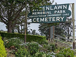
Aerial view of Colma, facing north; 280 Metro Center is in the lower center, adjacent to Woodlawn (to the north) and Greenlawn (to the east)
Originally, Colma's residents were primarily employed in occupations related to the many cemeteries in the town. Since the 1980s, however, Colma has become more diversified, and a variety of retail businesses and automobile dealerships has brought more sales tax revenue to the town government.[7][19] In 1986, 280 Metro Center opened for business in Colma; it is now recognized as the world's first power center.[20][21]
Site purchased in 1903 by the directors of the Independent Order of Odd Fellows cemetery in San Francisco using allegedly embezzled funds, resulting in the disavowal of the site by the IOOF Grand Lodge.[22]:113
Colma is situated on the San Francisco Peninsula at the highest point of the Merced Valley, a gap between San Bruno Mountain and the northernmost foothills of the Santa Cruz Mountain Range.[26][27] The foothills and eastern flanks of the range are composed largely of poorly consolidated Pliocene-Quaternary freshwater and shallow marine sediments that include the Colma and Merced Formations, recent slope wash, ravine fill, colluvium, and alluvium. These surficial deposits unconformably overlay the much older Jurassic to Cretaceous-aged Franciscan Assemblage. The Junipero Serra Landfill, which closed in 1983 and extended approximately 135ft (41m) deep, was developed and reopened as the 260,000sqft (24,000m2) mixed-use Metro Center.[28]
BART has two stations serving Colma: Colma, at the northern border near Daly City, and South San Francisco, just across the southern border. In addition, SamTrans buses serve the city with public transportation.
There are three primary north-south roads for automobile and truck traffic through Colma; from west to east, they are Junipero Serra Boulevard, El Camino Real, and Hillside Boulevard. They are connected approximately through the center of Colma by Serramonte Boulevard.
Government
Colma Town Hall, at the intersection of El Camino Real and Serramonte Blvd.
The census reported that 1,450 people (96.2% of the population) lived in households, 26 (1.7%) lived in non-institutionalized group quarters, and 31 (2.1%) were institutionalized.[32]
There were 509 households, out of which 192 (37.7%) had children under the age of 18 living in them, 224 (44.0%) were married-couple households, 32 (6.3%) were cohabiting couple households, 127 (25.0%) had a female householder with no partner present, and 126 (24.8%) had a male householder with no partner present. 110 households (21.6%) were one person, and 49 (9.6%) were one person aged 65 or older. The average household size was 2.85.[32] There were 353 families (69.4% of all households).[33]
The age distribution was 302 people (20.0%) under the age of 18, 116 people (7.7%) aged 18 to 24, 378 people (25.1%) aged 25 to 44, 430 people (28.5%) aged 45 to 64, and 281 people (18.6%) who were 65years of age or older. The median age was 41.8years. For every 100 females, there were 103.6 males.[32]
There were 526 housing units at an average density of 278.2 unitsper square mile (107.4 units/km2), of which 509 (96.8%) were occupied. Of these, 247 (48.5%) were owner-occupied, and 262 (51.5%) were occupied by renters.[32]
In 2023, the US Census Bureau estimated that the median household income was $121,488, and the per capita income was $49,693. About 8.6% of families and 9.5% of the population were below the poverty line.[34]
The Census reported that 1,763 people (98.4% of the population) lived in households, 0 (0%) lived in non-institutionalized group quarters, and 29 (1.6%) were institutionalized.
There were 564 households, out of which 217 (38.5%) had children under the age of 18 living in them, 271 (48.0%) were opposite-sex married couples living together, 110 (19.5%) had a female householder with no husband present, 42 (7.4%) had a male householder with no wife present. There were 44 (7.8%) unmarried opposite-sex partnerships, and 8 (1.4%) same-sex married couples or partnerships. 91 households (16.1%) were made up of individuals, and 31 (5.5%) had someone living alone who was 65 years of age or older. The average household size was 3.13. There were 423 families (75.0% of all households); the average family size was 3.45.
The population was spread out, with 390 people (21.8%) under the age of 18, 178 people (9.9%) aged 18 to 24, 532 people (29.7%) aged 25 to 44, 488 people (27.2%) aged 45 to 64, and 204 people (11.4%) who were 65 years of age or older. The median age was 36.4 years. For every 100 females, there were 92.7 males. For every 100 females age 18 and over, there were 88.9 males.
There were 586 housing units at an average density of 306.9 per square mile (118.5/km2), of which 224 (39.7%) were owner-occupied, and 340 (60.3%) were occupied by renters. The homeowner vacancy rate was 1.7%; the rental vacancy rate was 2.3%. 738 people (41.2% of the population) lived in owner-occupied housing units and 1,025 people (57.2%) lived in rental housing units.
In popular culture
Harold and Maude, (1971), a dark comedy about a death-obsessed young man and a vivacious older woman, filmed scenes at Holy Cross Cemetery and elsewhere on the Peninsula.[36]
Colma (1998), the fourth studio album released by guitarist Buckethead, makes reference to the town of Colma.
Alive in Necropolis (2008), a novel by Doug Dorst.
Colma: The Musical (2007) is an American independent film that was shot on location in Colma and Daly City.[37][38]
Further reading
A Second Final Rest: The History of San Francisco's Lost Cemeteries (2005) a documentary about the relocation of cemeteries from San Francisco to Colma.[39]
Colma: A Journey of Souls (2014) a documentary film about the history of Colma.[40]
↑"Colma Boundary Map". Town of Colma. December 4, 2020. Retrieved September 1, 2023.
↑Colma Cardroom Project, Environmental Impact Report, Environmental Science Associates, prepared for the city of Colma (1993); IV.B. "Geology and Soils"Archived July 25, 2015, at the Wayback Machine .
↑M.Papineau, B.George, J.Buxton et al., Environmental Impact Report for the Metro Center, Colma, California, Earth Metrics report 10062, prepared for the city of Colma and the California State Clearinghouse (1989)
This page is based on this Wikipedia article Text is available under the CC BY-SA 4.0 license; additional terms may apply. Images, videos and audio are available under their respective licenses.