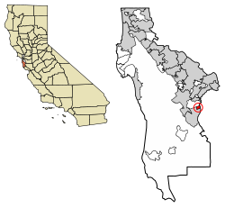
Ladera, California

Last updated
Ladera
San Mateo County California Incorporated and Unincorporated areas Ladera Highlighted 0639094.svg
Location of Ladera in San Mateo County, California.
USA California location map.svg
Red pog.svg
Ladera
Location within the state of California
Coordinates: 37°23′58″N122°11′50″W / 37.39944°N 122.19722°W / 37.39944; -122.19722 Coordinates: 37°23′58″N122°11′50″W / 37.39944°N 122.19722°W / 37.39944; -122.19722
Country United States
State California
County San Mateo
Government
  TypeCommunity Association
Area
[1]
  Total0.443 sq mi (1.146 km2)
  Land0.443 sq mi (1.146 km2)
  Water0 sq mi (0 km2)  0%
Elevation
[2]
315 ft (96 m)
Population
 (2020)
  Total1,557
  Density3,500/sq mi (1,400/km2)
Time zone UTC-8 (Pacific (PST))
  Summer (DST) UTC-7 (PDT)
ZIP codes
94028
Area code(s) 650
FIPS code 06-39094
GNIS feature ID2628745
[2]

Ladera is a census-designated place (CDP) in southern San Mateo County, California, [2] adjacent to Portola Valley. Primarily a residential community, it comprises approximately 520 homes, governed by the Ladera Community Association. The ZIP Code is 94028 and the community is inside area code 650. The population was 1,557 at the 2020 census.

Contents

Geography

Ladera is located at the bottom of the eastern slope of the Peninsula Range of the Santa Cruz Mountains. [3] It is bordered on the west by the Jasper Ridge Biological Preserve operated by Stanford University, on the east by Alpine Road, and on the north by Webb Ranch.

According to the United States Census Bureau, the CDP covers an area of 0.4 square miles (1.1 km2), all of it land.

History

The Ramaytush Ohlone peoples occupied the land that is now the community of Ladera, prior to the settlement of California by the Spanish. Ladera is located on the Rancho Corte de Madera Mexican land grant.

The land was used for grazing and timber through 1927 when it was joined to the Ormondale Ranch, owned by the Macdonough family. The Macdonoughs raised cattle and sheep, and bred racehorses; their most famous stud, Ormonde, had raced in England and never lost a race. In the 1930s, the majority of the Ormondale Ranch land was developed and incorporated into Portola Valley.

In 1944, the Peninsula Housing Association (PHA) was formed with the goal of purchasing a tract of land and developing a housing cooperative. Several prominent members of the Stanford and Palo Alto communities joined to develop the fledgling PHA co-op. It began subscribing members in 1945 and its 150 members purchased the remaining 260 acres (1.1 km2) of the former Ormondale ranch for $155,000 on July 31, 1946. The co-op selected noted landscape architect Garrett Eckbo to lay out the design for the new community. [4] Architects Joseph Allen Stein and John Funk were chosen to design several of the earliest model homes.

The members chose the name Ladera (over alternatives Lark Hills and New Rochdale ) to reflect the Spanish history of the land — ladera is Spanish for hillside. Streets are Spanish phrases or botanical names. Early members of the cooperative included author Wallace Stegner and Klystron tube inventor Sigurd Varian of Varian Associates. (Varian had grown up in Halcyon, another intentional community in southern California.)

The PHA refused to place restrictive covenants on title deeds. However, the Federal Housing Administration would not insure loans to co-ops that included African American members - an example of redlining. [5] Banks would not finance loans or issue mortgages without government approval, so the PHA failed due to financial difficulties after only a few houses had been constructed. [6] The co-op proposed the inclusion of a quota system, promising that the proportion of African American members would not exceed the proportion of African Americans in California's overall population. This stipulation was not sufficient for the government. The land was later sold to Hare, Brewer, and Kelley, who completed the development. Directly following completion, single family homes in the development were only sold to whites. [5] Four non-white families were required to sell their land. These types of provisions were mostly legally unenforceable after Shelley v. Kraemer (1948) though they continued to be added and privately unenforceable after the Fair Housing Act of 1968 (see Housing discrimination in the United States).

In November 2021, following a two-and-a-half-month petition drive that achieved signatures from owners of 391 of the 534 properties in Ladera, the clause forbidding residency by people "other than those of the Caucasian or white race" was replaced by the statement: "By provisions outlined in this document the Ladera Community has formally acted to remove the Race Restriction that previously comprised this subsection, and by so doing asserts that the Ladera Community supports diversity, equity, and inclusion." [7] [8]

Demographics

Historical population
CensusPop.
2010 1,426
2020 1,5579.2%
U.S. Decennial Census [9]

The 2010 United States Census [10] reported that Ladera had a population of 1,426. The population density was 3,221.9 inhabitants per square mile (1,244.0/km2). The racial makeup of Ladera was 1,269 (89.0%) White, 3 (0.2%) African American, 1 (0.1%) Native American, 98 (6.9%) Asian, 0 (0.0%) Pacific Islander, 5 (0.4%) from other races, and 50 (3.5%) from two or more races. Hispanic or Latino of any race were 33 persons (2.3%).

The Census reported that 1,426 people (100% of the population) lived in households, 0 (0%) lived in non-institutionalized group quarters, and 0 (0%) were institutionalized.

There were 525 households, out of which 207 (39.4%) had children under the age of 18 living in them, 392 (74.7%) were opposite-sex married couples living together, 24 (4.6%) had a female householder with no husband present, 6 (1.1%) had a male householder with no wife present. There were 10 (1.9%) unmarried opposite-sex partnerships, and 7 (1.3%) same-sex married couples or partnerships. 86 households (16.4%) were made up of individuals, and 53 (10.1%) had someone living alone who was 65 years of age or older. The average household size was 2.72. There were 422 families (80.4% of all households); the average family size was 3.05.

The population was spread out, with 405 people (28.4%) under the age of 18, 43 people (3.0%) aged 18 to 24, 243 people (17.0%) aged 25 to 44, 443 people (31.1%) aged 45 to 64, and 292 people (20.5%) who were 65 years of age or older. The median age was 46.0 years. For every 100 females, there were 94.5 males. For every 100 females age 18 and over, there were 90.1 males.

There were 539 housing units at an average density of 1,217.8 per square mile (470.2/km2), of which 481 (91.6%) were owner-occupied, and 44 (8.4%) were occupied by renters. The homeowner vacancy rate was 0.2%; the rental vacancy rate was 2.2%. 1,312 people (92.0% of the population) lived in owner-occupied housing units and 114 people (8.0%) lived in rental housing units.

According to Business Insider , as of December 2018 Ladera is the most educated town in the United States. [11]

Political and economic

As an unincorporated area, Ladera lies in the sphere of influence of Portola Valley. It draws its police services from the County of San Mateo and is a part of Woodside Fire District.

School districts that serve Ladera include the Las Lomitas Elementary School District for elementary and middle school and the Sequoia Union High School District for high school. The local school in the community is leased to the private Woodland School.

Along Alpine Road are two small commercial developments: a small shopping center to the north of La Mesa and an office complex south of La Mesa.

Notes

  1. U.S. Census Archived 2012-07-02 at the Wayback Machine
  2. 1 2 3 U.S. Geological Survey Geographic Names Information System: Ladera, California
  3. "US Gazetteer files: 2010, 2000, and 1990". United States Census Bureau. 2011-02-12. Retrieved 2011-04-23.
  4. Treib, Marc, and Dorothée Imbert. Garrett Eckbo: Modern Landscapes for Living. Berkeley: University of California Press, 1997. http://ark.cdlib.org/ark:/13030/ft6g50073x/
  5. 1 2 Rothstein, Richard (2017). The Color of Law: A Forgotten History of How Our Government Segregated America . p. 11.
  6. "Ladera Community Association History". www.laderaonline.org. Retrieved 30 May 2022. Also has more details of Ladera's history.
  7. Hepler, Lauren (15 November 2021). "Inside the quest to rewrite racist housing rules in a Silicon Valley town where homes go for $3 million". San Francisco Chronicle. Retrieved 30 May 2022.
  8. "The Ladera CC&R Race-Restriction Elimination Project". www.laderaonline.org. Retrieved 30 May 2022.
  9. "Census of Population and Housing". Census.gov. Retrieved June 4, 2016.
  10. "2010 Census Interactive Population Search: CA - Ladera CDP". U.S. Census Bureau. Archived from the original on July 15, 2014. Retrieved July 12, 2014.
  11. Kiersz, Andy. "Here's the most educated town in every state". Business Insider. Retrieved 2019-01-10.

Related Research Articles

Mojave Ranch Estates, Arizona CDP in Mohave County, Arizona

Mojave Ranch Estates is an unincorporated community and census-designated place (CDP) in Mohave County, Arizona, United States. The population was 53 as of the 2020 census.

Vail, Arizona CDP in Pima County, Arizona

Vail is a census-designated place (CDP) in Pima County, Arizona, United States. It is 24 miles (39 km) southeast of Tucson. The population was 10,208 at the 2010 census, up from 2484 in the 2000 census. The area is known for the nearby Colossal Cave, a large cave system, and the Rincon Mountains District of Saguaro National Park, a top tourism spot within Arizona.

Knightsen, California Census-designated place in California, United States

Knightsen is a census-designated place (CDP) in Contra Costa County, California, in the United States. As of the 2010 census, the CDP population was 1,568, up from 861 reported in the 2000 census.

Ladera Heights, California Unincorporated community in Los Angeles County, California, US

Ladera Heights is a community and unincorporated area in Los Angeles County, California. The population was 6,634 at the 2020 census. Culver City lies to its west, the Baldwin Hills neighborhood to its north, the View Park-Windsor Hills community to its east, the Westchester neighborhood to its south and southwest and the city of Inglewood to its southeast. With an average household income of $132,824, Ladera Heights ranks third amongst the ten wealthiest Black communities in the United States.

View Park–Windsor Hills, California Unincorporated community in California, United States

View Park−Windsor Hills is an unincorporated community in Los Angeles County, California.

Lucas Valley-Marinwood, California Census-designated place in California, United States

Lucas Valley-Marinwood is a census-designated place (CDP) in Marin County, California, United States. It includes the neighborhoods of Lucas Valley and Marinwood. As of the 2020 census, the population was 6,259.

Coto de Caza, California Census-designated place in California, United States

Coto de Caza is a census-designated place (CDP) and guard-gated private community in Orange County, California. The population was 14,799 at the 2017 census.

Portola Hills, California Place in California, United States

Portola Hills is a district in the city of Lake Forest, California in Orange County, United States. It was formerly an unincorporated community and census-designated place before it was annexed into Lake Forest in 2000. The population was 6,391 at the 2000 census. Portola Hills lies near Whiting Ranch Wilderness Park and Cleveland National Forest. Foothill Ranch is to the west, Rancho Santa Margarita in the southeast, Mission Viejo in the south, and the unincorporated regions of Silverado and Santiago Canyon to the north and northeast.

Beckwourth, California Census-designated place in California, United States

Beckwourth is a census-designated place (CDP) in Plumas County, California, United States. Beckwourth is located on the Middle Fork Feather River 5 miles (8.0 km) east of Portola. The population was 432 at the 2010 census, up from 342 at the 2000 census.

Valley Ranch, California Census-designated place in California, United States

Valley Ranch is a census-designated place in Plumas County, California, United States. The population was 109 at the 2010 census, up from 92 at the 2000 census.

Fairbanks Ranch, California Census-designated place in California, United States

Fairbanks Ranch is a census-designated place (CDP) in San Diego County, California. The population was 3,148 at the 2010 census, up from 2,244 at the 2000 census. The entire population is contained within two gated communities, divided into North and South sections by the formerly private San Dieguito Road.

Spring Valley, San Diego County, California Census-designated place in California, United States

Spring Valley is a census-designated place (CDP) in the East County region of San Diego County, California. The population was 28,205 at the 2010 census.

Arroyo Grande, California City in California, United States

Arroyo Grande is a city in San Luis Obispo County, California, United States. The population was 17,252 as of the 2010 Census.

Cambria, California Place in California, United States

Cambria is a seaside village in San Luis Obispo County, California, United States midway between San Francisco and Los Angeles along California State Route 1. The name Cambria, chosen in 1869, is the Latin name for Wales. Cambria is situated amidst Monterey pines in one of only three such native forests. Previously, the town had gone by the names of Slabtown, Rosaville, San Simeon, and Santa Rosa. For statistical purposes, the United States Census Bureau has defined the unincorporated community as a census-designated place (CDP). The CDP had a population of 5,678 at the 2020 census, down from 6,032 at the 2010 census.

Portola Valley, California Town in California, United States

Portola Valley is a town in San Mateo County, California. Located on the San Francisco Peninsula in the Bay Area, Portola Valley is a small, wealthy community nestled on the eastern slopes of the Santa Cruz Mountains.

Ladera Ranch, California Census-designated place in California, United States

Ladera Ranch is a master-planned community and census-designated place located in south Orange County, California, just outside the city limits of San Juan Capistrano, Rancho Santa Margarita and Mission Viejo.

Stevenson Ranch, California Unincorporated community in California, United States

Stevenson Ranch is an unincorporated community in the Santa Clarita Valley of Los Angeles County, California. Stevenson Ranch is set in the foothills of the Santa Susana Mountains and lies west of Interstate 5 and the city of Santa Clarita. Stevenson Ranch encompasses about 6.4 square miles (17 km2). About 1,000 acres (4.0 km2) are set aside as parks, recreation areas, and open space. A master-planned community, it was approved by the county in 1987. The population was 17,557 at the time of the 2010 census. For statistical purposes, the Census Bureau has designated it a census-designated place (CDP).

Potter Valley is a census-designated place in Mendocino County, California, United States. It is located 18 miles (29 km) north-northeast of Ukiah, at an elevation of 948 feet. It is located at the headwaters of the East Fork Russian River. The CDP population was 646 at the 2010 census.

Yolo is an unincorporated community and census-designated place in Yolo County, California. It is located 4.9 miles northwest of the county seat, Woodland and 24 miles northwest of the state capital of Sacramento. Yolo's ZIP Code is 95697 and its area code 530. It lies at an elevation of 82 feet. The population was 452 at the 2010 census.

Elizabeth Lake, California Census-designated place in California, United States

Elizabeth Lake is a census-designated place (CDP) and unincorporated community on Elizabeth Lake (lake), in Los Angeles County, California, United States. As of the 2010 census it had a population of 1,756.