Related Research Articles

San Mateo County, officially the County of San Mateo, is a county located in the U.S. state of California. As of the 2020 census, the population was 764,442. Redwood City is the county seat, and the third most populated city following Daly City and San Mateo. San Mateo County is included in the San Francisco–Oakland–Berkeley, CA MSA, Silicon Valley, and is part of the San Francisco Bay Area, the nine counties bordering San Francisco Bay. It covers most of the San Francisco Peninsula. San Francisco International Airport is located in the northeastern area of the county and is approximately 7 miles (11 km) south of the city and county limits of San Francisco, even though the airport itself is assigned a San Francisco postal address. The county's built-up areas are mostly suburban, and are home to many corporate campuses.

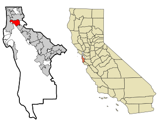
Menlo Park is a city at the eastern edge of San Mateo County within the San Francisco Bay Area of California, United States. It is bordered by San Francisco Bay on the north and east; East Palo Alto, Palo Alto, and Stanford to the south; and Atherton, North Fair Oaks, and Redwood City to the west. It had 33,780 residents at the 2020 United States census. It is home to the corporate headquarters of Meta, and is where Google, Roblox Corporation and Round Table Pizza were founded. The train station holds the record as the oldest continually operating train station in California. It is one of the most educated cities in California and the United States; nearly 70% of residents over 25 have earned a bachelor's degree or higher.

Daly City is the second most populous city in San Mateo County, California, United States. The population was 104,901 at the 2020 census. Located in the San Francisco Bay Area, and immediately south of San Francisco, it is named for businessman and landowner John Donald Daly.

Millbrae is a city located in northern San Mateo County, California, United States. To the northeast is San Francisco International Airport; San Bruno is to the northwest, and Burlingame is to the southeast. It is bordered by San Andreas Lake to the southwest. The population was 23,216 at the 2020 census.
San Bruno is a city in San Mateo County, California, United States, incorporated in 1914. The population was 43,908 at the 2020 United States Census. The city is between South San Francisco and Millbrae, adjacent to San Francisco International Airport and Golden Gate National Cemetery; it is approximately 12 miles (19 km) south of Downtown San Francisco.

San Carlos is a city in San Mateo County, California, United States. The population is 30,722 per the 2020 census.
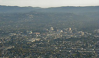
San Mateo is a city in San Mateo County, California, United States, on the San Francisco Peninsula. About 20 miles (32 km) south of San Francisco, the city borders Burlingame to the north, Hillsborough to the west, San Francisco Bay and Foster City to the east and Belmont to the south. The population was 105,661 at the 2020 census.

The Bayshore Freeway is a part of U.S. Route 101 in the San Francisco Bay Area of the U.S. state of California. It runs along the west shore of the San Francisco Bay, connecting San Jose with San Francisco. Within the city of San Francisco, the freeway is also known as James Lick Freeway, named after the California philanthropist. The road was originally built as a surface road, the Bayshore Highway, and later upgraded to freeway standards. Before 1964, it was mostly marked as U.S. Route 101 Bypass, with US 101 using the present State Route 82.

State Route 82 is a state highway in the U.S. state of California that runs from Interstate 880 (I-880) in San Jose to I-280 in San Francisco following the San Francisco Peninsula. It is the spinal arterial road of the peninsula and runs parallel to the nearby Caltrain line along much of the route. For much of its length, the highway is named El Camino Real and formed part of the historic El Camino Real mission trail. It passes through and near the historic downtowns of many Peninsula cities, including Burlingame, San Mateo, Redwood City, Menlo Park, Palo Alto, Mountain View, and Sunnyvale, and through some of the most walkable and transit-oriented neighborhoods in the region.

Coyote Point Recreation Area is a 670-acre (270 ha) park operated by San Mateo County, California in the United States. Located on San Francisco Bay, it is south of San Francisco International Airport on the border of Burlingame and San Mateo. Facilities within the park include a large playground, the CuriOdyssey junior museum, a sandy bathing beach, a marina and yacht club, hiking trails, and picnic areas. In addition, the San Mateo County Sheriff's office has a shooting range on-site for training of law enforcement. It is adjacent to the Peninsula Humane Society and the municipal Poplar Creek Golf Course.
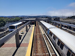
Daly City station is an elevated Bay Area Rapid Transit (BART) station in Daly City, California, just south of the city limits of San Francisco. It is adjacent to Interstate 280 and California Route 1, which it serves as a park-and-ride station. The station is served by the Red, Yellow, Green, and Blue lines; it is the west terminal for the Green and Blue lines.

San Bruno Mountain is a fault-block horst in northern San Mateo County, California; its northern slopes rise in San Francisco. It is surrounded by San Francisco Bay and the cities of Brisbane, Colma, Daly City, and South San Francisco, and has played an important role in the history of all these communities.
Bay Meadows was a horse racing track in San Mateo, California from 1934 until 2008, in the San Francisco Bay Area in the United States.
California's 15th congressional district is a congressional district in the U.S. state of California. The district is currently represented by Democrat Kevin Mullin.

Bayshore station is a Caltrain commuter rail station in the Visitacion Valley neighborhood of San Francisco, California. The station is on the border of San Francisco and the neighboring city of Brisbane. The parking lot and the northern section of the station are in San Francisco, while the remainder is in Brisbane. The station address is in San Francisco proper.

South San Francisco station is a Caltrain station in South San Francisco, California. The station is on the east side of the Bayshore Freeway, east and south of the curved Grand Avenue overpass, and north of where the freeway crosses over the tracks. Downtown South San Francisco is to the west, across the freeway. It previously underwent a substantial modernization and expansion project, completed in January 2022.

Tanforan Racetrack, also known as Tanforan Park, was a thoroughbred horse racing facility in San Bruno, on the San Francisco Peninsula, in California. It was in operation from November 4, 1899, to 1964. The horse racing track and buildings were constructed to serve a clientele from nearby San Francisco.
Bayshore Elementary School District is a small school district located in the northeastern corner of San Mateo County, California, United States, consisting of one PreK-8 school, Bayshore Elementary. The school district is located in the former town of Bayshore, which disincorporated and was later annexed to the city of Daly City.
The Brisbane Baylands is a 660-acre (270 ha) parcel of land in Brisbane, just south of the San Francisco border. There have been several proposals to develop the site, which was previously used as a railyard and a municipal landfill; historical uses have led to contaminated soil, polluted stormwater runoff, and potential buried toxic waste. None of the present proposals have been approved by Brisbane's city council.
The Peninsula Library System (PLS) is a consortium of public and community college libraries in San Mateo County, California, United States, which serves the part of the San Francisco Bay Area known as "The Peninsula". The system has dozens of branches in local communities and at various area community colleges, a bookmobile, and automated book kiosks called Library-a-Go-Go.
References
- 1 2 Levy, Joan (March 5, 2007). "Bayshore City was built for the dogs". The Daily Journal. Retrieved November 23, 2023.
- ↑ "Bayshore City Voted; Dogs to Leave Belmont". The San Mateo Times and Daily News Leader. December 21, 1932. p. 1-.
- ↑ "Bayshore City Votes Own End". San Mateo Times. February 6, 1940.
| Bodies of water |
|  | |||||||||||
|---|---|---|---|---|---|---|---|---|---|---|---|---|---|
| Counties | |||||||||||||
| Cities and towns |
| ||||||||||||
| CDPs over 10k | |||||||||||||
| Sub-regions | |||||||||||||
| Other | |||||||||||||
Municipalities and communities of San Mateo County, California, United States | ||
|---|---|---|
| Cities and towns |  | |
| CDPs | ||
| Unincorporated communities | ||
| Ghost towns | ||
| | This San Mateo County, California-related article is a stub. You can help Wikipedia by expanding it. |