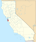
Broadmoor, California

Last updated

Broadmoor
San Mateo County California Incorporated and Unincorporated areas Broadmoor Highlighted.svg
Location in San Mateo County and the state of California
Usa edcp location map.svg
Red pog.svg
Broadmoor
Location in the United States
Coordinates: 37°41′33″N122°28′44″W / 37.69250°N 122.47889°W / 37.69250; -122.47889
Country United States
State California
County San Mateo
Area
[1]
  Total0.43 sq mi (1.12 km2)
  Land0.43 sq mi (1.12 km2)
  Water0.00 sq mi (0.00 km2)  0%
Elevation
348 ft (106 m)
Population
 (2020)
  Total4,411
  Density10,210.65/sq mi (3,942.63/km2)
Time zone UTC-8 (PST)
  Summer (DST) UTC-7 (PDT)
ZIP code
94014, 94015
Area code 650
FIPS code 06-08338
GNIS feature ID0255917

Broadmoor is a census-designated place (CDP) in an unincorporated area of San Mateo County, California, United States. The enclave is entirely surrounded by Daly City. The population was 4,176 at the 2010 census.

Contents

Geography

Broadmoor is located at 37°41′33″N122°28′44″W / 37.69250°N 122.47889°W / 37.69250; -122.47889 (37.692433, -122.478901). [2]

According to the United States Census Bureau, the CDP has a total area of 0.432 square miles, all of it land. [3]

Demographics

Historical population
CensusPop.Note
2010 4,176
2020 4,4115.6%
U.S. Decennial Census [4]

2020

Broadmoor's population in 2020 was reported as 4,411. [5] The population density was 10,210.6 inhabitants per square mile (3,942.3/km2). [5] [3] The racial makeup of the CDP was 1,206 (27.3%) White, 77 (6.4%) Black or African American, 43 (1.0%) American Indian and Alaska Native, 2,084 (47.2%) Asian, 38 (0.9%) Native Hawaiian and Other Pacific Islander, 466 (10.6%) Some Other Race, and 497 (11.3%) two or more races. The largest mixed-race groups were White and Some Other Race (271, 6.1%) and White and Asian (102, 2.3%). [5] 982 residents (22.3%) were Hispanic or Latino (of any race). [6] Among the residents who were not Hispanic or Latino, 1,060 were White, 65 were Black or African American, 14 were American Indian and Alaska Native, 2,061 were Asian, 34 were Native Hawaiians or other Pacific Islanders, 25 were Some Other Race, and 170 were of two or more races. [6] Among Hispanic and Latino residents, 146 identified their race as White, 12 Black or African American, 29 American Indian and Alaska Native, 23 Asian, 4 Native Hawaiian and Other Pacific Islander, 441 Some Other Race, and 327 two or more races. 250 Hispanic or Latino residents identified their race as both White and Some Other Race. [5] [6]

There were 1464 housing units, of which 1427 were occupied and 37 were vacant. [7]

3,658 people (82.9%) were 18 years old or older, [8] while 753 (17.1%) were younger than 18 years old. [5] [8]

65 people (1.5%) were living in group quarters, including 20 in nursing facilities and 45 in other facilities. [9]

2010

At the 2010 census Broadmoor had a population of 4,176. The population density was 9,277.0 inhabitants per square mile (3,581.9/km2). The racial makeup of Broadmoor was 1,705 (40.8%) White, 100 (2.4%) African American, 30 (0.7%) Native American, 1,676 (40.1%) Asian, 44 (1.1%) Pacific Islander, 359 (8.6%) from other races, and 262 (6.3%) from two or more races. Hispanic or Latino of any race were 981 people (23.5%). [10]

The census reported that 4,076 people (97.6% of the population) lived in households, 68 (1.6%) lived in non-institutionalized group quarters, and 32 (0.8%) were institutionalized.

There were 1,349 households, 461 (34.2%) had children under the age of 18 living in them, 782 (58.0%) were opposite-sex married couples living together, 163 (12.1%) had a female householder with no husband present, 80 (5.9%) had a male householder with no wife present. There were 64 (4.7%) unmarried opposite-sex partnerships, and 12 (0.9%) same-sex married couples or partnerships. 227 households (16.8%) were one person and 110 (8.2%) had someone living alone who was 65 or older. The average household size was 3.02. There were 1,025 families (76.0% of households); the average family size was 3.40.

The age distribution was 854 people (20.5%) under the age of 18, 345 people (8.3%) aged 18 to 24, 1,095 people (26.2%) aged 25 to 44, 1,228 people (29.4%) aged 45 to 64, and 654 people (15.7%) who were 65 or older. The median age was 41.7 years. For every 100 females, there were 95.9 males. For every 100 females age 18 and over, there were 93.9 males.

There were 1,392 housing units at an average density of 3,092.3 per square mile, of the occupied units 1,037 (76.9%) were owner-occupied and 312 (23.1%) were rented. The homeowner vacancy rate was 0.7%; the rental vacancy rate was 1.9%. 2,981 people (71.4% of the population) lived in owner-occupied housing units and 1,095 people (26.2%) lived in rental housing units.

2000

At the 2000 census there were 4,026 people, 1,275 households, and 984 families in the CDP. The population density was 8,998.9 inhabitants per square mile (3,474.5/km2). There were 1,295 housing units at an average density of 2,894.6 per square mile (1,117.6/km2). The racial makeup of the CDP in 2010 was 30.7% non-Hispanic White, 2.0% non-Hispanic African American, 0.2% Native American, 39.1% Asian, 1.0% Pacific Islander, 0.3% from other races, and 3.3% from two or more races. Hispanic or Latino of any race were 23.5%. [11]

Of the 1,275 households 34.9% had children under the age of 18 living with them, 60.0% were married couples living together, 13.0% had a female householder with no husband present, and 22.8% were non-families. 16.2% of households were one person and 8.6% were one person aged 65 or older. The average household size was 3.11 and the average family size was 3.48.

The age distribution was 23.2% under the age of 18, 7.4% from 18 to 24, 27.6% from 25 to 44, 26.7% from 45 to 64, and 15.1% 65 or older. The median age was 40 years. For every 100 females, there were 93.2 males. For every 100 females age 18 and over, there were 90.0 males.

The median household income was $69,836 and the median family income was $71,250. Males had a median income of $47,700 versus $37,784 for females. The per capita income for the CDP was $24,608. About 3.9% of families and 5.1% of the population were below the poverty line, including 4.8% of those under age 18 and 5.1% of those age 65 or over.

History

The farms that had long graced the area started to give way to suburban housing developments from the 1940s onwards.[ citation needed ] The residents of Broadmoor, rallying around their police protection district and their sense of identity as a separate community, have been mostly successful in fighting off annexation by Daly City, despite losing slices of their community's territory, including its police headquarters, in the many piecemeal annexations which over the years saw Daly City gradually encircle Broadmoor in its entirety.[ citation needed ] Daly City's attempts to annex the enclave and Broadmoor residents' resistance to those efforts have led to strained relations between the two entities at times. [12]

Public safety

A special property tax assessment funds the Broadmoor Police Department, which was founded in 1948 after residents grew concerned of long response times from the San Mateo County Sheriff's Department—most of whose deputies are based in the southern end of the county. The Broadmoor Police Protection District is governed by a Police Commission, the Broadmoor Police Protection District Board of Police Commissioners, which consists of three residents elected at large every four years. In 2007 State Senator Leland Yee (California's Eighth District) authored legislation sponsored by the Broadmoor Police Department to recognize Broadmoor as a municipal or city police department. Senate Bill 230, which was signed by Governor Schwarzenegger, provides Broadmoor Police with the same legal recognition and status of a city or municipal police department. The Broadmoor Police Department is staffed by eight full-time police officers, including the chief of police, and twenty-five part-time police officers.[ citation needed ]

As of 2021, an investigation of retirement fraud and misuse of public funds by former top employees of the District is ongoing. [13] [14] [15] The former police chief, Michael Connolly, was sentenced to probation for conflict-of-interest charges. [16]

Fire protection is provided by the Colma Fire Protection District. The Colma Fire Protection District also provides 24 hr paramedic (ALS) coverage 365 days a year. It is staffed with one paramedic at all times.

Government

In the California State Legislature, Broadmoor is in the 11th Senate District , represented by Democrat Scott Wiener, and in the 19th Assembly District , represented by Democrat Phil Ting. [17]

In the United States House of Representatives, Broadmoor is in California's 15th congressional district , represented by Democrat Kevin Mullin. [18]

Related Research Articles

<span class="mw-page-title-main">Del Aire, California</span> Census-designated place in California, United States

Del Aire is a census-designated place (CDP) in the inland South Bay, Los Angeles County, California, United States, between El Segundo and Hawthorne. The population was 10,001 at the 2010 census, up from 9,012 at the 2000 census.

<span class="mw-page-title-main">West Rancho Dominguez, California</span> Unincorporated community in California, United States

West Rancho Dominguez, formerly known as West Compton and also known as East Gardena, is an unincorporated census-designated place (CDP) located in southern Los Angeles County, California. Per the 2020 census, the population was 24,347. The community lies to the west of the city of Compton. The ZIP Codes encompassing the CDP area are 90220 & 90248.

<span class="mw-page-title-main">Tamalpais-Homestead Valley, California</span> Census-designated place in California, United States

Tamalpais-Homestead Valley is a census-designated place (CDP) in Marin County, California, United States. The population was 11,492 at the 2020 census.

<span class="mw-page-title-main">Camp Pendleton Mainside, California</span> Census-designated place in California, United States

Camp Pendleton Mainside is a census-designated place (CDP) in San Diego County, California, located at the southeast corner of the Marine Corps Base Camp Pendleton. Per the 2020 census, the population was 9,683. It was formerly known as Camp Pendleton North, but its name was changed for the 2020 Census. Along with Camp Pendleton South, it is one of two CDPs located on the base.

<span class="mw-page-title-main">Lake Magdalene, Florida</span> Census-designated place in Florida, United States

Lake Magdalene is a census-designated place (CDP) in Hillsborough County, Florida, United States. It is part of the Tampa Bay area. The population was 30,742 at the 2020 census.

<span class="mw-page-title-main">Palmetto Estates, Florida</span> Census-designated place in Florida

Palmetto Estates is an unincorporated area and census-designated place (CDP) in Miami-Dade County, Florida, United States. It is part of the Miami metropolitan area of South Florida. The population was 13,498 at the 2020 census.

<span class="mw-page-title-main">The Crossings, Florida</span> CDP in Florida

The Crossings is a census-designated place (CDP) and suburb of Miami in Miami-Dade County, Florida, United States. It is part of the Miami metropolitan area of South Florida. The CDP includes the neighborhoods of The Crossings, Devon Aire, and Calusa. The population was 23,276 at the 2020 census.

<span class="mw-page-title-main">The Hammocks, Florida</span> Census-designated place in Florida

The Hammocks is a planned community and census-designated place in Miami-Dade County, Florida, United States. It is part of the Miami metropolitan area of South Florida. The population was 59,480 at the 2020 census, up from 51,003 in 2010.

<span class="mw-page-title-main">Three Lakes, Florida</span> Census-designated place in Florida

Three Lakes is a census-designated place (CDP) and planned community in Miami-Dade County, Florida, United States. It is part of the Miami metropolitan area of South Florida. The population was 16,540 at the 2020 census, up from 15,047 in 2010.

<span class="mw-page-title-main">West Little River, Florida</span> CDP in Miami-Dade County, Florida, US

West Little River is a census-designated place (CDP) in Miami-Dade County, Florida, United States. It is part of the Miami metropolitan area of South Florida. The population was 34,128 at the 2020 census.

<span class="mw-page-title-main">West Perrine, Florida</span> Census-designated place in Florida

West Perrine is a census-designated place (CDP) in Miami-Dade County, Florida, United States. It is part of the Miami metropolitan area of South Florida. The population was 10,602 at the 2020 census, up from 9,460 in 2010.

<span class="mw-page-title-main">Westview, Florida</span> Census-designated place in Florida

Westview is a census-designated place (CDP) in Miami-Dade County, Florida, United States. It is part of the Miami metropolitan area of South Florida. The population was 9,923 at the 2020 census.

<span class="mw-page-title-main">Frankfort Square, Illinois</span> Census-designated place in Illinois, United States

Frankfort Square is a census-designated place (CDP) in Will County, Illinois, United States. Per the 2020 census, the population was 8,968.

<span class="mw-page-title-main">Marlton, Maryland</span> Census-designated place in Maryland

Marlton is an unincorporated area and census-designated place (CDP) in Prince George's County, Maryland, United States. The population was 9,802 at the 2020 census. The Marlton housing development, at first briefly called "Brandywine Country", grew up along U.S. Route 301 in the 1970s, and is part of the greater Upper Marlboro community. Originally made up of only single-family homes, more recently townhouses have been added.

<span class="mw-page-title-main">Rosaryville, Maryland</span> Census-designated place in Maryland, US

Rosaryville is an unincorporated area and census-designated place (CDP) in Prince George's County, Maryland, United States, located south of Cinton and Upper Marlboro beside U.S. Route 301. Per the 2020 census, the population was 11,548. including housing developments and rural open space. It was named for a local Roman Catholic church. Close to Rosaryville are the Marlton housing development, Maryland Veterans Cemetery, the Southern Maryland Farmers Market, and Rosaryville State Park.

<span class="mw-page-title-main">Springdale, Maryland</span> Census-designated place in Maryland

Springdale is an unincorporated area and census-designated place (CDP) in Prince George's County, Maryland, United States. Per the 2020 census, the population was 5,301.

<span class="mw-page-title-main">South Miami Heights, Florida</span> Census-designated place in Florida

South Miami Heights is a census-designated place (CDP), originally known as Eureka, in Miami-Dade County, Florida. It is part of the Miami metropolitan area of South Florida. The population was 36,770 as of the 2020 census.

<span class="mw-page-title-main">Castle Point, Missouri</span> Place in Missouri, United States

Castle Point is an unincorporated community and census-designated place (CDP) in St. Louis County, Missouri, United States. The population was 3,962 at the 2010 census.

<span class="mw-page-title-main">North Amityville, New York</span> Hamlet and Census-designated place in New York, United States

North Amityville is a hamlet and census-designated place (CDP) in the Town of Babylon in Suffolk County, on the South Shore of Long Island, in New York. The population was 18,643 at the 2020 Census.

Unity, also known as Hodges Park Station, is an unincorporated community and census-designated place in Alexander County, Illinois, United States. Illinois Route 127 passes by Unity south of Tamms. The population as of the 2020 census was 98.

References

  1. "2020 U.S. Gazetteer Files". United States Census Bureau. Retrieved October 30, 2021.
  2. "US Gazetteer files: 2010, 2000, and 1990". United States Census Bureau. February 12, 2011. Retrieved April 23, 2011.
  3. 1 2 "2020 National Places Gazetteer Files". Census.gov. United States Census Bureau. 2020. Retrieved August 10, 2022.
  4. "Census of Population and Housing". Census.gov. Retrieved June 4, 2016.
  5. 1 2 3 4 5 "2020 Census Redistricting Data (P.L. 94-171) Summary Files table P1. – Race for Broadmoor CDP, California". Census.gov. United States Census Bureau. September 16, 2021. Retrieved August 10, 2022.
  6. 1 2 3 "2020 Census Redistricting Data (P.L. 94-171) Summary Files table P2. – Hispanic or Latino, and not Hispanic or Latino by Race for Broadmoor CDP, California". Census.gov. United States Census Bureau. September 16, 2021. Retrieved August 10, 2022.
  7. "2020 Census Redistricting Data (P.L. 94-171) Summary Files table H1. – Occupancy Status (Housing) for Broadmoor CDP, California". Census.gov. United States Census Bureau. September 16, 2021. Retrieved August 10, 2022.
  8. 1 2 "2020 Census Redistricting Data (P.L. 94-171) Summary Files table P3. – Race for the Population 18 Years and Over for Broadmoor CDP, California". Census.gov. United States Census Bureau. September 16, 2021. Retrieved August 10, 2022.
  9. "2020 Census Redistricting Data (P.L. 94-171) Summary Files table P5. – Group Quarters Population by Major Group Quarters Type for Broadmoor CDP, California". Census.gov. United States Census Bureau. September 16, 2021. Retrieved August 10, 2022.
  10. "2010 Census Interactive Population Search: CA - Broadmoor CDP". U.S. Census Bureau. Archived from the original on July 15, 2014. Retrieved July 12, 2014.
  11. "U.S. Census website". United States Census Bureau . Retrieved January 31, 2008.
  12. Wilson, Marshall (February 10, 1997). "Times Press In On `Mayberry Of Peninsula'". San Francisco Chronicle . p. A-13. Retrieved November 17, 2009.
  13. "Theft of public funds and retirement fraud investigations" (PDF).
  14. "Police chiefs committed retirement fraud, CalPERS alleges".
  15. "'Reign of Terror': Former SFPD deputy chief accused of turning small-town police force into personal fiefdom".
  16. "Ex-SFPD deputy chief, Broadmoor police chief sentenced in plea bargain".
  17. "Statewide Database". UC Regents. Archived from the original on February 1, 2015. Retrieved December 29, 2014.
  18. "California's 15th Congressional District - Representatives & District Map". Civic Impulse, LLC. Retrieved March 12, 2013.