Bellvale, California

Last updated

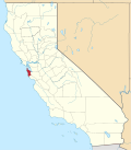
Bellvale is a populated place in San Mateo County, located at 37°18′43″N122°19′12″W / 37.31194°N 122.32000°W / 37.31194; -122.32000 . The small community is on Highway 84 (La Honda Road) between San Gregorio and La Honda, at 240 feet above sea level. [1]

Bellvale was named for the Bell family, who settled in the area in the mid-nineteenth century. James Bell paid for construction of a schoolhouse in 1869, which served children from nearby La Honda. [2] Although Bellvale once had a post office, the community is now only sparsely settled with homes and farms. [3] The Bellvale post office, located 2.25 miles west of La Honda, opened in 1897 and was discontinued in 1922. [4] U.S. Geological Survey maps show oil wells in the area, tapping a relatively small pool of petroleum that was first identified in the nineteenth century. [5]
Related Research Articles

<span class="mw-page-title-main">Lafayette, California</span> City in California, United States

Lafayette is a city in Contra Costa County, California, United States. As of 2020, the city's population was 25,391. It was named after the Marquis de Lafayette, a French military officer of the American Revolutionary War.

<span class="mw-page-title-main">Belvedere, California</span> City in California, United States

Belvedere is a residential incorporated city located on the San Francisco Bay in Marin County, California, United States. Consisting of two islands and a lagoon, it is connected to the Tiburon Peninsula by two causeways. At the 2020 census, the population was 2,126. The per-capita income of Belvedere residents in the year 2000 was $250,000, but currently the average income is $283,000, making it one of the highest-income cities in California and the eighth highest-income community in the United States. Belvedere and Tiburon share a post office and the 94920 ZIP code.

<span class="mw-page-title-main">Año Nuevo State Park</span> State park in California, United States

Año Nuevo State Park is a state park of California, United States, encompassing Año Nuevo Island and Año Nuevo Point, which are known for their pinniped rookeries. Located in San Mateo County, the low, rocky, windswept point juts out into the Pacific Ocean about 55 miles (89 km) south of San Francisco and the Golden Gate. Año Nuevo State Natural Reserve, formerly a separate unit of the California state park system, was merged into Año Nuevo State Park in October 2008. The coastal geographic center, or coastal-midpoint of California is located at the Northern end of this park at N 37°09′58″, W 122°21'40", as the absolute geographic center of California falls at N 37°09′58″, W 119°26′58″W.

<span class="mw-page-title-main">Area code 650</span> Area code for San Mateo County and parts of Santa Clara County, California

Area code 650 is a telephone area code in the North American Numbering Plan (NANP) for the San Francisco Bay Area in the U.S. state of California. It was split from area code 415 on August 2, 1997, and includes most of San Mateo County, part of San Francisco, and the northwestern portion of Santa Clara County including Palo Alto, Mountain View, and Los Altos.

<span class="mw-page-title-main">Davenport, California</span> Census-designated place in California, United States

Davenport is a census-designated place (CDP) in Santa Cruz County, California. Davenport sits at an elevation of 259 feet (79 m). The 2020 United States census reported Davenport's population was 388.

<span class="mw-page-title-main">Mount Eden, California</span>

Mt. Eden was an unincorporated agricultural district in Eden Township, Alameda County, California, United States. It was annexed by the City of Hayward. It lies at an elevation of 43 feet.

<span class="mw-page-title-main">Bell Station, California</span> Unincorporated community in California, United States

Bell Station is an unincorporated community located along State Route 152 between Casa de Fruta and Pacheco Pass near the southeast extent of Santa Clara County, California.

<span class="mw-page-title-main">Middleton Tract, California</span> Unincorporated community in California, United States

Middleton Tract is a rural community in the coastal Redwoods of San Mateo County, California. Unattributed press reports say the name Middleton Tract may have been applied to this area as early as 1925. In the present day, the name is official at the county government level. It appears on County Assessor's maps including County of San Mateo, Master Index Map, Revision 2, June, 1985,, page 40–41.

<span class="mw-page-title-main">Oakland Point, Oakland, California</span>

Oakland Point, or Gibbons' Point, was a small promontory formerly on the eastern shore of San Francisco Bay in West Oakland, California. It was located in the vicinity of what is now the Port of Oakland shipping terminal.

<span class="mw-page-title-main">Society of California Pioneers</span>

The Society of California Pioneers, established in 1850, is dedicated to the study and enjoyment of California art, history, and culture. Founded by individuals arriving in California before 1850 and thriving under the leadership of several generations of their direct descendants, the Society has continuously served its members, the academic community, and the public. As the self-proclaimed "oldest historical organization West of the Mississippi", the Society opened the first research library in California, as well as a grand hall for meetings, lectures, and social events.

Oak Run is a small unincorporated community 23 miles (37 km) east of Redding in Shasta County, California, United States. Its population is 158 as of the 2020 census. It has a store and a post office run by a family who lives in the town-famous "Oak Run House", just behind the store and post office. It also has a school, library, a volunteer fire department and 765 people. The ZIP Code is 96069. The community is inside area code 530. It was the site of a massacre of 300 Yana Indians in 1864

Alpine Creek is a small river in San Mateo County, California. It flows about 5 miles (8 km), from its source near West Alpine Road about a mile southwest of Skyline Boulevard (CA 35), to its confluence with La Honda Creek to form San Gregorio Creek in La Honda at California State Route 84.

Woodhams Creek is a small river in San Mateo County, California and is a tributary of San Gregorio Creek. It flows about 2 miles (3 km) from its source on Langley Hill to its confluence with La Honda Creek, in the town of La Honda.

Langley Creek is a small river in San Mateo County, California and a tributary to La Honda Creek, which in turn is a tributary to San Gregorio Creek. It flows about 2 miles (3 km) from its source on Langley Hill to its confluence with La Honda Creek, a short distance upstream from the town of La Honda.

<span class="mw-page-title-main">La Honda Creek</span> River in California, United States

La Honda Creek is a 7 miles (11 km) long stream on the Pacific slope of the Santa Cruz Mountains and is a tributary of San Gregorio Creek. From its source near Bear Gulch Road and Skyline Boulevard (CA 35) in San Mateo County, California, La Honda Creek's water flow south to its confluence with Alpine Creek to form San Gregorio Creek in La Honda, and thence to the Pacific Ocean.

Spanish Ranch Creek is a small river in San Mateo County, California. It flows about 1 mile (2 km) west from its source to its confluence with Weeks Creek, which in turn joins La Honda Creek in the La Honda Creek Regional Open Space, about 2 miles north of the town of La Honda.

<span class="mw-page-title-main">Peters Creek (California)</span>

Peters Creek is a 7.3-mile-long (11.7 km) stream in San Mateo County, California, and is a tributary of Pescadero Creek. It flows southwestwards through a small canyon to join Pescadero Creek in Portola Redwoods State Park, near La Honda.

La Honda−Pescadero Unified School District is a K−12 school district in California that serves the south coast of San Mateo County, including the communities of Pescadero, Loma Mar, and La Honda. It consists of three schools: two elementary schools, one in Pescadero and one in La Honda, and a combination middle and high school located in Pescadero. The District Office is located in portables at the southeastern end of the high school campus. As of 2021, the District serves 306 students.

Tamalpais Valley is an unincorporated community in Marin County, California.

Mayfield Mall was a shopping mall in Mountain View, California, United States. Operational from 1966 to 1984, it was the first air-conditioned, enclosed shopping mall in Northern California, though it has been an office complex since the 1980s. In 2013, Google rented the entire 500,000 square feet (46,000 m2) property and ultimately purchased it in 2016 for $225 million and is known as the company's Building RLS1.

References

  1. Bellvale, California: Bellvale, California Latitude and Longitude
  2. Dougherty, Bob (2007). La Honda. Charleston, SC: Arcadia Publishing. pp. 29–31. ISBN   9780738547381.
  3. "37.31194,-122.32 - Google Maps". Google Maps. Retrieved January 4, 2015.
  4. Durham, D.L. (1998). California's Geographic Names: A Gazetteer of Historic & Modern Names of the State. Word Dancer Press. p. 601. ISBN   9781884995149 . Retrieved January 4, 2015.
  5. "Bellvale USGS La Honda Quad, California, Topographic Map". Archived from the original on October 11, 2012. Retrieved January 4, 2015.