Transportation in the San Francisco Bay Area

Last updated

BART is a major provider of regional and transbay transit (seen here is a train approaching Civic Center/UN Plaza station) Civic Center UN Plaza BART 2022.jpg
BART is a major provider of regional and transbay transit (seen here is a train approaching Civic Center/UN Plaza station)
Interstate 80 is a major urban freeway in the Bay Area (seen here in Berkeley, California, as the Eastshore Freeway). I-80 Eastshore Fwy.jpg
Interstate 80 is a major urban freeway in the Bay Area (seen here in Berkeley, California, as the Eastshore Freeway ).

People in the San Francisco Bay Area rely on a complex multimodal transportation infrastructure consisting of roads, bridges, highways, rail, tunnels, airports, seaports, and bike and pedestrian paths. The development, maintenance, and operation of these different modes of transportation are overseen by various agencies, including the California Department of Transportation (Caltrans), the Association of Bay Area Governments, San Francisco Municipal Transportation Agency, and the Metropolitan Transportation Commission. These and other organizations collectively manage several interstate highways and state routes, eight passenger rail networks, eight trans-bay bridges, transbay ferry service, local and transbay bus service, three international airports, and an extensive network of roads, tunnels, and bike paths.

Contents

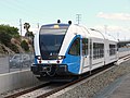
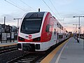
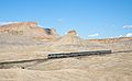
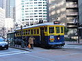
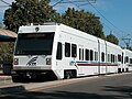
The Bay Area, especially San Francisco, are frequently listed as one of the best and most extensive cities and/or metropolitan areas in the United States for public transportation. [1] [2] Local trips on transit are frequently accomplished by bus services. Different agencies serve different corners of the Bay Area, such as samTrans serving mostly San Mateo County and County Connection connecting the suburbs of Contra Costa County; though some bus agencies operate transbay services, such as Golden Gate Transit. While ferries also connect communities across the bay, most transbay and longer-distance trips on public transportation, however, use rail-based transit. Bay Area Rapid Transit (BART) is the sole rapid transit system within the bay and the dominant provider of regional transportation between San Francisco, northern San Mateo County, and much of the East Bay. The Bay Area is also home to various commuter rail services, such as SMART within Sonoma and Marin counties, Caltrain on the San Francisco Peninsula, ACE between San Jose and Stockton, and various Amtrak routes out of Oakland and San Jose. San Francisco is also the home of the world's last manually-operated cable car system, and both San Francisco's Muni and Santa Clara's VTA operate light rail networks to complement their bus services. With few exceptions, most public transit within the Bay Area can be paid for by using the Clipper card.

Though not as extensive as Southern California's freeways, the Bay Area is also home to an extensive network of highways. Four bridges traverse the San Francisco Bay itself, and four more traverse the northern San Pablo Bay, in addition to more localized expressways such as US 101 and Interstate 280 in the Peninsula, Interstates 680 and 880 in the East Bay, and Interstate 505 in the north. Many highways have tolled express lanes, paid for by using FasTrak. Streets within the Bay Area vary from wider stroads such as El Camino Real in the Peninsula, to denser slower streets within urban cores, to scenic routes like California State Route 1. However, San Francisco has historically approached freeways with hostility, and activists have moved to stop the construction of new highways and tear down existing ones, most notably inciting the 1991 demolition of the Embarcadero Freeway. The city today is seen as the birthplace of American highway revolts. [3]

Airports

An aerial view of San Francisco International Airport at night. San Francisco International Airport at night.jpg
An aerial view of San Francisco International Airport at night.

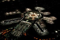
The Bay Area has four airports served by commercial airlines, three of which are international airports. In addition to these airports, there are many general aviation airports in the region.

Airport transportation

All major Bay Area airports are located near freeways and are served by public transportation, ride-share services, and various private shuttle bus operators.

Major airport/public transportation connections

Public transportation

Map of rail services in the Bay Area region SF Bay Rail Transit.svg
Map of rail services in the Bay Area region

Public transportation in the San Francisco Bay Area is quite extensive, including one rapid transit system, three commuter rail lines, two light rail systems, two ferry systems, Amtrak inter-city rail services, and four major overlapping bus agencies, in addition to dozens of smaller ones. Most agencies accept the Clipper Card, a reloadable universal electronic payment card.

An extensive rail infrastructure that provides a mix of services exists within the nine Bay Area counties. Bay Area Rapid Transit, commonly known as BART, provides rapid transit service between San Francisco and Contra Costa, Alameda, San Mateo, and Santa Clara counties. Caltrain, which runs on the right-of-way of the historic Southern Pacific Railroad, provides commuter rail service on the San Francisco Peninsula, linking the cities of San Francisco, San Jose, Gilroy, and numerous peninsula cities in between. The Millbrae Intermodal Terminal provides transfers between Caltrain and BART. The Altamont Corridor Express, commonly known as ACE, also provides commuter rail service, but from the Central Valley into Silicon Valley, terminating at San Jose's Diridon Station. To the north, Sonoma–Marin Area Rail Transit (SMART) line provides commuter rail service in Sonoma and Marin counties.

In addition, Amtrak has a presence throughout the Bay Area. There are two intercity services: the Capitol Corridor connects Bay Area cities to Sacramento, and the San Joaquins connects to cities across the San Joaquin Valley. Additionally, there are two long-distance services, the Coast Starlight offers service to Seattle and Los Angeles, while California Zephyr runs to Chicago via Denver.

The Bay Area also has two light rail systems: one run by San Francisco Municipal Railway called Muni Metro, which operates within the city of San Francisco, and the other run by the Santa Clara Valley Transportation Authority, which operates within Santa Clara County.

A series of overlapping bus agencies provide additional public transit coverage to Bay Area regions both served and not served by rail transit. The four largest agencies, Muni, AC Transit, SamTrans, and VTA operate within the City of San Francisco, East Bay, the Peninsula, and South Bay respectively, although their service areas generally overlap with neighboring agencies and numerous smaller agencies. All of these agencies also provide limited night bus service, which are intended to "shadow" the rail routes that are closed during the nighttime hours for maintenance. In addition, the four bus agencies are each independently pursuing constructing bus rapid transit systems by developing separated right-of-ways and traffic signaling on busy corridors, including on Geary and Van Ness for Muni, El Camino Real for SamTrans and VTA, and International Boulevard for AC Transit.

Although BART and certain bus agencies provide travel over (or under) the San Francisco bay, Golden Gate Ferry and San Francisco Bay Ferry provide ferry service across the bay.

Most systems allow bicycles onto their systems with no additional charge. In addition, Bay Area residents may rent bicycles from the Bay Wheels bike share in certain parts of San Francisco, San Mateo, and Santa Clara counties.

Rapid transit

AgencyTrain ExampleService AreaDaily ridership [lower-alpha 1] Clipper Payment OptionRoutesStationsTrack LengthTrack Gauge
BART Blue, Green, Orange, Red and Yellow Lines Future Fleet Open House at El Cerrito Del Norte Station (cropped).jpg San Francisco, Alameda, Contra Costa, San Mateo and Santa Clara counties154,600Yes550131 mi (211 km) 5 ft 6 in (1,676 mm)
broad gauge
eBART Westbound eBART train approaching Pittsburg Center station, May 2018.JPG Eastern Contra Costa County4,500Yes1310.1 mi (16.3 km)4 ft 8+12 in (1,435 mm) standard gauge
Oakland Airport Connector OAK-Coliseum Airport Mover.jpg Oakland International Airport 1,300Yes123.2 mi (5.1 km)

Commuter rail

AgencyTrain ExampleService AreaDaily ridership [lower-alpha 1] Clipper Payment OptionRoutesStationsTrack LengthTrack Gauge
ACE Altamont Commuter Express at Pleasanton.jpg San Joaquin, Alameda and Santa Clara counties2,500No11086 mi (138 km)4 ft 8+12 in (1,435 mm) standard gauge
Caltrain Caltrain passing through College Park.jpg San Francisco, San Mateo and Santa Clara counties19,400Yes132
1 planned
77.4 mi (124.6 km)
SMART NipponSharyoDMU-108-at-SMART-railyard-in-Windsor-2016-06-07-172244.jpg Marin and Sonoma counties2,700Yes112
4 planned
45 mi (72 km)

Long-distance and intercity rail

AgencyTrain ExampleService AreaDaily ridership [9] Clipper Payment OptionRoutesStationsTrack LengthTrack Gauge
Amtrak California Capitol Corridor Amtrak Capitol Corridor.jpg Santa Clara, Alameda, Contra Costa, Yolo, Sacramento and Placer counties2,500No117168 mi (270 km)4 ft 8+12 in (1,435 mm) standard gauge
San Joaquins A San Joaquin at Emeryville in 2012.JPG Alameda and Contra Costa counties in the Bay Area section of its route2,3001 to Bay Area
(2 total)
4 in the Bay Area
(16 total)
315 mi (507 km)
Amtrak California Zephyr Amtrak California Zephyr Green River - Floy, Utah.jpg Alameda and Contra Costa counties in the Bay Area section of its route90013 in the Bay Area
(33 total)
2,438 mi (3,924 km)
Coast Starlight Coast Starlight passing Alviso Marina, December 2013.jpg Alameda, Contra Costa and Santa Clara counties in the Bay Area section of its route93013 in the Bay Area
(28 total)
1,377 mi (2,216 km)

Light rail

AgencyTrain ExampleService AreaDaily ridership [lower-alpha 1] Clipper Payment OptionRoutesStationsTrack LengthTrack Gauge
Muni Muni Metro T Third Islais.jpg San Francisco 75,500Yes633 (+ 87 additional stops)34.6 mi (55.7 km)4 ft 8+12 in (1,435 mm) standard gauge
Heritage streetcars
(E Embarcadero 1, F Market & Wharves)
Muni streetcar 130.JPG 2366 mi (9.7 km)
Cable cars Sfcablecar at lombardst cropped.jpg 14,900 (2019) [10] 352 stops5.1 mi (8.2 km) 3 ft 6 in (1,067 mm)
VTA light rail VTA Tasman Station (August 11th, 2005).jpg Santa Clara County 13,80036242.2 mi (67.9 km)4 ft 8+12 in (1,435 mm) standard gauge

1The E Embarcadero was suspended due to the COVID-19 Pandemic and as of March 2024 has yet to resume. [11]

Bus services and stations

The Transbay Terminal serves as the terminus for Greyhound long-distance bus services and as a hub for regional bus systems AC Transit (Alameda & Contra Costa counties), WestCAT, SamTrans (San Mateo County), and Golden Gate Transit (Marin and Sonoma Counties). [12]

There are several bus stations in the San Francisco Bay Area including Fairfield Transportation Center, Richmond Parkway Transit Center, Naglee Park and Ride, Hercules Transit Center, Curtola Park & Ride, Eastmont Transit Center, San Rafael Transit Center and many bus bays at BART stations.

Major bus agencies

Agency NameBus ExampleService AreaDaily ridership [lower-alpha 1] Clipper Payment OptionNumber of Routes
LocalRapid/
Limited
Express/
Commuter
Shuttle All-Nighter
AC Transit Actransitroute70.jpg Entire: Inner East Bay (western Alameda County and western Contra Costa County)
Parts of: San Francisco, San Mateo and Santa Clara counties
158,100Yes684296
SamTrans SamTrans bus.jpg Entire: San Mateo County
Parts of: San Francisco and Santa Clara counties
33,1003012
Muni Muni route 49 bus on Ocean Avenue, January 2018.JPG Entire: San Francisco
Parts of: Marin and San Mateo counties
367,3004251610
VTA VTA Bus 35.jpg Entire: Santa Clara County
Parts of: San Mateo County
72,50054512121
Note: Some routes that operate as one route type may also be listed as another type (e.g. select daytime AC Transit, Muni, and VTA services also operate as All-Nighter routes)

Minor bus agencies

Several other transit agencies (including San Benito Transit, Stanislaus Regional Transit Authority, San Joaquin RTD, Rio Vista Delta Breeze, Mendocino Transit, and Santa Cruz Metro) operate regional service from outside the Bay Area to transit stations in the Bay Area.

Private bus companies operate an additional 800 buses, often referred to as tech shuttles. If combined, private shuttles would be the 7th largest transportation provider in the Bay Area. [13]

Ferries

Agency NameFerryExampleService AreaDaily ridership [lower-alpha 1] Clipper Payment OptionRoutesTerminals
Golden Gate Ferry Ferry-sonoma-MCB.jpg San Francisco and Marin County 3,500Yes2
(+2 limited)
4
(+2 limited)
San Francisco Bay Ferry San Francisco Bay Ferry Hydrus May 2017.jpg San Francisco, Alameda, Contra Costa, San Mateo, and Solano counties8,4006
(+3 limited)
10
(+2 limited)

There are also private ferries from Emeryville, Berkeley, and Richmond.

Bike and scooter sharing

A bike share station in San Jose, California. Bay Area Bike Share launch in San Jose CA.jpg
A bike share station in San Jose, California.

Bay Wheels (launched as Bay Area Bike Share) is a regional public bicycle sharing system that serves the cities of San Francisco, Oakland, Berkeley, Emeryville, and San Jose.

The bicycles are available 24 hours a day, seven days a week to anyone who purchases a membership, with three options, annual fee of US$149, US$20 for three days or US$10 for 24 hours. [14] Any rider may take unlimited trips of up to 30 minutes, as measured from the time the bike is withdrawn from a dock to the time it is returned. Bikes can be picked up at any of the stations using a key fob or electronic code, and dropping them off at any station. Longer trips incur additional fees starting at US$4 for the first additional half-hour, since the idea of bike sharing is to make bicycles available for short trips. [15] A replacement fee of $1,200 is charged if a rented bike is lost. [15]

Several companies also operate dockless bicycle sharing systems in the Bay Area such as Jump Bikes, Lime, and Spin. [16] [17] These dockless systems differ from the Ford GoBike system in that bicycles can be parked freely on the street (or at a bicycle rack in the case of Jump) and do not need to be docked at a designation station. Currently, Jump is the only dockless bicycle sharing company that operates in San Francisco while other competing companies operate dockless systems in other Bay Area cities such as South San Francisco, Oakland, and San Jose.

In 2018, several companies started offering dockless scooter-sharing systems in Bay Area cities such as San Francisco and Oakland. [18] [19] These systems offer electric kick scooters for rent, similar to dockless bicycle sharing systems. Some operators, such as Lime, operate both scooter and bicycle sharing systems. These shared scooters were temporarily banned in San Francisco during summer 2018, but as of October 15,2018 are available under two operators: Skip and Scoot Networks. [20]

Public transportation statistics

The average amount of time people spend commuting with public transit in San Francisco, for example to and from work, on a weekday is 77 min. 23% of public transit riders, ride for more than 2 hours every day. The average amount of time people wait at a stop or station for public transit is 13 min, while 17% of riders wait for over 20 minutes on average every day. The average distance people usually ride in a single trip with public transit is 9.1 km, while 20% travel for over 12 km in a single direction. [21]

A 2011 Brookings Institution study ranked the San Francisco MSA and the San Jose MSA sixteenth [22] and second, [23] respectively, on transit coverage to job access. Another nationwide study, conducted by the University of Minnesota in 2014, ranked the San Francisco MSA second and San Jose MSA tenth. [24] In 2012 it was the joint winner of the Sustainable Transport Award. Despite this, the San Francisco Bay Area remains the second most traffic-congested region in the country with a declining per capita use of public transit.[ citation needed ]

In 2013, the San Francisco-Oakland-Hayward metropolitan statistical area (San Francisco MSA) had the second lowest percentage of workers who commuted by private automobile (69.8 percent), with 7.6 percent of area workers traveling via bus. During the period starting in 2006 and ending in 2013, the San Francisco MSA had the greatest percentage decline of workers commuting by automobile (3.8 percent) among MSAs with more than a half million residents. [25]

Freeways and highways

Freeways and highways in the San Francisco Bay Area SFBay Highways-01.png
Freeways and highways in the San Francisco Bay Area

The Bay Area possesses an extensive freeway and highway system (although it is not as extensive as Southern California).

Trans-bay crossings

I-80 (CA).svg Interstate 80
San Francisco – Oakland Bay Bridge
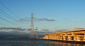
The western terminus of I-80 is located in San Francisco as James Lick Skyway (Bayshore Freeway), just west of the San Francisco–Oakland Bay Bridge. The interstate continues to the east over the bridge, connecting to Oakland and the north coast of the East Bay as the Eastshore Freeway, and then on to Sacramento, Reno, and New Jersey.
I-580 (CA).svg Interstate 580
Richmond – San Rafael Bridge
This spur route's western terminus is in Marin County. The Interstate crosses the San Pablo Bay over the Richmond-San Rafael Bridge, goes through Richmond as the John T. Knox Freeway, passes through Oakland as the MacArthur Freeway, then continues to Livermore, through the Altamont Pass to Tracy, where it intersects with Interstate 5, thus providing a link with Southern California.
California 92.svg Route 92
San Mateo – Hayward Bridge
SR 92's western terminus is in Half Moon Bay. The two-lane highway crosses the Santa Cruz Mountains, connecting to Interstate 280 and U.S. Route 101 as the J. Arthur Younger Freeway, becoming a freeway as it passes through San Mateo before crossing the San Mateo-Hayward Bridge to Hayward as Jackson Street.
California 84.svg Route 84
Dumbarton Bridge
SR 84 begins at Route 1 (at the Pacific Coast) near San Gregorio State Beach, and crosses the Santa Cruz Mountains on a scenic route between La Honda and Woodside as Woodside Road. It then crosses the Bay over the Dumbarton Bridge from Redwood City to Newark. The route then passes through Fremont as Thornton Avenue and Peralta Boulevard, continuing as Niles Canyon Road to Sunol and Livermore as Vallecitos Road and Isabel Avenue, terminating at Interstate 580 as Airway Boulevard.

The Peninsula to the South Bay

I-280 (CA).svg US 101 (CA).svg Interstate 280
Southern, Junipero Serra, & Sinclair Freeways
Highway 101
Bayshore & South Valley Freeways
Eight-lane and, in some parts, 10-lane freeways connecting San Francisco to San Jose through the Peninsula. Highway 101 continues south to Gilroy and Salinas, California, before continuing to Los Angeles. For most of its route I-280 runs along the foothills of the Santa Cruz Mountains, and is very scenic, while 101 is highly urban.
California 1.svg California 35.svg Route 1
Cabrillo Highway
Route 35
Skyline Boulevard
Two-lane highways also traveling down the Peninsula, SR 1 along the Pacific coast, and SR 35 near the ridge of the Santa Cruz Mountains. SR 1 as Cabrillo Highway connects to Half Moon Bay, Santa Cruz, and Monterey, before continuing to Los Angeles.
California 9.svg California 17.svg Route 9
Route 17
Highways through the Santa Cruz Mountains, connecting the South Bay to Santa Cruz. Part of SR 17 in San Jose is a 6 to 8 lane freeway.
California 85.svg California 237.svg Route 85
West Valley Freeway
Route 237
Southbay Freeway
Six-lane and, in some parts, seven to eight-lane freeways connecting the west Santa Clara Valley to the east Santa Clara Valley, bypassing Downtown San Jose.
California 87.svg Route 87
Guadalupe Freeway
North-south six-lane freeway entirely in San Jose, connecting San Jose International Airport, Downtown to the Almaden Valley. (formerly the Guadalupe Parkway)
California 152.svg Route 152 Two-lane highway from Watsonville, crosses the Santa Cruz Mountains to Gilroy, then crosses the Diablo Range through Pacheco Pass to I-5 near Los Banos.
California 156.svg Route 156 Two-lane highway connecting the Monterey Peninsula from Castroville to northern San Benito County and Route 152.
California 82.svg Route 82
El Camino Real
Highway running from San Jose to Interstate 280 in San Francisco. It is designated a State Route, although it is more similar to an inner-city boulevard, and contains either 2, 4, or 6 lanes. It runs from Daly City in the north through the Peninsula and beyond.

The freeway system in Santa Clara county is augmented by the Santa Clara County expressway system.

North Bay

US 101 (CA).svg California 1.svg Highway 101
Redwood Highway
Route 1
Shoreline Highway
Continue north of San Francisco, crossing the Golden Gate Bridge and connecting San Francisco to Marin and Sonoma counties, and eventually to Oregon. They are concurrent between the Golden Gate Bridge and Marin City
I-505 (CA).svg Interstate 505 This interstate highway provides a direct link from Interstate 80 in Vacaville in Solano County to I-5, bypassing Sacramento.
California 29.svg Route 29 Four-lane expressway connecting Interstate 80 in Vallejo in Solano County as Sonoma Boulevard to the towns of American Canyon and Napa. North of Napa, SR 29 is a two-lane rural highway through the towns of the Napa Valley, California's Wine Country, to Clear Lake.
California 37.svg Route 37 Four- and two-lane expressway connecting US 101 in Novato with Interstate 80 in Vallejo, along the northern shore of San Pablo Bay.
California 12.svg Route 12
Sonoma Highway
A highway connecting Santa Rosa with suburbs to the west and Interstate 80 through Sonoma and Napa to the east.

East Bay

I-680 (CA).svg I-880 (CA).svg Interstate 680
Sinclair Freeway
Interstate 880
Nimitz Freeway
Two interstate highways that travel up the East Bay from San Jose, 880 close to the bay to Oakland and 680 inland from San Jose north through Fremont, Pleasanton and Concord; then crosses the Benicia-Martinez Bridge and ends at Interstate 80 in Fairfield.
I-980 (CA).svg California 24.svg Interstate 980
Grover Shafter Freeway
Route 24
Grover Shafter Freeway
A freeway entirely in Downtown Oakland and begins at Interstate 880 and travels north to become Route 24 at Interstate 580. The freeway continues north as SR 24, which is a state highway that begins at Interstate 580 in Oakland and travels east through the Caldecott Tunnel to Interstate 680 in Walnut Creek.
I-205 (CA).svg Interstate 205 This interstate highway's western terminus is at Interstate 580 in Alameda County just west of the San Joaquin County line. I-205 heads east through Tracy to I-5, providing access from the Bay Area to Stockton and the northern San Joaquin Valley.
California 13.svg Route 13
Warren Freeway
A highway entirely in the Oakland Hills and travels north from Interstate 580 to Route 24, where the freeway portion ends. Beyond SR 24, SR 13 is Berkeley's Ashby Avenue.
I-238 (CA).svg California 238.svg Interstate 238
Route 238
Mission Boulevard
An arterial from Fremont to Hayward, along the base of the hills, then becomes a freeway near Oakland.
California 4.svg Route 4
John Muir Parkway
California Delta Highway
Western terminus at Interstate 80 in Hercules, travels east through Martinez, Pittsburg, and Antioch, where the freeway portion ends. The highway continues to Brentwood and east to Stockton.

Named interchanges

The Alemany Maze is the interchange between the James Lick Freeway (US 101) and I-280.

The MacArthur Maze is the interchange between the Eastshore Freeway (I-80 east / I-580 west), Nimitz Freeway (I-880 south), and MacArthur Freeway (I-580 east) at the east end of the Bay Bridge (I-80 west).

The Joe Colla Interchange is the interchange between US 101, I-280, and I-680. Both I-280 and I-680's southern termini is located as this interchange. [26]

San Francisco streets

Market Street, the main thoroughfare in San Francisco, as seen from Twin Peaks. Market Street San Francisco From Twin Peaks.jpg
Market Street, the main thoroughfare in San Francisco, as seen from Twin Peaks.

Due to its unique geography, and the freeway revolts of the late 1950s, [27] San Francisco is one of the few American cities served primarily by arterial roads for most trips within city limits, rather than a freeway network supplemented by arterial roads.[ citation needed ]

Interstate 80 begins at the approach to the Bay Bridge and is the only direct automobile link to the East Bay. U.S. Route 101 connects to the western terminus of Interstate 80 and provides access to the south of the city along San Francisco Bay toward Silicon Valley. Northward, the routing for U.S. 101 uses arterial streets Mission Street (northbound) and South Van Ness Avenue (southbound), Van Ness Avenue, Lombard Street, Richardson Avenue, and Doyle Drive to connect to the Golden Gate Bridge, the only direct automobile link to Marin County and the North Bay.[ citation needed ]

Van Ness Avenue near San Francisco City Hall in 2024 Van Ness Avenue in 2024.png
Van Ness Avenue near San Francisco City Hall in 2024

State Route 1 also enters San Francisco from the north via the Golden Gate Bridge, but turns south away from the routing of U.S. 101, first onto Park Presidio Blvd through Golden Gate Park, and then bisecting the west side of the city as the 19th Avenue arterial thoroughfare, joining with Interstate 280 at the city's southern border. Interstate 280 continues south from San Francisco. Interstate 280 also turns to the east along the southern edge of the city, terminating just south of the Bay Bridge in the South of Market neighborhood. After the 1989 Loma Prieta earthquake, city leaders decided to demolish the Embarcadero Freeway, and a portion of the Central Freeway, converting them into street-level boulevards. [27]

State Route 35 enters the city from the south as Skyline Boulevard, following city streets until it terminates at its intersection with Highway 1. State Route 82 enters San Francisco from the south as Mission Street, following the path of the historic El Camino Real and terminating shortly thereafter at its junction with 280. Major east–west thoroughfares include Geary Boulevard, the Lincoln Way/Fell Street corridor, and Market Street/Portola Drive.[ citation needed ]

The Western Terminus of the historic transcontinental Lincoln Highway, the first road across America, is in San Francisco's Lincoln Park.[ citation needed ]

Highway revolts

San Francisco is the birthplace of highway revolts in the United States, and highways have historically been approached with hostility by locals across the Bay Area. Protests have occurred against highways as early as 1955, and these protests eventually cancelled the construction of additional highways through Golden Gate Park and the Presidio, and further led to the demolishing of the Embarcadero Freeway in the early 1990s. [3] [28] Protests additionally occurred throughout the East Bay, cancelling projects such as the Ashby Freeway through Berkeley and the Richmond Boulevard Freeway in Oakland. [29] [30]

Bridges

1.
Richmond-San Rafael Bridge
2.
Golden Gate Bridge
3.
San Francisco-Oakland Bay Bridge
4.
San Mateo-Hayward Bridge
5.
Dumbarton Bridge
6.
Carquinez Bridge
7.
Benicia-Martinez Bridge
8.
Antioch Bridge
Arrows show toll direction and plazas San Francisco Bay bridges.svg
1. Richmond-San Rafael Bridge
2. Golden Gate Bridge
3. San Francisco-Oakland Bay Bridge
4. San Mateo-Hayward Bridge
5. Dumbarton Bridge
6. Carquinez Bridge
7. Benicia–Martinez Bridge
8. Antioch Bridge
Arrows show toll direction and plazas

Due to the central location of the San Francisco Bay, eight toll bridges cross the Bay or Bay tributaries. Each of the bridges collect separate tolls, and all of them accept payment through FasTrak, an electronic toll collection system used in the state of California. Seven of these eight bridges are owned directly by the State of California, while the Golden Gate Bridge is owned and operated by the Golden Gate Bridge, Highway and Transportation District. [31]

Bridge NamePictureConnectsLengthHighway
Antioch Bridge Antioch Bridge.jpg Antioch in Contra Costa County with Sacramento County 1.8 mi (2.9 km) SR 160
Benicia-Martinez Bridge BeniciaMartinezbridge.jpg Solano County with Contra Costa County1.7 mi (2.7 km) I-680
Carquinez Bridge Alfred zampa memorial bridge.jpg Vallejo in Solano County with Crockett in Contra Costa County0.66 mi (1.06 km) I-80
Dumbarton Bridge DumbartonBridgeCA and Towers.jpg Menlo Park in San Mateo County with Fremont in Alameda County 1.63 mi (2.62 km) SR 84
Golden Gate Bridge GoldenGateBridge-001.jpg San Francisco with Marin County 1.7 mi (2.7 km) US 101, SR 1
Richmond-San Rafael Bridge Richmond-San Rafeal Bridge.jpg Richmond in Contra Costa County with San Rafael in Marin County5.5 mi (8.9 km) I-580
San Francisco–Oakland Bay Bridge Oakland Bay Bridge Western Part.jpg San Francisco with Oakland, California and the East Bay 4.46 mi (7.18 km) I-80
San Mateo-Hayward Bridge San Mateo-Hayward Center Span.jpg San Francisco Peninsula with the East Bay7 mi (11 km) SR 92

San Francisco Bay Trail

The San Francisco Bay Trail alignment. San Francisco Bay Trail Map.pdf
The San Francisco Bay Trail alignment.

The San Francisco Bay Trail is a bicycle and pedestrian trail that will eventually allow continuous travel around the shoreline of San Francisco Bay. As of 2016, 350 miles (560 km) of trail have been completed, while the full plan calls for a trail over 500 miles (800 km) long that link the shoreline of nine counties, passing through 47 cities and crossing seven toll bridges. Sections of the Bay Trail exist in all nine Bay Area counties. The longest continuous segments include 26 miles (42 km) primarily on gravel levees between East Palo Alto and San Jose in Santa Clara County; 25 miles (40 km) in San Mateo County between Millbrae and San Carlos; 17 miles (27 km) in central Alameda County from San Leandro to Hayward; and 15 miles (24 km) along the shoreline and on city streets through Richmond in Contra Costa County. The northernmost trail section passes through San Pablo Bay National Wildlife Refuge.

Seaports

Aerial view of the Port of Oakland Oakland California aerial view.jpg
Aerial view of the Port of Oakland

The Port of San Francisco was once the largest and busiest seaport on the West Coast. It featured rows of piers perpendicular to the shore, where cargo from the moored ships was handled by cranes and manual labor and transported to nearby warehouses. The port handled cargo to and from trans-Pacific and Atlantic destinations, and was the West Coast center of the lumber trade. The 1934 West Coast Longshore Strike, an important episode in the history of the American labor movement, brought most ports to a standstill. The advent of container shipping made pier-based ports obsolete, and most commercial berths moved to the Port of Oakland and Port of Richmond. A few active berths specializing in break bulk cargo remain alongside the Islais Creek Channel.[ citation needed ]

The port currently uses Pier 35 to handle the 60–80 cruise ship calls and 200,000 passengers that come to San Francisco. [32] Itineraries from San Francisco usually include round trip cruises to Alaska and Mexico. The James R. Herman Cruise Terminal Project at Pier 27 opened in 2014 as a replacement. The previous primary terminal at Pier 35 had neither the sufficient capacity to allow for the increasing length and passenger capacity of new cruise ships nor the amenities needed for an international cruise terminal. [33]

On March 16, 2013, Princess Cruises Grand Princess became the first ship to home port in San Francisco year round. The ship offers cruises to Alaska, California Coasts, Hawaii, and Mexico. Grand Princess will be stationed in San Francisco until April 2014. Princess will also operate other ships during the summer of 2014, making it the only cruise line home porting year round in San Francisco. [34]

See also

Notes

  1. 1 2 3 4 5 6 weekdays, Q4 2023 [8]

Related Research Articles

<span class="mw-page-title-main">Dumbarton Bridge (California)</span> Southernmost bridge crossing the San Francisco Bay

The Dumbarton Bridge is the southernmost of the highway bridges across San Francisco Bay in California. Carrying over 70,000 vehicles and about 118 pedestrian and bicycle crossings daily, it is the shortest bridge across San Francisco Bay at 1.63 miles. Its eastern end is in Fremont, near Newark in the San Francisco Bay National Wildlife Refuge, and its western end is in Menlo Park. Bridging State Route 84 across the bay, it has three lanes each way and a separated bike/pedestrian lane along its south side. Like the San Mateo Bridge to the north, power lines parallel the bridge.

<span class="mw-page-title-main">San Francisco Peninsula</span> Peninsula in the San Francisco Bay Area

The San Francisco Peninsula is a peninsula in the San Francisco Bay Area that separates San Francisco Bay from the Pacific Ocean. On its northern tip is the City and County of San Francisco. Its southern base is Mountain View, in Santa Clara County, south of Palo Alto and north of Sunnyvale and Los Altos. Most of the Peninsula is occupied by San Mateo County, between San Francisco and Santa Clara counties, and including the cities and towns of Atherton, Belmont, Brisbane, Burlingame, Colma, Daly City, East Palo Alto, El Granada, Foster City, Hillsborough, Half Moon Bay, La Honda, Loma Mar, Los Altos, Menlo Park, Millbrae, Pacifica, Palo Alto, Pescadero, Portola Valley, Redwood City, San Bruno, San Carlos, San Mateo, South San Francisco, and Woodside.

<span class="mw-page-title-main">Bay Area Rapid Transit</span> Rapid transit system serving the San Francisco Bay Area

Bay Area Rapid Transit (BART) is a rapid transit system serving the San Francisco Bay Area in California. BART serves 50 stations along six routes and 131 miles of track, including a 9-mile (14 km) spur line running to Antioch, which uses diesel multiple unit vehicles, and a 3-mile (4.8 km) automated guideway transit line serving Oakland International Airport. With an average of 160,400 weekday passengers as of the fourth quarter of 2023 and 48,119,400 annual passengers in 2023, BART is the seventh-busiest rapid transit system in the United States.

<span class="mw-page-title-main">Northern California</span> American geographic and cultural region

Northern California is a geographic and cultural region that generally comprises the northern portion of the U.S. state of California, spanning the northernmost 48 of the state's 58 counties. Its main population centers include the San Francisco Bay Area, the Greater Sacramento area, the Redding, California, area south of the Cascade Range, and the Metropolitan Fresno area. Northern California also contains redwood forests, along with most of the Sierra Nevada, including Yosemite Valley and part of Lake Tahoe, Mount Shasta, and most of the Central Valley, one of the world's most productive agricultural regions.

<span class="mw-page-title-main">San Francisco–Oakland Bay Bridge</span> Complex of bridges spanning San Francisco Bay

The San Francisco–Oakland Bay Bridge, known locally as the Bay Bridge, is a complex of bridges spanning San Francisco Bay in California. As part of Interstate 80 and the direct road between San Francisco and Oakland, it carries about 260,000 vehicles a day on its two decks. It includes one of the longest bridge spans in the United States.

<span class="mw-page-title-main">Caltrain</span> California commuter rail line

Caltrain is a California commuter rail line serving the San Francisco Peninsula and Santa Clara Valley. The southern terminus is in San Jose at Tamien station with weekday rush hour service running as far as Gilroy. The northern terminus of the line is in San Francisco at 4th and King Street. Caltrain has 28 regular stops, one limited-service weekday-only stop, one weekend-only stop (Broadway), and one football-only stop (Stanford). While average weekday ridership in 2019 exceeded 63,000, impacts of the COVID-19 pandemic have been significant: in August 2022, Caltrain had an average weekday ridership of 18,600 passengers.

<span class="mw-page-title-main">AC Transit</span> Public transit operator in Alameda County and Contra Costa County, California

AC Transit is an Oakland-based public transit agency serving the western portions of Alameda and Contra Costa counties in the East Bay of the San Francisco Bay Area. AC Transit also operates "Transbay" routes across San Francisco Bay to San Francisco and selected areas in San Mateo and Santa Clara counties. AC Transit is constituted as a special district under California law. It is governed by seven elected members. It is not a part of or under the control of Alameda or Contra Costa counties or any local jurisdictions.

<span class="mw-page-title-main">Key System</span> Former local electric railway service in the East Bay

The Key System was a privately owned company that provided mass transit in the cities of Oakland, Berkeley, Alameda, Emeryville, Piedmont, San Leandro, Richmond, Albany, and El Cerrito in the eastern San Francisco Bay Area from 1903 until 1960, when it was sold to a newly formed public agency, AC Transit. The Key System consisted of local streetcar and bus lines in the East Bay, and commuter rail and bus lines connecting the East Bay to San Francisco by a ferry pier on San Francisco Bay, later via the lower deck of the Bay Bridge. At its height during the 1940s, the Key System had over 66 miles (106 km) of track. The local streetcars were discontinued in 1948 and the commuter trains to San Francisco were discontinued in 1958. The Key System's territory is today served by BART and AC Transit bus service.

<span class="mw-page-title-main">Transportation in Los Angeles</span> Complex multimodal regional, national and international hub for passenger and freight traffic

Los Angeles has a complex multimodal transportation infrastructure, which serves as a regional, national and international hub for passenger and freight traffic. The system includes the United States' largest port complex; an extensive freight and passenger rail infrastructure, including light rail lines and rapid transit lines; numerous airports and bus lines; vehicle for hire companies; and an extensive freeway and road system. People in Los Angeles rely on cars as the dominant mode of transportation, but since 1990 the Los Angeles County Metropolitan Transportation Authority has built over one hundred miles (160 km) of light and heavy rail serving more and more parts of Los Angeles and the greater area of Los Angeles County. As a result, Los Angeles was the last major city in the United States to get a permanent rail system installed.

<span class="mw-page-title-main">East Bay</span> Eastern region of the San Francisco Bay Area, California, US

The East Bay is the eastern region of the San Francisco Bay Area and includes cities along the eastern shores of the San Francisco Bay and San Pablo Bay. The region has grown to include inland communities in Alameda and Contra Costa counties. With a population of roughly 2.5 million in 2010, it is the most populous subregion in the Bay Area.

<span class="mw-page-title-main">Golden Gate Transit</span> Public transit operator in the North Bay region of California

Golden Gate Transit (GGT) is a public transportation system serving the North Bay region of the San Francisco Bay Area in California, United States. It primarily serves Marin County, Sonoma County, and San Francisco, and also provides limited service to Contra Costa County. In 2023, Golden Gate Transit had a ridership of 1,366,600, or about 4,200 per weekday as of the fourth quarter of 2023.

<span class="mw-page-title-main">San Francisco Transbay Terminal</span> Former transit terminal in San Francisco, CA, USA

The San Francisco Transbay Terminal was a transportation complex in San Francisco, California, United States, roughly in the center of the rectangle bounded north–south by Mission Street and Howard Street, and east–west by Beale Street and 2nd Street in the South of Market area of the city. It opened on January 14, 1939 as a train station and was converted into a bus depot in 1959. The terminal mainly served San Francisco's downtown and Financial District, as transportation from surrounding communities of the Bay Area terminated there such as: Golden Gate Transit buses from Marin County, AC Transit buses from the East Bay, and SamTrans buses from San Mateo County. Long-distance buses from beyond the Bay Area such as Greyhound and Amtrak Thruway also served the terminal. Several bus lines of the San Francisco Municipal Railway connected with the terminal.

<span class="mw-page-title-main">Intermodal passenger transport</span> Places for travelers to transfer from one category of vehicle to another

Intermodal passenger transport, also called mixed-mode commuting, involves using two or more modes of transportation in a journey. Mixed-mode commuting is often used to combine the strengths of various transportation options. A major goal of modern intermodal passenger transport is to reduce dependence on the automobile as the major mode of ground transportation and increase use of public transport. To assist the traveller, various intermodal journey planners such as Rome2rio and Google Transit have been devised to help travellers plan and schedule their journey.

<span class="mw-page-title-main">All Nighter (bus service)</span> San Francisco Bay Area late night bus service

The All Nighter is a night bus service network in the San Francisco Bay Area, California. Portions of the service shadow the rapid transit and commuter rail services of BART and Caltrain, which are the major rail services between San Francisco, the East Bay, the Peninsula, and San Jose. Neither BART nor Caltrain operate owl service due to overnight track maintenance; the All Nighter network helps fill in this service gap. The slogan is, "Now transit stays up as late as you do!"

<span class="mw-page-title-main">Transportation in California</span> Overview of the transport in the State of California

California's transportation system is complex and dynamic. Although known for its car culture and extensive network of freeways and roads, the state also has a vast array of rail, sea, and air transport. Several subway, light rail, and commuter rail networks are found in many of the state's largest population centers. In addition, with the state's location on the West Coast of the United States, several important ports in California handle freight shipments from the Pacific Rim and beyond. A number of airports are also spread out across the state, ranging from small general aviation airports to large international hubs like Los Angeles International Airport and San Francisco International Airport.

The San Francisco Transbay development is a completed redevelopment plan for the neighborhood surrounding the Transbay Transit Center site, South of Market near the Financial District in San Francisco, California. The new transit center replaced the since-demolished San Francisco Transbay Terminal, and new skyscrapers, such as Salesforce Tower, took advantage of the height increases allowed through the San Francisco Transit Center District Plan. The sale of several land parcels formerly owned by the state and given to the managing Transbay Joint Powers Authority helped finance the construction of the transit center.

The Bay Area Toll Authority (BATA) is a state agency created by the California State Legislature in 1997 to administer the auto tolls on the San Francisco Bay Area's seven state-owned toll bridges. On January 1, 1998, the Metropolitan Transportation Commission (MTC) — the transportation planning, financing and coordinating agency for the nine-county region — began operations as BATA. In August 2005, the California Legislature expanded BATA's responsibilities to include administration of all toll revenue and joint oversight of the toll bridge construction program with Caltrans and the California Transportation Commission.

Throughout the history of Bay Area Rapid Transit, there have been plans to extend service to other areas.

<span class="mw-page-title-main">Transportation in the Sacramento metropolitan area</span> Complex multi-modal network moving people and goods in the region of Californias state capital

Transportation in the Sacramento metropolitan area consists of a variety of modes of travel in El Dorado County, Placer County, Sacramento County, and Yolo County, which are the four counties that comprise the Sacramento metropolitan area.

References

  1. Balevic, Danielle Muoio, Katie. "Here are the 9 North American cities with the best public transit systems". Business Insider. Retrieved February 13, 2023.{{cite web}}: CS1 maint: multiple names: authors list (link)
  2. @tilpa. "The Best And Worst Cities For Public Transit In America, Ranked | Digg". digg.com. Retrieved February 13, 2023.
  3. 1 2 "The Freeway Revolt – FoundSF". www.foundsf.org. Retrieved February 13, 2023.
  4. 1 2 "Mineta San Jose Airport surpasses Oakland for number of travelers". KGO-TV (ABC7 News). December 19, 2018. Retrieved June 14, 2019.
  5. "SJC Named Second Fastest Growing Medium Hub Airport in US for 2013". Archived from the original on September 14, 2014. Retrieved September 14, 2014.
  6. "Network – Alaska Airlines". Newsroom – Alaska Airlines. Alaska Airlines. August 2018. Retrieved November 3, 2018. Though Alaska calls Seattle home, the company has hubs in Anchorage, Alaska, Los Angeles, San Francisco and Portland, Oregon. Other focus cities include San Diego and San Jose, California.
  7. "Airline Information". Charles M. Schulz Sonoma County Airport. Retrieved March 7, 2019.
  8. "Transit Ridership Report Fourth Quarter 2023" (PDF). American Public Transportation Association. March 4, 2024. Retrieved March 14, 2024.
  9. "Amtrak Fiscal Year 2023 Ridership" (PDF). Amtrak. November 27, 2023. Retrieved November 30, 2023.
  10. "Public Transportation Ridership Report Fourth Quarter 2019" (PDF). American Public Transportation Association (APTA). February 27, 2020. Retrieved December 5, 2021.
  11. https://www.sfmta.com/routes/e-embarcadero-suspended
  12. "Project Overview – Regional Transit". Transbay Transit Center. Archived from the original on December 13, 2006. Retrieved July 25, 2010.
  13. "Report: Tech buses proliferating throughout Bay Area". eastbaytimes.com. September 15, 2016. Archived from the original on January 25, 2018. Retrieved May 7, 2018.
  14. "Membership and pass options". Ford GoBike. Retrieved June 18, 2018.
  15. 1 2 CBS San Francisco (August 29, 2013). "Bike Share Program Launched In 5 Bay Area Cities". CBS 5 KPIX. Archived from the original on September 2, 2013. Retrieved September 14, 2013.
  16. "Competing Bike Share Companies Launch Services In South San Francisco". CBS SF Bay Area. August 8, 2017. Retrieved September 12, 2018.
  17. Baldassari, Erin (January 17, 2018). "JUMP Bikes to launch dockless, electric bikeshare in San Francisco". The Mercury News. Retrieved September 12, 2018.
  18. Pender, Kathleen (March 29, 2018). "Scooters descend on San Francisco sidewalks". San Francisco Chronicle. Retrieved September 12, 2018.
  19. Swan, Rachel (September 1, 2018). "As San Francisco banned scooter use, Oakland embraced the two-wheelers". San Francisco Chronicle. Retrieved September 12, 2018.
  20. Chinn, Jerold (October 15, 2018). "Electric scooters power back onto San Francisco streets". SFBay. Retrieved October 15, 2018.
  21. "San Francisco Public Transportation Statistics". Global Public Transit Index by Moovit. Archived from the original on August 24, 2017. Retrieved June 19, 2017. CC-BY icon.svg Material was copied from this source, which is available under a Creative Commons Attribution 4.0 International License Archived October 16, 2017, at the Wayback Machine .
  22. "Missed Opportunity: Transit and Jobs in Metropolitan America (San Francisco)". Brookings Institution. Archived from the original on January 9, 2014. Retrieved January 8, 2014.
  23. "Missed Opportunity: Transit and Jobs in Metropolitan America (San Jose)". Brookings Institution. Archived from the original on January 9, 2014. Retrieved January 8, 2014.
  24. "Access Across America: Transit 2014". University of Minnesota. Archived from the original on October 16, 2014. Retrieved October 14, 2014.
  25. McKenzie, Brian (August 2015). "Who Drives to Work? Commuting by Automobile in the United States: 2013" (PDF). American Survey Reports. Archived (PDF) from the original on December 21, 2017. Retrieved December 26, 2017.
  26. Rodriguez, Joe (January 9, 2016). "San Jose's Infamous Monument to Nowhere Freeway Interchange Finally Named after Joe Colla". San Jose Mercury News. Archived from the original on April 22, 2016. Retrieved April 6, 2016.
  27. 1 2 Gordon, Rachel (September 8, 2005). "Boulevard of dreams, the premiere". San Francisco Chronicle. Hearst Communications. p. B-1. Archived from the original on September 30, 2008. Retrieved June 16, 2008.
  28. "Freeways Never Built, or Unbuilt after 1989 quake – FoundSF". www.foundsf.org. Retrieved February 13, 2023.
  29. "The Expanding City – 1960s to 1980s | City of Emeryville, CA – Official Website". www.ci.emeryville.ca.us. Retrieved February 13, 2023.
  30. "Richmond Group Attacks Plan for Extending Freeway," Oakland Tribune, July 5, 1949
  31. "Bay Area FasTrak – Agencies and Partners". Bay Area Toll Authority. Archived from the original on September 19, 2016.
  32. "SFPort – Cruises". Archived from the original on March 17, 2013. Retrieved March 16, 2013.
  33. "SFPort – James R. Herman Cruise Terminal Project at Pier 27". Archived from the original on July 3, 2013. Retrieved March 16, 2013.
  34. Engle, Jane (April 15, 2013). "LA Times – Cruises: The Grand Princess finds a home in San Francisco". Los Angeles Times. Archived from the original on April 22, 2013. Retrieved April 22, 2013.