
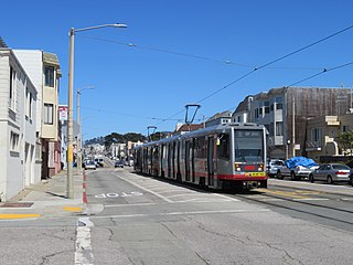
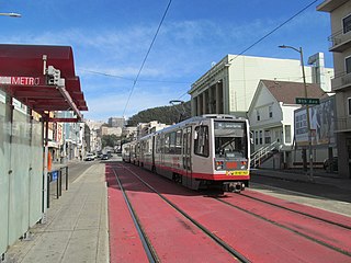
Muni Metro is a light rail system serving San Francisco, California, United States. Operated by the San Francisco Municipal Railway (Muni), a part of the San Francisco Municipal Transportation Agency (SFMTA), Muni Metro served an average of 157,700 passengers per weekday in the fourth quarter of 2019, making it the second-busiest light rail system in the United States.

The M Ocean View is a hybrid light rail/streetcar line of the Muni Metro system in San Francisco, California. The line opened on October 6, 1925.

The J Church is a hybrid light rail/streetcar line of the Muni Metro system in San Francisco, California. The line runs between Embarcadero station and Balboa Park station through Noe Valley. Opened on August 11, 1917, it is the oldest and has the lowest ridership of all of the Muni Metro lines.
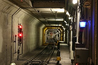
The Market Street subway is a two-level subway tunnel that carries Muni Metro and BART trains under Market Street in San Francisco, California. It runs under the length of Market Street between Embarcadero station and Castro station. The upper level is used by Muni Metro lines and the lower level is used by BART lines. BART does not run through the whole subway; it turns south and runs under Mission Street southwest of Civic Center/UN Plaza station. The northeastern end of the BART level is connected to the Transbay Tube. On the Muni Metro level, the southwestern end of the Market Street subway connects to the much-older Twin Peaks Tunnel, and the northeastern end connects to surface tracks along the Embarcadero.

Balboa Park station is a Bay Area Rapid Transit (BART) station and Muni Metro complex in the Mission Terrace neighborhood of San Francisco, California, located near the eponymous Balboa Park. It is an intermodal hub served by four BART routes, three Muni Metro lines, and a number of Muni bus routes. The station complex also includes two rail yards, Cameron Beach Yard and Green Light Rail Center, where Muni maintains Muni Metro trains and heritage streetcars. BART uses a below-grade island platform on the west side of the complex; Muni Metro routes use several smaller side platforms located on surface-level rail loops around the yards.
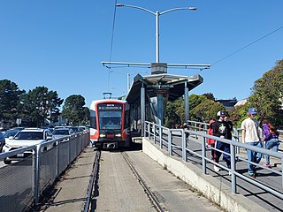
Stonestown station is a light rail station on the Muni Metro M Ocean View line, located in the median of 19th Avenue adjacent to Stonestown Galleria and the Lakeside neighborhood in San Francisco, California. It opened in 1925 with the first phase of the line and was rebuilt with a high-level island platform in 1993. The station is accessible to people with disabilities.

Duboce and Church is a light rail stop on the Muni Metro J Church and N Judah lines, located in the Duboce Triangle neighborhood of San Francisco, California. Just east of the station, the two lines enter the Market Street subway. The stop originally opened with the 22 Fillmore line in 1895. The station has complex layout with two side platforms in the middle of Duboce Avenue for the N Judah, one side platform in the middle of Church Street for northbound J Church trains entering the Market Street subway, and two mini-high platforms at the subway portal which provides access to both lines for people with disabilities.
San Jose and Santa Rosa is a light rail stop on the Muni Metro J Church line, located in the Mission Terrace neighborhood of San Francisco, California. The station has two short side platforms in the middle of San Jose Avenue located before the intersection in each direction where passengers board or depart from trains. The station is not accessible to people with disabilities.

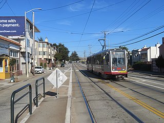
Ocean and Aptos is a light rail stop on the Muni Metro K Ingleside line, located between the Balboa Terrace and Ingleside Terrace neighborhoods of San Francisco, California. The stop consists of two side platforms, with the eastbound (outbound) platform located on Ocean Avenue west of the intersection with Aptos Avenue, and vice versa. It originally opened around 1896 on the United Railroads 12 line; K Ingleside service began in 1919.

Ocean and Fairfield (inbound) and Ocean and Victoria (outbound) are a pair of one-way light rail stops on the Muni Metro K Ingleside line, located between the Mount Davidson and Ingleside Terrace neighborhoods of San Francisco, California. The stops consist of one side platform each, with the eastbound (outbound) platform located on Ocean Avenue west of the intersection with Victoria Street and the westbound (inbound) located east of the intersection and just west of Fairfield Way. They originally opened in 1895 on the United Railroads 12 line; K Ingleside service began in 1919.

Ocean and Miramar is a light rail stop on the Muni Metro K Ingleside line, located between the Westwood Park and Ingleside neighborhoods of San Francisco, California. The stop consists of two side platforms, with the eastbound (outbound) platform located on Ocean Avenue west of the intersection with Miramar Avenue and the westbound (inbound) platform located east of the intersection. It originally opened in 1895 on the United Railroads 12 line; K Ingleside service began in 1919.

Ocean Avenue/CCSF Pedestrian Bridge station is a light rail station on the Muni Metro K Ingleside line, located between the Sunnyside and Ingleside neighborhoods of San Francisco, California adjacent to the City College of San Francisco (CCSF) campus. The stop consists of two side platforms in the median of Ocean Avenue, with stairs to a concrete footbridge that connects the campus to Geneva Avenue. It opened in 1979 with the extension of the line to Balboa Park station; it was previously served by the United Railroads 12 line from 1895 to 1945, and the K from 1945 to 1952.

Taraval and 17th Avenue is an eastbound-only light rail stop on the Muni Metro L Taraval line, located in the Parkside neighborhood of San Francisco, California. The stop opened with the first section of the L Taraval line on April 12, 1919.

Taraval and 22nd Avenue / Taraval and 23rd Avenue stations are a pair of light rail stops on the Muni Metro L Taraval line, located in the Parkside neighborhood of San Francisco, California. The eastbound stop is located on Taraval Street and 22nd Avenue, while westbound trains stop on Taraval Street at 23rd Avenue.

Taraval and 26th Avenue is a light rail stop on the Muni Metro L Taraval line, located in the Parkside neighborhood of San Francisco, California. The station opened with the first section of the L Taraval line on April 12, 1919; irregular shuttle service had run on a United Railroads line since around 1910.
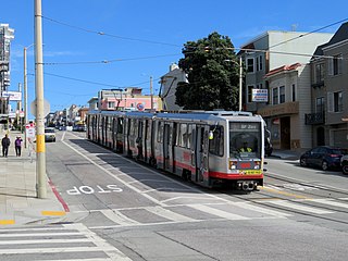
Taraval and 30th Avenue is a light rail stop on the Muni Metro L Taraval line, located in the Parkside neighborhood of San Francisco, California. The station opened with the first section of the L Taraval line on April 12, 1919; irregular shuttle service had run on a United Railroads line since around 1910.
Taraval and 42nd Avenue is a light rail stop on the Muni Metro L Taraval line, located in the Parkside neighborhood of San Francisco, California. The station opened with the first section of the L Taraval line on January 14, 1923.

Wawona and 46th Avenue station is a light rail stop on the Muni Metro L Taraval line, located in the Parkside neighborhood of San Francisco, California. The stop opened as the terminus of an extension of the line to the San Francisco Zoo on September 15, 1937. It has a single side platform serving a single-track loop. A mini-high platform provides access to people with disabilities.

Right Of Way/Ocean station is a light rail stop on the Muni Metro M Ocean View line, located in the Merced Manor neighborhood of San Francisco, California. It opened in 1925 with the first phase of the line. The station is located where the line's private right-of-way crosses Ocean Avenue, with narrow side platforms located on the near side of the grade crossing. The northbound platform is across the tracks from the southbound platform of Right Of Way/Eucalyptus station. The stop is not accessible to people with disabilities.
Judah and 9th Avenue is a light rail stop on the Muni Metro N Judah line, located in the Sunset District neighborhood of San Francisco, California. The station opened with the N Judah line on October 21, 1928. The station has two side platforms in the middle of Judah Street where passengers board or depart from trains. The station also has mini-high platforms providing access to people with disabilities.


