Walnut Creek, California

Last updated

Walnut Creek, California
City of Walnut Creek
Shell Ridge Open Space - Walnut Creek, California.jpg
Shell Ridge Open Space
Flag of Walnut Creek, California.gif
City of Walnut Creek, California logo.png
Contra Costa County California Incorporated and Unincorporated areas Walnut Creek Highlighted.svg
Location of Walnut Creek within California
Location Map San Francisco Bay Area.png
Red pog.svg
Walnut Creek
Location in the United States
USA California location map.svg
Red pog.svg
Walnut Creek
Walnut Creek (California)
Usa edcp location map.svg
Red pog.svg
Walnut Creek
Walnut Creek (the United States)
Coordinates: 37°54′23″N122°03′54″W / 37.90639°N 122.06500°W / 37.90639; -122.06500
CountryFlag of the United States (23px).png  United States
State Flag of California.svg  California
County Contra Costa
First settled1849 [1]
Incorporated October 21, 1914 [1]
Government
  TypeGeneral Law
   City Council
   State Leg.
   U. S. Congress Mark DeSaulnier (D) [5]
Area
[6]
  Total19.77 sq mi (51.21 km2)
  Land19.76 sq mi (51.18 km2)
  Water0.01 sq mi (0.03 km2)  0.06%
Elevation
131 ft (40 m)
Population
 (2020)
  Total70,127
  Density3,500/sq mi (1,400/km2)
Time zone UTC-8 (PST)
  Summer (DST) UTC-7 (PDT)
ZIP codes
94595–94598
Area code 925
FIPS code 06-83346
GNIS feature IDs 1660120, 2412174
Website Official website OOjs UI icon edit-ltr-progressive.svg

Walnut Creek is a city in Contra Costa County, California, United States, located in the East Bay region of the San Francisco Bay Area, about 16 miles (26 kilometers) east of the city of Oakland. Walnut Creek has a total population of 70,127 per the 2020 census, is located at the junction of the highways from Sacramento and San Jose (I-680) and San Francisco/Oakland (SR-24), and is accessible by BART. [7] The city shares its borders with Clayton, Lafayette, Alamo, Pleasant Hill, and Concord.

Contents

History

Downtown Walnut Creek Downtown Walnut Creek 02 BW.jpg
Downtown Walnut Creek

There are three bands of Bay Miwok Native Americans associated with the area of Walnut Creek (the stream for which the city is named): [8] [9] the Saclan , whose territory extended through the hills east of present-day cities of Oakland, Rossmoor, Lafayette, Moraga and Walnut Creek; the Volvon (also spelled Bolbon, Wolwon or Zuicun), who were near Mt. Diablo; and the Tactan, located on the San Ramon Creek in present-day Danville and Walnut Creek.

The city of Walnut Creek has developed within the earlier area of four extensive Mexican land grants. One of these land grants  measuring 18,000 acres (73 km2)  belonged to Juana Sanchez de Pacheco. The grant was called Rancho Arroyo de Las Nueces y Bolbones, named after the principal waterway, Arroyo de las Nueces (Walnut Creek in English), and for the local group of Volvon indigenous Americans (also known as Bolbones in Spanish). The Arroyo de las Nueces was named for the local species of walnut tree, the California Walnut. The two grandsons of Sanchez de Pacheco inherited the thousands of acres of land. One, Ygnacio Sibrian, built the first roofed home in the valley in about 1850.

As settlers from the United States arrived following US annexation of California after victory in the Mexican–American War, a small settlement called "The Corners" emerged. It was named for the junction where roads met from the settlements of Pacheco and Lafayette. The intersection of Mt. Diablo Boulevard and North Main Street is now at this site. The first town settler was William Slusher, who built a dwelling on the bank of Walnut Creek, first called "Nuts Creek" by Americans in 1849. In 1855, Milo Hough of Lafayette built the hotel named "Walnut Creek House" in The Corners. A blacksmith shop and a store were soon established by settlers. In 1850 Hiram Penniman laid out the town site and realigned Main Street to what it is today. (Penniman also developed Shadelands Ranch.)

In December 1862 a United States Post Office was established here, named "Walnut Creek". [10] Pioneer Homer Shuey platted the downtown street patterns in 1871–1872 on a portion of one of his family's large cattle ranches. These streets have been maintained to the present.

The arrival of Southern Pacific Railroad service in 1891 stimulated development of Walnut Creek. On October 21, 1914, the town and the surrounding area were incorporated as the 8th city in Contra Costa County. A branch line of the Southern Pacific ran through Walnut Creek until the late 1970s. Portions were adapted by East Bay Regional Park District for the Iron Horse Trail, which is used by walkers, runners and bikers. [11] The mainline of the Sacramento Northern Railway passed through Walnut Creek. Both railroads had stations here. Today, the Yellow Line of the Bay Area Rapid Transit (BART) serves Walnut Creek with a station adjacent to Highway 680.

With the 1951 opening of the downtown Broadway Shopping Center (now Broadway Plaza), Contra Costa County's first major retail center, the city took off in a new direction. In the postwar period of suburban development, its population more than quadrupled  from 2,460 in 1950 to 9,903 in 1960. Growth has accelerated since the late 20th century, with a population just over 70,000 according to the latest census.

Geography and climate

Walnut Creek is located at 37°54′23″N122°03′54″W / 37.90639°N 122.06500°W / 37.90639; -122.06500 . [12] Portions lie in both the San Ramon Valley and the Ygnacio Valley below the western slopes of Mount Diablo. According to the United States Census Bureau, the city has a total area of 19.8 sq mi (51.2 km2), 0.06 percent of which is water. Walnut Creek  the actual waterway that runs through the town  has been routed underneath downtown through a series of tunnels. These start at the southwest end of Macy's and end just southwest of Bar Camino Restaurant.

Neighborhoods

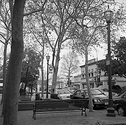
Walnut Creek consists of a bustling, upscale downtown with established neighborhoods in its surrounding areas. Neighborhoods range in affordability and feel, with some being exceptionally charming and tight-knit (e.g., Parkmead) while others are more rural and forested with homes on generous lots (e.g., Tice Valley). Not all neighborhoods are incorporated; there are many unincorporated areas that are serviced by Contra Costa County. A non-exhaustive list of neighborhoods in Walnut Creek include:

Depending on the neighborhood, homes can be assigned to schools in Lafayette, San Ramon Valley, Walnut Creek, or Mt. Diablo Unified School District.

Open space

Walnut Creek as seen from Acalanes Open Space Walnut Creek view from Acalanes Open Space (cropped).jpg
Walnut Creek as seen from Acalanes Open Space

Walnut Creek owns more open space per capita than any other community in the state of California. In 1974, Walnut Creek voters approved a $6.7 million bond measure to acquire and protect open space: the city purchased 1,800 acres (730 ha) of undeveloped hillsides, ridge lines, and park sites. Walnut Creek owns parts of Lime Ridge Open Space, Acalanes Ridge Open Space, Shell Ridge Open Space, and Sugarloaf Open Space.

The East Bay Regional Park District operates Diablo Foothills Regional Park and Castle Rock Regional Recreation Area, both of which are located in Walnut Creek.

Climate

Walnut Creek's warm summer Mediterranean climate (Köppen climate classification Csb) is typical of California's interior valleys. In summer, high pressure results in almost unbroken sunshine and virtually no precipitation. Days start out cool but quickly warm up, with high temperatures normally in the 80s Fahrenheit (27 to 32 °C). Temperatures of 100 °F (38 °C) or hotter occur numerous times during heatwaves, however. In the winter, the jet stream moves far enough south so that Pacific storms can reach Walnut Creek, bringing much-needed rain  average annual rainfall approximates 26 inches (660 mm), with slight variations occurring in microclimates based on elevation and topography. During particularly cold storms, snow falls on the peak of nearby Mount Diablo, but snow in the valley floor is very rare. There are numerous clear, mild days in winter, often with morning frost. The climate allows for the successful cultivation of many plants and crops, being warm enough for citrus yet cold enough for apples. The Ruth Bancroft Garden is a renowned botanical garden that showcases the diversity of plants that can be successfully grown.

Climate data for Walnut Creek (1893–1974)
MonthJanFebMarAprMayJunJulAugSepOctNovDecYear
Record high °F (°C)80
(27)
83
(28)
97
(36)
94
(34)
103
(39)
109
(43)
115
(46)
112
(44)
114
(46)
101
(38)
89
(32)
76
(24)
115
(46)
Mean daily maximum °F (°C)56.4
(13.6)
61.3
(16.3)
65.8
(18.8)
70.2
(21.2)
76.0
(24.4)
81.9
(27.7)
85.8
(29.9)
85.5
(29.7)
83.2
(28.4)
75.9
(24.4)
64.5
(18.1)
56.4
(13.6)
71.9
(22.2)
Mean daily minimum °F (°C)39.5
(4.2)
42.3
(5.7)
44.6
(7.0)
46.7
(8.2)
50.6
(10.3)
52
(11)
54.2
(12.3)
55.7
(13.2)
54.8
(12.7)
50.5
(10.3)
44.1
(6.7)
39.6
(4.2)
47.9
(8.8)
Record low °F (°C)17
(−8)
21
(−6)
24
(−4)
28
(−2)
32
(0)
34
(1)
38
(3)
41
(5)
36
(2)
27
(−3)
23
(−5)
18
(−8)
17
(−8)
Average precipitation inches (mm)3.8
(97)
3.9
(99)
2.8
(71)
1.2
(30)
0.7
(18)
0.1
(2.5)
0
(0)
0
(0)
0.1
(2.5)
1
(25)
2.3
(58)
3.6
(91)
19.5
(494)
Average precipitation days (≥ 0.01 in)11119631001371163
Source 1: [13] [14]
Source 2: [15]

Public transit and bike trails

Ygnacio Valley Canal Trail to Lime Ridge Open Space Ygnacio Canal Trail - Walnut Creek, California.jpg
Ygnacio Valley Canal Trail to Lime Ridge Open Space

The city has two Bay Area Rapid Transit (BART) stations – Walnut Creek and Pleasant Hill (in the unincorporated area known as Contra Costa Centre Transit Village) – both served by the Yellow Line.

Central Contra Costa Transit Authority (County Connection/CCCTA) provides bus service throughout Walnut Creek and Contra Costa County at a modest cost. County Connection also operates three free weekday shuttles within city limits: the Downtown Trolley/Route 4 loops from Walnut Creek BART to Broadway Plaza; Route 5 runs from Walnut Creek BART to Creekside; and Route 7, which runs from Pleasant Hill BART to Shadelands Business Park.

Walnut Creek is transected by the Iron Horse Trail (running north–south) through its downtown, as well as the Contra Costa Canal Trail (running east–west) at the north end of the city. Both these trails, in addition to city bike lanes, make bicycle transportation feasible both for recreation and as an alternative commute.

Demographics

Historical population
CensusPop.Note
1880 94
1920 538
1930 1,01488.5%
1940 1,57855.6%
1950 2,42053.4%
1960 9,903309.2%
1970 39,844302.3%
1980 54,03335.6%
1990 60,56912.1%
2000 64,2966.2%
2010 64,173−0.2%
2020 70,1279.3%
U.S. Decennial Census [16]

The 2010 United States Census [17] reported that Walnut Creek had a population of 64,173. The population density was 3,246.2 inhabitants per square mile (1,253.4/km2). The racial makeup of Walnut Creek was 50,487 (78.7 percent) White, 1,035 (1.6 percent) African American, 155 (0.2 percent) Native American, 8,027 (12.5 percent) Asian, 125 (0.2 percent) Pacific Islander, 1,624 (2.5 percent) from other races, and 2,720 (4.2 percent) from two or more races. Hispanic or Latino of any race were 5,540 persons (8.6 percent).

The Census reported that 63,171 people (98.4 percent of the population) lived in households, 176 (0.3 percent) lived in non-institutionalized group quarters, and 826 (1.3 percent) were institutionalized.

There were 30,443 households, out of which 6,363 (20.9 percent) had children under the age of 18 living in them, 13,305 (43.7 percent) were opposite-sex married couples living together, 2,071 (6.8 percent) had a female householder with no husband present, 844 (2.8 percent) had a male householder with no wife present. There were 1,286 (4.2 percent) unmarried opposite-sex partnerships, and 298 (1.0 percent) same-sex married couples or partnerships. 11,884 households (39.0 percent) were made up of individuals, and 6,424 (21.1 percent) had someone living alone who was 65 years of age or older. The average household size was 2.08. There were 16,220 families (53.3 percent of all households); the average family size was 2.79.

The population was spread out, with 10,719 people (16.7 percent) under the age of 18, 3,599 people (5.6 percent) aged 18 to 24, 15,137 people (23.6 percent) aged 25 to 44, 17,653 people (27.5 percent) aged 45 to 64, and 17,065 people (26.6 percent) who were 65 years of age or older. The median age was 47.9 years. For every 100 females, there were 86.4 males. For every 100 females age 18 and over, there were 83.0 males.

There were 32,681 housing units at an average density of 1,653.2 per square mile (638.3/km2), of which 20,262 (66.6 percent) were owner-occupied, and 10,181 (33.4 percent) were occupied by renters. The homeowner vacancy rate was 2.4 percent; the rental vacancy rate was 6.7 percent. 43,079 people (67.1 percent of the population) lived in owner-occupied housing units and 20,092 people (31.3 percent) lived in rental housing units.

Demographic profile [18] 2010
Total Population64,173  100.0%
One Race61,453  95.8%
Not Hispanic or Latino58,633  91.4%
White alone47,170  73.5%
Black or African American alone996  1.6%
American Indian and Alaska Native alone99  0.2%
Asian alone7,955  12.4%
Native Hawaiian and Other Pacific Islander alone114  0.2%
Some other race alone148  0.2%
Two or more races alone2,152  3.4%
Hispanic or Latino (of any race)5,540  8.6%

Government

City Council members are elected at-large to staggered, four-year terms, in elections held in even-numbered years.

As of 2022, the current elected representatives are Matt Francois (Mayor), Cindy Silva (Mayor Pro Tem), Loella Haskew, Cindy Darling and Kevin Wilk (Council members). [19]

County, state, and federal representation

On the Contra Costa County Board of Supervisors, Walnut Creek is split between Supervisorial District 2 and Supervisorial District 4, represented by Candace Andersen and Karen Mitchoff, respectively. [20]

In the California State Legislature, Walnut Creek is split between the 14th Assembly District , represented by Democrat Buffy Wicks and the 16th Assembly District , represented by Democrat Rebecca Bauer-Kahan and in the 7th Senate District , represented by Democrat Steve Glazer. [21]

In the United States House of Representatives, Walnut Creek is located in California's 10th congressional district, represented by Mark DeSaulnier ( D Concord ). [22]

According to the California Secretary of State, as of February 10, 2019, Walnut Creek has 46,149 registered voters. Of those, 21,391 (46.4%) are registered Democrats, 10,708 (23.2%) are registered Republicans, and 12,147 (26.3%) have declined to state a political party. [23]

Education

Public K–12

Walnut Creek residents attend schools in five public school districts. [24] The Walnut Creek School District (K8) has five elementary schools, one magnet school (K–8), and one middle school in the city. Some residents are served by schools from the Mount Diablo Unified School District (K12), the Acalanes Union High School District (912), the San Ramon Valley Unified School District (K12), and the Lafayette School District (K8). The Walnut Creek and Lafayette districts feed into Acalanes Union HSD. [25]

The following public schools are within the city limits of Walnut Creek:

Walnut Creek School District
Acalanes Union High School District
Mount Diablo Unified School District
  • Eagle Peak Montessori (charter elementary)
  • Bancroft Elementary
  • Valle Verde Elementary
  • Walnut Acres Elementary
  • Foothill Middle
  • Northgate High School

Private K–12

Walnut Creek is home to several private schools, including:

  • Berean Christian High School (Grades: 9–12)
  • Contra Costa Christian Schools (Grades: PK–12) [26]
  • Fusion Academy Walnut Creek (Grades: 6–12)
  • Garden Gate Montessori School (Grades: PK–K)
  • North Creek Academy & Preschool (Grades: PK–8)
  • Palmer School (Grades: K–8)
  • St. Mary of the Immaculate Conception School (Grades: PK–8)
  • The Seven Hills School (Grades: PK–8)
  • Springfield Montessori School (Grades: PK–K)
  • Walnut Creek Christian Academy (Grades: K–8) [27]
  • Wellspring Educational Services [28]

Public libraries

Walnut Creek Library--sculpture by Marta Thoma Hall Walnut Creek Library, California.jpg
Walnut Creek Librarysculpture by Marta Thoma Hall

The Walnut Creek Library and the Ygnacio Valley Library of the Contra Costa County Library are located in Walnut Creek. [29] [30] The Ygnacio Valley Branch, which opened in 1975, is also known as the Thurman G. Casey Memorial Library. [30] Fundraising and other support is provided by the Walnut Creek Library Foundation.

On February 26, 2008, the city demolished the Walnut Creek Library, that was built in 1961 at the southern end of Civic Park. Mayor Gwen Regalia hosted a groundbreaking on the same site for the new library on May 19, 2008. The new library, designed by Group 4 Architecture, Research + Planning, Inc., has 42,000 square feet (3,900 m2) and an underground parking garage. [31] Construction was completed in 2010 and the library was officially opened on July 17, 2010. [32]

Economy

Companies based in Walnut Creek include Central Garden & Pet (makers of the AvoDerm, Amdro, Kaytee brands, among others), [33] American Reprographics Company, CSE Insurance Group, Maximum Games, and the PMI Group.

Points of interest

Community Center at Heather Farm Park in Walnut Creek Community Center at Heather Farm Park.jpg
Community Center at Heather Farm Park in Walnut Creek

Media

Walnut Creek is served by the daily newspaper, The East Bay Times (formerly The Contra Costa Times ). The paper was originally run and owned by the Lesher family. Since the death of Dean Lesher in 1993, the paper has had several owners. The Times, as it is known, has a section called "The Walnut Creek Journal."

Walnut Creek TV (WCTV) is the city's government-access television channel, covering local government and community events. WCTV is available in Walnut Creek on Comcast channel 28 (channel 26 in Rossmoor), Astound channel 29, AT&T U-verse channel 99 under the menu option "Walnut Creek Television", and on YouTube. Claycord.com is the widely read independent news and talk blog serving the greater Walnut Creek metropolitan area.

Notable people

Sister cities

Walnut Creek has an active Sister Cities International program with two sister cities. Schools in the city have a yearly student exchange with these cities. [46]

See also

Related Research Articles

<span class="mw-page-title-main">Contra Costa County, California</span> County in California, United States

Contra Costa County is a county located in the U.S. state of California, in the East Bay of the San Francisco Bay Area. As of the 2020 United States Census, the population was 1,165,927. The county seat is Martinez. It occupies the northern portion of the East Bay region of the San Francisco Bay Area and is primarily suburban. The county's name refers to its position on the other side of the bay from San Francisco. Contra Costa County is included in the San Francisco–Oakland–Berkeley, CA Metropolitan Statistical Area.

<span class="mw-page-title-main">Alamo, California</span> Unincorporated community in California, United States

Alamo is an unincorporated community and census-designated place (CDP) in Contra Costa County, California, in the United States. It is a suburb located in the San Francisco Bay Area's East Bay region, approximately 28 miles (45 km) east of San Francisco. Alamo is equidistant from the city of Walnut Creek and the incorporated town of Danville. As of the 2020 census, the population was 15,314.

<span class="mw-page-title-main">Bay Point, California</span> CDP in California, United States

Bay Point, formerly West Pittsburg and originally Bella Vista is a census-designated place located in the East Bay region of the San Francisco Bay Area in Contra Costa County, California. Bay Point is just west of Pittsburg, California, and northeast of Concord, California, on the southern shore of Suisun Bay. The population of Bay Point was 21,349 as of 2010. The Pittsburg/Bay Point Station of the Bay Area Rapid Transit (BART) rail system is located adjacent to Bay Point in Pittsburg. The community is traversed by a freeway, State Route 4, the California Delta Highway. Being unincorporated, Bay Point does not have its own police department. The community is policed by the California Highway Patrol and the Contra Costa County Sheriff's Office. The ZIP code is 94565, and the area code is 925.

<span class="mw-page-title-main">Concord, California</span> City in California, United States

Concord is the most populous city in Contra Costa County, California, United States. According to an estimate completed by the United States Census Bureau, the city had a population of 129,295 in 2019, making it the eighth largest city in the San Francisco Bay Area. Founded in 1869 as Todos Santos by don Salvio Pacheco II, a noted Californio ranchero, the name was later changed to Concord. The city is a major regional suburban East Bay center within the San Francisco Bay Area, and is 29 miles east of San Francisco.

<span class="mw-page-title-main">Lafayette, California</span> City in California, United States

Lafayette is a city in Contra Costa County, California, United States. As of 2020, the city's population was 25,391. It was named after the Marquis de Lafayette, a French military officer of the American Revolutionary War.

<span class="mw-page-title-main">Martinez, California</span> City in California, United States

Martinez is a city and the county seat of Contra Costa County, California, United States, in the East Bay region of the San Francisco Bay Area. Located on the southern shore of the Carquinez Strait, the city's population was 37,287 at the 2020 census. The city is named after Californio ranchero Ygnacio Martínez, having been founded on his Rancho El Pinole. Martinez is known for its historic center and its waterfront.

<span class="mw-page-title-main">Moraga, California</span> City in California, United States

Moraga is a town in Contra Costa County, California, in the San Francisco Bay Area. The town is named in honor of Joaquín Moraga, member of the famed Californio family. As of 2020, Moraga had a total population of 16,870 people. Moraga is the home of Saint Mary's College of California.

<span class="mw-page-title-main">Pleasant Hill, California</span> City in California, United States

Pleasant Hill is a city in Contra Costa County, California, United States, in the East Bay of the San Francisco Bay Area. The population was 34,613 at the 2020 census. It was incorporated in 1961. Pleasant Hill is the home of College Park High School, Diablo Valley College, the Pleasant Hill Library of the Contra Costa County Library system, and the Pleasant Hill Recreation & Park District.

Lamorinda is an area within Contra Costa County, California in the United States. The name is a portmanteau from the names of the three cities that make up the region: Lafayette, Moraga and Orinda.

Acalanes Union High School District is a public high school district in Contra Costa County, located in the Bay Area of California. The district takes its name from Rancho Acalanes, an 1834 Mexican rancho grant which occupied much of the area from Orinda to Lafayette. The district operates four high schools.

<span class="mw-page-title-main">San Ramon Valley Unified School District</span> School district in California, United States

The San Ramon Valley Unified School District (SRVUSD) is a public school district in Contra Costa County, California. It has 36 school sites serving more than 32,000 students within the communities of Alamo, Danville, Blackhawk, Diablo, and San Ramon. It was founded in 1964.

Mount Diablo Unified School District (MDUSD) is a public school district in Contra Costa County, California. It currently operates 29 elementary schools, 9 middle schools, and 5 high schools, with 7 alternative school programs and an adult education program. MDUSD is one of the largest school districts in the state of California, with over 56 school sites and a budget of approximately $270,000,000. The district has over 36,000 K-12 students, over 20,000 adult education students, and over 3,500 employees, including over 2,000 certificated educators. The district covers 150 square miles (390 km2), including the cities of Concord and Clayton; as well as most of Pleasant Hill and portions of Walnut Creek, Pittsburg, Lafayette, and Martinez; and unincorporated areas, including Pacheco, Clyde, and Bay Point.

<span class="mw-page-title-main">Briones Regional Park</span>

Briones Regional Park is a 6,117-acre (24.75 km2) regional park in the East Bay Regional Park District (EBRPD) system, located in the Briones Hills of central Contra Costa County of the San Francisco Bay Area in California.

<span class="mw-page-title-main">Shadelands Ranch</span> United States historic place

Shadelands Ranch was established by Hiram Penniman, an early American settler of California in 1856 as one of the first and largest farms in California's Ygnacio Valley.

The Contra Costa County Board of Supervisors is the governing body for Contra Costa County, California, in the San Francisco Bay Area's East Bay region. Members of the Board of supervisors are elected from districts, based on their residence.

Saranap is a residential census-designated place (CDP) within central Contra Costa County, California. Lying at an elevation of 180 feet, it is bounded on the south and east by portions of Walnut Creek and on the north and west by Lafayette. Saranap's ZIP code is 94595, but is addressed "Walnut Creek, CA" for delivery purposes as this is the postal designated city name used by residents. The community is in telephone area code 925. Saranap's population as of the 2010 census was 5,202.

<span class="mw-page-title-main">Northgate High School (Walnut Creek, California)</span> Public school in Walnut Creek, California, United States

Northgate High School (NHS) is a public high school located in the suburban Northgate neighborhood of Walnut Creek, California, United States. The most recent of five high schools in the Mount Diablo Unified School District, the school was built in 1974, and is home to approximately 1,500 students from Walnut Creek and Concord, California, grades 9–12. Its name derives from its location at the north entrance of Mount Diablo State Park.

<span class="mw-page-title-main">Rancho Arroyo de Las Nueces y Bolbones</span> Mexican land grant in Contra Costa County, California

Rancho Arroyo de Las Nueces y Bolbones was a 17,782-acre (71.96 km2) Mexican land grant in present-day Contra Costa County, California given in 1834 by Governor José Figueroa to Juana Sanchez de Pacheco.

Acalanes Ridge is a census-designated place in Contra Costa County, California. Acalanes Ridge sits at an elevation of 499 feet (152 m). The population was 1,285 at the 2020 Census.

<span class="mw-page-title-main">Walnut Creek (Contra Costa County)</span> Stream in Contra Costa County

The Walnut Creek mainstem is a 12.3-mile-long (19.8-kilometer) northward-flowing stream in northern California. The Walnut Creek watershed lies in central Contra Costa County, California and drains the west side of Mount Diablo and the east side of the East Bay Hills. The Walnut Creek mainstem is now mostly a concrete or earthen flood control channel until it reaches Pacheco Creek on its way to Suisun Bay. Walnut Creek was named for the abundant native Northern California walnut trees which lined its banks historically. The city of Walnut Creek, California was named for the creek when its post office was established in the 1860s.

References

  1. 1 2 walnut-creek.org, retrieved on October 8, 2007
  2. 1 2 3 4 5 "City Council". Walnut Creek. Retrieved December 11, 2020.
  3. "Senators". State of California. Retrieved March 27, 2013.
  4. "Members Assembly". State of California. Retrieved March 27, 2013.
  5. "California's 10th Congressional District - Representatives & District Map". Civic Impulse, LLC. Retrieved April 24, 2023.
  6. "2019 U.S. Gazetteer Files". United States Census Bureau. Retrieved July 1, 2020.
  7. "Walnut Creek, California Quickfacts". 2021. Retrieved May 23, 2021.
  8. Forester, 2006.
  9. Milliken, 1995
  10. Durham, David L. (1998). California's Geographic Names: A Gazetteer of Historic and Modern Names of the State. Clovis, Calif.: Word Dancer Press. p. 719. ISBN   1-884995-14-4.
  11. "About the Iron Horse Corridor". Contra Costa County. Retrieved July 12, 2018.
  12. "Walnut Creek". Geographic Names Information System . United States Geological Survey, United States Department of the Interior.
  13. "WALNUT CREEK 2 ESE, CALIFORNIA Period of Record General Climate Summary – Temperature". Wrcc.dri.edu. October 31, 2012. Retrieved August 19, 2013.
  14. "WALNUT CREEK 2 ESE, CALIFORNIA Period of Record General Climate Summary – Precipitation". Wrcc.dri.edu. October 31, 2012. Retrieved August 19, 2013.
  15. "WALNUT CREEK, CALIFORNIA". July 19, 2020. Retrieved July 19, 2020.
  16. "Census of Population and Housing". Census.gov. Retrieved June 4, 2015.
  17. "2010 Census Interactive Population Search: CA – Walnut Creek city". U.S. Census Bureau. Archived from the original on July 15, 2014. Retrieved July 12, 2014.
  18. "Bay Area Census". www.bayareacensus.ca.gov.
  19. "City Council | City of Walnut Creek". www.walnut-creek.org.
  20. Contra Costa county (2010) (PDF)
  21. "Legislative Representatives | City of Walnut Creek". www.walnut-creek.org.
  22. "Our District | Congressman Mark DeSaulnier". Desaulnier.house.gov. Retrieved February 7, 2020.
  23. "CA Secretary of State – Report of Registration – February 10, 2019" (PDF). ca.gov. Retrieved October 19, 2020.
  24. Walnut Creek City Council (April 4, 2006). "Walnut Creek General Plan 2025". pp. 2–15. Archived from the original on July 19, 2011. Retrieved February 23, 2010.
  25. "2020 CENSUS - SCHOOL DISTRICT REFERENCE MAP: Contra Costa County, CA" (PDF). U.S. Census Bureau . Retrieved December 25, 2022.
  26. "Contra Costa Christian School website". Cccss.org. Retrieved August 19, 2013.
  27. "Walnut Creek Christian Academy website". Wccaeagles.org. Retrieved August 19, 2013.
  28. Craine, Logan. "Walnut Creek, California". wellspring educational services. wellspring educational services.
  29. "Walnut Creek Library." Contra Costa County Library. Retrieved on April 1, 2010.
  30. 1 2 "Ygnacio Valley Library." Contra Costa County Library. Retrieved on April 1, 2010.
  31. City of Walnut Creek, Downtown Library Project, Construction on Track for New Library opening in 2010 Archived July 2, 2010, at the Wayback Machine . Retrieved July 26, 2010.
  32. Walnut Creek Library Foundation, New Walnut Creek Library Grand Opening, July 10, 2010.
  33. "Central Garden & Pet » Corporate & Investor Relations". Central.com. Retrieved August 19, 2013.
  34. 1 2 Scott, E.J. (July 31, 2017). "Scratch the Surface #147 with Arthur Adams & Joyce Chin". EJScott.com. Archived from the original on September 6, 2019. Retrieved September 6, 2019.
  35. DelVecchio, Rick (December 16, 2006). "RICHARD CARLSON: 1961–2006; 'Don't Sweat Small Stuff' author dies at 45". San Francisco Chronicle. article appeared on page B – 1 of the San Francisco Chronicle. Retrieved January 5, 2010.
  36. "Dr. Alette Coble-Temple crowned MWA 2016!," Ms. Wheelchair America. Retrieved on May 21, 2016.
  37. Fancher, Lou (August 10, 2015) "Walnut Creek woman crowned Ms. Wheelchair America," The East Bay Times. Retrieved on May 21, 2016.
  38. "Obama endorses Fil-Am TJ Cox for Congress —". August 5, 2018.
  39. Suchon, Josh (July 21, 2006). "Haren's home is in the East Bay". Oakland Tribune. Archived from the original on October 7, 2008. Retrieved March 8, 2007.
  40. Ronan, Alex (July 29, 2014) "'Like Seeing a Ghost’: Wasted, 15 Years Later," New York Magazine – The Cut. Retrieved on May 21, 2016.
  41. Sabrina Ionescu tracker (Jan 16, 2020). NCAA.com. Retrieved on January 19, 2020.
  42. Lutz, Rachel (April 4, 2016). "Who is... Kristian Ipsen," NBCOlympics.com. Retrieved on May 21, 2016.
  43. Mojadad, Ida (March 21, 2019). "We Are Here, We Have Always Been Here". SF Weekly. Retrieved March 9, 2022.
  44. "Karim, Persis M. 1962-". Encyclopedia.com. Retrieved March 9, 2022.
  45. Goldstein, Richard (December 23, 2009) "Lester Rodney, Early Voice in Fight Against Racism in Sports, Dies at 98," The New York Times. Retrieved on May 21, 2016.
  46. "Walnut Creek – Sister City Program". City of Walnut Creek. Archived from the original on July 18, 2011. Retrieved January 18, 2011.

Further reading