A ferry is a watercraft that carries passengers, and sometimes vehicles and cargo, across a body of water. A small passenger ferry with many stops, such as in Venice, Italy, is sometimes called a water taxi or water bus.

The San Francisco–Oakland Bay Bridge, known locally as the Bay Bridge, is a complex of bridges spanning San Francisco Bay in California. As part of Interstate 80 and the direct road between San Francisco and Oakland, it carries about 260,000 vehicles a day on its two decks. It includes one of the longest bridge spans in the United States.

Interstate 680 (I-680) is a north–south auxiliary Interstate Highway in Northern California. It curves around the eastern cities of the San Francisco Bay Area from San Jose to I-80 at Fairfield, bypassing cities along the eastern shore of San Francisco Bay such as Oakland and Richmond while serving others more inland such as Pleasanton and Concord.
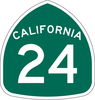
State Route 24 is a heavily traveled east–west state highway in the U.S. state of California that serves the eastern side of the San Francisco Bay Area. A freeway throughout its entire length, it runs from the Interstate 580/Interstate 980 interchange in Oakland, and through the Caldecott Tunnel under the Berkeley Hills, to the Interstate 680 junction in Walnut Creek. It lies in Alameda County, where it is highly urban, and Contra Costa County, where it passes through wooded hillsides and suburbs. SR 24 is a major connection between the San Francisco–Oakland Bay Bridge/MacArthur Maze complex and the inland cities of the East Bay.
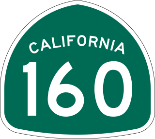
State Route 160 is a state highway in the U.S. state of California consisting of two sections. The longer, southern, section is a scenic highway through the alluvial plain of the Sacramento River, linking SR 4 in Antioch with Sacramento via the Antioch Bridge. The northern section, separated from the southern by Sacramento city streets, is the North Sacramento Freeway, running from the 16th Street Bridge over the American River to Interstate 80 Business towards Roseville.

State Route 84 is a state highway in the U.S. state of California that consists of two unconnected segments, one in the San Francisco Bay Area and the other primarily in the Sacramento–San Joaquin River Delta area.

The Carquinez Bridge is a pair of parallel bridges spanning the Carquinez Strait at the northeastern end of San Francisco Bay. They form the part of Interstate 80 between Crockett and Vallejo, California, United States.

The Antioch Bridge is an automobile, bicycle, and pedestrian bridge in the western United States. Located in northern California, it crosses the San Joaquin River-Stockton Deepwater Shipping Channel, linking Antioch in Contra Costa County with Sherman Island in southern Sacramento County, near Rio Vista.

The Yolo Causeway is a 3.2-mile (5.1 km) long elevated highway viaduct on Interstate 80 that crosses the Yolo Bypass floodplain, connecting the cities of West Sacramento, California and Davis, California. It is officially named the Blecher-Freeman Memorial Causeway after two California Highway Patrol officers who were killed in the line of duty just east of the causeway.

State Route 220 is a state highway in the U.S. state of California, defined to run between State Route 84 and State Route 160 on Ryer Island in the Sacramento–San Joaquin River Delta. At the eastern end of Ryer Island, the road crosses Steamboat Slough on the Howard Landing Ferry, a cable ferry.

The Port of Stockton is a major deepwater port on the Stockton Ship Channel of the Pacific Ocean and an inland port located more than seventy nautical miles from the ocean, in Stockton, California on the Stockton Channel and San Joaquin River-Stockton Deepwater Shipping Channel. The port sits on about 4,200 acres (17 km2), and occupies an island in the Sacramento–San Joaquin River Delta, and a portion of a neighborhood known as Boggs Tract. It is governed by a commission appointed by the City of Stockton and San Joaquin County. The Port of Stockton is a self-sustaining economic powerhouse in the Central Valley and in 2022, employed over 10,000 people and contributed over $78 million in state and local tax funds.
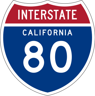
Interstate 80 (I-80) is a transcontinental Interstate Highway in the United States, stretching from San Francisco, California, to Teaneck, New Jersey. The segment of I-80 in California runs east from San Francisco across the San Francisco–Oakland Bay Bridge to Oakland, where it turns north and crosses the Carquinez Bridge before turning back northeast through the Sacramento Valley. I-80 then traverses the Sierra Nevada, cresting at Donner Summit, before crossing into the state of Nevada within the Truckee River Canyon. The speed limit is at most 65 mph (105 km/h) along the entire route instead of the state's maximum of 70 mph (110 km/h) as most of the route is in either urban areas or mountainous terrain. I-80 has portions designated as the Eastshore Freeway and Alan S. Hart Freeway.

State Route 255 is a state highway in the U.S. state of California. It is a loop route of U.S. Route 101 in Humboldt County that runs through the Samoa Peninsula on the western side of Humboldt Bay.

California's transportation system is complex and dynamic. Although known for its car culture and extensive network of freeways and roads, the state also has a vast array of rail, sea, and air transport. Several subway, light rail, and commuter rail networks are found in many of the state's largest population centers. In addition, with the state's location on the West Coast of the United States, several important ports in California handle freight shipments from the Pacific Rim and beyond. A number of airports are also spread out across the state, ranging from small general aviation airports to large international hubs like Los Angeles International Airport and San Francisco International Airport.

Ryer Island is an island in the Sacramento-San Joaquin River Delta surrounded by Miner Slough and Steamboat Slough at their confluence with the Sacramento River, 6.5 miles north-northeast of Rio Vista. It is in Solano County, California, and managed by Reclamation District 501. The 4,750 ha (11,700-acre) island is named in honor of a California pioneer, Dr. Washington M. Ryer, and his family. A map prepared at the time of statehood shows the area divided by the west fork of the Sacramento River, with the western half identified as Priest Island and the eastern half identified as Sutter Island.
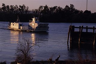
The Real McCoy was a ferryboat that operated for 63 years from Rio Vista, California on the Ryer Island Ferry route as part of California State Route 84, and was the oldest and most reliable piece of equipment owned by the California Department of Transportation. During its operating life – making the trip 24 hours per day, 7 days per week and roughly 200 trips a day – totaling approximately 460,000 safe passages over the 800 foot gap in the Sacramento River delta, between Ryer Island and Rio Vista.

The Rio Vista Bridge is a continuous truss span with a vertical-lift bridge in the middle which carries California State Route 12 across the Sacramento River at Rio Vista, California. The present bridge was completed in 1960 and is one of several moveable bridges spanning rivers in the Sacramento–San Joaquin River Delta. It is named after Helen Madere, who served as vice-mayor of Rio Vista. As of 2013 the bridge carries approximately 21,000 cars per day.

The Howard Landing Ferry is a cable ferry that operates between Ryde and Ryer Island, crossing Steamboat Slough in the Sacramento-San Joaquin River Delta in Solano County, California. The California Department of Transportation (Caltrans) operates the vehicle roll-on/roll-off service, which is classified as part of California State Route 220. The free ferry service operates 24 hours a day, 7 days a week. Boat operators are on duty 24 hours a day to provide service to individual passengers and motorists crossing Steamboat Slough.
The Real McCoy II is a ferryboat that has operated since 2011 from Rio Vista, California on the Ryer Island Ferry route as part of California State Route 84, operated by the California Department of Transportation. It replaced the original Real McCoy in 2011. It operates 24 hours per day, 7 days per week, three trips per hour, over the 800 foot gap in California State Route 84 in the Sacramento River delta, between Ryer Island and Rio Vista. Real McCoy II is 88 feet long by 38 feet wide, has a capacity of 80,000 pounds, and can carry up to ten vehicles. There is a 16.25-ton weight limit, tractor-trailers are prohibited, and the length limit is at the discretion of the Coast Guard.

Transportation in the Sacramento metropolitan area consists of a variety of modes of travel in El Dorado County, Placer County, Sacramento County, and Yolo County, which are the four counties that comprise the Sacramento metropolitan area.

