Grand Island is an island lying between Sycamore Slough and the Sacramento River. A post office operated at Grand Island from 1854 to 1919. It is shown, labeled "Taylor Island", on an 1850 survey map of the San Francisco Bay area made by Cadwalader Ringgold and an 1854 map of the area by Henry Lange.

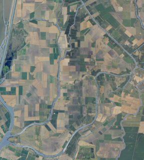
Andrus Island is an island in the Sacramento-San Joaquin River Delta in Sacramento County, California, twenty kilometres northeast of Antioch. The 3,000-hectare (7,400-acre) island is bounded on the north, and northwest by the Sacramento River, on the west, Georgiana Slough, on the southeast, Mokelumne River, and San Joaquin River, on the southwest Jackson Slough, and Seven Mile Slough. The island is entirely within the bounds of the immense Rio Vista Gas Field, although well drilling pads and associated infrastructure make up only a small part of its land use, which is mainly agriculture. It is managed by Reclamation Districts 556, 407 and 317.

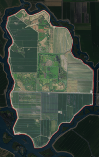
Staten Island is an island in the Sacramento-San Joaquin River Delta, twenty-five kilometres northwest of Stockton. The 3,700 ha is bordered on the east and south by South Mokelumne River, and on the west and north by North Mokelumne River. It is in San Joaquin County, and managed by Reclamation District 38.

Grizzly Island is a small island in Grizzly Bay in the San Francisco Bay Area of California. It is part of Solano County, partially managed by Reclamation Districts 2112, 2129 and 2136. Its coordinates are 38°09′05″N121°58′22″W. Islands that partially cover some of its current area, labelled "Warrington Island" and "Davis Island", are shown on an 1850 survey map of the San Francisco Bay area made by Cadwalader Ringgold and an 1854 map of the area by Henry Lange. It is labeled, along with Deadman Island, Joice Island, Simmons Island, Ryer Island and Roe Island, on a 1902 USGS map of the area.

Simmons Island is a small island in Grizzly Bay in the San Francisco Bay Area of California. It is part of Solano County, and included within Reclamation District 2127. Its coordinates are 38°05′49″N121°59′26″W. It is shown as "Simmons Island" on an 1850 survey map of the San Francisco Bay area made by Cadwalader Ringgold, and as "Simons Island" on an 1854 map of the area by Henry Lange. It is labeled, along with Deadman Island, Joice Island, Grizzly Island, Ryer Island and Roe Island, on a 1902 USGS map of the area.

Wheeler Island is a small island in Suisun Bay, California. It is part of Solano County; parts of it are included in Reclamation Districts 2127 and 2130. Its coordinates are 38°05′06″N121°56′15″W. An 1850 survey map of the San Francisco Bay area made by Cadwalader Ringgold, and an 1854 map by Henry Lange, show islands partially covering some of the current area of Wheeler Island, labeled "Davis Island" and "Warrington Island".

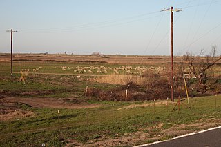
Bradford Island is a 2,172-acre (879 ha) island of the Sacramento–San Joaquin River Delta, in Contra Costa County, California, United States. Bradford Island is inaccessible by roads, and is served by a ferry across the False River from nearby Jersey Island. Approximately 48 people live on the island as of 2020; other uses of land include wheat farming, cattle grazing, and natural gas extraction.

Dead Horse Island is an island in the San Joaquin River delta, in California. It is located in Sacramento County, owned by the Wilson Family and managed by Reclamation District 2111. Its coordinates are 38.2290821°N 121.5021750°W.

Fay Island is a small, partially submerged island in the San Joaquin River delta, in California. It is part of San Joaquin County, and managed by Reclamation District 2113. Its coordinates are 37.9485348°N 121.5652291°W. It appears, almost completely submerged, on a 1952 United States Geological Survey map of the area.

Little Mandeville Island is a small, mostly submerged island in the San Joaquin River delta, in California. It is part of San Joaquin County, and its coordinates are 38.0104776°N 121.5649522°W. In 1994, 376 acres (152 ha) of former farmland was inundated with water after a levee broke.

Medford Island is a small island in the San Joaquin River delta, in California. It is part of San Joaquin County, and managed by Reclamation District 2041. Its coordinates are 38.0371435°N 121.5113407°W.

Prospect Island is a small island in the San Joaquin River delta, in California. It is part of Solano County, and managed by Reclamation District 1667. Its coordinates are 38.2463030°N 121.6655110°W. It appears on a 1952 USGS map; by 1978, survey maps show it cut diagonally by the Sacramento River Deep Water Ship Channel.

Brannan Island is a small island in the Sacramento–San Joaquin River Delta. It is part of Sacramento County, California, and managed by Reclamation District 2067. Its coordinates are 38°07′19″N121°38′37″W, and the United States Geological Survey measured its elevation as −13 ft (−4.0 m) in 1981. A "Brannan Island", with the same location but a slightly different shape, is labeled on an 1850 survey map of the San Francisco Bay area made by Cadwalader Ringgold as well as an 1854 map of the area by Henry Lange.
Liberty Island is a mostly-flooded island in the Sacramento–San Joaquin River Delta, in Solano County, California. It is administered by Reclamation District 2093. Its coordinates are 38°17′13″N121°40′43″W, and the United States Geological Survey measured its elevation as 0 ft (0 m) in 1981.
The Empire Tract is an island in the Sacramento–San Joaquin River Delta. It is part of San Joaquin County, California, and managed by Reclamation District 2029. Its coordinates are 38°03′55″N121°28′48″W, and the United States Geological Survey measured its elevation as −10 ft (−3.0 m) in 1981. It appears on a 1952 USGS map of the area.

The Webb Tract is an island in the Sacramento–San Joaquin River Delta. It is part of Contra Costa County, California, and managed by Reclamation District 2026. Its coordinates are 38°04′47″N121°36′32″W, and the United States Geological Survey measured its elevation as −13 ft (−4.0 m) in 1981.

The Rio Blanco Tract is an island in the Sacramento–San Joaquin River Delta. It is part of San Joaquin County, California, and managed by Reclamation District 2114. Its coordinates are 38°04′46″N121°24′18″W, and the United States Geological Survey measured its elevation as 0 ft (0 m) in 1981. It appears on a 1952 USGS map of the area.

The Shima Tract is an island in the Sacramento–San Joaquin River Delta. It is part of San Joaquin County, California, and managed by Reclamation District 2115. Its coordinates are 38°01′40″N121°23′06″W, and the United States Geological Survey measured its elevation as 0 ft (0 m) in 1981. It appears on a 1952 USGS map of the area.
The Holland Tract is an island in the Sacramento–San Joaquin River Delta. It is part of Contra Costa County, California, and managed by Reclamation District 2025. Its coordinates are 37°59′55″N121°36′08″W, and the United States Geological Survey measured its elevation as 7 ft (2.1 m) in 1981. It appears on a 1952 United States Geological Survey map of the area.

The Hastings Tract is an island in the Sacramento–San Joaquin River Delta. It is part of Solano County, California, and managed by Reclamation District 2060. Its coordinates are 38°16′19″N121°43′45″W, and the United States Geological Survey measured its elevation as 0 ft (0 m) in 1981.


