Yolo Bypass

Last updated
Yolo Bypass
Yolo Bypass Causeway2017-02-23 (32306199144).jpg
View of the flooded Yolo Bypass, looking southwest from West Sacramento (2017)
Relief map of Northern California.png
Red pog.svg
Coordinates 38°33′N121°36′W / 38.55°N 121.60°W / 38.55; -121.60 Coordinates: 38°33′N121°36′W / 38.55°N 121.60°W / 38.55; -121.60
CountryUnited States
State(s)California
Characteristics
Area59,000 acres (24,000 ha)
Hydrology
River(s) Sacramento, San Joaquin, American

The Yolo Bypass is one of the two flood bypasses in California's Sacramento Valley located in Yolo and Solano Counties. [1] Through a system of weirs, the bypass diverts floodwaters from the Sacramento River away from the state's capital city of Sacramento and other nearby riverside communities. [2]

Contents

During wet years, the bypass can be full of water. The main input to the bypass is through the passive Fremont Weir, where water spills from the Sacramento into the bypass if it reaches the 33.5 feet (10.2 m) crest. Downstream, the Sacramento Weir, just north of the city of West Sacramento, can also be opened to divert additional waters from the Sacramento if needed. From the west, Cache Creek drains into the bypass. The bypass itself runs south, parallel to the Sacramento, and drains into the Sacramento-San Joaquin Delta, a few kilometres north of Rio Vista.

The bypass is crossed by the Yolo Causeway, a long highway bridge on Interstate 80, linking West Sacramento and the city of Davis, as well as by a rail causeway just north of the Yolo Causeway used by freight and Amtrak trains. To the north, Interstate 5 also crosses the bypass on the Elkhorn Causeway, east of the city of Woodland.

History

Sacramento experienced several severe floods prior to construction of the bypass. The Yolo Basin, a depression formed during the last ice age, [3] :3.4-1 would fill up with water during the winter months from seasonal rainfall and runoff into the three rivers surrounding what is now the city of Sacramento (Sacramento, San Joaquin, and American). This created a diverse marsh ecosystem that could last more than 100 days. During the 1800s, seasonal flooding would limit travel and access between cities in the Sacramento River valley.

Destructive floods in 1862 and 1878 prompted various flood control measures, including the 11.5-mile (18.5 km) long Tule Canal (completed in 1864) along the eastern edge of the present-day Yolo Bypass; and the Elkhorn Weir (1897–1917), downstream of the confluence of the Feather and Sacramento Rivers. [4] :3.6-4

The California Department of Water Resources's schematic map of the Yolo Bypass, 2009. Yolo Bypass Schematic Map.jpg
The California Department of Water Resources's schematic map of the Yolo Bypass, 2009.

Congress approved the Sacramento River Flood Control Project in 1911, with a plan to divert the water through multiple weirs and bypasses. The Yolo Bypass is one of two major bypasses in the Sacramento Valley that helps deter urban flooding. [5] The other bypass is the Sutter Bypass, which lies upstream of the Yolo Bypass. [6] The 59,000-acre (24,000 ha) Yolo Bypass floodplain was designed in the early 1930s by the US Army Corps of Engineers.

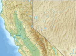
The Yolo Bypass extends approximately 41 miles (66 km) long, north to south, and 3 miles (4.8 km) wide. The western and eastern edges are defined by levees separated by a distance ranging from 7,000 to 16,000 feet (2,100 to 4,900 m) apart, except for an 8-mile (13 km) long segment immediately south of the mouth of Putah Creek. [7] The two largest sources for the Yolo Bypass are the Sacramento Weir, completed in 1916, and the Fremont Weir, completed in 1929. [3] :3.4-4 [4] :3.6-5

Uses

Almost 75% of the Yolo Bypass is privately owned, while the rest belongs to the Yolo Bypass Wildlife Area. Most of the land is used for agriculture during the summer and spring, and the rest makes up marshland. This marshland is ideal for animal habitat, and is also utilized for fishing, hunting, and other recreational activities. [8]

Flood control

Fremont Weir (2010) Fremont Weir (5393107883).jpg
Fremont Weir (2010)

Flood control is the main purpose of the Yolo Bypass. When the flowrate of the Sacramento River exceeds approximately 55,000 cubic feet per second (93,000 m3/min), the excess is released into the Yolo Bypass at the passive Fremont Weir, [9] :548 near that river's confluence with the Feather River. The Fremont Weir, which lies along the south bank of the Sacramento, is about 32 feet (9.8 m) tall, nearly 12 feet (3.7 m) shorter than the levee on the north bank. When the water reaches the 32 feet (9.8 m) mark it starts to flow out into the Yolo Basin. [10]

North of where the Elkhorn Causeway crosses the Yolo Bypass, the Cache Creek flood control basin drains into the Yolo Bypass. [6] The Knights Landing Ridge Cut, where the Colusa Basin Drainage Canal empties, also contributes to the flow in the Yolo Bypass near this point. [9] :587

There is a second weir just north of West Sacramento, the Sacramento Weir, upstream of the confluence of the Sacramento and American Rivers. The Sacramento Weir is opened manually when the Sacramento River reaches 27.5 feet (8.4 m) at the I Street Bridge. It was built in 1916 by the City of Sacramento and contains 48 gates over its 1,920-foot (590 m) length; water from the Sacramento Weir flows through the 1 mile (1.6 km) long Sacramento Bypass and drains into the Yolo Bypass. [6] The crest of the Sacramento Weir is at 25 feet (7.6 m) and the top of the moveable gates is 31 feet (9.4 m); each gate is 38.1 feet (11.6 m) long. [9] :549

Yolo Bypass inlets [6]
NameLocationCapacityNotes
Moulton Weir8 miles (13 km) N of Colusa
100 miles (160 km) N of Sacramento
25,000 cu ft/s
42,000 m3/min
Releases from Sacramento River to Butte Basin
Colusa Weir & Bypass1 mile (1.6 km) N of Colusa
100 miles (160 km) N of Sacramento
70,000 cu ft/s
120,000 m3/min
Releases from Sacramento River to Butte Basin
Tisdale Weir & Bypass10 miles (16 km) SE of Meridian
56 miles (90 km) N of Sacramento
38,000 cu ft/s
65,000 m3/min
Releases from Sacramento River to Sutter Bypass
Fremont Weir8 miles (13 km) NE of Woodland
15 miles (24 km) NW of Sacramento
343,000 cu ft/s
583,000 m3/min
Releases from Sacramento River
Sacramento Weir & Bypass West Sacramento
4 miles (6.4 km) N of Tower Bridge
112,000 cu ft/s
190,000 m3/min
Only manual weir in the Yolo Bypass system
Cache Creek Settling Basin & Weir2 miles (3.2 km) E of Woodland 30,000 cu ft/s
51,000 m3/min
Covers 3,600 acres (1,500 ha)

Water flowing through the Yolo Bypass is drained through a riparian channel along its southeastern edge, named the Toe Drain. In the Liberty Farms area, the bypass joins first Prospect Slough and then Cache Slough adjacent to the connection of the Sacramento Deep Water Ship Channel. Cache Slough then reconnects with the Sacramento River just north of Rio Vista. The water eventually flows into the Sacramento-San Joaquin Delta, just above Rio Vista, and from there into San Francisco Bay.

The Yolo Bypass can hold approximately four times the flow of the Sacramento River. Together, the Sacramento River and Yolo Bypass are designed to handle a maximum flow of 600,000 cubic feet per second (1,000,000 m3/min), of which the Sacramento handles 110,000 cu ft/s (190,000 m3/min) and the bypass 500,000 cu ft/s (850,000 m3/min). This flood management relieves pressure on the surrounding river levee systems and reduces the risk of urban flooding in nearby cities, such as Sacramento or Davis. During wet years, which occur during more than half of all rainy seasons, the Yolo Bypass is flooded; when flooded, it covers an area equal to 13 the area of San Francisco and San Pablo Bays, to a depth ranging from 6 to 10 feet (1.8 to 3.0 m). [6]

Flooded Yolo Bypass, February 2006. Interstate 80 runs along the causeway in the distance. Yolo Bypass.jpg
Flooded Yolo Bypass, February 2006. Interstate 80 runs along the causeway in the distance.

The state of California has the right to inundate any land in the Yolo Bypass with floodwater. These rights also limit landowners from growing vegetation or building structures that would significantly obstruct flow. There is no compensation for farmers who may lose crops or other losses due to flooding. The state manages the flooding of the Yolo Bypass with farmers and native species in mind. Using adaptive management, there is a balance between providing efficient flood protection, agriculture, and habitat benefits in the Yolo Bypass year-round. [11]

Wildlife habitats

The Yolo Bypass contains the Fremont Weir Wildlife Area, Sacramento Weir Wildlife Area and Yolo Bypass Wildlife Area. The Vic Fazio Yolo Wildlife Area is also part of the Yolo Bypass Wildlife Area and was the largest public/private restoration project west of the Florida Everglades. The entire bypass forms a valuable wetland habitat when flooded during the winter and spring rainy season. In the summer, areas of the bypass outside the wildlife areas are used for agriculture.

Approximately 250,000 Mexican free-tailed bats migrate to and nest under the Yolo Causeway during the summer (2018) Bat flight.jpg
Approximately 250,000 Mexican free-tailed bats migrate to and nest under the Yolo Causeway during the summer (2018)

The Yolo Bypass provides habitat for over 280 terrestrial vertebrate species, changing throughout the seasons. The natural flooding provides an exceptionally good nursery habitat for native fish species, including the endangered Chinook salmon. Juvenile salmon have been found to grow substantially better in the Yolo Bypass than the adjacent Sacramento River. [12] Other special-status wildlife residing in the Yolo Bypass includes giant garter snake, fairy shrimp, bald eagle, Swainson's Hawk, and more. Wildlife managers occasionally flood certain areas to create wetlands for migratory waterfowl. The Yolo Bypass is somewhat of a pit stop for the waterfowl, and it provides nesting habitat and food for this abundance of birds. The Yolo Basin Wetlands Project is accounted as being one of the largest wetland restoration projects in the Western United States. Habitats in the Yolo Basin Wetlands includes seasonal wetlands, uplands, perennial wetlands, vernal pools and riparian forest. The Bypass also holds species of riparian vegetation such as cottonwoods, black walnut, willows, saltgrass, and other assorted tree and grass species.

Habitat Management activities are monitored annually by the California Department of Fish and Wildlife's Wildlife Area Habitat Committee for area in the Yolo Bypass Wildlife Area. Each year they establish a specific management plan for different parts of the land. The targeted species for seasonal wetland management is the timothy species. This plant provides countless nutritional seeds for consumption by assorted migratory waterfowl. There are also quite a few nonnative species that are not necessarily wanted in the bypass such as dock and perennial pepperweed. [13]

The Yolo Bypass in March 2006, looking east from Davis toward Sacramento. Heavy rainstorms in January led to total flooding in the bypass. Yolo bypass072006.jpg
The Yolo Bypass in March 2006, looking east from Davis toward Sacramento. Heavy rainstorms in January led to total flooding in the bypass.

Years with high flows in the Yolo Bypass also benefit fish populations in the San Francisco Estuary. [14] [15] This is mainly because of increased habitat availability, food supply, larval transport, and reduced predation.

Agriculture

The floodplains of the Yolo Bypass are a surprisingly good farming ground for multiple seasonal crops. The California Department of Fish and Wildlife leases land to farmers through the Dixon Resource Conservation District. The most widely-grown crops include rice, safflower, processing tomatoes, corn, sunflower, and irrigated pasture. Half of the rice grown in the Yolo Bypass is wild due to its tolerance to colder weather. Farming is mainly done in late spring and summer when flooding does not usually occur, but farming can be halted or delayed depending on the water level in the Bypass.

Agricultural crops in Yolo County amount to about $300 million a year. Leftover crop residue is beneficial to animal habitat. The already-harvested land creates foraging area, and food opportunities, such as seeds for mourning dove and the non-native ring-necked pheasants.

Recreation and education

The Yolo Bypass provides a multitude of recreational uses and educational as well. The Yolo Bypass Wildlife Headquarters provides summer educational programs for children in kindergarten through high school. These programs include hands on activities on plants, animals, and wetlands, using the Yolo Bypass Wildlife Area as a classroom. They have summer camps, classes, and are open to schools wanting to coordinate field trips as well. The Bypass is also open for guided tours for all ages of the public every month.

Ducks take flight at Yolo Bypass Wildlife Area (2007) Mallard-skyline.jpg
Ducks take flight at Yolo Bypass Wildlife Area (2007)

The Yolo Bypass is often used for bird watching, hunting, and hiking. Game species include waterfowl (when the bypass is flooded), ring-necked pheasant, and mourning dove. There are also assorted trails that loop around the wetlands in the Yolo Bypass that may be accessed by the public.

Future

Recent modeling shows that increasing flow to the Yolo Bypass may be beneficial for animal habitat. An upcoming project looks to extend the Yolo Bypass by potentially pushing back the levees, and allowing more room for water to be released into the Yolo Bypass. Separately, the Bay Delta Conservation Plan includes plans to help restore fish habitat in the Yolo Bypass. Its plan is to put a notch at the top the Fremont Weir to allow for more water to flow, increasing the frequency of flooding for fish habitat.

The Nigiri Project

The Nigiri Project [16] is a collaborative research study being done in the Yolo Bypass at Knaggs Ranch by the UC Davis Center for Watershed Sciences, the California Department of Water Resources, and the nonprofit organization California Trout.

This research is being conducted to determine how floodplains, particularly flooded rice fields, can provide habitat to endangered species such as the Chinook Salmon. In the summer these fields are used for the production of rice, while in the winter, the land can be flooded to create ideal wetland habitat for salmon. They have been experimenting for the past four consecutive winters, and have documented the fastest growth of juvenile Chinook Salmon ever recorded in the Central Valley. The experiment aims to mimic the natural annual flood cycle of the Sacramento River, which most native fish species relied upon.

This project is currently funded by the U.S. Bureau of Reclamation, California Trout, and the California Department of Water Resources. [17]

Related Research Articles

<span class="mw-page-title-main">Sacramento River</span> River in Northern and Central California, United States

The Sacramento River is the principal river of Northern California in the United States and is the largest river in California. Rising in the Klamath Mountains, the river flows south for 400 miles (640 km) before reaching the Sacramento–San Joaquin River Delta and San Francisco Bay. The river drains about 26,500 square miles (69,000 km2) in 19 California counties, mostly within the fertile agricultural region bounded by the Coast Ranges and Sierra Nevada known as the Sacramento Valley, but also extending as far as the volcanic plateaus of Northeastern California. Historically, its watershed has reached as far north as south-central Oregon where the now, primarily, endorheic (closed) Goose Lake rarely experiences southerly outflow into the Pit River, the most northerly tributary of the Sacramento.

<span class="mw-page-title-main">San Joaquin River</span> Longest river of Central California, United States

The San Joaquin River is the longest river of Central California. The 366-mile (589 km) long river starts in the high Sierra Nevada, and flows through the rich agricultural region of the northern San Joaquin Valley before reaching Suisun Bay, San Francisco Bay, and the Pacific Ocean. An important source of irrigation water as well as a wildlife corridor, the San Joaquin is among the most heavily dammed and diverted of California's rivers.

<span class="mw-page-title-main">Clear Lake (California)</span> Freshwater lake in California

Clear Lake is a natural freshwater lake in Lake County in the U.S. state of California, north of Napa County and San Francisco. It is the largest natural freshwater lake wholly within the state, with 68 square miles (180 km2) of surface area. At an age of 2.5 million years, it is the oldest lake in North America. It is the latest lake to occupy a site with a history of lakes stretching back at least 2,500,000 years.

<span class="mw-page-title-main">Kings River (California)</span> River in central California, US

The Kings River is a 132.9-mile (213.9 km) river draining the Sierra Nevada mountain range in central California in the United States. Its headwaters originate along the Sierra Crest in and around Kings Canyon National Park and form the eponymous Kings Canyon, one of the deepest river gorges in North America. The river is impounded in Pine Flat Lake before flowing into the San Joaquin Valley southeast of Fresno. With its upper and middle course in Fresno County, the Kings River diverges into multiple branches in Kings County, with some water flowing south to the old Tulare Lake bed and the rest flowing north to the San Joaquin River. However, most of the water is consumed for irrigation well upstream of either point.

<span class="mw-page-title-main">Yolo Causeway</span> Viaduct carrying Interstate 80 from Davis to West Sacramento

The Yolo Causeway is a 3.2-mile (5.1 km) long elevated highway viaduct on Interstate 80 that crosses the Yolo Bypass floodplain, connecting the cities of West Sacramento, California and Davis, California. It is officially named the Blecher-Freeman Memorial Causeway after two California Highway Patrol officers who were killed in the line of duty just east of the causeway.

<span class="mw-page-title-main">Vic Fazio Yolo Wildlife Area</span>

The Vic Fazio Yolo Wildlife Area is a 3,700 acres (15 km2) wetland restoration project constructed by the United States Army Corps of Engineers and Ducks Unlimited within the Yolo Bypass Wildlife Area located in the Yolo Bypass in Yolo County, California, between the cities of Sacramento and Davis. The Yolo Causeway, part of Interstate 80, runs through it. The restoration was named for Congressman Vic Fazio, who lobbied for the project and was instrumental in appropriating funds for the initial construction. The Yolo Bypass Wildlife Area was dedicated in 1997 by President Bill Clinton. The facility is managed by the California Department of Fish and Wildlife while the educational programs and public tours are administered by the Yolo Basin Foundation, which works to educate and inform the public.

<span class="mw-page-title-main">Coyote Creek (Santa Clara County)</span> Creek in California, United States

Coyote Creek is a river that flows through the Santa Clara Valley in Northern California. Its source is on Mount Sizer, in the mountains east of Morgan Hill. It eventually flows into Anderson Lake in Morgan Hill and then northwards through Coyote Valley to San Jose, where it empties into San Francisco Bay.

<span class="mw-page-title-main">Suisun Marsh</span> Largest brackish water marsh on west coast of US

Located in northern California, the Suisun Marsh has been referred to as the largest brackish water marsh on west coast of the United States of America. The marsh land is part of the San Francisco Bay tidal estuary, and subject to tidal ebb and flood. The marsh is home to many species of birds and other wildlife, and is formed by the confluence of the Sacramento and San Joaquin rivers between Martinez and Suisun City, California and several other smaller, local watersheds. Adjacent to Suisun Bay, the marsh is immediately west of the legally defined Sacramento-San Joaquin Delta as well as part of the San Francisco Bay estuary.

<span class="mw-page-title-main">Cache Creek (Sacramento River tributary)</span> Stream from Lake to Yolo Counties, CA

Cache Creek is an 87-mile-long (140 km) stream in Lake, Colusa and Yolo counties, California.

<span class="mw-page-title-main">Alameda Creek</span> River in California, United States

Alameda Creek is a large perennial stream in the San Francisco Bay Area. The creek runs for 45 miles (72 km) from a lake northeast of Packard Ridge to the eastern shore of San Francisco Bay by way of Niles Canyon and a flood control channel. Along its course, Alameda Creek provides wildlife habitat, water supply, a conduit for flood waters, opportunities for recreation, and a host of aesthetic and environmental values. The creek and three major reservoirs in the watershed are used as water supply by the San Francisco Public Utilities Commission, Alameda County Water District and Zone 7 Water Agency. Within the watershed can be found some of the highest peaks and tallest waterfall in the East Bay, over a dozen regional parks, and notable natural landmarks such as the cascades at Little Yosemite and the wildflower-strewn grasslands and oak savannahs of the Sunol Regional Wilderness. After an absence of half a century, ocean-run steelhead trout will soon be able to return to Alameda Creek to mingle with remnant rainbow trout populations. Completion of a series of dam removal and fish passage projects, along with improved stream flows for cold-water fish and planned habitat restoration, will improve and restore habitat conditions for migratory fish. Steelhead trout and Chinook salmon will soon be able to access up to 20 miles (32 km) of spawning and rearing habitat in Alameda Creek and its tributaries.

<span class="mw-page-title-main">Nimbus Dam</span> Dam in Sacramento County, California

The Nimbus Dam is a base load hydroelectric dam on the American River near Folsom, California. Approximately 8,700 acre-feet (10,700 dam3) of water is retained by the dam. It is responsible for the impoundment of water from the American River to create the Lake Natoma reservoir. The dam stands 87 feet and spans 1,093 feet. The Nimbus powerplant consists of two generators. Each generator produces enough electrical power to power over 200,000 100-watt light bulbs, about 15,500 kilowatts of electrical power. Nimbus Dam consists of 18 radial gates, each with their own gate bays. These 18 gates today are the ones that were completed in 1955 along with the rest of the dam. Of the eighteen gates, four of them have had their coating system replaced. This protects the gates from a faster rate of corrosion. The other fourteen gates have the original coating.

<span class="mw-page-title-main">Yolo Bypass Wildlife Area</span> Wildlife area

The Yolo Bypass Wildlife Area is located within the Yolo Bypass in Yolo County, California. The wildlife area is managed by the California Department of Fish and Wildlife with the intent of restoring and managing a variety of wildlife habitats in the Yolo Basin, a natural basin in the north part of the Sacramento-San Joaquin River Delta. The creation of the wildlife area was spearheaded by the Yolo Basin Foundation. The California Department of Fish and Wildlife and Yolo Basin Foundation are the core partners in the operation of this unique community resource. Located at 38.550515°N 121.626291°W

<span class="mw-page-title-main">Cosumnes River Preserve</span> Jointly managed protected area in the Central Valley of California

The Cosumnes River Preserve is a nature preserve of over 51,000 acres (210 km2) located 20 miles (30 km) south of Sacramento, in the US state of California. The preserve protects a Central Valley remnant that once contained one of the largest expanses of oak tree savanna, riparian oak forest and wetland habitat in North America. Agricultural development has changed the landscape from groves of oaks and tule marshes to productive farmlands.

<span class="mw-page-title-main">American River</span> River in California, United States

The American River is a 30-mile (50 km)-long river in California that runs from the Sierra Nevada mountain range to its confluence with the Sacramento River in downtown Sacramento. Via the Sacramento River, it is part of the San Francisco Bay watershed. This river is fed by the melting snowpack of the Sierra Nevada and its many headwaters and tributaries, including the North Fork American River, the Middle Fork American River, and the South Fork American River.

<span class="mw-page-title-main">Sutter National Wildlife Refuge</span> National Wildlife Refuge in California

Sutter National Wildlife Refuge, the southernmost refuge in the Sacramento National Wildlife Refuge Complex, is located in the Sacramento Valley of California, about 50 miles (80 km) north of the metropolitan area of Sacramento. The refuge consists of about 2,600 acres (11 km2), consisting primarily of wetland impoundments with some riparian and grassland habitat.

The Sutter Basin is a 264 sq mi (680 km2) area of the Sacramento Valley in the U.S. state of California, and is part of the Feather River drainage basin. The basin includes the Sutter Basin Fire Protection District of ~127 sq mi (330 km2) and uses irrigation from the Thermalito Afterbay's Sutter-Butte Canal. The Feather River and the Sutter By-Pass are the basin's east and southwest borders.

<span class="mw-page-title-main">Fremont Weir Wildlife Area</span> Wildlife area in California

Fremont Weir Wildlife Area is 1,461 acres at the north end of the Yolo Bypass floodway along the Sacramento River in Sutter County and Yolo County. It is 6 miles north-east of the city of Woodland and 15 miles north of Yolo Bypass Wildlife Area and the nearby Sacramento Bypass Wildlife Area. Whenever water in the river exceeds the height of the weir the excess flow runs over the weir and down the Yolo Bypass floodway, thereby reducing the risks of flooding in the city of Sacramento and nearby urban areas along the river.

<span class="mw-page-title-main">Cottonwood Creek (Sacramento River tributary)</span> River in California, United States

Cottonwood Creek is a major stream and tributary of the Sacramento River in Northern California. About 68 miles (109 km) long measured to its uppermost tributaries, the creek drains a large rural area bounded by the crest of the Coast Ranges, traversing the northwestern Sacramento Valley before emptying into the Sacramento River near the town of Cottonwood. For its entire length, it defines the boundary of Shasta and Tehama counties. Because Cottonwood Creek is the largest undammed tributary of the Sacramento River, it is known for its Chinook salmon and steelhead runs.

<span class="mw-page-title-main">Red Bluff Diversion Dam</span> Dam in Tehama County, California

Red Bluff Diversion Dam is a disused irrigation diversion dam on the Sacramento River in Tehama County, California, United States, southeast of the city of Red Bluff. Until 2013, the dam provided irrigation water for two canals that serve 150,000 acres (61,000 ha) of farmland on the west side of the Sacramento Valley. The dam and canals are part of the Sacramento Canals Unit of the Central Valley Project, operated by the U.S. Bureau of Reclamation. In 2013, the dam was decommissioned and the river allowed to flow freely through the site in order to protect migrating fish. A pumping plant constructed a short distance upstream now supplies water to the canal system.

<span class="mw-page-title-main">Arcade Creek</span> Creek in California

Arcade Creek is a waterway in Northeastern Sacramento County in central California.

References

  1. "A Framework for the Future: Yolo Bypass Management Strategy" (PDF). Yolo Bypass Working Group, Yolo Basin Foundation, and Jones & Stokes. August 2001. Retrieved June 28, 2018.
  2. Tokita, Joyce; Cameron-Harley, Jamie. "Beneath the Flood". California Department of Water Resources . Retrieved 2009-02-28.
  3. 1 2 EDAW, Inc. (June 2008). "3.4 Geomorphology, Hydrology, and Water Quality". Yolo Bypass Wildlife Area Land Management Plan (Report). California Department of Fish and Game. Retrieved 5 December 2019.
  4. 1 2 EDAW, Inc. (June 2008). "3.6 Cultural Resources". Yolo Bypass Wildlife Area Land Management Plan (Report). California Department of Fish and Game. Retrieved 5 December 2019.
  5. "Managing for Multiple Benefits: Farming, Flood Protection, and Habitat Restoration in the Yolo Bypass Wildlife Area" (PDF). February 21, 2013. Retrieved June 28, 2018.
  6. 1 2 3 4 5 "Yolo Bypass And Its Sources" (PDF). California Department of Water Resources. Retrieved 5 December 2019.
  7. "1.5.3 Surface Water Resources". Integrated Regional Water Management Plan, IA7: Yolo Bypass Integrated Project (PDF) (Report). Water Resources Association of Yolo County. April 2007. Retrieved 5 December 2019.
  8. Cloé Garnache and Richard E. Howitt. "Species Conservation on a Working Landscape: The Joint Production of Wildlife and Crops in the Yolo Bypass Floodplain" (PDF). University of California, Davis . Retrieved June 28, 2018.
  9. 1 2 3 Hendricks, Ernest LeRoy (1964). Compilation of Records of Surface Waters of the United States, October 1950 to September 1960, Part 11. Pacific Slope Basins in California; Geological Survey water-supply paper 1735. Washington, D.C.: United States Department of the Interior, Geological Survey / United States Government Printing Office. pp. 548–549, 587. Retrieved 6 December 2019.
  10. "Our third river". Sacramento News & Review.
  11. "FLloodplains: Lessons from the Cosumes River and Yolo Bypass". Delta Council. Retrieved June 28, 2018.
  12. "Building Rivers: The Yolo Bypass - Hiding in Plain Sight". NRDC. September 23, 2011. Retrieved June 28, 2018.
  13. Biological Resources Retrieved June 28, 2018.
  14. Pope, Adam C.; Perry, Russell W.; Harvey, Brett N.; Hance, Dalton J.; Hansel, Hal C. (January 2021). "Juvenile Chinook Salmon Survival, Travel Time, and Floodplain Use Relative to Riverine Channels in the Sacramento–San Joaquin River Delta". Transactions of the American Fisheries Society. 150 (1): 38–55. doi:10.1002/tafs.10271.
  15. Hance, Dalton J.; Perry, Russell W.; Pope, Adam C.; Ammann, Arnold J.; Hassrick, Jason L.; Hansen, Gabriel (11 August 2021). "From drought to deluge: spatiotemporal variation in migration routing, survival, travel time and floodplain use of an endangered migratory fish". Canadian Journal of Fisheries and Aquatic Sciences. doi:10.1139/cjfas-2021-0042.
  16. The Nigiri Project Retrieved June 28, 2018.
  17. "Nigiri Project Mixes Salmon and Rice Fields for Fifth Year on Floodplain". ucdavis.edu. University of California, Davis. February 23, 2016. Retrieved June 28, 2018.

Further reading

  1. Christian-Smith, Juliet. Managing for Multiple Benefits: Farming, Flood Protection, and Habitat Restoration in the Yolo Bypass Wildlife Area (PDF) (Report). Pacific Institute. Retrieved 23 April 2016.
  2. "About the Yolo Bypass Wildlife Area". Yolo Basin Foundation. Retrieved 23 April 2016.
  3. "Environmental Services". Division of Environmental Services, California Department of Water Resources. Retrieved 23 April 2016.
  4. Garnache, Cloe; Howitt, Richard E. (July 24–26, 2011). Species Conservation on a Working Landscape: The Joint Production of Wildlife and Crops in the Yolo Bypass Floodplain. 2011 Annual Meeting. Agricultural and Applied Economics Association. doi:10.22004/ag.econ.103973.
  5. Kiparsky, Michael (October 2003). "Floodplains: Lessons from the Cosumnes River and Yolo Bypass" (PDF). California Bay-Delta Authority. Retrieved 23 April 2016.