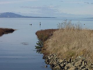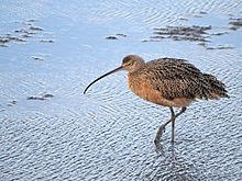
San Francisco Bay is a large tidal estuary in the U.S. state of California, and gives its name to the San Francisco Bay Area. It is dominated by the large cities of San Francisco, San Jose, and Oakland.

The East Bay Regional Park District (EBRPD) is a special district operating in Alameda County and Contra Costa County, California, within the East Bay area of the San Francisco Bay Area. It maintains and operates a system of regional parks which is the largest urban regional park district in the United States. The administrative office is located in Oakland.

Point Pinole Regional Shoreline is a regional park on the shores of the San Pablo Bay, California, in the United States. It is approximately 2,315 acres (9.37 km2) in area, and is operated by the East Bay Regional Park District. It includes the Dotson Family Marsh and the Point Pinole Lagoon and hosts the North Richmond Shoreline Festival.

Schoolhouse Creek is a creek which flows through the city of Berkeley, California in the San Francisco Bay Area.

McLaughlin Eastshore State Park is a state park and wildlife refuge along the San Francisco Bay shoreline of the East Bay between the cities of Richmond, Albany, Berkeley, Emeryville, and Oakland. It encompasses remnant natural wetlands, restored wetlands, as well as landfill west of the Eastshore Freeway. Its shoreline is 8.5 miles (13.7 km) long, and its total area is 1,854 acres (750 ha), which includes both tidelands and uplands. Originally named just Eastshore State Park, it was renamed in October 2012 to honor the late Save the Bay founder Sylvia McLaughlin, who, along with the late Dwight Steele of Citizens for Eastshore Park, drove the establishment of the park. Prior to 2013, it was jointly managed by the California State Parks and East Bay Regional Park District (EBRPD). The state agency and EBRPD executed a 30-year agreement for EBRPD to manage the park.

Point Isabel Regional Shoreline in Richmond, California, is operated by East Bay Regional Park District, and is a multi-use park for joggers, windsurfers, kayakers, photographers, picnickers, and people walking dogs. It has access for pedestrians and via public transit, private vehicles, and bikes. It also features a concession offering food for people and grooming for pets. A longtime community organization and nonprofit, Point Isabel Dog Owners and Friends (PIDO), is active in the maintenance and improvement of the park.
Point Isabel is a promontory on the eastern shore of San Francisco Bay in the Richmond Annex neighborhood of Richmond, United States.

Middle Harbor Shoreline Park (MHSP) is located on San Francisco Bay and the Port of Oakland entrance channel, west of downtown Oakland, California. It is owned and operated by the Port of Oakland. The park entrance is at the intersection of 7th Street and Middle Harbor Road. It is open seven days a week from 8 a.m. to dusk.

Carquinez Strait Regional Shoreline is a regional park, part of the East Bay Regional Park District system, located in northwestern Contra Costa County, California.

Radke Martinez Regional Shoreline (RMRS) is a regional park on the shoreline of Carquinez Strait in Martinez, located in northern Contra Costa County, California. Formerly known as the Martinez Regional Shoreline, it was renamed on December 6, 2016, in honor of the late Ted Radke and his late wife Kathy Radke.
Hoffman Marsh is a wetlands on San Francisco Bay in Richmond, California. The marsh has been protected within Eastshore State Park, and adjacent to Point Isabel Regional Shoreline. The marsh is an important nesting ground for wildfowl and stopping ground on the Pacific Flyway, as it is one of only a handful of undestroyed wetlands in the Bay Area. It borders Point Isabel Regional Shoreline and Interstate 80.

The Dotson Family Marsh, formerly Breuner Marsh, is a 238-acre regional park on San Pablo Bay in the East San Francisco Bay Area city of Richmond, California, In 2009 the East Bay Regional Parks District acquired the Breuner Marsh site, adding it to Point Pinole Regional Shoreline. A habitat restoration plan for 60 acres of wetlands and 90 acres of California coastal prairie was subsequently approved.

The Albany Bulb is a former landfill largely owned by the City of Albany, in California. The Bulb is the west end of a landfill peninsula jutting west from the east shore of San Francisco Bay. The term "Bulb" is often used to refer to the entire peninsula, which includes the Albany Plateau, north of Buchanan Street at its base; the high narrow "Neck," and the round "Bulb." The Bulb is part of the City of Albany, and can be reached via Buchanan Street or the Bay Trail along the east side of San Francisco Bay.

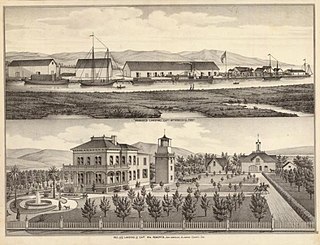
Roberts Landing was a settlement in Alameda County, California, now incorporated into the town of San Leandro. It is located at the mouth of San Lorenzo Creek on San Francisco Bay just west of the community of San Lorenzo. In the 19th century, it had warehouses and a wharf, and was used by farmers to ship their produce to the city of San Francisco. From 1906 to 1964, it was the site of an explosives manufacturing plant operated by the Trojan Powder Company. Following the plant's closure, the site was decontaminated. After protracted discussions, part was made into a housing development while a larger part was made an open space that is now also called the San Leandro Shoreline Marshlands.

Crissy Marsh is a wetland area in San Francisco, California, United States. Crissy Marsh has brackish waters, making an ideal habitat for many bird species along the Pacific Flyway. Here, freshwater runoff meets the salt water of the bay. It is 130-acres and located on the northern end of the San Francisco Peninsula. This salt marsh was largely destroyed to build Crissy Field, an airfield used during World War I and World War II. It has since been restored, with the airfield being removed. It now hosts abundant and recovering wildlife on the northern San Francisco coast.

The Palo Alto Baylands Nature Preserve, known officially as the Baylands Nature Preserve, is the largest tract of undisturbed marshland remaining in the San Francisco Bay. Fifteen miles of multi-use trails provide access to a unique mixture of tidal and fresh water habitats. The preserve encompasses 1,940 acres in both Palo Alto and East Palo Alto, and is owned by the city of Palo Alto, California, United States. It is an important habitat for migratory shorebirds and is considered one of the best birdwatching spots on the West Coast.

The Hayward Area Recreation and Park District (H.A.R.D.) is the park management agency for most of the parks in the city of Hayward, California. It was created in 1944 and is an independent special district under California law. H.A.R.D. is the largest recreation district in California. It also manages parks in the bordering unincorporated communities of Castro Valley, San Lorenzo, Fairview, Ashland and Cherryland. It manages the park grounds for numerous schools in the region. Events and classes are scheduled and listed in a quarterly brochure. The parks' 2021 budget is $24,306,495.

Eden Landing Ecological Reserve is a nature reserve in Hayward and Union City, California, on the eastern shore of San Francisco Bay. The reserve is managed by the California Department of Fish and Game and comprises 5,040 acres of former industrial salt ponds now used as a low salinity waterbird habitat.
Oyster Bay Regional Shoreline is a park in San Leandro, California, part of the East Bay Regional Park District (EBRPD). It is located along the eastern shore of San Francisco Bay directly to the south of Oakland International Airport. The property was originally used as a landfill for 37 years, until it was filled to capacity in 1977, when it was capped with a clay cover. EBRPD bought the property in 1980, intending to use it as a park.

The San Francisco Bay Salt Ponds are an approximately 16,500-acre (6,700 ha) part of the San Francisco Bay that have been used as salt evaporation ponds since the California Gold Rush era. Most of the ponds were once wetlands in the cities of Redwood City, Newark, Hayward and other parts of the bay.


