
The East Bay Regional Park District (EBRPD) is a special district operating in Alameda County and Contra Costa County, California, within the East Bay area of the San Francisco Bay Area. It maintains and operates a system of regional parks which is the largest urban regional park district in the United States. The administrative office is located in Oakland.
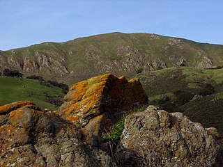
Mission Peak Regional Preserve is a public park east of Fremont, California, operated by the East Bay Regional Park District. It is the northern summit on a ridge that includes Mount Allison and Monument Peak. Mission Peak has symbolic importance, and is depicted on the logo of the City of Fremont.

Morgan Territory is a region in California on the east side of Mount Diablo in the San Francisco East Bay's Contra Costa County. The area is named for settler Jeremiah Morgan.
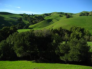
Briones Regional Park is a 6,117-acre (24.75 km2) regional park in the East Bay Regional Park District (EBRPD) system, located in the Briones Hills of central Contra Costa County of the San Francisco Bay Area in California.
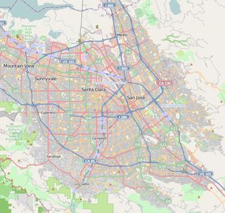
The Picchetti Winery, also known as the Picchetti Ranch, is a winery located at 13100 Montebello Rd., Cupertino, California in the Picchetti Ranch Open Space Preserve. The Picchetti brothers, Secondo and Vincenzo, for whom the ranch was named, were among the earliest settlers to plant grapes on this ridge, which they named "Monte Bello" or "beautiful mountain." This ridge was later to become one of Santa Clara County's important vineyard areas.
Bishop Ranch Regional Preserve (BRRP), also known as Bishop Ranch Regional Open Space Preserve is a 444-acre (1.80 km2) regional park on a ridge top at the edge of San Ramon, CA. It is near residential area, west of San Ramon Valley Road and South of Bollinger Canyon Road. Trails are steep and there are no facilities other than a trailhead. It is part of the East Bay Regional Parks system.
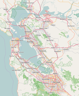
Brushy Peak Regional Preserve is a regional park that is part of the East Bay Regional Parks (EBRPD) and the Livermore Area Recreation and Park District (LARPD) systems. It is located in unincorporated land in Alameda County, just north of Livermore, California.
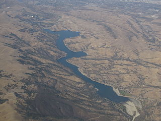
Del Valle Regional Park is a part of the East Bay Regional Park District (EBRPD) in an unincorporated region of Alameda County, California, 10 miles (16 km) south of the city of Livermore. The park covers 4,316 acres.
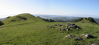
Las Trampas Regional Wilderness is a 5,342-acre (21.62 km2) regional park located in Alameda and Contra Costa counties in Northern California. The nearest city is Danville, California Las Trampas is Spanish for the traps, or the snares. The park belongs to the East Bay Regional Park District (EBRPD).

Radke Martinez Regional Shoreline (RMRS) is a regional park on the shoreline of Carquinez Strait in Martinez, located in northern Contra Costa County, California. Formerly known as the Martinez Regional Shoreline, it was renamed on December 6, 2016, in honor of the late Ted Radke and his late wife Kathy Radke.
Morgan Territory Regional Preserve is a regional park located north of Danville and Livermore, California, bordering on Mt. Diablo State Park, that is part of the East Bay Regional Park District. Since EBRPD acquired the Viera tract, it encompassed 5,230 acres (2,120 ha). The main access road runs from Livermore.

Robert Sibley Volcanic Regional Preserve is located in the Berkeley Hills of the East Bay region of the San Francisco Bay Area, California. The park is part of the East Bay Regional Parks District (EBRPD), covers 928 acres (3.76 km2), and lies partly in Alameda County and partly in Contra Costa County, east of Oakland. It can be entered from Oakland on Skyline Boulevard, or from Contra Costa County on Old Tunnel Road.

Round Valley Regional Preserve is a regional park just outside Antioch, CA and Brentwood, CA that is part of the East Bay Regional Parks (EBRPD) system. It is on Marsh Creek Road, approximately 5.2 miles (8.4 km) west of the intersection with Vasco Road. The park was begun in 1988, when Jim Murphy sold 700 acres (280 ha) of land to EBRPD. The land originally belonged to Mr. Davis' grandfather Thomas Murphy, an Irish immigrant, who had purchased the land in 1878 for a farming and ranching operation. The preserve has since expanded to encompass 1,911 acres (773 ha).

Sobrante Ridge Regional Preserve (SRRP) is a regional park in Contra Costa County, California near Richmond and is part of the East Bay Regional Parks (EBRPD) system. The park may be best known as habitat for the Alameda manzanita, which is deemed extremely rare, according to EBRPD.
Waterbird Regional Preserve is a 192 acres (0.78 km2) regional park located in Contra Costa County, California, adjacent to the city of Martinez, CA. It is part of the East Bay Regional Park District (EBRPD). It primarily consists of an area known as McNabney Marsh, which lies alongside Interstate 680 near the Sacramento-San Joaquin Delta and between two large and active oil refineries. The marsh drains into Suisun Bay via Peyton Slough. The area provides habitat for a wide variety of waterfowl and shorebirds for resting and feeding.
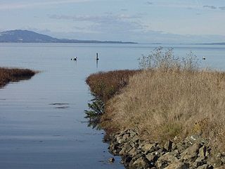
The Dotson Family Marsh, formerly Breuner Marsh, is a 238-acre regional park on San Pablo Bay in the East San Francisco Bay Area city of Richmond, California, In 2009 the East Bay Regional Parks District acquired the Breuner Marsh site, adding it to Point Pinole Regional Shoreline. A habitat restoration plan for 60 acres of wetlands and 90 acres of California coastal prairie was subsequently approved.
Vargas Plateau Regional Park sits on a plateau in the Fremont Hills of Alameda County, California that overlooks the San Francisco Bay, Niles Canyon, and the cities of Fremont, Union City and Newark. The elevation of the park is about 1,000 feet (300 m), making it an important link with nearby ridge-top parks such as Garin Regional Park, Pleasanton Ridge Regional Park, Mission Peak Regional Preserve, and Sunol Regional Wilderness.
Dublin Hills Regional Park covers 654 acres (2,650,000 m2) in Alameda County, California, west of the city of Dublin. It is part of the East Bay Regional Park District (EBRPD). The park is accessible from the Donlon Hill Staging Area, which is on Dublin Boulevard near Dublin, California.

Five Canyons Open Space (FCOS) is located in Castro Valley, in Alameda County, California. Five Canyons is a multi-agency collaboration between East Bay Regional Parks District (EBRPD), Alameda County Public Works, Hayward Area Recreation and Parks District (HARD), and several homeowners associations. EBRPD is the lead agency for this open space. FCOS opened in 1998, consists of 300 acres (1.2 km2) and 5 miles (8.0 km) of trails and has almost no amenities. The main visitors are hikers, bicyclists, equestrians and dog walkers. Restrooms and drinking water are available at HARD's nearby Five Canyons Park.


