McArthur–Burney Falls Memorial State Park is the second oldest state park in the California State Parks system, located approximately 6 miles (9.7 km) north of Burney, California. The park offers camping, fishing, watersports, hiking and horseback riding facilities. The park is mainly known for the waterfall, Burney Falls, at the entrance of the park. Wildlife in the park includes bass, trout, Steller's jay, squirrels, woodpeckers, deer, and on rare occasion, black bear.

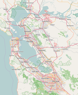
The East Bay Regional Park District (EBRPD) is a special district operating in Alameda County and Contra Costa County, California, within the East Bay area of the San Francisco Bay Area. It maintains and operates a system of regional parks which is the largest urban regional park district in the United States. The administrative office is located in Oakland.

Crowders Mountain State Park is a 5,126-acre (20.74 km2) North Carolina state park in Gaston County, North Carolina in the United States. It is near Kings Mountain, North Carolina and on the outskirts of Gastonia, North Carolina, it includes the peaks of Crowder's Mountain and The Pinnacle. Crowders Mountain was named for Crowders Creek which originated near its base. Contrary to some historical information, Crowders Mountain was not named for Ulrick Crowder. There is no historical evidence that he was ever in the immediate area. The cliffs are a popular destination for rock climbers.

The American Discovery Trail is a system of recreational trails and roads which collectively form a coast-to-coast hiking and biking trail across the mid-tier of the United States. Horses can also be ridden on most of this trail. It starts on the Delmarva Peninsula on the Atlantic Ocean and ends on the northern California coast on the Pacific Ocean. The trail has northern and southern alternates for part of its distance, passing through Chicago and St Louis respectively. The total length of the trail including both the north and south routes is 6,800 miles (10,900 km). The northern route covers 4,834 miles (7,780 km) with the southern route covering 5,057 miles (8,138 km). It is the only non-motorized coast-to-coast trail.

Cloudland Canyon State Park is a 3,485 acres (14.10 km2) Georgia state park located near Trenton and Cooper Heights on the western edge of Lookout Mountain. One of the largest and most scenic parks in Georgia, it contains rugged geology, and offers visitors a range of vistas across the deep gorge cut through the mountain by Sitton Gulch Creek, where the elevation varies from 800 to over 1,800 feet. Views of the canyon can be seen from the picnic area parking lot, in addition to additional views located along the rim trail. At the bottom of the gorge, two waterfalls cascade across layers of sandstone and shale, ending in small pools below.

Deep Creek Conservation Park is a protected area in the Australian state of South Australia located on the southern coast of Fleurieu Peninsula in the gazetted localities of Deep Creek and Delamere about 11 kilometres east of Cape Jervis. The conservation park encompasses 18 kilometres of coastline, which include views across Backstairs Passage to Kangaroo Island. The conservation park consists of mainly rolling coastal hills, the gullies of which contain orchids and ferns, while the hilltops have stunted scrub and low windswept trees. Walking trails provide access to most of the conservation park. It is classified as an IUCN class II protected area.

Samuel P. Taylor State Park is a state park located in Marin County, California. It contains approximately 2,700 acres (11 km2) of redwood and grassland. The park contains about 600 acres (2.4 km2) of old-growth forest, some of which can be seen along the Pioneer Tree Trail.

Manchester State Park is a state park of California, United States. It includes 18,000 feet (5,500 m) of protected beachfront on the Pacific Ocean in Northern California on State Route 1, 7 miles (11 km) north of Point Arena. The park features sand dunes, flat grasslands and five miles of gentle, sandy beachfront. The park is noted for steelhead and salmon fishing in the park's two streams, Brush Creek and Alder Creek, as well as the driftwood that collects in the catch basin created by the gently curved coastline. The 5,272-acre (2,134 ha) site was established as a California state park in 1955 and takes its name from Manchester, California, seven miles north of Point Arena.

Three Rivers Park District is a special park district serving the suburban areas of the Twin Cities including suburban Hennepin, Carver, Dakota, Scott and Ramsey counties. Three Rivers's mission is "To promote environmental stewardship through recreation and education in a natural resources-based park system." Three Rivers operates twenty parks and ten regional trails, with at least two more regional trails planned. Nearly seven million people visit Three Rivers facilities each year.

Mount Assiniboine Provincial Park is a provincial park in British Columbia, Canada, located around Mount Assiniboine.

Centennial Parkway, is a Lower City arterial road in Hamilton, Ontario, Canada. It is best known as the western terminus of former King's Highway 20, now maintained by the City of Hamilton. It starts off as Upper Centennial Parkway, a mountain-access road in the City right before the Canadian Pacific Railway line at the backend of Battlefield Park and is a two-way street throughout that extends north over the Queen Elizabeth Way and ends at Beach Boulevard/ Van Wagners Beach Road in front of Confederation Park.
Bishop Ranch Regional Preserve (BRRP), also known as Bishop Ranch Regional Open Space Preserve is a 444-acre (1.80 km2) regional park on a ridge top at the edge of San Ramon, CA. It is near residential area, west of San Ramon Valley Road and South of Bollinger Canyon Road. Trails are steep and there are no facilities other than a trailhead. It is part of the East Bay Regional Parks system.
Brushy Peak Regional Preserve is a regional park that is part of the East Bay Regional Parks (EBRPD) and the Livermore Area Recreation and Park District (LARPD) systems. It is located in unincorporated land in Alameda County, just north of Livermore, California.
Morgan Territory Regional Preserve is a regional park located north of Danville and Livermore, California, bordering on Mt. Diablo State Park, that is part of the East Bay Regional Park District. Since EBRPD acquired the Viera tract, it encompassed 5,230 acres (2,120 ha). The main access road runs from Livermore.

Round Valley Regional Preserve is a regional park just outside Antioch, CA and Brentwood, CA that is part of the East Bay Regional Parks (EBRPD) system. It is on Marsh Creek Road, approximately 5.2 miles (8.4 km) west of the intersection with Vasco Road. The park was begun in 1988, when Jim Murphy sold 700 acres (280 ha) of land to EBRPD. The land originally belonged to Mr. Davis' grandfather Thomas Murphy, an Irish immigrant, who had purchased the land in 1878 for a farming and ranching operation. The preserve has since expanded to encompass 1,911 acres (773 ha).
Sycamore Valley Regional Open Space Preserve is a regional park in Contra Costa County, California, outside of Danville, California, United States that is part of the East Bay Regional Parks (EBRPD) system.
The Pine Ridge Trail is a popular hiking route and gateway to the Ventana Wilderness of the Los Padres National Forest, California. The 19.5 miles (31.4 km) trail connects the Big Sur Station with Tassajara Road at China Camp. It transits a broad variety of ecosystems, including mixed hardwood forested ridges, dense chaparral, riparian woods, and redwood forests. The western portion has been closed since July 2017 due to damage that occurred during the Soberanes Fire and subsequent rains, which caused multiple landslides, wiping out the path, and left more than 100 trees blocking the trail.

Rough Mountain Wilderness is a U.S. Wilderness Area in the Warm Springs Ranger District of the George Washington and Jefferson National Forests. The wilderness area is located on Rough Mountain and consists of 9,300 acres (38 km2). Rough Mountain Wilderness ranges in elevation from 1,150 feet (351 m) to 2,842 feet (866 m) at Griffin Knob. The area has only one established hiking trail within its boundaries, and is characterized by steep slopes heading up to the ridgeline of Rough Mountain.

The Dutchmans Stern Conservation Park is a protected area located in South Australia about 5 kilometres north-west of the town of Quorn in the Flinders Ranges. It includes a mountain known as The Dutchmans Stern from which its name is derived.
Dublin Hills Regional Park covers 654 acres (2,650,000 m2) in Alameda County, California, west of the city of Dublin. It is part of the East Bay Regional Park District (EBRPD). The park is accessible from the Donlon Hill Staging Area, which is on Dublin Boulevard near Dublin, California.