Ardenwood Historic Farm

Last updated
George Washington Patterson Ranch--Ardenwood
Memorial-Day-2003.jpg
Patterson House during a Civil War demonstration (2003)
Location Map San Francisco Bay Area.png
Red pog.svg
Ardenwood Historic Farm
USA California location map.svg
Red pog.svg
Ardenwood Historic Farm
Usa edcp location map.svg
Red pog.svg
Ardenwood Historic Farm
Location34600 Newark Blvd.
Fremont, California
Coordinates 37°33′29″N122°02′58″W / 37.55806°N 122.04944°W / 37.55806; -122.04944
ArchitectGeorge Washington Patterson,
James Hawley
Architectural styleQueen Anne
NRHP reference No. 85003043
Added to NRHPNovember 29, 1985

Ardenwood Historic Farm is a Regional Historic Landmark in Fremont, California. It is managed by the East Bay Regional Park District. The Ardenwood Historic Farm consists of the Ardenwood Station, the former Ohlone village and burial site, a blacksmith shop, an area with farm animals, Patterson House, and a gazebo. [1] The Ardenwood Farm today is a working farm, producing grain and vegetables.

Contents

History

Officially opened to the public on July 28, 1985, the entire park includes a farm, a large forest and a mansion now called the Patterson House. [1] Patterson called his estate "Ardenwood", after the forested area in England mentioned in Shakespeare's play, As You Like It .

Patterson House

George W. Patterson was born in Pennsylvania in 1822 and came to California as a forty-niner during the California Gold Rush. [2] He came to Alameda County in 1851, after not having success in mining. [2] The Patterson House (also known as the George W. Patterson House) was first constructed as a humble farm house in 1857 by the original owner, George Washington Patterson and his neighbor James Hawley. [1] [3] [2] The original house was a two-story farmhouse built in redwood and having a rectangular floor plan and a gable roof. [2] The original structure is now seen as the dining room, smoking room, pantry, half bath, and two upstairs bedrooms and a full bathroom. [2]

There were two subsequent additions to the house. In sometimes around c.1883–1889, a Queen Anne style addition designed by noted architect Samuel Newsom, and funded by Patterson and his wife Clara. [1] [3] During the c.1883–1889 renovation they extended the size of the house and enclosed the porch to the south for a full two stories and the house size was doubled. [3]

The second addition came in c.1910–1915 when Patterson's son Henry and his wife Sarah remodeled with the construction of a two-story wood-framed addition containing a kitchen and upper floor bedroom. [2]

A portrait painting of a woman was found in the attic of the Patterson House, it is thought to be by artist John Koch of a relative of the Patterson family, May Morgan. [4] [5]

Ardenwood Station

A feature of the park is the Railroad Museum at Ardenwood which operates a 3 ft (914 mm) narrow gauge [6] railroad, which is a recreation of a historic local branch of the South Pacific Coast Railroad. The museum has a collection of narrow gauge railroad cars and other artifacts of 19th-century railroading. The museum is run by the Society for the Preservation of Carter Railroad Resources.

Farm

The local area was in agricultural usage beginning sometime in the 1850s. [7] The Ardenwood Farm locale was characterized first for its use as grazing land and dairy production, and gradually became increasingly dedicated to wheat and vegetable production. At the time of Patterson's death in 1895, the ranch was 3,000 acres, one of the largest in the area. [2]

A review of available aerial photographs by Earth Metrics reveals [8] that the area immediately to the south was used for agricultural purposes from at least 1960 until some time in the late 1970s cultivated with a grain crop. No discrete rows are visible in the aerial photographs of that time. The Alameda family was a prominent occupant in the area for much of the period of agricultural land use. Mel Alameda of The Alameda Company confirmed to Earth Metrics that while cauliflower has been the dominant historic crop for the area, hay and grazing were the primary use later and until the late 1970s. Based on the lack of visible rows on the aerial photos, it is most probable that the area to the south was used for hay production rather than cauliflower.

Holidays and events

The park has hosted many events, [9] a Celtic festival, [10] an Independence Day celebration, the Railroad Fair on Memorial Day, a Renaissance Faire in September, [11] The Harvest Festival, annual Rail Fair, [12] and pumpkin patch in October, and many Halloween celebrations, complete with a haunted railroad. Among other crops, in the fall the farm harvests a large pumpkin patch.

Patterson-House.JPG
Panorama of the Patterson House on the Ardenwood Historic Farm property in Fremont, California.

Related Research Articles

<span class="mw-page-title-main">Alameda, California</span> Incorporated city in the state of California, United States

Alameda is a city in Alameda County, California, United States, located in the East Bay region of the Bay Area. The city is built on an informal archipelago in San Francisco Bay, consisting of Alameda Island, Bay Farm Island and Coast Guard Island, along with other smaller islands. As of the 2020 census, the city's population was 78,280.

<span class="mw-page-title-main">Dumbarton Bridge (California)</span> Southernmost bridge crossing the San Francisco Bay

The Dumbarton Bridge is the southernmost of the highway bridges across San Francisco Bay in California. Carrying over 70,000 vehicles and about 118 pedestrian and bicycle crossings daily, it is the shortest bridge across San Francisco Bay at 1.63 miles. Its eastern end is in Fremont, near Newark in the San Francisco Bay National Wildlife Refuge, and its western end is in Menlo Park. Bridging State Route 84 across the bay, it has three lanes each way and a separated bike/pedestrian lane along its south side. Like the San Mateo Bridge to the north, power lines parallel the bridge.

<span class="mw-page-title-main">Fremont, California</span> City in California, United States

Fremont is a city in Alameda County, California, United States. Located in the East Bay region of the Bay Area, Fremont has a population of 230,504 as of 2020, making it the fourth most populous city in the Bay Area, behind San Jose, San Francisco, and Oakland. It is the closest East Bay city to the high-tech Silicon Valley network of businesses, and has a strong tech industry presence.

<span class="mw-page-title-main">Alameda County, California</span> County in California, United States

Alameda County is a county located in the U.S. state of California. As of the 2020 census, the population was 1,682,353, making it the 7th-most populous county in the state and 21st most populous nationally. The county seat is Oakland. Alameda County is in the San Francisco Bay Area, occupying much of the East Bay region.

<span class="mw-page-title-main">Hayward, California</span> City in California, United States

Hayward is a city located in Alameda County, California, United States, in the East Bay subregion of the San Francisco Bay Area. With a population of 162,954 as of 2020, Hayward is the sixth largest city in the Bay Area, and the third largest in Alameda County. Hayward was ranked as the 36th most populous municipality in California. It is included in the San Francisco–Oakland–San Jose Metropolitan Statistical Area by the US Census. It is located primarily between Castro Valley, San Leandro and Union City, and lies at the eastern terminus of the San Mateo–Hayward Bridge. The city was devastated early in its history by the 1868 Hayward earthquake. From the early 20th century until the beginning of the 1980s, Hayward's economy was dominated by its now defunct food canning and salt production industries.

<span class="mw-page-title-main">Union City, California</span> City in California, United States

Union City is a city in Alameda County, California, United States in the San Francisco Bay Area. The population in the 2020 census was 70,143, up from 69,628 in the 2020 census. The population is estimated to be about 70.3K in 2025.

<span class="mw-page-title-main">East Bay Regional Park District</span> Special district in California, US

The East Bay Regional Park District (EBRPD) is a special district operating in Alameda County and Contra Costa County, California, within the East Bay area of the San Francisco Bay Area. It maintains and operates a system of regional parks which is the largest urban regional park district in the United States. The administrative office is located in Oakland.

<span class="mw-page-title-main">Robert Livermore</span>

Robert Thomas Livermore, also known as Don Roberto Livermore, was an English-born Californian ranchero. He emigrated to Alta California in 1822, eventually becoming a Mexican citizen and a prominent landowner in the Bay Area. The city of Livermore, California, and in turn the element Livermorium, are named for him.

<span class="mw-page-title-main">Alameda Creek</span> River in California, United States

Alameda Creek is a large perennial stream in the San Francisco Bay Area. The creek runs for 45 miles (72 km) from a lake northeast of Packard Ridge to the eastern shore of San Francisco Bay by way of Niles Canyon and a flood control channel. Along its course, Alameda Creek provides wildlife habitat, water supply, a conduit for flood waters, opportunities for recreation, and a host of aesthetic and environmental values. The creek and three major reservoirs in the watershed are used as water supply by the San Francisco Public Utilities Commission, Alameda County Water District and Zone 7 Water Agency. Within the watershed can be found some of the highest peaks and tallest waterfall in the East Bay, over a dozen regional parks, and notable natural landmarks such as the cascades at Little Yosemite and the wildflower-strewn grasslands and oak savannahs of the Sunol Regional Wilderness.

<span class="mw-page-title-main">Society for the Preservation of Carter Railroad Resources</span> Railway line in the United States of America

The Society for the Preservation of Carter Railroad Resources is a non-profit organization dedicated to the preservation of railroad artifacts created by the Carter Brothers of California. The society operates The Railroad Museum at Ardenwood, which is a heritage railroad located at Ardenwood Historic Farm Regional Park in Fremont, California.

<span class="mw-page-title-main">Fremont Unified School District</span> School district in California, United States

Fremont Unified School District (FUSD) is a primary and secondary education school district located in Fremont, California, United States.
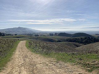
<span class="mw-page-title-main">Vargas Plateau Regional Park</span>

Vargas Plateau Regional Park sits on a plateau in the Fremont Hills of Alameda County, California that overlooks the San Francisco Bay, Niles Canyon, and the cities of Fremont, Union City, and Newark. The elevation of the park is about 1,000 feet (300 m), making it an important link with nearby ridge-top parks such as Garin Regional Park, Pleasanton Ridge Regional Park, Mission Peak Regional Preserve, and Sunol Regional Wilderness.
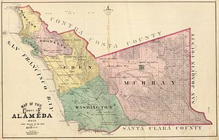
<span class="mw-page-title-main">Washington Township Museum of Local History (Fremont, California)</span> Historical museum located in Fremont, California

Washington Township Museum of Local History is a historical museum located in Fremont, California. The two historical organizations, the Mission Peak Heritage Foundation (MPHF) and Washington Township Historical Society (WTHS), formed the Museum of Local History Guild to focus on education, archival research and preservation of the historical resources of Washington Township. The Washington Township was created in 1853 from the southwestern part of Alameda County. For many decades, Washington Township consisted of agricultural fields dotted with eight towns, many now part of Fremont and some with local historians publishing their stories. The eight towns were the town of Newark, the two towns that became Union City, viz., Alvarado and Decoto, and the five towns that became Fremont, viz., Centerville, Niles, Mission San Jose, Irvington, and Warm Springs.

<span class="mw-page-title-main">Laguna Creek watershed</span> River in California, United States

The Laguna Creek watershed consists of 25.1 square miles (100 km2) of land within northern California's Alameda County. The watershed drains the foothills of the Diablo Range south of Niles Canyon. To the southeast, the area of Mission Peak Regional Preserve around Mission Peak is included. Agua Caliente, Canada del Aliso, Mission, Morrison, Sabercat, Vargas, and Washington creeks drain the area of the watershed. They drain into Laguna Creek and eventually Mud Slough.

Ardenwood is a park and ride bus station in Fremont, California. It is located off California State Route 84, adjacent to the Ardenwood Historic Farm. It is served by AC Transit and Dumbarton Express transbay buses.

Samuel Newsom was a Canadian-born American architect. Together with his brother Joseph Cather Newsom founded the architecture firm Newsom and Newsom, practicing in Northern and Southern California. Their most celebrated house is the Carson Mansion in Eureka, California.

References

  1. 1 2 3 4 Hession, Stephanie Wright (2010-06-10). "Ardenwood Historic Farm, Fremont". SFGATE. Retrieved 2021-01-08.
  2. 1 2 3 4 5 6 7 Mellon, Knox; Sugaya, Hisashi B. (1985). "National Register off Historic Places Inventory —Nomination Form, Patterson, George Washington Ranch (Ardenwood)". United States Department off the Interior, National Park Service. Archived from the original on 2021-01-11.
  3. 1 2 3 "NPGallery Asset Detail, Patterson, George Washington, Ranch--Ardenwood". National Park Service, U.S. Department of the Interior. Retrieved 2021-01-09.
  4. "Fremont attic's $50,000 'mystery' painting". The Mercury News. 2014-07-22. Retrieved 2021-01-09.
  5. "Fremont's Historic Patterson House Hits Jackpot with $50,000 Appraisal at Antiques Roadshow". Fremont, CA Patch. 2014-06-23. Retrieved 2021-01-09.
  6. "Ardenwood's Horses" (PDF). Archived from the original (PDF) on 2015-04-21. Retrieved 2014-01-29.
  7. Phase I Environmental Site Assessment, APN 537-521-1-11, Fremont, California, Earth Metrics Inc. report 10302, Nov. 15, 1989
  8. Aerial Photo GS-VACY 1-99, July 12, 1960, United States Geological Survey Photo Library, Washington DC,
  9. "Park It: Fremont's Patterson House to kick off holiday festivities". East Bay Times. 2019-12-02. Retrieved 2021-01-09.
  10. Ardenwood Celtic Festival Archived May 21, 2006, at the Wayback Machine
  11. Ardenwood Renaissance Faire Archived September 18, 2009, at the Wayback Machine
  12. Flaherty, Mary (2014-08-28). "Rail Fair gets rolling at the Ardenwood Historic Farm in Fremont". SFGATE. Retrieved 2021-01-09.