National Register of Historic Places listings in Plumas County, California

Last updated
Location of Plumas County in California Map of California highlighting Plumas County.svg
Location of Plumas County in California

This is a list of the National Register of Historic Places listings in Plumas County, California.

Contents

This is intended to be a complete list of the properties and districts on the National Register of Historic Places in Plumas County, California, United States. Latitude and longitude coordinates are provided for many National Register properties and districts; these locations may be seen together in an online map. [1]

National Register of Historic Places federal list of historic sites in the United States

The National Register of Historic Places (NRHP) is the United States federal government's official list of districts, sites, buildings, structures, and objects deemed worthy of preservation for their historical significance. A property listed in the National Register, or located within a National Register Historic District, may qualify for tax incentives derived from the total value of expenses incurred preserving the property.

Plumas County, California County in California, United States

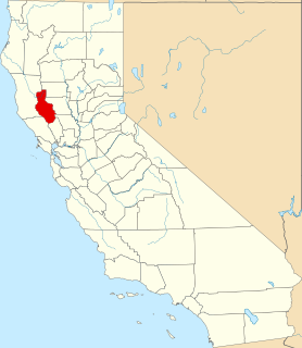
Plumas County is a county in the Sierra Nevada of California, United States. As of the 2010 census, the population was 20,007. The county seat is Quincy, and the only incorporated city is Portola. The largest community in the county is East Quincy. The county was named for the Spanish Río de las Plumas, which flows through the county.

California State of the United States of America

California is a state in the Pacific Region of the United States. With 39.6 million residents, California is the most populous U.S. state and the third-largest by area. The state capital is Sacramento. The Greater Los Angeles Area and the San Francisco Bay Area are the nation's second- and fifth-most populous urban regions, with 18.7 million and 9.7 million residents respectively. Los Angeles is California's most populous city, and the country's second-most populous, after New York City. California also has the nation's most populous county, Los Angeles County, and its largest county by area, San Bernardino County. The City and County of San Francisco is both the country's second-most densely populated major city after New York City and the fifth-most densely populated county, behind only four of the five New York City boroughs.

There are 6 properties and districts listed on the National Register in the county.

This National Park Service list is complete through NPS recent listings posted May 3, 2019. [2]
Map all coordinates using: OpenStreetMap  
Download coordinates as: KML  ·  GPX

Current listings

[3] Name on the Register [4] ImageDate listed [5] Location City or townDescription
1 Ch'ichu'yam-bam September 25, 2003
(#03000963)
Address Restricted
Crescent Mills
2 Drakesbad Guest Ranch
Drakesbad Guest Ranch Drakesbad Lodge NPS.jpg
Drakesbad Guest Ranch
October 22, 2003
(#03001062)
Head of Warner Creek Valley, Lassen Volcanic National Park
40°26′23″N121°24′52″W / 40.439722°N 121.414444°W / 40.439722; -121.414444 (Drakesbad Guest Ranch)
Chester
3 Lakes Basin Petroglyphs May 6, 1971
(#71000172)
Address Restricted
Gold Lake
4 Mount Harkness Fire Lookout June 19, 2017
(#100001211)
Lassen Volcanic National Park
40°25′52″N121°18′06″W / 40.431182°N 121.301583°W / 40.431182; -121.301583 (Mount Harkness Fire Lookout)
Mineral
5 Plumas-Eureka Mill, Jamison Mines District
Plumas-Eureka Mill, Jamison Mines District Plumas-Eureka Mill.jpg
Plumas-Eureka Mill, Jamison Mines District
July 16, 1973
(#73000421)
W of Blairsden off Alt. U.S. 40 in Plumas-Eureka State Park
39°44′56″N120°43′09″W / 39.748889°N 120.719167°W / 39.748889; -120.719167 (Plumas-Eureka Mill, Jamison Mines District)
Blairsden
6 Warner Valley Ranger Station
Warner Valley Ranger Station Lassen Volcanic National Park, Warner Valley Ranger Residence, Mineral vicinity, Tehama, (Plumas County, California).jpg
Warner Valley Ranger Station
April 3, 1978
(#78000364)
North of Chester in Lassen Volcanic National Park
40°26′28″N121°22′57″W / 40.441111°N 121.3825°W / 40.441111; -121.3825 (Warner Valley Ranger Station)
Chester

See also

National Register of Historic Places listings in California Wikimedia list article

Buildings, sites, districts, and objects in California listed on the National Register of Historic Places:

Related Research Articles

National Register of Historic Places listings in San Diego County, California Wikimedia list article

This is a list of the National Register of Historic Places listings in San Diego County, California.

National Register of Historic Places listings in Contra Costa County, California Wikimedia list article

This is a list of the National Register of Historic Places listings in Contra Costa County, California.

National Register of Historic Places listings in Mariposa County, California Wikimedia list article

This is a list of the National Register of Historic Places listings in Mariposa County, California.

National Register of Historic Places listings in Santa Barbara County, California Wikimedia list article

This is a list of the National Register of Historic Places listings in Santa Barbara County, California.

National Register of Historic Places listings in Tulare County, California Wikimedia list article

This is a list of the National Register of Historic Places listings in Tulare County, California.

National Register of Historic Places listings in Nevada County, California Wikimedia list article

This is a list of the National Register of Historic Places listings in Nevada County, California.

National Register of Historic Places listings in Shasta County, California Wikimedia list article

This is a list of the National Register of Historic Places listings in Shasta County, California.

National Register of Historic Places listings in Solano County, California Wikimedia list article

This is a list of the National Register of Historic Places listings in Solano County, California.

National Register of Historic Places listings in Colusa County, California Wikimedia list article

This is a list of the National Register of Historic Places listings in Colusa County, California.

National Register of Historic Places listings in Kern County, California Wikimedia list article

This is a list of the National Register of Historic Places listings in Kern County, California.

National Register of Historic Places listings in Mono County, California Wikimedia list article

This is a list of the National Register of Historic Places listings in Mono County, California.

National Register of Historic Places listings in Stanislaus County, California Wikimedia list article

This is a list of the National Register of Historic Places listings in Stanislaus County, California.

National Register of Historic Places listings in Siskiyou County, California Wikimedia list article

This is a list of the National Register of Historic Places listings in Siskiyou County, California.

National Register of Historic Places listings in Merced County, California Wikimedia list article

This is a list of the National Register of Historic Places listings in Merced County, California.

National Register of Historic Places listings in Del Norte County, California Wikimedia list article

This is a list of the National Register of Historic Places listings in Del Norte County, California.

National Register of Historic Places listings in Imperial County, California Wikimedia list article

This is a list of the National Register of Historic Places listings in Imperial County, California.

National Register of Historic Places listings in San Benito County, California Wikimedia list article

This is a list of the National Register of Historic Places listings in San Benito County, California.

National Register of Historic Places listings in Yuba County, California Wikimedia list article

This is a list of the National Register of Historic Places listings in Yuba County, California.

National Register of Historic Places listings in Tehama County, California Wikimedia list article

This is a list of the National Register of Historic Places listings in Tehama County, California.

National Register of Historic Places listings in Lake County, California Wikimedia list article

This is a list of the National Register of Historic Places listings in Lake County, California.

References

  1. The latitude and longitude information provided in this table was derived originally from the National Register Information System, which has been found to be fairly accurate for about 99% of listings. For about 1% of NRIS original coordinates, experience has shown that one or both coordinates are typos or otherwise extremely far off; some corrections may have been made. A more subtle problem causes many locations to be off by up to 150 yards, depending on location in the country: most NRIS coordinates were derived from tracing out latitude and longitudes from USGS topographical quadrant maps created under the North American Datum of 1927 , which differs from the current, highly accurate WGS84 GPS system used by most on-line maps. Chicago is about right, but NRIS longitudes in Washington are higher by about 4.5 seconds, and are lower by about 2.0 seconds in Maine. Latitudes differ by about 1.0 second in Florida. Some locations in this table may have been corrected to current GPS standards.
  2. "National Register of Historic Places: Weekly List Actions". National Park Service, United States Department of the Interior. Retrieved on May 3, 2019.
  3. Numbers represent an ordering by significant words. Various colorings, defined here, differentiate National Historic Landmarks and historic districts from other NRHP buildings, structures, sites or objects.
  4. National Park Service (2010-07-09). "National Register Information System". National Register of Historic Places . National Park Service.
  5. The eight-digit number below each date is the number assigned to each location in the National Register Information System database, which can be viewed by clicking the number.