Bells Bar, California

Last updated
Bells Bar
Former settlement
USA California location map.svg
Red pog.svg
Bells Bar
Location in California
Coordinates: 39°51′57″N120°45′07″W / 39.86583°N 120.75194°W / 39.86583; -120.75194 Coordinates: 39°51′57″N120°45′07″W / 39.86583°N 120.75194°W / 39.86583; -120.75194
Country Flag of the United States.svg  United States
State Flag of California.svg  California
County Plumas County
Elevation [1] 4,068 ft (1,240 m)

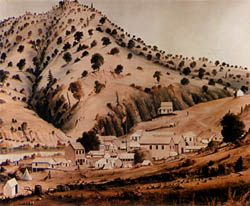
Bells Bar (also, Bell Bar) [2] is a former settlement in Plumas County, California. [1] It lay at an elevation of 4068 feet (1240 m). [1] Bells Bar is located on the Middle Fork of the Feather River, 11.5 miles (18.5 km) east-southeast of Quincy. [2]

Plumas County, California County in California, United States

Plumas County is a county in the Sierra Nevada of California, United States. As of the 2010 census, the population was 20,007. The county seat is Quincy, and the only incorporated city is Portola. The largest community in the county is East Quincy. The county was named for the Spanish Río de las Plumas, which flows through the county.

California State of the United States of America

California is a state in the Pacific Region of the United States. With 39.6 million residents, California is the most populous U.S. state and the third-largest by area. The state capital is Sacramento. The Greater Los Angeles Area and the San Francisco Bay Area are the nation's second and fifth most populous urban regions, with 18.7 million and 8.8 million residents respectively. Los Angeles is California's most populous city, and the country's second most populous, after New York City. California also has the nation's most populous county, Los Angeles County, and its largest county by area, San Bernardino County. The City and County of San Francisco is both the country's second-most densely populated major city after New York City and the fifth-most densely populated county, behind only four of the five New York City boroughs.

Feather River river in the United States of America

The Feather River is the principal tributary of the Sacramento River, in the Sacramento Valley of Northern California. The river's main stem is about 73 miles (117 km) long. Its length to its most distant headwater tributary is just over 210 miles (340 km). The main stem Feather River begins in Lake Oroville, where its four long tributary forks join together—the South Fork, Middle Fork, North Fork, and West Branch Feather Rivers. These and other tributaries drain part of the northern Sierra Nevada, and the extreme southern Cascades, as well as a small portion of the Sacramento Valley. The total drainage basin is about 6,200 square miles (16,000 km2), with approximately 3,604 square miles (9,330 km2) above Lake Oroville.

Related Research Articles

Bidwells Bar, California Former settlement in California, United States

Bidwell's Bar was a gold mining camp in Butte County, California, United States, which lay at the end of the California Trail. It was located 6.5 miles (10.5 km) east-northeast of Oroville, at an elevation of 902 feet.

Camanche, California Former settlement in California, United States

Camanche is a former settlement in Calaveras County, California. It lay at an elevation of 220 feet. Once called Limerick, the town became Camanche in 1849. Gold mining at nearby Cat Camp, Poverty Bar, and Sand Hill brought its population to a peak of 1,500. Mokelumne River water was brought in by Lancha Plana and Poverty Bar Ditch. A fire on June 21, 1873, destroyed Camanche's large Chinatown. Buhach, an insect powder made from a plant, was manufactured on the nearby Hill Ranch. Camanche is now inundated by Camanche Reservoir.

Bell Station, California human settlement in United States of America

Bell Station is an unincorporated community located along State Route 152 between Casa de Fruta and Pacheco Pass near the southeast extent of Santa Clara County, California.

Enterprise, Butte County, California Former settlement in California, United States

Enterprise is a former settlement in Butte County, California. It was located 5 miles (8.0 km) west-northwest of Forbestown on the South Fork of the Feather River, at an elevation of 902 feet. In 1968, it was inundated by Lake Oroville.

Bullards Bar, California Former settlement in California, United States

Bullards Bar is a former gold mining settlement in Yuba County, California.

Condemned Bar, California Former settlement in California, United States

Condemned Bar is a former settlement, in Yuba County, California.

Foster Bar, California Former settlement in California, United States

Foster Bar is a former settlement in Yuba County, California. It was located on the North Yuba River 5.5 miles (8.9 km) southeast of Challenge, at an elevation of 1909 feet. It was inundated by the Bullards Bar Reservoir.

Garden Valley, Yuba County, California Former settlement in California, United States

Garden Valley is a former settlement in Yuba County, California. It was located 3.25 miles (5.2 km) west-southwest of Camptonville, at an elevation of 1909 feet. It was inundated by Bullards Bar Reservoir.

Big Bar, Butte County, California Unincorporated community in California, United States

Big Bar is an unincorporated community in Butte County, California, on the North Fork of the Feather River, 0.5 mi (0.8 km) east of Pulga. It lies at an elevation of 1414 feet.

Bloomer, California Former settlement in California, United States

Bloomer is a former settlement in Butte County, California, United States. It was located 5.5 miles (8.9 km) north-northwest from Bidwell's Bar on the Western Pacific Railroad, at an elevation of 902 feet, and was inundated by Lake Oroville.

Land, California Former settlement in California, United States

Land is a former settlement in Butte County, California, United States. It was located 1.5 miles (2.4 km) west-southwest of Bidwell's Bar on the Western Pacific Railroad, at an elevation of 902 feet. Land is now covered by Lake Oroville. The place was named for A.H. Land, a lumber company president.

Nelson Bar, California Former settlement in California, United States

Nelson Bar is a former settlement in Butte County, California. It was located 5.25 miles (8.45 km) southeast of Paradise on the West Branch of the Feather River, at an elevation of 974 feet. It is now under Lake Oroville.

Big Bar, Calaveras County, California Unincorporated community in California, United States

Big Bar is an unincorporated community in Calaveras County, California. It lies at an elevation of 630 feet.

Meadow Brook, California Unincorporated community in California, United States

Meadow Brook is an unincorporated community in El Dorado County, California. It is located 6.5 miles (10 km) north of Chili Bar, at an elevation of 2277 feet.

Nashville, California Unincorporated community in California, United States

Nashville is an unincorporated community in El Dorado County, California. It is located on the North Fork of the Cosumnes River 10.5 miles (17 km) south of Placerville, at an elevation of 863 feet.

Chili Bar is a former settlement and mining camp in El Dorado County, California. It was located on the South Fork of the American River 4.5 miles (7.2 km) east-southeast of Coloma.

Texas Bar is a former settlement in El Dorado County, California. It was located on the South Fork of the American River 0.5 miles (0.80 km) upstream of Chili Bar.

Bell Springs, California Unincorporated community in California, United States

Bell Springs was a town and stage coach stop on Bell Springs Road in Mendocino County, California. It was located 9 miles (14 km) northeast of Leggett, at an elevation of 3622 feet . A post office operated at Bell Springs from 1920 to 1961. The place was named in 1861 by Jim Graham for the cowbells he found at the site. What was once Bell Springs is now the location of the Bell Springs Ranch. Bell Springs Road, 28 miles of steep narrow unpaved mountain road, was originally called Mail Ridge, and was the only through road connecting Mendocino County and Humboldt County before Highway 101 was built.

Jones Bar, California Former settlement in California, United States

Jones Bar is a former settlement in Nevada County, California. It is located at an elevation of 1073 feet. Jones Bar is located on the South Yuba River, 5.25 miles (8.4 km) west-northwest of Nevada City.

Bonnie Bell, California Unincorporated community in California, United States

Bonnie Bell is an unincorporated community in Riverside County, California. It lies at an elevation of 1683 feet. Bonnie Bell is located on the Whitewater River, 9.5 miles (15.3 km) northwest of Palm Springs.

References

  1. 1 2 3 U.S. Geological Survey Geographic Names Information System: Bells Bar, California
  2. 1 2 Durham, David L. (1998). California's Geographic Names: A Gazetteer of Historic and Modern Names of the State. Clovis, Calif.: Word Dancer Press. p. 355. ISBN   1-884995-14-4.