Quincy, California

Last updated

Quincy
Quincy, California from Q on mountain..JPG
Motto: 
"Heart of the Feather River Country" [1]
Plumas County California Incorporated and Unincorporated areas Quincy Highlighted 0659080.svg
Location in Plumas County and the state of California
Usa edcp location map.svg
Red pog.svg
Quincy
Location in the United States
Coordinates: 39°56′11″N120°56′53″W / 39.93639°N 120.94806°W / 39.93639; -120.94806
Country Flag of the United States.svg  United States
State Flag of California.svg  California
County Plumas
Area
[2]
  Total4.224 sq mi (10.94 km2)
  Land4.224 sq mi (10.94 km2)
  Water0 sq mi (0 km2)  0%
Elevation
[3]
3,432 ft (1,046 m)
Population
 (2020) [4]
  Total1,630
  Density390/sq mi (150/km2)
Time zone UTC-8 (Pacific (PST))
  Summer (DST) UTC-7 (PDT)
ZIP code
95971
Area code 530 Exchange: 283
FIPS code 06-59080
GNIS feature ID 265113
Website Quincy California Chamber of Commerce

Quincy (formerly Quinsy) [5] is a census-designated place and the county seat of Plumas County, California. [6] The population was 1,630 during the 2020 Census, [7] down from 1,728 during the 2010 Census, and 1,879 during the 2000 Census. [8]

Contents

History

Quincy is on the current and ancestral lands of the Maidu people. Quincy started as a Gold Rush town, associated with the former Elizabethtown, California. Started in 1852, Elizabethtown slowly faded.

Development moved a mile away into the American Valley after settler James H. Bradley, who helped organize Plumas County, donated land there for the county seat. He laid out the town and named it after his farm in Illinois [5] that had been named for John Quincy Adams (1767–1848), the sixth president of the United States (1825–1829). [9]

The Quincy post office opened in 1855, [5] and the town was formally recognized in 1858.

Geography and climate

Quincy is located at 39°56′11″N120°56′53″W / 39.93639°N 120.94806°W / 39.93639; -120.94806 (39.936279, −120.947921). [10]

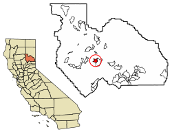
According to the United States Census Bureau, the CDP has a total area of 4.2 square miles (11 km2), all of it is land.

Quincy is underlain by metasedimentary rock of the Shoo Fly Complex. [11] Its dominant silica-rich clastic material weathers to a stony coarse soil which includes the well or somewhat excessively drained alluvial fan material (mainly Forgay very gravelly sandy loam) on which most of Quincy's businesses and homes have been built. Cultivated land north of the residential area lies on poorly drained loam, silt loam or fine sandy loam. [12]

Quincy has a Mediterranean climate (Köppen Csb) though its inland location and altitude makes it more continental and wetter than usual for this type, with very heavy snowfalls sometimes occurring in winter – the record being 133 inches (337.8 cm) in the very wet January 1916. [13] [14] Although summer days are hot and only 1.4 days per winter fail to top 32 °F (0 °C), nights can be very cold and frosts occur on 179 days per year and have been recorded even in July.

Climate data for Quincy, California, 1991–2020 normals, extremes 1895–present
MonthJanFebMarAprMayJunJulAugSepOctNovDecYear
Record high °F (°C)74
(23)
80
(27)
85
(29)
89
(32)
100
(38)
105
(41)
111
(44)
111
(44)
110
(43)
98
(37)
86
(30)
76
(24)
111
(44)
Mean maximum °F (°C)57.6
(14.2)
64.4
(18.0)
73.4
(23.0)
81.1
(27.3)
89.2
(31.8)
96.0
(35.6)
100.7
(38.2)
100.2
(37.9)
95.3
(35.2)
85.4
(29.7)
68.3
(20.2)
56.3
(13.5)
102.6
(39.2)
Average high °F (°C)43.9
(6.6)
49.9
(9.9)
56.3
(13.5)
62.3
(16.8)
70.7
(21.5)
80.2
(26.8)
89.0
(31.7)
88.1
(31.2)
82.4
(28.0)
69.1
(20.6)
52.3
(11.3)
43.0
(6.1)
65.6
(18.7)
Daily mean °F (°C)34.5
(1.4)
38.0
(3.3)
42.6
(5.9)
47.1
(8.4)
54.7
(12.6)
61.8
(16.6)
68.3
(20.2)
66.6
(19.2)
61.1
(16.2)
50.9
(10.5)
40.3
(4.6)
34.2
(1.2)
50.0
(10.0)
Average low °F (°C)25.2
(−3.8)
26.1
(−3.3)
28.9
(−1.7)
32.0
(0.0)
38.6
(3.7)
43.3
(6.3)
47.7
(8.7)
45.1
(7.3)
39.8
(4.3)
32.6
(0.3)
28.4
(−2.0)
25.4
(−3.7)
34.4
(1.3)
Mean minimum °F (°C)14.7
(−9.6)
17.0
(−8.3)
20.7
(−6.3)
24.1
(−4.4)
29.7
(−1.3)
34.7
(1.5)
40.4
(4.7)
37.9
(3.3)
32.0
(0.0)
24.0
(−4.4)
17.7
(−7.9)
13.7
(−10.2)
9.8
(−12.3)
Record low °F (°C)−24
(−31)
−16
(−27)
0
(−18)
12
(−11)
20
(−7)
25
(−4)
23
(−5)
20
(−7)
15
(−9)
10
(−12)
−3
(−19)
−24
(−31)
−24
(−31)
Average precipitation inches (mm)7.65
(194)
7.59
(193)
6.66
(169)
3.14
(80)
1.94
(49)
0.71
(18)
0.10
(2.5)
0.14
(3.6)
0.42
(11)
1.94
(49)
4.06
(103)
7.32
(186)
41.67
(1,058.1)
Average snowfall inches (cm)5.8
(15)
7.6
(19)
5.4
(14)
1.6
(4.1)
0.0
(0.0)
0.0
(0.0)
0.0
(0.0)
0.0
(0.0)
0.0
(0.0)
0.1
(0.25)
1.7
(4.3)
6.2
(16)
28.4
(72.65)
Average precipitation days (≥ 0.01 inch)12.011.112.09.16.73.10.60.91.65.18.312.282.7
Average snowy days (≥ 0.1 in)2.62.41.90.80.00.00.00.00.00.10.72.410.9
Source 1: NOAA [15]
Source 2: National Weather Service [16]

Demographics

2010

At the 2010 census Quincy had a population of 1,728. The population density was 407.6 inhabitants per square mile (157.4/km2). The racial makeup of Quincy was 1,500 (86.8%) White, 132 people (7.6%) Hispanic or Latino of any race, 37 (2.1%) Black, 29 (1.7%) Native American, 19 (1.1%) Asian, 2 (0.1%) Pacific Islander, 66 (3.8%) from other races, and 75 (4.3%) from two or more races. [17]

The census reported that 1,673 people (96.8% of the population) lived in households, no one lived in non-institutionalized group quarters and 55 (3.2%) were institutionalized.

There were 798 households, 183 (22.9%) had children under the age of 18 living in them, 300 (37.6%) were opposite-sex married couples living together, 85 (10.7%) had a female householder with no husband present, 28 (3.5%) had a male householder with no wife present. There were 63 (7.9%) unmarried opposite-sex partnerships, and 5 (0.6%) same-sex married couples or partnerships. 314 households (39.3%) were one person and 93 (11.7%) had someone living alone who was 65 or older. The average household size was 2.10. There were 413 families (51.8% of households); the average family size was 2.77.

The age distribution was 341 people (19.7%) under the age of 18, 163 people (9.4%) aged 18 to 24, 350 people (20.3%) aged 25 to 44, 556 people (32.2%) aged 45 to 64, and 318 people (18.4%) who were 65 or older. The median age was 45.5 years. For every 100 females, there were 84.2 males. For every 100 females age 18 and over, there were 81.1 males.

There were 872 housing units at an average density of 205.7 per square mile, of the occupied units 388 (48.6%) were owner-occupied and 410 (51.4%) were rented. The homeowner vacancy rate was 2.7%; the rental vacancy rate was 5.5%. 872 people (50.5% of the population) lived in owner-occupied housing units and 801 people (46.4%) lived in rental housing units.

2000

Main street in Quincy (May 2022) Main street in Quincy, Plumas County-5242.jpg
Main street in Quincy (May 2022)

At the 2000 census there were 1,879 people, 858 households, and 479 families in the CDP. The population density was 443.4 inhabitants per square mile (171.2/km2). There were 899 housing units at an average density of 212.2 per square mile (81.9/km2). The racial makeup of the CDP was 90.9% White, 4.8% were Hispanic or Latino of any race, 1.5% African American, 2.2% Native American, 0.8% Asian, 0.1% Pacific Islander, 1.5% from other races, and 3.0% from two or more races. [18]

Of the 858 households 27.3% had children under the age of 18 living with them, 40.2% were married couples living together, 12.7% had a female householder with no husband present, and 44.1% were non-families. 38.7% of households were one person and 13.8% were one person aged 65 or older. The average household size was 2.13 and the average family size was 2.79.

The age distribution was 23.9% under the age of 18, 8.6% from 18 to 24, 24.3% from 25 to 44, 25.8% from 45 to 64, and 17.4% 65 or older. The median age was 41 years. For every 100 females, there were 89.2 males. For every 100 females age 18 and over, there were 87.2 males.

The median household income was $30,508 and the median family income was $40,536. Males had a median income of $38,438 versus $27,411 for females. The per capita income for the CDP was $19,944. About 5.1% of families and 11.1% of the population were below the poverty line, including 11.3% of those under age 18 and 2.8% of those age 65 or over.

Education

The 1905 historic schoolhouse in downtown Quincy Historic Quincy Schoolhouse-5261.jpg
The 1905 historic schoolhouse in downtown Quincy

Quincy's students attend the Quincy Elementary School and Quincy Junior-Senior High School. The schools come under the authority of the Plumas County Board of Education and the Plumas Unified School District. The 'Trojans' are the mascot for the Quincy Junior-Senior High School. [19] Quincy is also home to Feather River College, a public community college. [20]

Government

In the California State Legislature, Quincy is in the 1st Senate District , represented by Republican Brian Dahle, and in the 1st Assembly District , represented by Republican Megan Dahle. [21] Federally, Quincy is in California's 1st congressional district , represented by Republican Doug LaMalfa. [22]

Notable people

Historical Landmarks

See also

Related Research Articles

Rheems is an unincorporated community and census-designated place (CDP) in Lancaster County, Pennsylvania, United States, between the boroughs of Elizabethtown and Mount Joy. The population was 1,598 during the 2010 census.

<span class="mw-page-title-main">Beckwourth, California</span> Census-designated place in California, United States

Beckwourth is a census-designated place (CDP) in Plumas County, California, United States. Beckwourth is located on the Middle Fork Feather River 5 miles (8.0 km) east of Portola. The population was 432 at the 2010 census, up from 342 at the 2000 census.

<span class="mw-page-title-main">Blairsden, California</span> Census-designated place in California, United States

Blairsden is a census-designated place (CDP) in Plumas County, California, United States. Blairsden is located 20 miles (32.2 km) east-southeast of Quincy. It is located on the Feather River Route. The population was 39 at the 2010 census, down from 50 at the 2000 census.

<span class="mw-page-title-main">Bucks Lake, California</span> Census-designated place in California, United States

Bucks Lake is a census-designated place (CDP) in Plumas County, California, United States. Bucks Lake is located on the south shore of the lake of the same name, 13 miles (20.9 km) west-southwest of Quincy. The population was 22 at the 2020 census, up from 10 at the 2010 census.

<span class="mw-page-title-main">Canyondam, California</span> Census-designated place in California, United States

Canyondam is a census-designated place (CDP) in Plumas County, California, United States. Canyondam is located near the dam that forms Lake Almanor, 6.25 miles (10.1 km) east-southeast of Almanor. The population was 31 as of the 2010 census, down from 37 as of the 2000 census. On August 6, 2021, the community was destroyed in the Dixie Fire.

<span class="mw-page-title-main">Chester, California</span> Census-designated place in California, United States

Chester is a census-designated place (CDP) in Plumas County, California, United States. Chester is located on Lake Almanor, 30 miles (48.3 km) north-northwest of Quincy. The town is located along State Route 36. The US Postal Service ZIP code for the community is 96020. The population was 2,144 at the 2010 census, down from 2,316 at the 2000 census.

<span class="mw-page-title-main">Clio, California</span> Census-designated place in California, United States

Clio is a census-designated place in Plumas County, California, United States. Clio is located 23 miles (37.0 km) southeast of Quincy. The population was 66 at the 2010 census, down from 90 at the 2000 census.

<span class="mw-page-title-main">East Quincy, California</span> Census-designated place in California, United States

East Quincy is a census-designated place (CDP) in Plumas County, California, United States. The population was 2,489 at the 2010 census, up from 2,398 at the 2000 census.

<span class="mw-page-title-main">Graeagle, California</span> Census-designated place in California, United States

Graeagle is a town and census-designated place in eastern Plumas County, California, United States, located along the Middle Fork Feather River in the Northern Sierra Nevada. The population was 737 as of 2010.

<span class="mw-page-title-main">Greenhorn, California</span> Census-designated place in California, United States

Greenhorn is a census-designated place (CDP) in Plumas County, California, United States. The population was 236 at the 2010 census, up from 146 at the 2000 census.

<span class="mw-page-title-main">Greenville, California</span> Place in California, United States

Greenville is a unincorporated community in Plumas County, California, United States, on the north-west side of Indian Valley. Most of the buildings were destroyed by the Dixie Fire in August 2021. The population was 1,129 at the 2010 census, down from 1,160 at the 2000 census. For statistical purposes, the United States Census Bureau has defined Greenville as a census-designated place (CDP). According to the Census Bureau, the CDP has a total area of 8.0 square miles (21 km2), all of it land.

<span class="mw-page-title-main">Keddie, California</span> Census-designated place in California, United States

Keddie is a census-designated place in Plumas County, California, United States. The population was 66 at the 2010 census.

<span class="mw-page-title-main">La Porte, California</span> Census-designated place in California, United States

La Porte is a census-designated place (CDP) in Plumas County, California, United States. The population was 26 at the 2010 census, down from 43 at the 2000 census. The twon was frist known as Rabbit Creek.

<span class="mw-page-title-main">Lake Almanor West, California</span> Census-designated place in California, United States

Lake Almanor West is a census-designated place (CDP) in Plumas County, California, United States. The population was 270 at the 2010 census, down from 329 at the 2000 census.

<span class="mw-page-title-main">Lake Davis, California</span> Census-designated place in California, United States

Lake Davis is a census-designated place (CDP) in Plumas County, California, United States, located on Lake Davis. The population was 45 at the 2010 census.

<span class="mw-page-title-main">Mohawk Vista, California</span> Census-designated place in California, United States

Mohawk Vista is a census-designated place in Plumas County, California, United States. The population was 159 at the 2010 census, up from 121 at the 2000 census.

<span class="mw-page-title-main">Paxton, California</span> Census-designated place in California, United States

Paxton is a census-designated place (CDP) in Plumas County, California, United States. The population was 14 at the 2010 census, down from 21 at the 2000 census.

<span class="mw-page-title-main">Plumas Eureka, California</span> Census-designated place in California, United States

Plumas Eureka is a census-designated place (CDP) in Plumas County, California, United States. The population was 320 at the 2000 census.

<span class="mw-page-title-main">Tobin, California</span> Census-designated place in California, United States

Tobin is a census-designated place (CDP) in Plumas County, California, United States. The population was 12 at the 2010 census, up from 11 at the 2000 census.

<span class="mw-page-title-main">Valley Ranch, California</span> Census-designated place in California, United States

Valley Ranch is a census-designated place in Plumas County, California, United States. The population was 109 at the 2010 census, up from 92 at the 2000 census.

References

  1. "Quincy California Chamber of Commerce". Quincy California Chamber of Commerce. Retrieved September 12, 2012.
  2. "2020 U.S. Gazetteer Files". United States Census Bureau. Retrieved August 30, 2023.
  3. "Quincy". Geographic Names Information System . United States Geological Survey, United States Department of the Interior . Retrieved December 30, 2014.
  4. "Quincy CDP, California". United States Census Bureau . Retrieved August 30, 2023.
  5. 1 2 3 Durham, David L. (1998). California's Geographic Names: A Gazetteer of Historic and Modern Names of the State. Clovis, Calif.: Word Dancer Press. p. 410. ISBN   1-884995-14-4.
  6. "Profile for Quincy, California, CA". Podunk. Archived from the original on June 25, 2017. Retrieved September 12, 2012.
  7. "Explore Census Data". data.census.gov. Retrieved May 5, 2022.
  8. Bureau, U.S. Census. "U.S. Census website". United States Census Bureau . Retrieved June 3, 2018.
  9. "Quincy, California Epodunk Database". 2006. Archived from the original on June 25, 2017. Retrieved July 11, 2007.
  10. "US Gazetteer files: 2010, 2000, and 1990". United States Census Bureau. February 12, 2011. Retrieved April 23, 2011.
  11. Saucedo, G.J., and Wagner, D.L., 1992, Geologic map of the Chico quadrangle: California Division of Mines and Geology, Regional Geologic Map 7A
  12. "SoilWeb: An Online Soil Survey Browser - California Soil Resource Lab". casoilresource.lawr.ucdavis.edu. Retrieved June 3, 2018.
  13. "QUINCY, CALIFORNIA - Climate Summary". www.wrcc.dri.edu. Retrieved June 3, 2018.
  14. Enloe. "Climatological Rankings - Temperature, Precipitation, and Drought - National Centers for Environmental Information (NCEI)". www.ncdc.noaa.gov. Retrieved June 3, 2018.
  15. "U.S. Climate Normals Quick Access – Station: Quincy, CA". National Oceanic and Atmospheric Administration. Retrieved May 23, 2023.
  16. "NOAA Online Weather Data – NWS Sacramento". National Weather Service. Retrieved May 23, 2023.
  17. "2010 Census Interactive Population Search: CA – Quincy CDP". U.S. Census Bureau. Archived from the original on July 15, 2014. Retrieved July 12, 2014.
  18. "U.S. Census website". United States Census Bureau . Retrieved January 31, 2008.
  19. "Plumas County Office of Education" . Retrieved April 28, 2017.
  20. "Feather River College" . Retrieved June 27, 2023.
  21. "Statewide Database". UC Regents. Archived from the original on February 1, 2015. Retrieved December 3, 2014.
  22. "California's 1st Congressional District - Representatives & District Map". Civic Impulse, LLC. Retrieved March 3, 2013.
  23. Fariss and Smith's History of Plumas, Lassen & Sierra Counties, California, 1882. 1971. ISBN   9780831070830.
  24. "Jason Ellison". Baseball-Reference.Com. Retrieved September 14, 2012.
  25. PCN On-line News – Plumas County California Archived 2007-11-13 at the Wayback Machine

News from Quincy