Cascade | |
---|---|
Unincorporated community | |
Coordinates: 39°42′00″N121°10′42″W / 39.70000°N 121.17833°W Coordinates: 39°42′00″N121°10′42″W / 39.70000°N 121.17833°W | |
Country | |
State | |
County | Plumas County |
Elevation [1] | 4,055 ft (1,236 m) |
GNIS feature ID | 258029 |
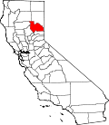
Cascade (formerly, Cascade City) is an unincorporated community in Plumas County, California. [1] It lies at an elevation of 4055 feet (1236 m). [1] Cascade is located 20 miles (32.2 km) southwest of Quincy. [2]
In law, an unincorporated area is a region of land that is not governed by a local municipal corporation; similarly an unincorporated community is a settlement that is not governed by its own local municipal corporation, but rather is administered as part of larger administrative divisions, such as a township, parish, borough, county, city, canton, state, province or country. Occasionally, municipalities dissolve or disincorporate, which may happen if they become fiscally insolvent, and services become the responsibility of a higher administration. Widespread unincorporated communities and areas are a distinguishing feature of the United States and Canada. In most other countries of the world, there are either no unincorporated areas at all, or these are very rare; typically remote, outlying, sparsely populated or uninhabited areas.
Plumas County is a county in the Sierra Nevada of California, United States. As of the 2010 census, the population was 20,007. The county seat is Quincy, and the only incorporated city is Portola. The largest community in the county is East Quincy. The county was named for the Spanish Río de las Plumas, which flows through the county.
California is a state in the Pacific Region of the United States. With 39.6 million residents, California is the most populous U.S. state and the third-largest by area. The state capital is Sacramento. The Greater Los Angeles Area and the San Francisco Bay Area are the nation's second and fifth most populous urban regions, with 18.7 million and 8.8 million residents respectively. Los Angeles is California's most populous city, and the country's second most populous, after New York City. California also has the nation's most populous county, Los Angeles County, and its largest county by area, San Bernardino County. The City and County of San Francisco is both the country's second-most densely populated major city after New York City and the fifth-most densely populated county, behind only four of the five New York City boroughs.
California is a U.S. state on the western coast of North America. Covering an area of 163,696 sq mi (423,970 km2), California is geographically diverse. The Sierra Nevada, the fertile farmlands of the Central Valley, and the arid Mojave Desert of the south are some of the major geographic features of this U.S. state. It is home to some of the world's most exceptional trees: the tallest, most massive, and oldest. It is also home to both the highest and lowest points in the 48 contiguous states. The state is generally divided into Northern and Southern California, although the boundary between the two is not well defined. San Francisco is decidedly a Northern California city and Los Angeles likewise a Southern California one, but areas in between do not often share their confidence in geographic identity. The US Geological Survey defines the geographic center of the state at a point near North Fork, California.
Bridalveil Fall is one of the most prominent waterfalls in the Yosemite Valley in California, Yosemite National Park. The waterfall is 188 metres (617 ft) in height and flows year round.
The Cascade Range or Cascades is a major mountain range of western North America, extending from southern British Columbia through Washington and Oregon to Northern California. It includes both non-volcanic mountains, such as the North Cascades, and the notable volcanoes known as the High Cascades. The small part of the range in British Columbia is referred to as the Canadian Cascades or, locally, as the Cascade Mountains. The latter term is also sometimes used by Washington residents to refer to the Washington section of the Cascades in addition to North Cascades, the more usual U.S. term, as in North Cascades National Park. The highest peak in the range is Mount Rainier in Washington at 14,411 feet (4,392 m).
Mount Shasta is a potentially active volcano at the southern end of the Cascade Range in Siskiyou County, California. At an elevation of 14,179 feet (4321.8 m), it is the second-highest peak in the Cascades and the fifth-highest in the state. Mount Shasta has an estimated volume of 85 cubic miles (350 km3), which makes it the most voluminous stratovolcano in the Cascade Volcanic Arc. The mountain and surrounding area are part of the Shasta–Trinity National Forest.
ThePacific Coast Ranges, are the series of mountain ranges that stretch along the West Coast of North America from Alaska south to Northern and Central Mexico.
Año Nuevo State Park is a state park of California, USA, encompassing Año Nuevo Island and Año Nuevo Point, which are known for their pinniped rookeries. Located in San Mateo County, the low, rocky, windswept point juts out into the Pacific Ocean about 55 miles (89 km) south of San Francisco and the Golden Gate. Año Nuevo State Natural Reserve, formerly a separate unit of the California state park system, was merged into Año Nuevo State Park in October 2008. The coastal geographic center, or coastal-midpoint of California is located at the Northern end of this park at N 37°09′58″, W 122°21'40", as the absolute geographic center of California falls at N 37°09′58″, W 119°26′58″W.
Mount Thielsen, or Big Cowhorn, is an extinct shield volcano in the Oregon High Cascades, near Mount Bailey. Because eruptive activity ceased 250,000 years ago, glaciers have heavily eroded the volcano's structure, creating precipitous slopes and a horn-like peak. The spire-like shape of Thielsen attracts lightning strikes and creates fulgurite, an unusual mineral. The prominent horn forms a centerpiece for the Mount Thielsen Wilderness, a reserve for recreational activities such as skiing and hiking.
Cascade Mountain is in Essex County of New York. It is one of the 46 Adirondack High Peaks (36th) and is located in the Adirondack Park. Its name comes from a series of waterfalls on a brook near the mountain's base. The lake it flows into and the pass between Cascade and Pitchoff mountains are also named Cascade.
Porter Mountain is one of the Adirondack High Peaks. It is number 38 in order of height, and one of the easier hikes of the Adirondack Forty-Sixers. It is named after Noah Porter, one of the first to climb it, later president of Yale University.
Cascade River State Park is a state park near the northeastern tip of Minnesota, USA, on the north shore of Lake Superior. The park is in a rocky and rugged location, and has many different types of wildlife.
The North American Cordillera is the North American portion of the American Cordillera which is a mountain chain (cordillera) along the western side of the Americas. The North American Cordillera covers an extensive area of mountain ranges, intermontane basins, and plateaus in western North America, including much of the territory west of the Great Plains. It is also sometimes called the Western Cordillera, the Western Cordillera of North America, or the Pacific Cordillera.
Kinaskan Lake Provincial Park is a provincial park in British Columbia, Canada, located at the south end of Kinaskan Lake along the Stewart-Cassiar Highway near Mowdade Lake and southeast of Mount Edziza. At the south end of the park, the Iskut River, of which the lake is an expansion, spills over 40-foot Cascade Falls. The park is approximately 800 ha. in size.
Stephen L. Harris is Professor Emeritus of Humanities and Religious Studies at California State University, Sacramento. He served there ten years as department chair and was named a Woodrow Wilson Fellow. He received his MA and PhD degrees from Cornell University. Harris is a member of the American Academy of Religion, a fellow at the Westar Institute, was a fellow of the controversial Jesus Seminar, and has authored several books on religion, some of which are used in introductory university courses.
The Table Rock Wilderness is a small pocket wilderness designated in 1984 in the western Cascade Mountains in northwestern Oregon, United States. The wilderness area protects 5,500 acres (2,200 ha) of forest in the historic Molalla River–Pudding River drainage basin, some 19 miles (31 km) southeast of Molalla, Oregon and 50 miles (80 km) southeast of Portland. Somewhat unusual for a wilderness in this area is that it is on BLM land rather the nearby Mount Hood National Forest.
The Cascade Volcanoes are a number of volcanoes in a volcanic arc in western North America, extending from southwestern British Columbia through Washington and Oregon to Northern California, a distance of well over 700 miles (1,100 km). The arc formed due to subduction along the Cascadia subduction zone. Although taking its name from the Cascade Range, this term is a geologic grouping rather than a geographic one, and the Cascade Volcanoes extend north into the Coast Mountains, past the Fraser River which is the northward limit of the Cascade Range proper.
Yamsay Mountain is a large shield volcano in the Cascade Range of south-central Oregon, located about 35 miles (56 km) east of Crater Lake on the border between Klamath County and Lake County. It is part of the Cascade Volcanic Arc but is located in a mountain range 30 to 50 miles behind the main Cascade volcanic front. The best known members of this enigmatic arc are the massive shields of Newberry Volcano, about 55 miles (89 km) farther north in Oregon, and Medicine Lake Volcano, about 80 miles (130 km) south in Northern California. Yamsay is the highest volcano in the eastern arc, almost 300 feet (90 m) higher than Newberry and Medicine Lake.
The Cascade Recreation Area was a Provincial Recreation Area in the Hozameen Range of the Cascade Mountains of British Columbia, Canada, located north of and was added to E.C. Manning Provincial Parkin 2010. It is roughly 11,858 ha. and was created on March 14, 1987. The recreation area has limited road access and is used by hikers, horse riders, mountain bikers and, in winter, snowmobilers. The nearest towns are Hope and Princeton.
The Coquihalla Range is an informally named mountain range in British Columbia that lies between the Coquihalla River and the Fraser Canyon. It is part of the Canadian Cascades, which are officially named the Cascade Mountains and are the northernmost part of the Cascade Range, which begins in northern California. Other subranges of the Canadian Cascades are the Skagit Range, Hozameen Range and Okanagan Range
The Pywiack Cascade is a waterfall in Yosemite National Park within the U.S. state of California. It is located a few miles downstream from the outlet of Tenaya Lake on Tenaya Creek at the head of the steep and rugged granite gorge, Tenaya Canyon. The waterfall can be viewed from Glacier Point, or by a 6-mile (9.7 km) hike from Olmsted Point, but the canyon is dangerous and the waterfall is unsafe to be reached on foot. The waterfall is highly seasonal. It typically rages in the spring and early summer while shrinking to a trickle by late summer to mid-autumn.
Cascade Diggings is a former settlement in Nevada County, California. Cascade Diggings is located 3.5 miles (5.6 km) northeast of Quaker Hill.
This Plumas County, California-related article is a stub. You can help Wikipedia by expanding it. |