Lake Almanor West, California

Last updated
Lake Almanor West
Plumas County California Incorporated and Unincorporated areas Lake Almanor West Highlighted.svg
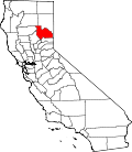
Location in Plumas County and the state of California
Usa edcp location map.svg
Red pog.svg
Lake Almanor West
Location in the United States
Coordinates: 40°14′7″N121°12′15″W / 40.23528°N 121.20417°W / 40.23528; -121.20417 Coordinates: 40°14′7″N121°12′15″W / 40.23528°N 121.20417°W / 40.23528; -121.20417
Country Flag of the United States.svg  United States
State Flag of California.svg  California
County Plumas
Area
[1]
  Total2.286 sq mi (5.920 km2)
  Land2.286 sq mi (5.920 km2)
  Water0 sq mi (0 km2)  0%
Population
 (2010)
  Total270
  Density120/sq mi (46/km2)
Time zone UTC-8 (Pacific (PST))
  Summer (DST) UTC-7 (PDT)
ZIP code
96020
Area code(s) 530
FIPS code 06-39425

Lake Almanor West is a census-designated place (CDP) in Plumas County, California, United States. The population was 270 at the 2010 census, down from 329 at the 2000 census.

Contents

Geography

Lake Almanor West is located at 40°14′7″N121°12′15″W / 40.23528°N 121.20417°W / 40.23528; -121.20417 (40.235246, -121.204180), [2] along the southwest shore of Lake Almanor. It is locally referred to as "West Shore."

According to the United States Census Bureau, the CDP has a total area of 2.3 square miles (6.0 km2), all of it land.

Demographics

Historical population
CensusPop.
U.S. Decennial Census [3]

2010

The 2010 United States Census [4] reported that Lake Almanor West had a population of 270. The population density was 118.1 inhabitants per square mile (45.6/km2). The racial makeup of Lake Almanor West was 259 (95.9%) White, 1 (0.4%) African American, 1 (0.4%) Native American, 0 (0.0%) Asian, 1 (0.4%) Pacific Islander, 1 (0.4%) from other races, and 7 (2.6%) from two or more races. Hispanic or Latino of any race were 11 persons (4.1%).

The Census reported that 270 people (100% of the population) lived in households, 0 (0%) lived in non-institutionalized group quarters, and 0 (0%) were institutionalized.

There were 134 households, out of which 8 (6.0%) had children under the age of 18 living in them, 108 (80.6%) were opposite-sex married couples living together, 3 (2.2%) had a female householder with no husband present, 2 (1.5%) had a male householder with no wife present. There were 3 (2.2%) unmarried opposite-sex partnerships, and 0 (0%) same-sex married couples or partnerships. 20 households (14.9%) were made up of individuals, and 13 (9.7%) had someone living alone who was 65 years of age or older. The average household size was 2.01. There were 113 families (84.3% of all households); the average family size was 2.17.

The population was spread out, with 12 people (4.4%) under the age of 18, 3 people (1.1%) aged 18 to 24, 16 people (5.9%) aged 25 to 44, 99 people (36.7%) aged 45 to 64, and 140 people (51.9%) who were 65 years of age or older. The median age was 65.4 years. For every 100 females, there were 107.7 males. For every 100 females age 18 and over, there were 106.4 males.

There were 475 housing units at an average density of 207.8 per square mile (80.2/km2), of which 129 (96.3%) were owner-occupied, and 5 (3.7%) were occupied by renters. The homeowner vacancy rate was 7.2%; the rental vacancy rate was 40.0%. 261 people (96.7% of the population) lived in owner-occupied housing units and 9 people (3.3%) lived in rental housing units.

2000

As of the census [5] of 2000, there were 329 people, 165 households, and 134 families residing in the CDP. The population density was 143.0 inhabitants per square mile (55.2/km2). There were 367 housing units at an average density of 159.5 per square mile (61.6/km2). The racial makeup of the CDP was 98.78% White, 0.30% from other races, and 0.91% from two or more races. Hispanic or Latino of any race were 1.82% of the population.

There were 165 households, out of which 7.3% had children under the age of 18 living with them, 78.8% were married couples living together, 1.8% had a female householder with no husband present, and 18.2% were non-families. 15.8% of all households were made up of individuals, and 8.5% had someone living alone who was 65 years of age or older. The average household size was 1.99 and the average family size was 2.19.

In the CDP, the population was spread out, with 7.0% under the age of 18, 0.3% from 18 to 24, 9.4% from 25 to 44, 45.6% from 45 to 64, and 37.7% who were 65 years of age or older. The median age was 60 years. For every 100 females, there were 104.3 males. For every 100 females age 18 and over, there were 97.4 males.

The median income for a household in the CDP was $48,092, and the median income for a family was $49,539. Males had a median income of $80,102 versus $42,875 for females. The per capita income for the CDP was $29,294. About 13.0% of families and 13.4% of the population were below the poverty line, including 48.0% of those under age 18 and 5.5% of those age 65 or over.

Politics

In the state legislature, Lake Almanor West is in the 1st Senate District , represented by Republican Brian Dahle, [6] and the 1st Assembly District , represented by Republican Megan Dahle. [7]

Federally, Lake Almanor West is in California's 1st congressional district , represented by Republican Doug LaMalfa. [8]

Related Research Articles

Mountain Mesa, California Census-designated place in California, United States

Mountain Mesa is a census-designated place (CDP) in Kern County, California, United States. Mountain Mesa is located 2 miles (3.2 km) west of South Lake at an elevation of 2,641 feet (805 m). The population was 777 at the 2010 census, up from 716 at the 2000 census.

Lake Wildwood, California Census-designated place in California, United States

Lake Wildwood is a census-designated place (CDP) in Nevada County, California, United States. The population was 4,991 at the 2010 census, up from 4,868 at the 2000 census.

Canyondam, California Census-designated place in California, United States

Canyondam is a census-designated place (CDP) in Plumas County, California, United States. Canyondam is located near the dam that forms Lake Almanor, 6.25 miles (10.1 km) east-southeast of Almanor. The population was 31 as of the 2010 census, down from 37 as of the 2000 census. On August 6, 2021, the community was destroyed in the Dixie Fire.

Chester, California Census-designated place in California, United States

Chester is a census-designated place (CDP) in Plumas County, California, United States. Chester is located on Lake Almanor, 30 miles (48.3 km) north-northwest of Quincy. The town is located along State Route 36. The US Postal Service ZIP code for the community is 96020. The population was 2,144 at the 2010 census, down from 2,316 at the 2000 census.

East Shore, California Census-designated place in California, United States

East Shore is a census-designated place (CDP) in Plumas County, California, United States. The population was 156 at the 2010 census, down from 177 at the 2000 census.

Hamilton Branch, California Census-designated place in California, United States

Hamilton Branch is a census-designated place (CDP) in Plumas County, California, United States. The population was 587 at the 2000 census.

Lake Almanor Country Club, California Census-designated place in California, United States

Lake Almanor Country Club is a census-designated place (CDP) in Plumas County, California, United States. The population was 419 at the 2010 census, down from 847 at the 2000 census. The ZIP code for the CDP is 96137.

Lake Almanor Peninsula, California Census-designated place in California, United States

Lake Almanor Peninsula is a census-designated place (CDP) in Plumas County, California, United States. The population was 356 at the 2010 census, up from 336 at the 2000 census.

Goshen, California Census-designated place in California, United States

Goshen is a census-designated place (CDP) near Visalia, in Tulare County, California, United States. The population was 3,006 at the 2010 census, up from 2,394 at the 2000 census. Until the twentieth century, Goshen was an island in a marsh at the edge of Tulare Lake, formerly the largest freshwater lake west of the Great Lakes until drained.

Lake Hart, Florida Census-designated place in Florida, United States

Lake Hart is a census-designated place and an unincorporated area in Orange County, Florida, United States. The population was 542 as of the 2010 census. It is part of the Orlando–Kissimmee Metropolitan Statistical Area.

Gages Lake is a census-designated place (CDP) in Warren Township, Lake County, Illinois, United States. The population was 10,637 at the 2020 census.

China Lake Acres, California Census-designated place in California, United States

China Lake Acres is a census-designated place (CDP) in Kern County, California, United States. The population was 1,876 at the 2010 census, up from 1,761 at the 2000 census.

Laurel Lake, New Jersey Census-designated place in New Jersey, United States

Laurel Lake is an unincorporated community and census-designated place (CDP) located within Commercial Township, in Cumberland County, New Jersey, United States. It is part of the Vineland-Millville-Bridgeton Primary Metropolitan Statistical Area for statistical purposes. As of the 2010 United States Census, the CDP's population was 2,989.

Victory Lakes, New Jersey Census-designated place in New Jersey, United States

Victory Lakes is an unincorporated community and census-designated place (CDP) located within Monroe Township, in Gloucester County, New Jersey, United States. As of the 2010 United States Census, the CDP's population was 2,111.

Leisure Village, New Jersey Census-designated place in New Jersey, United States

Leisure Village is an unincorporated community and census-designated place (CDP) located within Lakewood Township, in Ocean County, New Jersey, United States. As of the 2010 United States Census, the CDP's population was 4,400. The sprawling active adult community is also locally known as "Original" Leisure Village because it was the first of three neighboring active adult communities bearing similar names. Leisure Village East, and Leisure Village West are the other two communities nearby. Original Leisure Village (OLV) is also referred to by the moniker "The Village of Seven Lakes."

Angola on the Lake, New York Census-designated place in New York, United States

Angola on the Lake is a hamlet and census-designated place (CDP) in Erie County, New York, United States. The population was 1,675 at the 2010 census. It is part of the Buffalo–Niagara Falls Metropolitan Statistical Area.

Jefferson Heights is a hamlet and census-designated place (CDP) in Greene County, New York, United States. The population was 1,094 at the 2010 census.

Foundryville is a census-designated place (CDP) in Columbia County, Pennsylvania, United States. The population was 256 at the 2010 census. It is part of the Bloomsburg–Berwick Micropolitan Statistical Area.

Waller, Washington CDP in Washington, United States

Waller is a census-designated place (CDP) in Pierce County, Washington, United States. The population was 9,200 at the 2000 census.

Martha Lake, Washington CDP in Washington, United States

Martha Lake is a census-designated place (CDP) in Snohomish County, Washington, United States. The population was 21,129 at the 2020 census. It lies west of Mill Creek and northeast of Lynnwood, near the lake of the same name.

References

  1. U.S. Census Archived 2012-01-25 at the Wayback Machine
  2. "US Gazetteer files: 2010, 2000, and 1990". United States Census Bureau. 2011-02-12. Retrieved 2011-04-23.
  3. "Census of Population and Housing". Census.gov. Retrieved June 4, 2016.
  4. "2010 Census Interactive Population Search: CA - Lake Almanor West CDP". U.S. Census Bureau. Archived from the original on July 15, 2014. Retrieved July 12, 2014.
  5. "U.S. Census website". United States Census Bureau . Retrieved 2008-01-31.
  6. "Senators". State of California. Retrieved March 10, 2013.
  7. "Members Assembly". State of California. Retrieved March 2, 2013.
  8. "California's 1st Congressional District - Representatives & District Map". Civic Impulse, LLC. Retrieved March 3, 2013.