Little Grass Valley | |
---|---|
Coordinates: 39°42′59″N120°58′35″W / 39.71639°N 120.97639°W | |
Country | United States |
State | California |
County | Plumas |
Area | |
• Total | 10.002 sq mi (25.906 km2) |
• Land | 10.002 sq mi (25.906 km2) |
• Water | 0 sq mi (0 km2) 0% |
Population (2010) | |
• Total | 2 |
• Density | 0.20/sq mi (0.077/km2) |
Time zone | UTC-8 (Pacific (PST)) |
• Summer (DST) | UTC-7 (PDT) |
ZIP code | 96053 |
Area code | 530 |
FIPS code | 06-41789 |
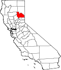
Little Grass Valley is a census-designated place in Plumas County, California, USA. As of the 2010 census, it had a total population of 2.
According to the United States Census Bureau, the town has a total area of 10.0 square miles (26 km2). Although the Bureau states there is no water, the lake covers about 1600 acres (6.5 km2 or 2.5 sq mi).
Census | Pop. | Note | %± |
---|---|---|---|
U.S. Decennial Census [2] |
The 2010 United States Census [3] reported that Little Grass Valley had a population of 2. The population density was 0.2 inhabitants per square mile (0.077/km2). The racial makeup of Little Grass Valley was 2 (100.0%) White, 0 (0.0%) African American, 0 (0.0%) Native American, 0 (0.0%) Asian, 0 (0.0%) Pacific Islander, 0 (0.0%) from other races, and 0 (0.0%) from two or more races. Hispanic or Latino of any race were 0 persons (0.0%).
The Census reported that 2 people (100% of the population) lived in households, 0 (0%) lived in non-institutionalized group quarters, and 0 (0%) were institutionalized.
There were 1 households, out of which 0 (0%) had children under the age of 18 living in them, 1 (100%) were opposite-sex married couples living together, 0 (0%) had a female householder with no husband present, 0 (0%) had a male householder with no wife present. There were 0 (0%) unmarried opposite-sex partnerships, and 0 (0%) same-sex married couples or partnerships. 0 households (0%) were made up of individuals, and 0 (0%) had someone living alone who was 65 years of age or older. The average household size was 2.00. There were 1 families (100% of all households); the average family size was 2.00.
The population was spread out, with 0 people (0%) under the age of 18, 0 people (0%) aged 18 to 24, 0 people (0%) aged 25 to 44, 2 people (100%) aged 45 to 64, and 0 people (0%) who were 65 years of age or older. The median age was 55.5 years. For every 100 females, there were 100.0 males. For every 100 females age 18 and over, there were 100.0 males.
There were 159 housing units at an average density of 15.9 per square mile (6.1/km2), of which 1 (100%) were owner-occupied, and 0 (0%) were occupied by renters. The homeowner vacancy rate was 0%; the rental vacancy rate was 0%. 2 people (100% of the population) lived in owner-occupied housing units and 0 people (0%) lived in rental housing units.
Little Grass Valley was initially occupied by the Maidu Native American tribe during the summers. During the California Gold Rush, it became a mining camp. The camp disappeared before 1900, but there are still gold mines in the area. The land in the valley was used to graze cattle and there was a Boy Scout Camp located on the banks of the South Fork of the Feather River. In 1963 the whole area was flooded and a lake filled the valley. Today there are campgrounds all around the lake, cabins on the south side, and it is the center of a snowmobiling area. It is about three miles (5 km) from La Porte (population 43).
In the state legislature, Little Grass Valley is in the 1st Senate District , represented by Republican Brian Dahle, [4] and the 1st Assembly District , represented by Republican Megan Dahle. [5]
Federally, Little Grass Valley is in California's 1st congressional district , represented by Republican Doug LaMalfa. [6]
About 2.5 miles (4.0 km) north of Little Grass Valley Lake lies a small, natural lily pond called Fowler Lake. Its coordinates are 39°46′27″N121°00′19″W / 39.77417°N 121.00528°W , and its altitude is 5,446 feet (1,660 m).
Alta Sierra is a census-designated place (CDP) in Nevada County, California, United States. The population was 6,911 at the 2010 census, up from 6,522 at the 2000 census.
Lake of the Pines is a census-designated place (CDP) and a gated residential community in Nevada County, California, United States. The population was 3,917 at the 2010 census.
Lake Wildwood is a census-designated place (CDP) in Nevada County, California, United States. The population was 4,991 at the 2010 census, up from 4,868 at the 2000 census.
Penn Valley is a census-designated place (CDP) in Nevada County, California. The population was 1,621 at the 2010 census, up from 1,387 at the 2000 census. The large Lake Wildwood master-planned community, although a separate CDP, has a Penn Valley postal address, and is sometimes considered part of the general Penn Valley community.
Belden is a census-designated place (CDP) in Plumas County, California, United States. Belden is located on the Feather River Route and the North Fork Feather River, 7 miles (11.3 km) southwest of Caribou. The population was 22 at the 2010 census, down from 26 in 2000.
Bucks Lake is a census-designated place (CDP) in Plumas County, California, United States. Bucks Lake is located on the south shore of the lake of the same name, 13 miles (20.9 km) west-southwest of Quincy. The population was 22 at the 2020 census, up from 10 at the 2010 census.
Canyondam is a census-designated place (CDP) in Plumas County, California, United States. Canyondam is located near the dam that forms Lake Almanor, 6.25 miles (10.1 km) east-southeast of Almanor. The population was 31 as of the 2010 census, down from 37 as of the 2000 census. On August 6, 2021, the community was destroyed in the Dixie Fire.
East Shore is a census-designated place (CDP) in Plumas County, California, United States. The population was 156 at the 2010 census, down from 177 at the 2000 census.
La Porte is a census-designated place (CDP) in Plumas County, California, United States. The population was 26 at the 2010 census, down from 43 at the 2000 census. The town was first known as Rabbit Creek.
Lake Almanor Country Club is a census-designated place (CDP) in Plumas County, California, United States. The population was 419 at the 2010 census, down from 847 at the 2000 census. The ZIP code for the CDP is 96137.
Lake Almanor Peninsula is a census-designated place (CDP) in Plumas County, California, United States. The population was 356 at the 2010 census, up from 336 at the 2000 census.
Lake Almanor West is a census-designated place (CDP) in Plumas County, California, United States. The population was 270 at the 2010 census, down from 329 at the 2000 census.
Lake Davis is a census-designated place (CDP) in Plumas County, California, United States, located on Lake Davis. The population was 45 at the 2010 census.
Meadow Valley is a census-designated place (CDP) in Plumas County, California, United States. The population was 453 at the 2020 census, down from 464 at the 2010 census.
Mohawk Vista is a census-designated place in Plumas County, California, United States. The population was 159 at the 2010 census, up from 121 at the 2000 census.
Valley Ranch is a census-designated place in Plumas County, California, United States. The population was 109 at the 2010 census, up from 92 at the 2000 census.
McArthur is a census-designated place (CDP) in Shasta County, California, United States. Its population is 334 as of the 2020 census, down from 338 from the 2010 census. McArthur is a small ranching community, located 4 mi east of Fall River Mills.
Dorris is a city in Siskiyou County, California, United States. Its population is 860 as of the 2020 census, down from 939 from the 2010 census. The town being small, the only attractions are the flagpole and county library. The most notable people who have been residents of Dorris are two athletes who were born here.
Tennant is a census-designated place (CDP) in Siskiyou County, California, United States. Its population is 63 as of the 2020 census, up from 41 from the 2010 census.
Patton Village is a census-designated place in Lassen County, California. It lies at an elevation of 4111 feet. Its population is 632 as of the 2020 census, down from 702 from the 2010 census.