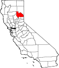
C-Road, California

Last updated

C-Road
Plumas County California Incorporated and Unincorporated areas C-Road Highlighted.svg
Location in Plumas County and the state of California
Usa edcp location map.svg
Red pog.svg
C-Road
Location in the United States
Coordinates: 39°45′34″N120°35′1″W / 39.75944°N 120.58361°W / 39.75944; -120.58361
Country Flag of the United States.svg  United States
State Flag of California.svg  California
County Plumas
Area
[1]
  Total2.66 sq mi (6.89 km2)
  Land2.66 sq mi (6.89 km2)
  Water0.00 sq mi (0.00 km2)  0%
Elevation
[2]
4,793 ft (1,461 m)
Population
 (2020)
  Total140
  Density52.61/sq mi (20.32/km2)
Time zone UTC-8 (Pacific (PST))
  Summer (DST) UTC-7 (PDT)
ZIP code
96135
Area code 530
FIPS code 06-17267
GNIS feature ID2407682
U.S. Geological Survey Geographic Names Information System: C-Road, California

C-Road is a census-designated place (CDP) in Plumas County, California, United States. [2] The population was 150 at the 2010 census, down from 152 at the 2000 census.

Contents

Geography

C-Road is located at 39°45′34″N120°35′1″W / 39.75944°N 120.58361°W / 39.75944; -120.58361 (39.759419, -120.583560). [3]

According to the United States Census Bureau, the CDP has a total area of 2.7 square miles (7.0 km2), all of it land.

Demographics

Historical population
CensusPop.Note
2020 140
U.S. Decennial Census [4]

2010

The 2010 United States Census [5] reported that C-Road had a population of 150. The population density was 56.3 inhabitants per square mile (21.7/km2). The racial makeup of C-Road was 140 (93.3%) White, 0 (0.0%) African American, 0 (0.0%) Native American, 2 (1.3%) Asian, 0 (0.0%) Pacific Islander, 0 (0.0%) from other races, and 8 (5.3%) from two or more races. Hispanic or Latino of any race were 9 persons (6.0%).

The Census reported that 150 people (100% of the population) lived in households, 0 (0%) lived in non-institutionalized group quarters, and 0 (0%) were institutionalized.

There were 73 households, out of which 11 (15.1%) had children under the age of 18 living in them, 49 (67.1%) were opposite-sex married couples living together, 3 (4.1%) had a female householder with no husband present, 2 (2.7%) had a male householder with no wife present. There were 2 (2.7%) unmarried opposite-sex partnerships, and 1 (1.4%) same-sex married couples or partnerships. 17 households (23.3%) were made up of individuals, and 4 (5.5%) had someone living alone who was 65 years of age or older. The average household size was 2.05. There were 54 families (74.0% of all households); the average family size was 2.37.

The population was spread out, with 17 people (11.3%) under the age of 18, 6 people (4.0%) aged 18 to 24, 25 people (16.7%) aged 25 to 44, 73 people (48.7%) aged 45 to 64, and 29 people (19.3%) who were 65 years of age or older. The median age was 53.3 years. For every 100 females, there were 117.4 males. For every 100 females age 18 and over, there were 111.1 males.

There were 102 housing units at an average density of 38.3 per square mile (14.8/km2), of which 65 (89.0%) were owner-occupied, and 8 (11.0%) were occupied by renters. The homeowner vacancy rate was 3.0%; the rental vacancy rate was 0%. 131 people (87.3% of the population) lived in owner-occupied housing units and 19 people (12.7%) lived in rental housing units.

2000

As of the census [6] of 2000, there were 152 people, 61 households, and 50 families residing in the CDP. The population density was 58.3 inhabitants per square mile (22.5/km2). There were 79 housing units at an average density of 30.3 per square mile (11.7/km2). The racial makeup of the CDP was 94.08% White, 2.63% Black or African American, 0.66% Native American, 1.97% Asian, and 0.66% from two or more races. 1.32% of the population were Hispanic or Latino of any race.

There were 61 households, out of which 31.1% had children under the age of 18 living with them, 67.2% were married couples living together, 4.9% had a female householder with no husband present, and 18.0% were non-families. 16.4% of all households were made up of individuals, and 4.9% had someone living alone who was 65 years of age or older. The average household size was 2.49 and the average family size was 2.80.

In the CDP, the population was spread out, with 23.0% under the age of 18, 3.3% from 18 to 24, 22.4% from 25 to 44, 39.5% from 45 to 64, and 11.8% who were 65 years of age or older. The median age was 46 years. For every 100 females, there were 130.3 males. For every 100 females age 18 and over, there were 129.4 males.

The median income for a household in the CDP was $26,250, and the median income for a family was $51,250. Males had a median income of $51,250 versus $0 for females. The per capita income for the CDP was $18,088. About 27.1% of families and 33.8% of the population were below the poverty line, including 66.7% of those under the age of eighteen and 66.7% of those 65 or over.

Politics

In the state legislature, C-Road is in the 1st Senate District , represented by Republican Brian Dahle, [7] and the 1st Assembly District , represented by Republican Megan Dahle. [8]

Federally, C-Road is in California's 1st congressional district , represented by Republican Doug LaMalfa. [9]

Related Research Articles

<span class="mw-page-title-main">Easton, California</span> Census-designated place in California, United States

Easton is a census-designated place (CDP) in Fresno County, California, United States. The population was 2,083 at the 2010 census, up from 1,966 at the 2000 census. Easton is located 7.5 miles (12.1 km) south of downtown Fresno, at an elevation of 276 feet.

<span class="mw-page-title-main">West Bishop, California</span> Census-designated place in California, United States

West Bishop is a census-designated place (CDP) in Inyo County, California, United States. The population was 2,607 at the 2010 census, down from 2,807 at the 2000 census.

<span class="mw-page-title-main">South San Gabriel, California</span> Census-designated place in California, United States

South San Gabriel is a census-designated place (CDP) in Los Angeles County, California, United States. The population was 8,070 at the 2010 census, up from 7,595 at the 2000 census.

<span class="mw-page-title-main">West Rancho Dominguez, California</span> Unincorporated community in California, United States

West Rancho Dominguez, formerly known as West Compton, is an unincorporated census-designated place (CDP) located in southern Los Angeles County, California. Per the 2020 census, the population was 24,347. The community lies to the west of the city of Compton. The ZIP Codes encompassing the CDP area are 90220 & 90248.

<span class="mw-page-title-main">Las Lomas, California</span> Census-designated place in California, United States

Las Lomas is an unincorporated community and census-designated place (CDP) in Monterey County, California, United States. Las Lomas is located 7 miles (11 km) north-northwest of Prunedale. The elevation is 43 feet (13 m). The population was 3,046 at the 2020 census.

<span class="mw-page-title-main">East Shore, California</span> Census-designated place in California, United States

East Shore is a census-designated place (CDP) in Plumas County, California, United States. The population was 156 at the 2010 census, down from 177 at the 2000 census.

<span class="mw-page-title-main">Indian Falls, California</span> Census-designated place in California, United States

Indian Falls is a census-designated place (CDP) in Plumas County, California, United States. The population was 54 at the 2010 census, up from 37 at the 2000 census.

<span class="mw-page-title-main">Iron Horse, California</span> Census-designated place in California, United States

Iron Horse is a census-designated place (CDP) in Plumas County, California, United States. The population was 297 at the 2010 census, down from 321 at the 2000 census.

<span class="mw-page-title-main">Keddie, California</span> Census-designated place in California, United States

Keddie is a census-designated place in Plumas County, California, United States. The population was 66 at the 2010 census.

<span class="mw-page-title-main">La Porte, California</span> Census-designated place in California, United States

La Porte is a census-designated place (CDP) in Plumas County, California, United States. The population was 26 at the 2010 census, down from 43 at the 2000 census.

<span class="mw-page-title-main">El Cerrito, Riverside County, California</span> Census-designated place in Riverside County, California, United States

El Cerrito is a census-designated place (CDP) in Riverside County, California, United States. It is an unincorporated area mostly surrounded by the city of Corona. The population was 5,100 at the 2010 census, up from 4,590 at the 2000 census.

<span class="mw-page-title-main">Winchester, California</span> Census-designated place in California, United States

Winchester is a census-designated place (CDP) in Riverside County, California, USA. As of the 2010 census, the CDP had a total population of 2,534, up from 2,155 at the 2000 census.

<span class="mw-page-title-main">Camp Pendleton Mainside, California</span> Census-designated place in California, United States

Camp Pendleton Mainside is a census-designated place (CDP) in San Diego County, California, located at the southeast corner of the Marine Corps Base Camp Pendleton. Per the 2020 census, the population was 9,683. It was formerly known as Camp Pendleton North, but its name was changed for the 2020 Census. Along with Camp Pendleton South, it is one of two CDPs located on the base.

<span class="mw-page-title-main">Camp Pendleton South, California</span> Census-designated place in California, United States

Camp Pendleton South is a census-designated place (CDP) in San Diego County, California, located at the southwest corner of the Marine Corps Base Camp Pendleton. The population was 10,616 at the 2010 census, up from 8,854 at the 2000 census. Much of the population are residents of Camp Pendleton barracks situated in the area, as well as housing communities for married Marine and Navy personnel and their families. It, along with Camp Pendleton Mainside CDP, is one of two CDPs on the base.

<span class="mw-page-title-main">Hidden Meadows, California</span> Census designated place in California, United States

Hidden Meadows is a census-designated place (CDP) near Escondido in San Diego County, California. The population was 3,485 at the 2010 census, up from 3,463 at the 2000 census.

<span class="mw-page-title-main">East Foothills, San Jose</span> Census designated place in California, United States

East Foothills is a census-designated place (CDP) in Santa Clara County, California, United States and a neighborhood of San Jose. The population was 8,269 at the 2010 census and it is located about 4 miles east of downtown San Jose.

<span class="mw-page-title-main">Stanford, California</span> Census-designated place in Santa Clara County, California, US

Stanford is a census-designated place (CDP) in the northwest corner of Santa Clara County, California, United States. It is the home of Stanford University. The population was 21,150 at the 2020 census.

<span class="mw-page-title-main">Ducor, California</span> Census-designated place in California, United States

Ducor is a census-designated place (CDP) in Tulare County, California, United States. The population was 616 at the 2020 census, up from 612 at the 2010 census. Ducor is an abbreviation of an earlier name, Dutch Corners, which was given because several early settler families were German. The word "Dutch" in this case derives from German deutsch "German".

<span class="mw-page-title-main">El Refugio, Texas</span> CDP in Texas, United States

El Refugio is a census-designated place (CDP) in Starr County, Texas, United States. The population was 331 at the 2010 census. El Refugio gained area in the 2010 census.

<span class="mw-page-title-main">Cheektowaga (CDP), New York</span> Census-designated place in New York, United States

Cheektowaga is a suburban community and census-designated place (CDP) in Erie County, New York, United States. The population was 75,178 at the 2010 census, making it the most populous census-designated place in New York. It is within the town of Cheektowaga. The CDP includes Buffalo Niagara International Airport.

References

  1. "2020 U.S. Gazetteer Files". United States Census Bureau. Retrieved October 30, 2021.
  2. 1 2 U.S. Geological Survey Geographic Names Information System: C-Road, California
  3. "US Gazetteer files: 2010, 2000, and 1990". United States Census Bureau. February 12, 2011. Retrieved April 23, 2011.
  4. "Census of Population and Housing". Census.gov. Retrieved June 4, 2016.
  5. "2010 Census Interactive Population Search: CA - C-Road CDP". U.S. Census Bureau. Archived from the original on July 15, 2014. Retrieved July 12, 2014.
  6. "U.S. Census website". United States Census Bureau . Retrieved January 31, 2008.
  7. "Senators". State of California. Retrieved March 10, 2013.
  8. "Members Assembly". State of California. Retrieved March 2, 2013.
  9. "California's 1st Congressional District - Representatives & District Map". Civic Impulse, LLC. Retrieved March 3, 2013.