Grays Flat, California

Last updated

Grays Flat
California Locator Map with US.PNG
Red pog.svg
Grays Flat
Location in California
Usa edcp location map.svg
Red pog.svg
Grays Flat
Grays Flat (the United States)
Coordinates: 40°01′04″N121°03′49″W / 40.01778°N 121.06361°W / 40.01778; -121.06361
Country Flag of the United States.svg  United States
State Flag of California.svg  California
County Plumas County
Elevation
[1]
2,949 ft (899 m)

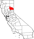
Grays Flat is an unincorporated community in Plumas County, California. [1] It lies at an elevation of 2,949 feet (899 m). [1] Grays Flat is located across the North Fork Feather River from Twain. [2]

Related Research Articles

<span class="mw-page-title-main">Mount Skylight</span> Mountain in United States of America

Mount Skylight is a mountain in the Adirondack High Peaks in the Adirondack Mountains of New York. It gets its name from its open, bare and relatively flat summit, unusual in the Adirondack High Peaks. Skylight is the fourth highest peak in New York.

<span class="mw-page-title-main">Douglas Flat, California</span> Unincorporated community in California, United States

<span class="mw-page-title-main">Grays Harbor</span> Estuary in the U.S. state of Washington

Grays Harbor is an estuarine bay located 45 miles (72 km) north of the mouth of the Columbia River, on the southwest Pacific coast of Washington state, in the United States. It is a ria, which formed at the end of the last ice age, when sea levels flooded the Chehalis River. The bay is 17 miles (27 km) long and 12 miles (19 km) wide. The Chehalis River flows into its eastern end, where the city of Aberdeen stands at that river's mouth, on its north bank, with the somewhat smaller city of Hoquiam immediately to its northwest, along the bayshore. Besides the Chehalis, many lesser rivers and streams flow into Grays Harbor, such as the Hoquiam River and Humptulips River. A pair of low peninsulas separate it from the Pacific Ocean, except for an opening about two miles (3 km) in width. The northern peninsula, which is largely covered by the community of Ocean Shores, ends in Point Brown. Facing that across the bay-mouth is Point Chehalis, at the end of the southern peninsula upon which stands the town of Westport.

Myers Flat is a census-designated place in Humboldt County, California. It is located 4.5 miles (7.2 km) south-southeast of Weott, at an elevation of 203 feet. The ZIP Code is 95554. The population was 146 at the 2010 census.

Grays Flat is an unincorporated community in Marion County, West Virginia, United States. It lies along the Paw Paw Creek, adjacent on the northeast of Grant Town.

<span class="mw-page-title-main">Kernville (former town), California</span> Former settlement in California, United States

Kernville is a former settlement in the Kern River Valley of the Sierra Nevada, in Kern County, California. It lay at an elevation of 2,575 feet near the present-day town of Wofford Heights; the site was submerged under the Lake Isabella reservoir in 1954. The original townsite, parts of which are revealed when the lake is low, is registered as California Historical Landmark #132.

<span class="mw-page-title-main">Grizzly Flats, California</span> Census-designated place in California, United States

Grizzly Flats is a census-designated place in El Dorado County, California. It is located southeast of Camino, at an elevation of 3868 feet (1179 m). Grizzly Flats is the town nearest to Baltic Peak, a small peak to the northwest. The population at the 2010 census was 1,066.

Bailey Flats is a former settlement in Madera County, California. It was located 10 miles (16 km) north-northeast of Raymond, at an elevation of 1047 feet.

<span class="mw-page-title-main">Bottle Beach State Park</span> State park in the U.S. state of Washington

Bottle Beach State Park is a public recreation area on the southern shore of Grays Harbor in Grays Harbor County, Washington. The 64-acre (26 ha) state park consists mainly of tide flats with 6,000 feet (1,800 m) of shoreline near the historic townsite of Ocosta. It was created at the urging of birding experts Bob Morse and Ruby Egbert, who personally donated funds for land purchases at the site in 1993 and for whom the park's Ruby Egbert Natural Area is named. The park opened in 1995. Activities include hiking, birdwatching, and wildlife viewing.

Gold Flat is an unincorporated community in Nevada County, California. It lies at an elevation of 2651 feet. Gold Flat is located 2.5 miles (4.0 km) northeast of Grass Valley.

Hills Flat is an unincorporated community in Nevada County, California. It lies at an elevation of 2457 feet. Hills Flat is 0.5 miles (0.8 km) northeast of Grass Valley.

Newtown is an unincorporated community in Nevada County, California. It lies at an elevation of 2113 feet. Newtown is located 4.5 miles (7.2 km) west of Nevada City.

Scotts Flat is an unincorporated community in Nevada County, California. Scotts Flat is located 6 miles (9.7 km) south of North Bloomfield. It lies at an elevation of 3094 feet.

Shelby Flat is a former settlement in Nevada County, California. Shelby Flat is located 2 miles (3.2 km) north-northwest of Nevada City. It lay at an elevation of 2664 feet.

Grays Flat may refer to:

Rodgers Flat is an unincorporated community in Plumas County, California. It lies at an elevation of 2096 feet. Rodgers Flat is located on the Western Pacific Railroad, 3.5 miles (5.6 km) northeast of Storrie.

References

  1. 1 2 3 U.S. Geological Survey Geographic Names Information System: Grays Flat, California
  2. Durham, David L. (1998). California's Geographic Names: A Gazetteer of Historic and Modern Names of the State. Clovis, Calif.: Word Dancer Press. p. 381. ISBN   1-884995-14-4.