Iron Horse | |
---|---|
Coordinates: 39°47′23″N120°29′44″W / 39.78972°N 120.49556°W Coordinates: 39°47′23″N120°29′44″W / 39.78972°N 120.49556°W | |
Country | United States |
State | California |
County | Plumas |
Area | |
• Total | 7.747 sq mi (20.065 km2) |
• Land | 7.747 sq mi (20.065 km2) |
• Water | 0 sq mi (0 km2) 0% |
Elevation | 4,944 ft (1,507 m) |
Population (2010) | |
• Total | 297 |
• Density | 38/sq mi (15/km2) |
Time zone | UTC-8 (Pacific (PST)) |
• Summer (DST) | UTC-7 (PDT) |
ZIP code | 96122 |
Area code(s) | 530 |
FIPS code | 06-36735 |
GNIS feature ID | 1853395 |
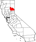
Iron Horse is a census-designated place (CDP) in Plumas County, California, United States. The population was 297 at the 2010 census, down from 321 at the 2000 census.
Iron Horse is located at 39°47′23″N120°29′44″W / 39.78972°N 120.49556°W (39.789714, -120.495605). [2]
According to the United States Census Bureau, the CDP has a total area of 7.7 square miles (20 km2), all of it land.
Historical population | |||
---|---|---|---|
Census | Pop. | %± | |
U.S. Decennial Census [3] |
At the 2010 census Iron Horse had a population of 297. The population density was 38.3 inhabitants per square mile (14.8/km2). The racial makeup of Iron Horse was 276 (92.9%) White, 0 (0.0%) African American, 0 (0.0%) Native American, 1 (0.3%) Asian, 0 (0.0%) Pacific Islander, 12 (4.0%) from other races, and 8 (2.7%) from two or more races. Hispanic or Latino of any race were 17 people (5.7%). [4]
The whole population lived in households, no one lived in non-institutionalized group quarters and no one was institutionalized.
There were 126 households, 30 (23.8%) had children under the age of 18 living in them, 79 (62.7%) were opposite-sex married couples living together, 5 (4.0%) had a female householder with no husband present, 4 (3.2%) had a male householder with no wife present. There were 12 (9.5%) unmarried opposite-sex partnerships, and 0 (0%) same-sex married couples or partnerships. 26 households (20.6%) were one person and 7 (5.6%) had someone living alone who was 65 or older. The average household size was 2.36. There were 88 families (69.8% of households); the average family size was 2.75.
The age distribution was 51 people (17.2%) under the age of 18, 23 people (7.7%) aged 18 to 24, 53 people (17.8%) aged 25 to 44, 115 people (38.7%) aged 45 to 64, and 55 people (18.5%) who were 65 or older. The median age was 49.0 years. For every 100 females, there were 96.7 males. For every 100 females age 18 and over, there were 108.5 males.
There were 168 housing units at an average density of 21.7 per square mile, of the occupied units 101 (80.2%) were owner-occupied and 25 (19.8%) were rented. The homeowner vacancy rate was 7.3%; the rental vacancy rate was 16.7%. 242 people (81.5% of the population) lived in owner-occupied housing units and 55 people (18.5%) lived in rental housing units.
At the 2000 census there were 321 people, 122 households, and 96 families in the CDP. The population density was 35.0 inhabitants per square mile (13.5/km2). There were 148 housing units at an average density of 16.1 per square mile (6.2/km2). The racial makeup of the CDP was 92.83% White, 0.62% Black or African American, 0.62% Native American, 2.18% from other races, and 3.74% from two or more races. 5.61% of the population were Hispanic or Latino of any race. [5] Of the 122 households 33.6% had children under the age of 18 living with them, 69.7% were married couples living together, 7.4% had a female householder with no husband present, and 21.3% were non-families. 18.0% of households were one person and 6.6% were one person aged 65 or older. The average household size was 2.63 and the average family size was 2.94.
The age distribution was 24.9% under the age of 18, 5.0% from 18 to 24, 26.8% from 25 to 44, 27.1% from 45 to 64, and 16.2% 65 or older. The median age was 41 years. For every 100 females, there were 85.5 males. For every 100 females age 18 and over, there were 94.4 males.
The median household income was $30,208 and the median family income was $30,000. Males had a median income of $29,091 versus $25,938 for females. The per capita income for the CDP was $11,732. About 14.0% of families and 9.8% of the population were below the poverty line, including none of those under age 18 and 22.2% of those age 65 or over.
In the state legislature, Iron Horse is in the 1st Senate District , represented by Republican Brian Dahle, [6] and the 1st Assembly District , represented by Republican Megan Dahle. [7]
Federally, Iron Horse is in California's 1st congressional district , represented by Republican Doug LaMalfa. [8]
Mountain View is a census designated place (CDP) in Contra Costa County, California, United States. The population was 2,372 at the 2010 census.
Golden Hills is a census-designated place (CDP) in the Tehachapi Mountains, in Kern County, California, United States. The population was 8,656 at the 2010 census, up from 7,434 at the 2000 census. Golden Hills adjoins the city of Tehachapi on the west.
Rosedale is a Census-designated place (CDP) in Kern County, California, United States. The population was 14,058 at the 2010 census, up from 8,445 at the 2000 census. Formerly a country town 10 miles (16 km) west of Bakersfield, it is now surrounded by suburban housing and currently has the highest household income in Kern County, according to Census estimates.
Desert View Highlands is a census-designated place (CDP) in Los Angeles County, California, United States. The population was 2,360 at the 2010 census, up from 2,337 at the 2000 census. It is surrounded by the City of Palmdale.
Tamalpais-Homestead Valley is a census-designated place (CDP) in Marin County, California, United States. The population was 11,492 at the 2020 census.
Lake Wildwood is a census-designated place (CDP) in Nevada County, California, United States. The population was 4,991 at the 2010 census, up from 4,868 at the 2000 census.
Lake Almanor West is a census-designated place (CDP) in Plumas County, California, United States. The population was 270 at the 2010 census, down from 329 at the 2000 census.
Plumas Eureka is a census-designated place (CDP) in Plumas County, California, United States. The population was 320 at the 2000 census.
Taylorsville is a census-designated place (CDP) in Plumas County, California, United States. The population was 150 at the 2010 census, down from 154 at the 2000 census. The annual Stone Ranch Reunion is held in Taylorsville.
Lakeview is a census-designated place (CDP) in Riverside County, California, United States. The population was 2,104 at the 2010 census, up from 1,619 at the 2000 census. The community is named for nearby Mystic Lake.
Toro Canyon is a census-designated place (CDP) in Santa Barbara County, California, United States. The population was 1,835 at the 2020 census, up from 1,508 at the 2010 census.
Traver is a census-designated place (CDP) in Tulare County, California, United States. The population was 713 at the 2010 census, down from 732 at the 2000 census.
Edgemoor is a census-designated place in New Castle County, Delaware, United States. The population was 5,677 at the 2010 census.
Vamo is a census-designated place (CDP) in Sarasota County, Florida, United States. The population was 4,727 at the 2010 census. It is part of the Bradenton–Sarasota–Venice Metropolitan Statistical Area.
Hillsmere Shores was a census-designated place (CDP) in Anne Arundel County, Maryland, United States. It is a suburb of Annapolis. The population was 2,977 at the 2000 census. It was included in the Annapolis Neck CDP at the 2010 census. Built in phases, beginning in 1960, the community has been home to The Key School, a non-sectarian private school, since the 1960s.
Stallion Springs is a census-designated place (CDP) in the Tehachapi Mountains, in Kern County, California, USA. The population was 2,488 at the 2010 census, up from 1,522 at the 2000 census. Stallion Springs is located in the greater Tehachapi Area.
Heathcote is an unincorporated community and census-designated place (CDP) located within South Brunswick Township, in Middlesex County, New Jersey, United States. As of the 2010 United States Census, the CDP's population was 5,821.
Leisure Knoll is an unincorporated community and census-designated place (CDP) located within Manchester Township, in Ocean County, New Jersey, United States. As of the 2010 United States Census, the CDP's population was 2,490.
Eagleton Village is a census-designated place (CDP) in Blount County, Tennessee, United States. The population was 5,052 at the 2010 census. It is included in the Knoxville, Tennessee Metropolitan Statistical Area.
Windsor is a village and former town in Dane County, Wisconsin. The population was 8,754 at the time of the 2020 census. The communities of Lake Windsor, Morrisonville, and Token Creek are located within the village. Windsor voted to incorporate as a village on November 3, 2015; prior to its incorporation, it was a town, and a portion of the town was a census-designated place. Windsor is a part of the Census Bureau's Madison metropolitan statistical area.