Susanville, California

Last updated

City of Susanville
Downtown Susanville 1.jpg
Historic Uptown Susanville
Nickname: 
The Hub of Northeastern California
Lassen County California Incorporated and Unincorporated areas Susanville Highlighted.svg
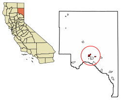
Location in Lassen County and the state of California
USA California location map.svg
Red pog.svg
Susanville
Location within California
Usa edcp location map.svg
Red pog.svg
Susanville
Location within the United States
Coordinates: 40°24′59″N120°39′11″W / 40.41639°N 120.65306°W / 40.41639; -120.65306 Coordinates: 40°24′59″N120°39′11″W / 40.41639°N 120.65306°W / 40.41639; -120.65306
Country United States
State California
County Lassen
Incorporated August 24, 1900 [1]
Named for Susan Roop
Government
   Mayor Quincy McCourt [2]
Area
[3]
  Total8.03 sq mi (20.80 km2)
  Land7.94 sq mi (20.58 km2)
  Water0.09 sq mi (0.22 km2)  1.07%
Elevation
[4]
4,186 ft (1,276 m)
Population
 (2020)
  Total16,728
  Density2,106.80/sq mi (812.83/km2)
Demonym Susanvillain
Time zone UTC-8 (Pacific (PST))
  Summer (DST) UTC-7 (PDT)
ZIP codes
96127, 96130
Area code 530
FIPS code 06-77364
GNIS feature IDs 277619, 2412017
Website cityofsusanville.org
Another view of Uptown Susanville Downtown Susanville 2.jpg
Another view of Uptown Susanville

Susanville (formerly known as Rooptown) is a town in and the county seat of Lassen County, California, United States. [4] Susanville is located on the Susan River in the southern part of the county, [5] at an elevation of 4,186 feet (1,276 m). [4] Its population is 16,728 as of the 2020 census, down from 17,947 from the 2010 census.

Contents

Susanville, a former logging and mining town, is the site of two state prisons: the California Correctional Center, a minimum-medium security facility, which opened in 1963; and the High Desert State Prison, California (not to be confused with High Desert State Prison, Nevada), which opened in 1995. The Federal Correctional Institution, Herlong is nearby, having opened in 2001.

The prisons and their effects on the community, including the addition of local jobs, were explored in the documentary Prison Town, USA (2007), aired on PBS. [6] [7] Nearly half the adult population of Susanville works at the three prisons in the area, where 6,000 people are incarcerated. [8]

Etymology

It was originally known as Rooptown, named for Isaac Roop, a pioneer of the Honey Lake District. [4] Roop later renamed the town Susanville in honor of his daughter in 1857. [9]

History

The Susanville US post office was established in 1860. [5] Susanville was incorporated in 1900. [5]

Formerly the center of farming, mining and the lumber industry, Susanville suffered from the loss of jobs as these industries changed or declined in the 20th century. Since the late 20th century, the only area of growth in the economy has been associated with the construction and operation of two state prisons in the city and one federal prison in the area. In 2007, half of the adult population of Susanville worked in the prisons: [8] the California Correctional Center, a minimum-medium security facility, which opened in 1963; the High Desert State Prison, California (not to be confused with High Desert State Prison, Nevada), which opened in 1995; and the Federal Correctional Institution, Herlong, which opened in 2007.

Geography

Susanville is located at the head of Honey Lake Valley, 40 miles (64 km) east of Lassen Peak, [9] The elevation is approximately 4,186 feet (1,276 m) above sea level. [4] It is considered a gateway city to Reno on U.S. Route 395.

According to the United States Census Bureau, the city has a total area of 8.03 square miles (20.8 km2), of which 7.95 square miles (20.58 km2) or 98.93% is land and 0.09 square miles (0.22 km2) or 1.07% is water.

Eagle Lake is located 15 miles (24 km) north of the town.[ citation needed ]

Geology

Susanville is underlain by igneous rock, which provides the parent material for its well-drained brown stony to gravelly sandy loams or loams. On the western outskirts under forest cover, the soils are often reddish brown. The most common soil series in Susanville's urban area is Springmeyer gravelly fine sandy loam. [10]

Climate

Susanville has an alpine climate (Köppen Dsb) with cool winters and hot, mostly dry summers, except for occasional afternoon thunderstorms. Records have been kept at several stations since 1893, including Susanville Airport and Susanville 2 SW, southwest of the town center, along with two other stations with shorter records.

Average January temperatures are a high of 40.4 °F (4.7 °C) and a low of 20.8 °F (−6.2 °C). [11] Average July temperatures are a high of 88.4 °F (31.3 °C) and a low of 49.8 °F (9.9 °C). [11] Temperatures reach 90 °F (32 °C) or higher on an average of 36.9 days annually, and drop to 32 °F (0 °C) or lower on an average of 164.6 days annually; [11] freezing temperatures have been recorded in every month of the year and summer nighttime temperatures are usually cool, but extreme cold is rare and temperatures under 0 °F (−17.8 °C) are reached only on 2.9 days per winter. [11] The highest recorded temperature in Susanville was 106 °F (41 °C) in July 1931, and the lowest recorded temperature was −23 °F (−31 °C) on February 1, 1956. [12]

Annual precipitation averaged 13.44 inches (341 mm) from 1971 to 2000, with an average of 66 days with measurable precipitation. [11] Susanville Airport has averaged a somewhat higher 15.04 inches (382.0 mm) between 1893 and 2012. At the airport the wettest calendar year has been 1907 with 33.51 inches (851.2 mm) and the driest 1976 with 5.33 inches (135.4 mm), though the wettest "rain year" was from July 1937 to June 1938 with 33.01 inches (838.5 mm) as against 32.42 inches (823.5 mm) between July 1906 and June 1907 and 4.36 inches (110.7 mm) in the driest rain year from July 1975 to June 1976. The most precipitation in one month was 12.30 inches (312.4 mm) in March 1907, and the most in 24 hours 5.04 inches (128.0 mm) on January 31, 1897. [13]

Annual snowfall averages 18.7 inches (47.5 cm) at Susanville 2 SW and 32.8 inches (83 cm) at the airport, though the median at Susanville 2 SW is only 6.5 inches (16.5 cm). [14] The most snowfall in one year was 89 inches (226.1 cm) in 1937, with the most in one month being 65.5 inches (166 cm) in January 1895.

Climate data for Susanville 2 SW, California (1971-2000)
MonthJanFebMarAprMayJunJulAugSepOctNovDecYear
Record high °F (°C)67
(19)
69
(21)
81
(27)
90
(32)
96
(36)
102
(39)
106
(41)
105
(41)
101
(38)
90
(32)
83
(28)
65
(18)
106
(41)
Average high °F (°C)40.4
(4.7)
45.9
(7.7)
53.3
(11.8)
61.3
(16.3)
70.3
(21.3)
79.6
(26.4)
88.7
(31.5)
87
(31)
78.4
(25.8)
66.4
(19.1)
51.9
(11.1)
41.8
(5.4)
63.8
(17.7)
Average low °F (°C)20.9
(−6.2)
24.3
(−4.3)
28.8
(−1.8)
33.1
(0.6)
39.3
(4.1)
45.6
(7.6)
50.8
(10.4)
48.8
(9.3)
42.4
(5.8)
35.1
(1.7)
27.9
(−2.3)
22.3
(−5.4)
34.9
(1.6)
Record low °F (°C)−22
(−30)
−23
(−31)
−4
(−20)
13
(−11)
20
(−7)
25
(−4)
30
(−1)
31
(−1)
18
(−8)
14
(−10)
−1
(−18)
−22
(−30)
−23
(−31)
Average precipitation inches (mm)2.36
(60)
2.06
(52)
1.53
(39)
0.57
(14)
0.88
(22)
0.45
(11)
0.28
(7.1)
0.19
(4.8)
0.49
(12)
1.00
(25)
1.65
(42)
1.98
(50)
13.44
(338.9)
Average snowfall inches (cm)7.3
(19)
1.8
(4.6)
2.6
(6.6)
0.4
(1.0)
0.1
(0.25)
0.0
(0.0)
0.0
(0.0)
0.0
(0.0)
0.1
(0.25)
0.2
(0.51)
1.3
(3.3)
4.9
(12)
18.7
(47.51)
Average precipitation days (≥ 0.01 inch)8.38.68.26.05.13.52.01.83.14.57.27.565.8
Average snowy days (≥ 0.1 inch)2.81.11.00.20.10.00.00.00.10.10.71.77.8
Source: National Oceanic and Atmospheric Administration [11]

Demographics

Historical population
CensusPop.
1890 882
1910 688
1920 91833.4%
1930 1,35847.9%
1940 1,57516.0%
1950 5,338238.9%
1960 5,5984.9%
1970 6,60818.0%
1980 6,520−1.3%
1990 7,27911.6%
2000 13,54186.0%
2010 17,94732.5%
2020 16,728−6.8%
U.S. Decennial Census [15]

2010

At the 2010 census Susanville had a population of 17,947. The population density was 2,238.7 inhabitants per square mile (864.4/km2). The racial makeup of Susanville was 11,269 (62.8%) White, 2,249 (12.5%) African American, 212 (1.2%) Native American, 198 (1.1%) Asian, 111 (0.6%) Pacific Islander, 2,928 (16.3%) from other races, and 580 (3.2%) from two or more races. There were 4,259 people (23.7%) of Hispanic or Latino ancestry. [16]

The census reported that 9,439 people (52.6% of the population) lived in households, 108 (0.6%) lived in non-institutionalized group quarters, and 8,400 (46.8%) were institutionalized.

There were 3,833 households, 1,357 (35.4%) had children under the age of 18 living in them, 1,645 (42.9%) were opposite-sex married couples living together, 499 (13.0%) had a female householder with no husband present, 233 (6.1%) had a male householder with no wife present. There were 327 (8.5%) unmarried opposite-sex partnerships, and 16 (0.4%) same-sex married couples or partnerships. 1,161 households (30.3%) were one person and 405 (10.6%) had someone living alone who was 65 or older. The average household size was 2.46. There were 2,377 families (62.0% of households); the average family size was 3.05.

The age distribution was 2,559 people (14.3%) under the age of 18, 2,547 people (14.2%) aged 18 to 24, 7,633 people (42.5%) aged 25 to 44, 4,024 people (22.4%) aged 45 to 64, and 1,184 people (6.6%) who were 65 or older. The median age was 33.6 years. For every 100 females, there were 273.7 males. For every 100 females age 18 and over, there were 327.3 males.

2000

As of the census [17] [18] of 2000, there were 13,541 people in 3,516 households, including 2,250 families, in the city. The population density was 2,294.8 inhabitants per square mile (886.0/km2). There were 3,882 housing units at an average density of 657.9 per square mile (254.0/km2). The racial makeup of the city was 76.0% White, 12.5% African American, 3.2% Native American, 1.1% Asian, 0.9% Pacific Islander, 3.5% from other races, and 2.8% from two or more races. Hispanic or Latino of any race were 15.6% of the population.

Of the 3,516 households 37.4% had children under the age of 18 living with them, 46.4% were married couples living together, 13.2% had a female householder with no husband present, and 36.0% were non-families. 29.9% of households were one person and 10.7% were one person aged 65 or older. The average household size was 2.49 and the average family size was 3.10.

The age distribution was 20.0% under the age of 18, 13.6% from 18 to 24, 41.5% from 25 to 44, 17.1% from 45 to 64, and 7.7% 65 or older. The median age was 32 years. For every 100 females, there were 198.3 males. For every 100 females age 18 and over, there were 231.6 males.

The median income for a household in the city was $35,675, and the median family income was $45,216. Males had a median income of $29,973 versus $27,044 for females. The per capita income for the city was $13,238. About 11.0% of families and 14.3% of the population were below the poverty line, including 14.5% of those under age 18 and 9.1% of those age 65 or over.

Government

Local government

The current city council members are: [2]

PositionName
MayorQuincy McCourt
Mayor Pro TemThomas Herrera
City CouncillorKevin Stafford
City CouncillorRuss Brown
City CouncillorMendy Schuster

List of mayors

This is a list of Susanville mayors by year.

State and federal representation

In the California State Legislature, Susanville is in the 1st Senate District , represented by Republican Brian Dahle, [21] and the 1st Assembly District , represented by Republican Megan Dahle. [22]

In the United States House of Representatives, Susanville is in California's 1st congressional district , represented by Republican Doug LaMalfa. [23]

Transportation

Susanville Railroad Depot, on the National Register of Historic Places, in 2013 Susanville Railroad Depot.jpg
Susanville Railroad Depot, on the National Register of Historic Places, in 2013

Susanville lies at the junction of California State Routes 36 and 139. Highway 139 heads north to the Oregon border as a direct route to Klamath Falls. Highway 36 runs west to Red Bluff, then east to where it terminates with U.S. Route 395 just outside Susanville's city limits. U.S. 395 connects Alturas to the north and Reno to the south.

Susanville Municipal Airport, 5 miles (8 km) southeast of Susanville, serves as a public, general aviation airport. Lassen Rural Bus, operated by the Lassen County Transportation Commission, provided bus service within the city. Sage Stage, operated by Modoc County, connects Alturas, Susanville, and Reno, Nevada, with connections to Redding, California and Klamath Falls, Oregon.

The Quincy Railroad no longer serves Susanville on the former Southern Pacific Railroad line since 2004. A Union Pacific Railroad caboose has been placed on an intact section of track next to the rail depot.

Economy

Two California Department of Corrections and Rehabilitation facilities, High Desert State Prison and California Correctional Center, [25] [26] are in Susanville. [27] [28]

Top employers

According to Susanville's 2014 Comprehensive Annual Financial Report, [29] the top employers in the city are:

#Employer# of Employees
1 High Desert State Prison 1,250
2 California Correctional Center 1,000
3 Lassen County 441
4 Susanville Indian Rancheria 295
5 Lassen College 267
6 Banner Lassen Medical Center 197
7 Diamond Mountain Casino 179
8 Walmart 150
9Susanville School District101
10Lassen Nursing & Rehabilitation Center101
11Lassen Union High School District85
12Northeastern Rural Health81
13 Safeway 80
14City of Susanville62
15Susanville Supermarket IGA 48

Notable people

Related Research Articles

<span class="mw-page-title-main">Winters, California</span> City in the state of California, United States

Winters is a city in rural Yolo County, and the western Sacramento Valley, in northern California.

<span class="mw-page-title-main">Lassen County, California</span> County in California, United States

Lassen County is a county in the northeastern portion of the U.S. state of California. As of the 2020 census, the population was 32,730. The county seat and only incorporated city is Susanville. Lassen County comprises the Susanville, California, micropolitan statistical area. A former farming, mining and lumber area, its economy now depends on employment at one federal and two state prisons; the former in Herlong and the latter two in Susanville. In 2007, half the adults in Susanville worked in one of the facilities.

<span class="mw-page-title-main">Parker, Arizona</span> Town in La Paz County, Arizona

Parker is the county seat of La Paz County, Arizona, United States, on the Colorado River in Parker Valley. The population was 3,083 at the 2010 census.

<span class="mw-page-title-main">Markleeville, California</span> Census-designated place in California, United States

Markleeville is a census-designated place (CDP) and the county seat of Alpine County, California, United States. The population was 210 at the 2010 census, up from 197 at the 2000 census.

<span class="mw-page-title-main">Brawley, California</span> City in the state of California, United States

Brawley is a city in Imperial County, California, United States within the Imperial Valley.

<span class="mw-page-title-main">Mojave, California</span> Unincorporated community in California, United States

Mojave is an unincorporated community in Kern County, California, United States. Mojave is located 50 miles (80 km) east of Bakersfield, and 100 miles (161 km) north of Los Angeles, at an elevation of 2,762 feet (842 m). The town is located in the western region of the Mojave Desert, below and east of Oak Creek Pass and the Tehachapi Mountains. Mojave is on the Pacific Crest Trail.

<span class="mw-page-title-main">Tehachapi, California</span> City in the United States

Tehachapi is a city in Kern County, California, United States, in the Tehachapi Mountains, at an elevation of 3,970 feet (1,210 m), between the San Joaquin Valley and the Mojave Desert. Tehachapi is 35 miles (56 km) east-southeast of Bakersfield, and 20 miles (32 km) west of Mojave. According to the United States Census Bureau, the city has a total area of 10 square miles (26 km2) and a population of 14,414. The Tehachapi area is known for the nearby Tehachapi Loop, the Pacific Crest Trail and for the excellent conditions for the aerial sport of gliding.

<span class="mw-page-title-main">Alturas, California</span> City in the state of California, United States

Alturas is a city and the county seat of Modoc County, California. Located in the Shasta Cascade region of Northern California, the city had a population of 2,715 at the 2020 census. Alturas is located at the confluence of the south and north forks of the Pit River, east of the center of Modoc County, at an elevation of 4,370 feet (1,330 m). Alturas is one of the largest cities in the region and a local economic hub.

<span class="mw-page-title-main">Blythe, California</span> City in the state of California, United States

Blythe is a city in eastern Riverside County, California, United States. It is in the Palo Verde Valley of the Lower Colorado River Valley region, an agricultural area and part of the Colorado Desert along the Colorado River, approximately 224 miles (360 km) east of Los Angeles and 150 miles (240 km) west of Phoenix. Blythe was named after Thomas Henry Blythe, a San Francisco financier, who established primary water rights to the Colorado River in the region in 1877. The city was incorporated on July 21, 1916. The population was 18,317 at the 2020 census.

<span class="mw-page-title-main">Borrego Springs, California</span> Census-designated place in California, United States

Borrego Springs is a census-designated place (CDP) in San Diego County, California. The population was 3,429 at the 2010 census, up from 2,535 at the 2000 census, made up of both seasonal and year-round residents. Borrego Springs is surrounded by Anza-Borrego State Park, California's largest state park.

<span class="mw-page-title-main">Red Bluff, California</span> City in the state of California, United States

Red Bluff is a city in and the county seat of Tehama County, California, United States. The population was 14,710 at the 2020 census, up from 14,076 at the 2010 census.

<span class="mw-page-title-main">Basin, Wyoming</span> Town in Wyoming, United States

Basin is a town in, and the county seat of, Big Horn County, Wyoming, United States. The population was 1,225 at the 2020 census. The community is located near the center of the Bighorn Basin with the Big Horn River east of the town. Basin's post office, built in 1919, is listed on the National Register of Historic Places.

<span class="mw-page-title-main">Bridgeport, California</span> Census designated place and county seat in California, United States

Bridgeport is an unincorporated community and census-designated place (CDP) in Mono County, California, United States. It is the Mono county seat. The population was 553 at the 2020 census.

Doyle is a rural small town in Lassen County, California. It is located 40 miles (64 km) southeast of Susanville, at an elevation of 4275 feet. It is located 45 miles (72 km) northwest of Reno, Nevada. The ZIP Code is 96109. The community is inside area code 530. It is located within a census-designated place named after the town, while the population of the town itself was not given. Its population is 536 as of the 2020 census, down from 678 from the 2010 census.

<span class="mw-page-title-main">Herlong, California</span> Census-designated place in California, United States

Herlong is a census-designated place in Lassen County, California. Herlong is located at the extreme eastern edge of the Sierra Nevada Mountain Range in the southeastern region of Honey Lake Valley, 8 miles (13 km) north of Doyle, at an elevation of 4,114 feet (1,254 m). Its population is 237 as of the 2020 census, down from 298 from the 2010 census. Herlong is located in southern Lassen County near the southeast edge of Honey Lake, about 70 miles (110 km) north of Reno, Nevada, and about 45 miles (72 km) south of Susanville, the county seat. The community is accessible to U.S. Route 395 via Lassen County Route A25 or Lassen County Route A26.

<span class="mw-page-title-main">Janesville, California</span> Census-designated place in California, United States

Janesville is a census-designated place in Lassen County, California. It is located 11 miles (18 km) southeast of Susanville, at an elevation of 4239 feet. Janesville is located on the eastern slopes of the Sierra Nevada Mountain range. Its population is 2,461 as of the 2020 census, up from 1,408 from the 2010 census.

<span class="mw-page-title-main">Old Station, California</span> Census-designated place in California, United States

Old Station is a census-designated place (CDP) in Shasta County, California. It is located 13 miles (21 km) north of Lassen Volcanic National Park, directly between Redding and Susanville. The ZIP code in Old Station is 96071 and the area code 530. Old Station sits at an elevation of 4,386 feet (1,337 m). Its population is 64 as of the 2020 census, up from 51 from the 2010 census.

<span class="mw-page-title-main">California Correctional Center</span>

California Correctional Center (CCC) is a state prison in the city of Susanville in Northern California. It is a minimum-security facility.

<span class="mw-page-title-main">Johnstonville, California</span> Census-designated place in California, United States

Johnstonville is a census-designated place in Lassen County, California. It is located 4.5 miles (7 km) east-southeast of Susanville, at an elevation of 4131 feet. Its population is 973 as of the 2020 census, down from 1,024 from the 2010 census.

<span class="mw-page-title-main">High Desert State Prison (California)</span>

High Desert State Prison (HDSP) is a high-security state prison that houses level IV inmates located in Leavitt, Lassen County, California. Opened in 1995, it has a capacity of 2,324 persons.

References

  1. "California Cities by Incorporation Date". California Association of Local Agency Formation Commissions. Archived from the original (Word) on November 3, 2014. Retrieved August 25, 2014.
  2. 1 2 "Susanville City Council". cityofsusanville.net. Retrieved July 19, 2020.
  3. "2019 U.S. Gazetteer Files". United States Census Bureau. Retrieved July 1, 2020.
  4. 1 2 3 4 5 "Susanville". Geographic Names Information System . United States Geological Survey, United States Department of the Interior . Retrieved December 17, 2014.
  5. 1 2 3 Durham, David L. (1998). California's Geographic Names: A Gazetteer of Historic and Modern Names of the State. Clovis, Calif.: Word Dancer Press. p. 423. ISBN   1-884995-14-4.
  6. "Prison Town, USA]". Making Contact]. Season 11. Episode 31. July 30, 2008.
  7. POV - Prison Town, pbs.org; retrieved 2010-05-13.
  8. 1 2 Taylor, Robert. "'Prison Town' a view from outside", Contra Costa Times, 28 July 2007; hosted at The Mercury News.
  9. 1 2 Capace, Nancy (1999). Encyclopedia of California. North American Book Dist LLC. Pages 447-48. ISBN   9780403093182.
  10. "SoilWeb: An Online Soil Survey Browser | California Soil Resource Lab".
  11. 1 2 3 4 5 6 Station: Susanville 2 SW, CA, Climatography of the United States No. 20 1971-2000, U.S. Department of Commerce, National Oceanic & Atmospheric Administration, Golden Gate Weather Services, accessed 22 April 2013.
  12. Monthly Averages for Susanville, CA (96130), Weather.com, accessed 22 April 2013
  13. Susanville Airport – Precipitation Summary
  14. Susanville, California (048701) Period of Record Monthly Climate Summary, General Climate Summary Tables: Precipitation, Western Regional Climate Center, Desert Research Institute, accessed 22 April 2013.
  15. "Census of Population and Housing". Census.gov. Retrieved June 4, 2015.
  16. "2010 Census Interactive Population Search: CA - Susanville city". U.S. Census Bureau. Archived from the original on July 15, 2014. Retrieved July 12, 2014.
  17. "U.S. Census website". United States Census Bureau . Retrieved January 31, 2008.
  18. Census 2000 Gateway
  19. "Long Time Lassen County Supervisor Jim Chatnan". californiacountynews.org. October 25, 2016. Retrieved July 21, 2020.
  20. Hibbitts, Jake (June 27, 2018). "City welcomes new mayor, councilmember". lassennews.com. Retrieved July 21, 2020.
  21. "Senators". State of California. Retrieved March 10, 2013.
  22. "Members Assembly". State of California. Retrieved March 2, 2013.
  23. "California's 1st Congressional District - Representatives & District Map". Civic Impulse, LLC. Retrieved March 2, 2013.
  24. California Office of Historic Preservation (April 5, 2001). "National Register of Historic Places Inventory Nomination Form: Susanville Railroad Depot" (PDF). National Park Service. Retrieved April 27, 2015.{{cite journal}}: Cite journal requires |journal= (help)
  25. "High Desert State Prison." California Department of Corrections. Retrieved on September 25, 2011. "475-750 Rice Canyon Rd. Susanville, CA"
  26. "California Correctional Center." California Department of Corrections and Rehabilitation. Retrieved on September 25, 2011. "711-045 Center Rd. Susanville, CA 96127-0790"
  27. "Susanville city, California Archived October 20, 2012, at archive.today ." U.S. Census Bureau. Retrieved on September 25, 2011.
  28. Mathews, Joe (March 31, 2022). "Susanville, California, is being punished for town's business of punishment". Ventura County Star. Retrieved April 8, 2022.
  29. City of Susanville CAFR
  30. Hardin Barry, Statistics and History, Baseball-Reference.com, USA TODAY, 2013, accessed September 13, 2013
  31. Slotnik, Daniel E. (June 11, 2012). "Frank Cady, Kept Store on 'Green Acres,' Dies at 96". The New York Times. Retrieved January 3, 2013.
  32. Aaron Duran – Media Guest of Honor, 34.orycon.org, Oregon Science Fiction Conventions.
  33. "Jack Ellena". Pro-Football-Reference. Retrieved December 22, 2010.
  34. Mike Leach profile, NNDB.com; accessed March 22, 2015.
  35. "SusanvilleStuff.com WebXtra". susanvillestuff.com. Retrieved December 20, 2018.
  36. Profile, archive.patriots.com; accessed March 22, 2015.
  37. 1 2 Woods, Michael, Brothers Ken, Frank Shamrock itching to fight, ESPN.go.com, October 12, 2008; accessed September 13, 2013.
  38. Mike Skinner website Archived July 9, 2015, at the Wayback Machine ; accessed September 13, 2013.
  39. Magagnini, Stephen (October 31, 2009). "Susanville Symphony Hits a High Note in Small Lassen County City". Sacramento Bee . p. 1B.