
Bucks Lake is a census-designated place (CDP) in Plumas County, California, United States. Bucks Lake is located on the south shore of the lake of the same name, 13 miles (20.9 km) west-southwest of Quincy. The population was 10 at the 2010 census, down from 17 at the 2000 census.

Canyondam is a census-designated place (CDP) in Plumas County, California, United States. Canyondam is located near the dam that forms Lake Almanor, 6.25 miles (10.1 km) east-southeast of Almanor. The population was 31 as of the 2010 census, down from 37 as of the 2000 census. On August 6, 2021, the community was destroyed in the Dixie Fire.

Indian Falls is a census-designated place (CDP) in Plumas County, California, United States. The population was 54 at the 2010 census, up from 37 at the 2000 census.

Storrie is a census-designated place (CDP) in Plumas County, California and about 20 miles northeast of Lake Oroville. As of the 2010 Census, the CDP had a population of four.

Shingletown is a census-designated place (CDP) in Shasta County, California, United States. Its population is 2,442 as of the 2020 census, up from 2,283 from the 2010 census.

Montgomery Creek is a census-designated place in Shasta County, California, United States. Its population is 176 as of the 2020 census, up from 163 from the 2010 census. The town and associated creek were named after Zachariah Montgomery.
Bieber is a census-designated place (CDP) in Lassen County, California. It is located on the Pit River, 55 miles (89 km) north-northwest of Susanville, at an elevation of 4,124 feet (1,257 m) Its population is 266 as of the 2020 census, down from 312 from the 2010 census. The ZIP Code is 96009. The community is inside area code 530.
Doyle is a rural small town in Lassen County, California. It is located 40 miles (64 km) southeast of Susanville, at an elevation of 4275 feet. It is located 45 miles (72 km) northwest of Reno, Nevada. The ZIP Code is 96109. The community is inside area code 530. It is located within a census-designated place named after the town,while the population of the town itself was not given. Its population is 536 as of the 2020 census, down from 678 from the 2010 census.

Herlong is a census-designated place in Lassen County, California. Herlong is located at the extreme eastern edge of the Sierra Nevada Mountain Range in the southeastern region of Honey Lake Valley, 8 miles (13 km) north of Doyle, at an elevation of 4,114 feet (1,254 m). Its population is 237 as of the 2020 census, down from 298 from the 2010 census. Herlong is located in southern Lassen County near the southeast edge of Honey Lake, about 70 miles (110 km) north of Reno, Nevada, and about 45 miles (72 km) south of Susanville, the county seat. The community is accessible to U.S. Route 395 via Lassen County Route A25 or Lassen County Route A26.

Janesville is a census-designated place in Lassen County, California. It is located 11 miles (18 km) southeast of Susanville, at an elevation of 4239 feet. Janesville is located on the eastern slopes of the Sierra Nevada Mountain range. Its population is 2,461 as of the 2020 census, up from 1,408 from the 2010 census.
Hat Creek is a census designated place (CDP) in Shasta County, California. Hat Creek is situated at an elevation of 3,422 feet (1,043 m). Its population is 266 as of the 2020 census, down from 309 from the 2010 census.
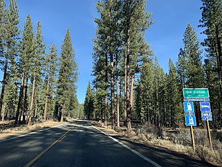
Old Station is a census-designated place (CDP) in Shasta County, California. It is located 13 miles (21 km) north of Lassen Volcanic National Park, directly between Redding and Susanville. The ZIP code in Old Station is 96071 and the area code 530. Old Station sits at an elevation of 4,386 feet (1,337 m). Its population is 64 as of the 2020 census, up from 51 from the 2010 census.
New Pine Creek is a census-designated place in Modoc County, California. It is located on the Oregon border 7 miles (11 km) north-northeast of Willow Ranch, at an elevation of 4842 feet. Its population is 87 as of the 2020 census, down from 98 from the 2010 census. A 1913 book described Pine Creek as being on Goose Lake and having a population of 300.
Johnstonville is a census-designated place in Lassen County, California. It is located 4.5 miles (7 km) east-southeast of Susanville, at an elevation of 4131 feet. Its population is 973 as of the 2020 census, down from 1,024 from the 2010 census.

Litchfield is a census-designated place in Lassen County, California. It is located 15 miles (24 km) east of Susanville, at an elevation of 4,065 feet (1,239 m). Its population is 160 as of the 2020 census, down from 195 from the 2010 census.
Milford is a census-designated place in Lassen County, California. It is located on Mill Creek 15 miles (24 km) south of Litchfield, at an elevation of 4222 feet. Its population is 147 as of the 2020 census, down from 167 from the 2010 census.
Nubieber is a census-designated place in Lassen County, California. It was located at the common terminus of the Western Pacific Railroad and the Great Northern Railway Bieber Line 3 miles (4.8 km) southwest of Bieber, at an elevation of 4121 feet. Its population is 19 as of the 2020 census, down from 50 from the 2010 census.
Patton Village is a census-designated place in Lassen County, California. It lies at an elevation of 4111 feet. Its population is 632 as of the 2020 census, down from 702 from the 2010 census.
Spaulding is a census-designated place in Lassen County, California. It is located on the west side of Eagle Lake, 2.1 miles (3.4 km) east-northeast of Whaleback Mountain and 3 miles (4.8 km) northeast of Eagle Lodge, at an elevation of 5138 feet. Its population is 206 as of the 2020 census, up from 178 from the 2010 census.

Gold Mountain is an unincorporated community in Plumas County, California. Gold Mountain sits at an elevation of 5,341 feet (1,628 m). The 2010 United States census reported Gold Mountain's population was 80. For statistical purposes, the United States Census Bureau has defined Gold Mountain as a census-designated place (CDP).

