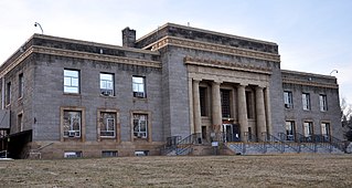
Weedpatch is an unincorporated community and census-designated place (CDP) in Kern County, California, United States. Weedpatch is 10 miles (16 km) south-southeast of Bakersfield. It is considered to be one of the poorest areas in Kern County. As of the 2010 census it had a population of 2,658.

Camp Eighteen is an unincorporated community in Butte County, California, about 1.25 miles (2.01 km) from the Plumas County line. It lies 7 miles (11 km) north of Clipper Mills, at an elevation of 3947 feet. The ZIP Code is 95940. The community is inside area code 530. Nearby communities are Lumpkin and Rogerville. The now-defunct Feather River Railway used to serve the area but appears to have been decommissioned. Sly Creek Reservoir is about 3.6 miles (5.8 km) southeast.

Whitethorn is an unincorporated community in Humboldt County, California. It is located 9.5 miles (15 km) southwest of Garberville, at an elevation of 1024 feet, population 817. Whitethorn shares a zip code with Shelter Cove, California. It is located along California's Lost Coast. The ZIP Code is 95589.

Richland is a former settlement in Butte County, California. It was located 3.5 miles (5.6 km) east-southeast of Biggs, at an elevation of 102 feet. It still appeared at its prior location on maps as of 1912 but moved half a mile west by 1952.
Chardon is a former settlement Butte County, California, United States. It was located on the railroad between Oroville Junction and East Biggs, 8 miles (13 km) west of Oroville. The place was named for Charles Langdon, an early settler. A post office operated at Chardon from 1894 to 1907. In 1897, the townsite and post office were moved 2 miles (3.2 km) southwest from its original site.

Sunnyside is a census-designated place in Fresno County, California. It is located on the Southern Pacific Railroad 5 miles (8 km) north-northeast of Malaga, at an elevation of 328 ft (100 m). At the 2010 census, Sunnyside's population was 4,235.

Englewood is an unincorporated community in Humboldt County, California. It is located 0.5 miles (0.8 km) east-southeast of Redcrest, at an elevation of 364 feet. The area is the site of a few homes and a derelict Eel River Sawmills mill.

Annette is an unincorporated community in Kern County, California. It is located 6.5 miles (10 km) south-southwest of Orchard Peak, at an elevation of 2,198 feet (670 m).

Burton Mill is an unincorporated community in Kern County, California. It is located 7.5 miles (12 km) southeast of Bodfish, at an elevation of 6,722 feet (2,049 m).

Calico is an unincorporated community in Kern County, California. It is located on the Southern Pacific Railroad 3.5 miles (5.6 km) south-southeast of McFarland, at an elevation of 400 feet (121.9 m).

Fleta is an unincorporated community in Kern County, California. It is located on the Southern Pacific Railroad 3.5 miles (6 km) south-southeast of Mojave, at an elevation of 2,644 feet (806 m).

Marcel is an unincorporated community in Kern County, California. It is located on the railroad 3.5 miles (5.6 km) southeast of Keene, at an elevation of 3,245 feet (989 m).

Midoil is an unincorporated community in Kern County, California. It is located 2 miles (3.2 km) southeast of Fellows, at an elevation of 1,339 feet (408 m).

Sanborn is an unincorporated community in Kern County, California. It is located on the Atchison, Topeka and Santa Fe Railroad 5.5 miles (8.9 km) southeast of Mojave, at an elevation of 2,572 feet (784 m).

Terese is a former settlement in Kern County, California.
Gest is a former settlement in Lassen County, California. It was located 8 miles (13 km) north of Chats.
Cuba is a former settlement in Lassen County, California. It was located 2 miles (3.2 km) south of Chats and 5.5 miles (8.9 km) south of Summit.
Addington is a former settlement in Lassen County, California. It was located 15 miles (24 km) southeast of Hayden Hill.
Oak is a former settlement in Madera County, California. It was located 13 miles (21 km) southeast of Borden.

Atlas is an unincorporated community in Napa County, California. It lies at an elevation of 1719 feet. Atlas is located 8 miles (13 km) north-northwest of Mount Vaca and 1.5 miles (2.4 km) south-southeast of Atlas Peak.


