Constantia, California

Last updated

Constantia is a former settlement in Lassen County, California. [1] It was located near the south end of Long Valley 45 miles (72 km) southeast of Susanville. [1]

Lassen County, California County in California, United States

Lassen County is a county in the northeastern portion of the U.S. state of California. As of the 2010 census, the population was 34,895. The county seat and only incorporated city is Susanville.

California State of the United States of America

California is a state in the Pacific Region of the United States. With 39.6 million residents, California is the most populous U.S. state and the third-largest by area. The state capital is Sacramento. The Greater Los Angeles Area and the San Francisco Bay Area are the nation's second and fifth most populous urban regions, with 18.7 million and 9.7 million residents respectively. Los Angeles is California's most populous city, and the country's second most populous, after New York City. California also has the nation's most populous county, Los Angeles County, and its largest county by area, San Bernardino County. The City and County of San Francisco is both the country's second-most densely populated major city after New York City and the fifth-most densely populated county, behind only four of the five New York City boroughs.

Susanville, California City in California, United States

Susanville is the county seat of Lassen County, California, United States. Susanville is located on the Susan River in the southern part of the county, at an elevation of 4,186 feet (1,276 m). The population was 17,974 in the 2010 census, up from 13,541 in the 2000 census. Much of the population increase is related to persons held at two state prisons in the city.

The Constantia post office opened in 1912 (having been moved from Long Valley and closed in 1927. [1]

Long Valley is a former settlement in Lassen County, California. It was located in Long Valley 5 miles (8 km) northwest of Constantia.

Related Research Articles

Feather River river in the United States of America

The Feather River is the principal tributary of the Sacramento River, in the Sacramento Valley of Northern California. The river's main stem is about 73 miles (117 km) long. Its length to its most distant headwater tributary is just over 210 miles (340 km). The main stem Feather River begins in Lake Oroville, where its four long tributary forks join together—the South Fork, Middle Fork, North Fork, and West Branch Feather Rivers. These and other tributaries drain part of the northern Sierra Nevada, and the extreme southern Cascades, as well as a small portion of the Sacramento Valley. The total drainage basin is about 6,200 square miles (16,000 km2), with approximately 3,604 square miles (9,330 km2) above Lake Oroville.

Cwm Silicon is an epithet applied to a region of South Wales in the far west of Newport that attracted much interest and inward investment from the technology sector in the early 2000s.

Santa Rosa, Guyana

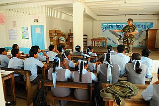
Santa Rosa is a community in the Barima-Waini region of northern Guyana. Its population is approximately 10,000.

Victor Lake Provincial Park is a provincial park in British Columbia, Canada, located southwest of Revelstoke to the north of Three Valley Lake.

Happy Valley is an area in Plumas County, California, United States, is located in Grizzly Valley.

Pululahua Geobotanical Reserve

Reserva Geobotánica Pululahua is a protected area around Pululuhua Volcano in the north of Quito Canton, Pichincha Province, Ecuador. It is 17 km north of Quito, in the northwestern part of the Pomasqui Valley.

Oak Valley, California Unincorporated community in California, United States

Oak Valley is an unincorporated community in Yuba County, California. It is located 5.5 miles (8.9 km) south-southeast of Strawberry Valley, at an elevation of 3012 feet.

French Lake, California, located in Nevada County, was a California Gold Rush community, now uninhabited. It was located by a lake of the same name.

Isabel, Illinois Unincorporated community in Illinois, United States

Isabel is an unincorporated community in Embarrass Township, Edgar County, Illinois, United States.

Ambrose, Contra Costa County, California Former settlement in California, United States

Ambrose is a former settlement in Contra Costa County, California. It was located on the Atchison, Topeka and Santa Fe Railroad 3.5 miles (5.6 km) west of Pittsburg, at an elevation of 16 feet. It still appeared on maps as of 1918.

Greenwood, El Dorado County, California Unincorporated community in California, United States

Greenwood is an unincorporated community in El Dorado County, California. It is located 4 miles (6.4 km) west of Georgetown, at an elevation of 1608 feet.

Pleasant Valley, California Unincorporated community in California, United States

Pleasant Valley is an unincorporated community in El Dorado County, California. It is located 3.5 miles (6 km) south of Camino, at an elevation of 2461 feet.

Voss, California Unincorporated community in California, United States

Voss is an unincorporated community in El Dorado County, California. It lies at an elevation of 5499 feet. Voss is located at 38°39′26″N120°23′16″W.

Belcaro, Denver human settlement in United States of America

Belcaro is a neighborhood of Denver, Colorado. According to the Piton Foundation, in 2007, the population of the neighborhood was 4,394, and there were 2,343 housing units. The neighborhood is a wealthy one, and Piton Foundation data from 2000 indicates the neighborhood’s average household income was $163,553.

Santa Rita is a former settlement in Santa Barbara County, California. It was located in the Santa Rita Valley 7.5 miles (12 km) east of Lompoc.

Farad, California former settlement in Nevada County

Farad is a former settlement in Nevada County, California. Farad is located on the Southern Pacific Railroad, 1 mile (1.6 km) south-southwest of Mystic. The Truckee River crosses Farad halfway between Truckee, CA and Reno, NV.

Eureka is a former settlement in Nevada County, California. Eureka was located 4 miles (6.4 km) east of Snow Point,i.e. 39°25.6′N120°54.2′W. It still appeared on maps as of 1873.

Whites Bridge, California Former settlement in California, United States

Whites Bridge or Whitesbridge is a former settlement on the Fresno Slough near Tranquillity in Fresno County, California.

Deavertown is an unincorporated community in Morgan County, in the U.S. state of Ohio.

References

  1. 1 2 3 Durham, David L. (1998). California's Geographic Names: A Gazetteer of Historic and Modern Names of the State. Clovis, Calif.: Word Dancer Press. p. 366. ISBN   1-884995-14-4.

Coordinates: 39°57′00″N120°02′17″W / 39.95000°N 120.03806°W / 39.95000; -120.03806

Geographic coordinate system Coordinate system

A geographic coordinate system is a coordinate system that enables every location on Earth to be specified by a set of numbers, letters or symbols. The coordinates are often chosen such that one of the numbers represents a vertical position and two or three of the numbers represent a horizontal position; alternatively, a geographic position may be expressed in a combined three-dimensional Cartesian vector. A common choice of coordinates is latitude, longitude and elevation. To specify a location on a plane requires a map projection.