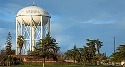
Madera, California

Last updated

Madera, California
Madera, California - Aerial (49394852076).jpg
Aerial view of Madera
Nickname: 
"The Heart of California" [1]
Madera County California Incorporated and Unincorporated areas Madera Highlighted.svg
Location in Madera County and the state of California
Relief map of California.png
Red pog.svg
Madera, California
Location in California
Usa edcp relief location map.png
Red pog.svg
Madera, California
Madera, California (the United States)
Coordinates: 36°57′41″N120°03′39″W / 36.96139°N 120.06083°W / 36.96139; -120.06083
Country United States
State California
County Madera
Region Central Valley
Northern California
Incorporated March 27, 1907 [2]
Government
  Type Council–manager [3]
   City council
  • Mayor Cece Gallegos
    * Rohi Zacharia (D1)
    * Jose Rodriguez (D2)
    * Steve Montes (D3)
    * Anita Evans (D4)
    * Elsa Mejía (D5)
    * Artemio Villegas (D6)
   City Manager Arnoldo Rodriguez [4]
Area
[5]
   City
16.47 sq mi (42.67 km2)
  Land16.47 sq mi (42.67 km2)
  Water0 sq mi (0.00 km2)  0%
Elevation
[6]
272 ft (83 m)
Population
 (2020) [7]
   City
66,224
  Density4,020/sq mi (1,552/km2)
   Metro
152,465
Demonym Maderan
Time zone UTC−8 (Pacific)
  Summer (DST) UTC−7 (PDT)
ZIP Code
93636–93639
Area code 559
FIPS code 06-45022
GNIS feature IDs 277552, 2410906
Website www.madera.gov

Madera (Spanish for "lumber") is a city in, and the county seat of, Madera County, located in the San Joaquin Valley of California. [8] Founded in 1876 as a timber settlement at the terminus of a major log flume, the city grew around the lumber trade before transitioning to an agriculture-based economy during the 20th century. Irrigation from the San Joaquin River and nearby canals transformed the surrounding plains into fertile farmland that now supports vineyards, nut orchards, and row crops.

Contents

As of the 2020 United States census, Madera had a population of 66,224. [7] More than 80 percent of residents identify as Hispanic or Latino, reflecting the city’s deep cultural and agricultural ties to California’s Central Valley. Known as "The Heart of California," Madera today functions as a regional center for education, industry, and community life in the northern San Joaquin Valley.

History

Early Beginnings and the Lumber Era (1876–1931)

The original Madera log flume. California Lumber Company Log Flume.jpg
The original Madera log flume.

Madera was founded in 1876 as a lumber town at the terminus of a flume constructed by the California Lumber Company. [9] The town’s name, meaning “wood” in Spanish, reflected its timber-based economy. [10]

In October 1876, company president William H. Thurman auctioned the first town lots, and Capt. Russell Perry Mace erected Madera’s first building—the Yosemite Hotel—to serve travelers bound for Yosemite Valley. [11] A sixty-mile wooden V-flume carried rough-cut lumber from sawmills in the Sierra Nevada to Madera’s railroad planing mill. The first boards traveled the flume in 1877, the same year Madera’s post office opened. [11]

That same year’s drought dried the flume and left unsold lumber stacked in the yards, forcing the California Lumber Company into bankruptcy by 1878. Banker Return Roberts of San Jose acquired the assets and reorganized them as the Madera Flume and Trading Company, which revived the mills and camps. By 1880, shipments resumed, and the town stabilized.

A devastating 1881 fire destroyed the lumber yards, but the facilities were rebuilt. Local leaders, including Roberts, later lobbied to establish a separate county, and on May 16, 1893, Madera County was created from parts of Fresno County. [11] Madera incorporated as a city on March 27, 1907. [9]

The Madera Sugar Pine Company and the Flume’s Legacy (1899–1931)

Madera celebrates completion of the world's longest lumber flume on October 27, 1900. Madera Flume Celebration 1900.jpg
Madera celebrates completion of the world’s longest lumber flume on October 27, 1900.

At the turn of the twentieth century, Madera entered its industrial peak. On May 8, 1899, Michigan lumberman Arthur Hill, entrepreneur Elmer H. Cox, and Return Roberts founded the Madera Sugar Pine Company, acquiring the earlier flume and vast mountain timberlands. The new company modernized operations, rebuilt and lengthened the flume, and added logging railroads to reach higher elevations. By 1900, the rebuilt flume stretched roughly 60–65 miles from the Sugar Pine highlands to Madera, making it one of the world’s longest. [12]

Thousands gathered on October 27, 1900, to celebrate its completion with a citywide barbecue. [12] At its height, Madera became one of the West’s major lumber centers. The company’s mill—on the site now occupied by Martin Luther King Middle School [13] —produced up to 50 million board feet of lumber per year, shipping products statewide by rail.

Periodic fires plagued the mills, including a destructive 1922 blaze at the Sugar Pine camp, but operations continued until the onset of the Great Depression. Collapsing markets forced the company to end production in 1931; by 1933 its assets were liquidated, concluding nearly six decades of timber-driven growth. [14]

Agricultural Transformation (1930s–Present)

Madera Water Tower, a local landmark. Madera Water Tower.jpg
Madera Water Tower, a local landmark.

As the timber industry declined, agriculture became Madera’s economic foundation. Farming had begun in the late nineteenth century, but the 1930s marked a decisive transition from sawmills to irrigated agriculture. During the Great Depression, many displaced lumber workers joined migrant farm laborers—including Dust Bowl refugees—who cultivated the region’s orchards and vineyards.

Major irrigation projects fueled this transformation. In 1920, local growers organized the Madera Irrigation District to secure a reliable water supply. Protracted disputes with cattle baron Henry Miller over water rights led to federal involvement and eventual construction of Friant Dam in the late 1930s and 1940s. The accompanying Madera Canal distributed San Joaquin River water throughout the valley. [15] Reliable irrigation converted former rangeland into highly productive farmland.

By the 1940s, Madera County’s fruit and nut output rose sharply—up 27 percent from 1940 to 1945—as growers expanded vineyards, fig orchards, and peach groves, later diversifying into almonds, pistachios, cotton, and alfalfa.

The post-war years brought new labor forces through the Bracero Program and subsequent unionization efforts that shaped Central Valley farm politics. Agriculture dominated Madera’s economy by the 1960s, complemented by food processing, cotton gins, wineries, and nut plants that spurred city growth.

A civic milestone occurred in the 1960s with the election of Rev. Naaman N. Haynes to the Madera School Board—one of the first African Americans to hold local office. [16]

Landmarks from this period include the historic Madera County Courthouse, the prominent Madera Water Tower, and one of California’s few remaining fully operational drive-in theaters. [17] Together they reflect the city’s evolution from a timber town to a diverse agricultural and community center.

Geography

According to the United States Census Bureau, Madera has a total area of 16.5 square miles (43 km2), all of it land. [5] The Fresno River, a tributary of the San Joaquin River, passes north of downtown.

Madera lies within California’s San Joaquin Valley, in the geographic heart of the state. The city is part of the Madera AVA wine region, known for vineyards producing Chardonnay, Zinfandel, and other Central Valley varietals.

Climate

Madera experiences a hot, dry steppe climate (BSk), characteristic of California’s interior valleys. [18] Summers are long, hot, and arid, while winters are mild and relatively wet. Average highs exceed 90 °F (32 °C) (32 °C (90 °F)) on more than 100 days per year, and temperatures above 100 °F (38 °C) (38 °C (100 °F)) occur on nearly 30 days annually. The record high of 116 °F (47 °C) was recorded on July 13, 1961, while the record low of 15 °F (−9 °C) occurred on January 10, 1949. [19] [20]

Annual precipitation averages about 10.8 inches (274.3 mm), concentrated between November and March. The wettest year on record (1983) produced 22.13 inches (562.1 mm) of rainfall, while the driest (2013) received only 4.49 inches (114.0 mm). [20] Snowfall is rare, with minor accumulations recorded only once in modern history (January 1962).

Climate data for Madera, California (Madera Municipal Airport), 1991–2020 normals, extremes 1928–present
MonthJanFebMarAprMayJunJulAugSepOctNovDecYear
Record high °F (°C)77
(25)
83
(28)
91
(33)
99
(37)
107
(42)
115
(46)
116
(47)
113
(45)
115
(46)
105
(41)
92
(33)
76
(24)
116
(47)
Mean daily maximum °F (°C)57
(14)
63
(17)
69
(21)
75
(24)
84
(29)
92
(33)
98
(37)
97
(36)
92
(33)
80
(27)
66
(19)
56
(13)
78
(26)
Mean daily minimum °F (°C)39
(4)
41
(5)
44
(7)
46
(8)
52
(11)
58
(14)
63
(17)
61
(16)
58
(14)
50
(10)
42
(6)
38
(3)
49
(9)
Average precipitation inches (mm)2.08
(53)
1.99
(51)
1.98
(50)
0.89
(23)
0.47
(12)
0.16
(4.1)
0.01
(0.25)
0.00
(0.00)
0.03
(0.76)
0.44
(11)
0.92
(23)
1.82
(46)
10.79
(274)
Average precipitation days (≥ 0.01 in)10109521001371058
Source 1: NOAA [19]
Source 2: National Weather Service [20]

Demographics

Historical population
CensusPop.Note
1880 217
1890 950337.8%
1910 2,404
1920 3,44443.3%
1930 4,66535.5%
1940 6,45738.4%
1950 10,49762.6%
1960 14,43037.5%
1970 16,04411.2%
1980 21,73235.5%
1990 29,28134.7%
2000 43,20747.6%
2010 61,41642.1%
2020 66,2247.8%
2024 (est.)69,094 [21] 4.3%
U.S. Decennial Census [22]

As of the 2020 United States census, Madera had a population of 66,224, reflecting a 7.8% increase from 2010. The population density was approximately 4,020 inhabitants per square mile (1,552/km²). [23] The city’s demographic profile is characterized by a youthful population, large households, and a strong Hispanic majority. More than 80% of residents identified as Hispanic or Latino, underscoring Madera’s role as a cultural and economic hub within the San Joaquin Valley.

2020 Census

Of Madera’s 66,224 residents, 17,063 (25.8%) identified as White, 1,750 (2.6%) as African American, 4,554 (6.9%) as Native American, 1,834 (2.8%) as Asian, 66 (0.1%) as Pacific Islander, 28,665 (43.3%) as “other races,” and 12,292 (18.6%) as two or more races. [23] A total of 53,471 residents (80.7%) identified as Hispanic or Latino of any race. [23]

There were 17,672 households in the city, with an average household size of 3.69 and an average family size of 4.00. [23] Approximately 51.5% of households had children under age 18, while 50.5% were opposite-sex married couples. Female-headed households comprised 19.8%, and male-headed households 8.6%. About 17% of households consisted of individuals, and 7.9% had someone living alone aged 65 or older.

In terms of age distribution, 32.8% of residents were under 18, 11% were aged 18–24, 28% were 25–44, 20% were 45–64, and 8% were 65 or older. The median age was 29.3 years.

Madera contained 18,189 housing units, averaging 1,104 per square mile (426/km²). Of the 17,672 occupied units, 51.3% were owner-occupied and 48.7% rented. The homeowner vacancy rate was 1.0%, and the rental vacancy rate 2.9%, both down from 2010 levels. [23]

Parks and recreation

As of 2024, Madera maintains 11 public parks encompassing roughly 160 acres of green space. Facilities include three community centers, one skate park, one community garden, and the city-owned Madera Municipal Golf Course. The city also operates a cross-town trail network and three public swimming pools located at the Centennial Pool Complex. [24] Parks and recreation services are administered by the Department of Parks and Community Services, which oversees special events, youth programs, and community enrichment activities.

Economy

Madera’s economy is driven primarily by agriculture, manufacturing, education, and public administration. The surrounding county is among the leading producers of grapes, almonds, pistachios, and figs in the United States. Food processing and distribution facilities support the region’s agricultural output, while the Madera Unified School District and City of Madera are major public employers. The industrial sector continues to expand near State Route 99, supported by transportation and warehousing infrastructure. [25]

Retail, logistics, and construction contribute to the city’s private-sector growth. Although service-based employment has increased, agriculture and education remain the dominant job sectors.[ citation needed ]

Government

Madera operates under a council–manager system. The mayor is elected at large, while six city council members represent individual districts. The city serves as the seat of Madera County. In the California State Legislature, Madera is in the 14th senatorial district , represented by Democrat Anna Caballero and the 27th Assembly district , represented by Democrat Esmeralda Soria. [26] Federally, Madera lies within California’s California's 13th congressional district , represented by Democrat Adam Gray congressional district. [27]

Education

Madera Unified School District administers public education throughout the city. The district includes:

Private schools include:

Higher education is provided by Madera Community College, part of the State Center Community College District.

Infrastructure

Madera maintains approximately 203 miles of city streets within its limits. The city’s water system includes 20 active wells and about 200 miles of waterlines, while wastewater is managed through roughly 175 miles of sewer lines. Public safety is provided by the Madera Police Department and the Madera Fire Department.

The city manages about 3,300 streetlights and 40 traffic signals, balancing pedestrian safety and vehicle flow.

Transportation

Madera is served by several major highways:

Public transportation is provided by Madera Metro, which operates fixed-route intracity service, and by Madera County Connection, offering intercity routes to nearby communities. [32] [33] A Greyhound Lines station operates in downtown Madera. [34]

Just north of the city lies the Madera Amtrak station, and a future California High-Speed Rail stop is planned. [35]

Madera Municipal Airport serves general aviation on approximately 524 acres (2.12 km2) on the northwest edge of the city, operated by the Public Works Department.

Notable people

Arts and culture

Sports

Public service and science

See also

References

  1. "City of Madera : The Heart of California". City of Madera. Archived from the original on August 31, 2019. Retrieved July 11, 2020.
  2. "California Cities by Incorporation Date". California Association of Local Agency Formation Commissions. Archived from the original (Word) on February 21, 2013. Retrieved August 25, 2014.
  3. "Government". City of Madera. Retrieved October 17, 2025.
  4. "City Manager". City of Madera. Retrieved October 17, 2025.
  5. 1 2 "2021 U.S. Gazetteer Files: California". United States Census Bureau. Retrieved June 24, 2022.
  6. "Madera". Geographic Names Information System . United States Geological Survey, United States Department of the Interior . Retrieved April 9, 2015.
  7. 1 2 "P1. Race – Madera city, California: 2020 DEC Redistricting Data (PL 94-171)". U.S. Census Bureau. Retrieved June 24, 2022.
  8. "Find a County". National Association of Counties. Archived from the original on July 12, 2012. Retrieved June 7, 2011.
  9. 1 2 "Welcome to Madera / Our History". Archived from the original on October 30, 2020. Retrieved October 17, 2025.
  10. "California's Geographic Names" . Retrieved May 25, 2025.
  11. 1 2 3 Kreamer, Matthew (October 10, 1999). "About Madera". The Fresno Bee.
  12. 1 2 Johnston, Hank (1968). Thunder in the Mountains: The Life and Times of Madera Sugar Pine. Trans-Anglo Books. ISBN   0-87046-017-X.
  13. "Madera Method – The House That Lumber Built". Madera Method. Madera Unified School District . Retrieved October 4, 2025. This 1900 panorama shows the Sugar Pine Lumber Company office on the left and a sizable portion of the lumber stock stacked up in the yards. If a person were to visit the site today, he or she would be at Madera Unified School District's Martin Luther King Middle School.
  14. Durham, David L. (1998). California’s Geographic Names: A Gazetteer of Historic and Modern Names of the State. Clovis, CA: Word Dancer Press. p. 834. ISBN   1-884995-14-4.
  15. "Friant Dam Construction Begins". Madera Tribune. 1936.
  16. "Rev. Naaman N. Haynes elected to Madera school board". Madera Tribune. 1960.
  17. "Madera Drive-In Facebook Page". Facebook . Retrieved July 11, 2020.
  18. "Madera, California Köppen Climate Classification (Weatherbase)". Weatherbase. Archived from the original on September 23, 2015. Retrieved December 13, 2018.
  19. 1 2 "U.S. Climate Normals Quick Access – Station: Madera MUNI AP, CA". National Oceanic and Atmospheric Administration. Retrieved May 26, 2023.
  20. 1 2 3 "NOAA Online Weather Data – NWS Hanford". National Weather Service. Retrieved May 26, 2023.
  21. "City and Town Population Totals: 2020–2024". United States Census Bureau. Retrieved June 25, 2025.
  22. "Census of Population and Housing". Census.gov. Archived from the original on March 21, 2021. Retrieved June 4, 2015.
  23. 1 2 3 4 5 "QuickFacts: Madera city, California". U.S. Census Bureau. Retrieved May 25, 2025.
  24. "Budget City of Madera". City of Madera Budget FY 2024/2025. June 2024.
  25. "City of Madera Economic Overview" . Retrieved October 17, 2025.
  26. "Final Maps | California Citizens Redistricting Commission" . Retrieved October 8, 2025.
  27. "California's 13th Congressional District - Representatives & District Map". Civic Impulse, LLC.
  28. "MADTEC".
  29. "KHS 2026".
  30. "Home – Saint Joachim School". Archived from the original on February 5, 2022. Retrieved February 23, 2022.
  31. "Crossroads Christian School". Archived from the original on February 4, 2022. Retrieved February 23, 2022.
  32. "Transit". City of Madera. November 17, 2015. Archived from the original on October 16, 2019. Retrieved October 16, 2019.
  33. "Madera County Connection | Public Transit for Madera, Chowchilla, Fairmead, and North Fork". Archived from the original on October 16, 2019. Retrieved October 16, 2019.
  34. "Contact and Directions for Madera Bus Station in Madera, California". Greyhound.com. Greyhound Lines, Inc. Archived from the original on February 23, 2022. Retrieved October 26, 2020.
  35. Sheehan, Tim. "High-speed rail plans Madera stop". The Fresno Bee. Archived from the original on March 19, 2018. Retrieved March 18, 2018.
  36. Glotfelty, Cheryll (2008). Frank Bergon in Literary Nevada: Writings from the Silver State. University of Nevada Press. pp. 649–650. ISBN   978-0-87417-755-8.
  37. Nix, Tami Jo (February 14, 2021). "Riley writes to Bolder Woman". The Madera Tribune. Retrieved December 17, 2023.
  38. Coate, Bill (May 6, 2020). "John D. Rockefeller and the girl from Madera". The Madera Tribune. Retrieved December 17, 2023.
  39. "Memoirs of Lorin J. Whitney". Sierra Chapter, American Theatre Organ Society. Retrieved December 18, 2023.
  40. "Virginia Stroud – U.S. Department of State" . Retrieved December 18, 2023.
  41. "Connor Brogdon – Baseball". Lewis–Clark State College Athletics. Retrieved December 17, 2023.
  42. "Dwayne Crump Stats, Height, Weight, Position, Draft, College". Pro-Football-Reference.com. Retrieved December 17, 2023.
  43. "In Remembrance, Lee Evans". Recreational Habits. Retrieved December 17, 2023.
  44. "Madera MMA fighter wins title," The Madera Tribune, October 29, 2010, p. A6
  45. "Lavar Johnson cut by UFC after suspension, source says". ESPN. March 21, 2013. Archived from the original on May 17, 2014. Retrieved November 8, 2013.
  46. "Jack William Kelso | Korean War | U.S. Marine Corps | Medal of Honor Recipient". Congressional Medal of Honor Society. Retrieved December 17, 2023.
  47. Larkin, Duncan (July 13, 2011). "Oswaldo Lopez Prevails at the Badwater Ultramarathon". Competitor. Archived from the original on February 2, 2014. Retrieved January 28, 2014.
  48. "Frank McNally to Play Professional Football". The Madera Tribune. August 28, 1931. p. 4. Archived from the original on November 9, 2016. Retrieved November 8, 2016.
  49. "Olympedia – Wally O'Connor". Olympedia. Retrieved December 17, 2023.
  50. "La Schelle Tarver – Society for American Baseball Research" . Retrieved December 18, 2023.
  51. "Fresno Athletic Hall of Fame – Roy Zimmerman". Fresno Athletic Hall of Fame. Archived from the original on December 18, 2023. Retrieved December 18, 2023.
  52. "California Digital Newspaper Collection". Madera Tribune. April 10, 1930. Retrieved December 17, 2023.
  53. Glotfelty, Cheryll (2008). Frank Bergon in Literary Nevada. University of Nevada Press. pp. 649–650.
  54. "In Remembrance, Lee Evans". Recreational Habits. Retrieved December 17, 2023.