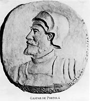
Gaspar de Portolá y Rovira (1723–1786) was a Spanish soldier and administrator in New Spain. As commander of the Spanish colonizing expedition on land and sea that established San Diego and Monterey, Portolá expanded New Spain's Las Californias province far to the north from its beginnings on the Baja California peninsula. Portolá's expedition also was the first European to see San Francisco Bay. The expedition gave names to geographic features along the way, many of which are still in use.
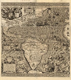
California is a North American place name used by the U.S. state of California and the Mexican states of Baja California and Baja California Sur. Collectively, these three areas constitute the region formerly referred to as The Californias. The name California is shared by many other places in other parts of the world, whose names derive from the same original.

Hupa are a Native American people of the Athabaskan-speaking ethnolinguistic group in northwestern California. Their endonym is Natinixwe, also spelled Natinook-wa, meaning "People of the Place Where the Trails Return". The majority of the tribe is enrolled in the Federally recognized Hoopa Valley Tribe.

Merrimac is an unincorporated community in Butte County, California located along Oroville-Quincy Road about 2.1 miles (3.4 km) south of the Plumas County line. It lies at an elevation of 3999 feet. While the location is shown as official in the National Geographic Names Database, it is not known if locals use this name to describe the place today. Nearby is Rogers Cow Camp, a campground in Lassen National Forest. The USGS feature ID for this populated place is 1659117. The US Postal Service does not show a ZIP Code for this community. The location is within area code 530.
Pablo Vicente de Solá, (1761–1826), was a Spanish officer and the twelfth and last Spanish colonial governor of Alta California, 1815-1822. He was born in Mondragón, Gipuzkoa (Spain).
Diego de Borica was a Basque Spanish explorer and the seventh governor of Alta California from 1794 to 1800. He died on August 19, 1800 in Durango, Mexico.
Dayton is a small unincorporated community in Butte County, California. Its zip code is 95928 and its area code is 530. It lies at an elevation of 141 feet.

Mariano Aguerre, is a professional polo player in Argentina and the United States. He achieved a 10-goal handicap in the United States in 1994 and in Argentina in 1998. He is currently rated at 9 goals in both countries. He is a nine-time winner of the Argentine Open at Palermo, winning with three different teams: Ellerstina, Chapa I and La Dolfina. The Museum of Polo and Hall of Fame announced that Mariano was inducted into the Hall of Fame in 2017.

New Blinzing is a former settlement in Butte County, California, United States. It was located 5.25 miles north of Berry Creek and about 1 mile (1.6 km) northwest of Blinzing, on the Western Pacific Railroad, at an elevation of 942 feet. It still appeared on maps as of 1948.
Ceneda is an unincorporated community in Kern County, California. It is located on the Southern Pacific Railroad about 1 mile (1.6 km) southwest of Saltdale, at an elevation of 1946 feet.
Levee is a former settlement in Kern County, California. It was located on the Sunset Railroad 1.5 miles (2.4 km) north of Levee Spur, at an elevation of 289 feet. Levee still appeared on maps as of 1933.
Myricks Corner is an unincorporated community in Kern County, California. It is located 1.25 miles (2 km) northwest of Shafter, at an elevation of 351 feet.
North Shafter is an unincorporated community in Kern County, California. It is located 1 mile (1.6 km) north of Shafter, at an elevation of 351 feet.
Sage is a former settlement in Kern County, California.
Saltdale is an unincorporated community in Kern County, California. It is located near Koehn Lake 21 miles (34 km) south-southwest of Ridgecrest near Garlock, California.
Ysabeau S. Wilce is an American author of young adult fantasy novels. Her novels feature the rebellious young heroine Flora Fyrdraaca and her adventures in the fictional land of Califa.

Plaza de Toros de los Califas is a building in Córdoba, Spain. It is currently used for bull fighting. The stadium holds 14,000 people after the installation of red seats. It was built in 1965.

The CALIFA Survey is an astronomical project to map 600 galaxies with integral field spectroscopy (IFS), to allow detailed studies of these objects. The data are taken at the Calar Alto Observatory in Spain.