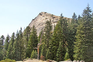
Sierra Vista, Madera County, California

Last updated
Sierra Vista
Unincorporated community
California Locator Map with US.PNG
Red pog.svg
Sierra Vista
Location in California
Usa edcp location map.svg
Red pog.svg
Sierra Vista
Sierra Vista (the US)
Coordinates: 37°09′05″N120°17′11″W / 37.15139°N 120.28639°W / 37.15139; -120.28639 Coordinates: 37°09′05″N120°17′11″W / 37.15139°N 120.28639°W / 37.15139; -120.28639
Country United States
State California
County Madera County
Elevation [1] 236 ft (72 m)

Sierra Vista is an unincorporated community in Madera County, California. [1] It is located on the Southern Pacific Railroad 2.5 miles (4 km) north-northwest of Chowchilla, [2] at an elevation of 236 feet (72 m). [1]

Unincorporated area Region of land not governed by own local government

In law, an unincorporated area is a region of land that is not governed by a local municipal corporation; similarly an unincorporated community is a settlement that is not governed by its own local municipal corporation, but rather is administered as part of larger administrative divisions, such as a township, parish, borough, county, city, canton, state, province or country. Occasionally, municipalities dissolve or disincorporate, which may happen if they become fiscally insolvent, and services become the responsibility of a higher administration. Widespread unincorporated communities and areas are a distinguishing feature of the United States and Canada. In most other countries of the world, there are either no unincorporated areas at all, or these are very rare; typically remote, outlying, sparsely populated or uninhabited areas.

Madera County, California County in California, United States

Madera County, officially the County of Madera, is a county at the geographic center of the U.S. state of California. As of the 2010 census, the population was 150,865. The county seat is Madera.

California State of the United States of America

California is a state in the Pacific Region of the United States. With 39.6 million residents, California is the most populous U.S. state and the third-largest by area. The state capital is Sacramento. The Greater Los Angeles Area and the San Francisco Bay Area are the nation's second and fifth most populous urban regions, with 18.7 million and 8.8 million residents respectively. Los Angeles is California's most populous city, and the country's second most populous, after New York. California also has the nation's most populous county, Los Angeles County, and its largest county by area, San Bernardino County. The City and County of San Francisco is both the country's second-most densely populated major city after New York and the fifth-most densely populated county, behind only four of the five New York City boroughs.

Related Research Articles

Oakhurst, California census-designated place in California, United States

Oakhurst is a census-designated place (CDP) in Madera County, California, 14 miles (23 km) south of the entrance to Yosemite National Park, in the foothills of the Sierra Nevada mountain range. At the 2010 census, the population was 2,829, down from 2,868 at the 2000 census. According to the Oakhurst Area Chamber of Commerce, the area population was 12,787 at the 2000 census. It is part of the Madera–Chowchilla metropolitan statistical area.

Fresno Dome mountain in United States of America

Fresno Dome is a dominant granite dome rising in isolation above the forest of Soquel Meadow in the Sierra National Forest in Madera County, California.

Mount Ritter mountain

Mount Ritter is the highest mountain in Madera County, California, in the Western United States, at an elevation of 13,149 feet (4,008 m). It is also the highest and most prominent peak of its namesake, the Ritter Range, a subrange of the Sierra Nevada in the Ansel Adams Wilderness of the Inyo and Sierra National Forests. Mount Ritter is the 15th highest mountain peak in California with at least 500 meters of topographic prominence.

Central California Place in California, United States

Central California is a subregion of Northern California, generally thought of as the middle third of the state, north of Southern California. It includes the northern portion of the San Joaquin Valley, the Central Coast, the central hills of the California Coast Ranges, and the foothills and mountain areas of the central Sierra Nevada.

North Fork, California Unincorporated community in California, United States

North Fork is an unincorporated community in Madera County, California. It is located 22 miles (35 km) east of Raymond, 9.89 miles (15.92 km) south east of Bass Lake and 14 miles (23 km) from Oakhurst.

Chowchilla River river in the United States of America

The Chowchilla River is a river in central California, United States and a minor tributary of the San Joaquin River. It flows for 54.2 miles (87.2 km) from the western side of the Sierra Nevada Range to the San Joaquin River system in the San Joaquin Valley.

Parsons Peak is a mountain in Yosemite National Park and the Cathedral Range of California's Sierra Nevada. The peak, located on the Madera–Tuolumne county line, rises to an elevation of 12,153 feet (3,704 m). The mountain has a ridge extending northwest from the summit. On this ridge is a point, referred to as Parsons Peak-Northwest Ridge, which rises to an elevation of about 8,848 feet (2,697 m) and at this point the boundaries of Mariposa, Tuolumne, and Madera counties meet. This point is the highest point in Mariposa County. The summit of Parsons Peak is just outside Mariposa County.

Bonita, Madera County, California Unincorporated community in California, United States

Bonita is an unincorporated community in Madera County, California. It is 8 miles (13 km) west of Madera, at an elevation of 207 feet.

Hillside, Madera County, California Former settlement in California, United States

Hillside is a former settlement in Madera County, California. It was located on the Southern Pacific Railroad just southwest of Knowles, at an elevation of 912 feet.

Indian Springs, Madera County, California Unincorporated community in California, United States

Indian Springs is an unincorporated community in Madera County, California. It is located on Cottonwood Creek 5.5 miles (9 km) south-southwest of O'Neals, at an elevation of 525 feet.

Lincoln, Madera County, California Former settlement in California, United States

Lincoln is a former settlement in Madera County, California. It was located on the Chowchilla Pacific Railroad 8 miles (13 km) south-southwest of Chowchilla, at an elevation of 171 feet. Lincoln still appeared on maps as of 1918.

Sierra Vista, California may refer to:

Storey, California Unincorporated community in California, United States

Storey is an unincorporated community in Madera County, California, United States. It is located on the Atchison, Topeka and Santa Fe Railroad (ATSF) 2.5 miles (4 km) east-northeast of Madera, at an elevation of 289 feet (88 m) It is also about 1 mile (1.6 km) southeast of the Fresno River.

The Pines, Madera County, California Unincorporated community in California, United States

The Pines is an unincorporated community in Madera County, California. It is located on the northeast shore of Bass Lake 5.25 miles (8.4 km) southeast of Yosemite Forks, at an elevation of 3435 feet.

Trigo, Madera County, California Unincorporated community in California, United States

Trigo is an unincorporated community in Madera County, California. It is located 7 miles (11 km) east-southeast of Madera, at an elevation of 289 feet.

Willow Glen, Madera County, California Former settlement in California, United States

Willow Glen is a former settlement in Madera County, California. It was located 6 miles (9.7 km) north of O'Neals, at an elevation of 1831 feet.

Cascadel is a former settlement in Madera County, California.

Minarets is a former settlement in Madera County, California. It was located 5 miles (8 km) southeast of North Fork.

Corte Madera Creek (Marin County, California)

Corte Madera Creek is a short stream which flows southeast for 4.5 miles (7.2 km) in Marin County, California. Corte Madera Creek is formed by the confluence of San Anselmo Creek and Ross Creek in Ross and entering a tidal marsh at Kentfield before connecting to San Francisco Bay near Corte Madera.

References

  1. 1 2 3 U.S. Geological Survey Geographic Names Information System: Sierra Vista, Madera County, California
  2. Durham, David L. (1998). California's Geographic Names: A Gazetteer of Historic and Modern Names of the State. Clovis, Calif.: Word Dancer Press. p. 827. ISBN   1-884995-14-4.