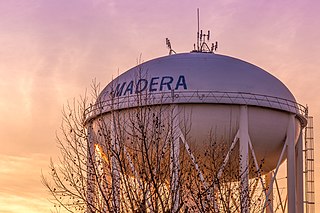
Madera is a city in California and the county seat of Madera County. As of the 2010 United States Census, the city's population was 61,416, up from 43,207 in 2000.

North Fork is an unincorporated community in Madera County, California. It is located 22 miles (35 km) east of Raymond, 9.89 miles (15.92 km) south east of Bass Lake and 14 miles (23 km) from Oakhurst.

Area code 559 is a California telephone area code that was split from area code 209 on November 14, 1998.
Raymond is an unincorporated community in Madera County, California. It is located 22 miles (35 km) north-northeast of Madera, at an elevation of 948 feet.

Central California Women's Facility (CCWF) is a female-only California Department of Corrections and Rehabilitation state prison located in Chowchilla, California. It is across the road from Valley State Prison. CCWF prison is the largest female correctional facility in the United States, and houses the only State of California death row for women.

State Route 233 is a state highway in the U.S. state of California in Madera County. It serves as an alternate route between Route 152 and Route 99, going through the city of Chowchilla instead of bypassing it. Drivers going from eastbound Route 152 to northbound Route 99 must especially use SR 233 since there is no such direct ramp at the 99/152 interchange.

The Chowchilla River is a river in central California, United States and a minor tributary of the San Joaquin River. It flows for 54.2 miles (87.2 km) from the western side of the Sierra Nevada Range to the San Joaquin River system in the San Joaquin Valley.
Minturn is an unincorporated community in Madera County, California. It is located on the Atchison, Topeka and Santa Fe Railroad and California State Route 99 1.5 miles (2 km) north-northwest of Chowchilla, at an elevation of 236 feet. Minturn is near the Geographic Center of California, between Madera and Merced.
The Madera Canal is a 35.9 mi (57.8 km) aqueduct in the U.S. state of California. It is part of the Central Valley Project managed by the United States Bureau of Reclamation to convey water north to augment irrigation capacity in Madera County, California. It was also the subject of the United States Supreme Court's decision in Central Green Co. v. United States.
Myron Donovan Crocker was a United States District Judge of the United States District Court for the Southern District of California and the United States District Court for the Eastern District of California.
Bonita is an unincorporated community in Madera County, California. It is 8 miles (13 km) west of Madera, at an elevation of 207 feet.
Dairyland is an unincorporated community in Madera County, California. It is located 7.5 miles (12 km) south-southwest of Chowchilla, at an elevation of 184 feet. Dairyland was at one terminus of the Chowchilla Pacific Railroad, and at a terminus of a branch of the Southern Pacific Railroad.
Sierra Vista is an unincorporated community in Madera County, California. It is located on the Southern Pacific Railroad 2.5 miles (4 km) north-northwest of Chowchilla, at an elevation of 236 feet.

Tillman is a former settlement in Madera County, California, United States. It was located on the Chowchilla Pacific Railroad 6.25 miles (10 km) south-southwest of Chowchilla, at an elevation of 187 feet (57 m). Tillman still appeared on maps as of 1918.
Tyler is a former settlement in Madera County, California. It was located on the Chowchilla Pacific Railroad 5 miles (8 km) south-southwest of Chowchilla, at an elevation of 197 feet. Tyler still appeared on maps as of 1918.
H. V. Eastman Lake is an artificial lake formed by the construction of Buchanan Dam across the Chowchilla River in the foothills of Madera County, California. A small percentage of the northwest area of the reservoir is in Mariposa County.
Chowchilla Elementary School District is a public school district based in Madera County, California.


