Fort Miller, California

Last updated
Fort Miller
Historic American Buildings Survey Robert W. Kerrigan, Photographer 1935 - 1936 VIEW FROM EAST - Fort Miller Hospital, Lake Millerton, Millerton, Madera County, CA HABS CAL,10-MILL,1C-1.tiff
Fort Miller Hospital, c. 1935
USA California location map.svg
Red pog.svg
Fort Miller
Location in California
Coordinates: 37°0′54.82″N119°39′33.51″W / 37.0152278°N 119.6593083°W / 37.0152278; -119.6593083
Country United States
State California
County Madera County
Fort Miller1852
Elevation
[1]
561 ft (171 m)
Reference no.584

Fort Miller, also known as Camp Barbour, was a fort on the south bank of the San Joaquin River in what is now Fresno County, California. It lay at an elevation of 561 feet (171 m). [1] The site is now under Millerton Lake, formed by the Friant Dam in 1944. It is registered as California Historical Landmark #584. [2]

Contents

History

Invisible Square.svg
Mapscaleline.svg
3km
2miles
Red pog.svg
5
4
3
Fort Miller location and nearby features
1
Abandoned Fort Miller settlement
2
Abandoned Millerton settlement
3
Friant Dam
4
Millerton (modern Census Designated Place)
5
Table Mountain Rancheria

In early 1851, a temporary outpost was built along the banks of the San Joaquin River and named Camp Barbour, after the George W. Barbour, the California Indian Commissioner. It was here that Federal Indian Commissioners negotiated and signed a treaty with many California tribes in the area on April 29, 1851. The treaty established the Fresno River Reservation on which the tribes would live. The refusal of the Ahwahneechee and Chowchilla tribes to sign the treaty and relocate to the reservation led to the Mariposa War. [3]

To supervise the newly established reservation and protect the booming mining activity on the San Joaquin River, it became clear that a permanent fort was needed. Once the Camp Barbour outpost was converted to a permanent fort and made operational by Lieutenant Tredwell Moore of the U. S. Army, it was renamed Fort Miller, named after Major Albert S. Miller. [4] [5] [6]

Fort Miller was constructed on one of the widest reaches of the San Joaquin River, above the river's navigable portion. The fort had easy access to the local mining camps. However, the surrounding foothills caused intense summer heat. The fort consisted of a blockhouse, barracks, officers quarters, mess hall and other buildings. A hospital was completed in 1853. [3]

Hostilities with the local tribes had receded by 1858 and the fort was evacuated of military personnel but left with all the buildings intact. It was given to a local caretaker for maintenance. [7]

Upon the outbreak of the American Civil War, an informant reported that nearby townspeople had "celebrated the occasion by a public demonstration, in which all joined (of both sexes), by firing a Confederate salute...cheering for them and groaning for the United States government and its officers." Soldiers were sent back to Fort Miller in 1863 to investigate the situation, but found no such trouble with confederate sympathizers. [8]

The Army again abandoned the post on December 1, 1864, and auctioned off the buildings in 1866. The property itself, with a few of the structures intact, became Judge Charles A. Hart's Fort Miller Ranch. William H. McKenzie later bought the ranch. [7]

The buildings stood until they were demolished to make way for the Friant Dam and Millerton Lake in 1944. The Fort Miller blockhouse was dismantled and displayed for a time in Fresno's Roeding Park. It was dismantled again and given to the Table Mountain Rancheria tribe. [7]

Impact

Fort Miller as it appeared in an engraving in the 1882 History of Fresno. It was then part of the Judge Hart ranch. Fort Miller Sketch 1882.jpg
Fort Miller as it appeared in an engraving in the 1882 History of Fresno. It was then part of the Judge Hart ranch.

Fort Miller lent its name to the civilian settlement which grew up west of it. The settlement was originally named Rootville but changed to Millerton and it served as the first county seat for Fresno county. The settlement was abandoned but the name remains in the form of Lake Millerton. [1] [8] The Fresno Unified School District named a middle school after Fort Miller.

Fort Miller is listed as a California Historical Landmark. It was added as landmark #584 on May 22, 1957. It is also listed on the Fresno County register of historic places. The Fort Miller blockhouse is considered the oldest remaining structure in Fresno County, since it was built first out of all the buildings in the fort. It is on the county register of historic places as a separate entry from the overall fort and it is also on the city of Fresno register of historic places. [9]

Related Research Articles

<span class="mw-page-title-main">Fresno County, California</span> County in California, United States

Fresno County, officially the County of Fresno, is a county located in the central portion of the U.S. state of California. As of the 2020 Census, the population was 1,008,654. The county seat is Fresno, the fifth-most populous city in California.

<span class="mw-page-title-main">Fresno, California</span> City in California, United States

Fresno is a major city in the San Joaquin Valley of California, United States. It is the county seat of Fresno County and the largest city in the greater Central Valley region. It covers about 115 square miles (300 km2) and had a population of 542,107 as of the 2020 Census, making it the fifth-most populous city, in California, the most populous inland city in California, and the 34th-most populous city in the nation.

<span class="mw-page-title-main">Friant, California</span> Census-designated place in California, United States

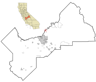
Friant is a census-designated place (CDP) in Fresno County, California, United States. The population was 549 at the 2010 census, down from 778 at the 2000 census. Friant is located 11.5 miles (19 km) north of Clovis, at an elevation of 344 feet.

<span class="mw-page-title-main">San Joaquin River</span> Longest river of Central California, United States

The San Joaquin River is the longest river of Central California. The 366-mile (589 km) long river starts in the high Sierra Nevada, and flows through the rich agricultural region of the northern San Joaquin Valley before reaching Suisun Bay, San Francisco Bay, and the Pacific Ocean. An important source of irrigation water as well as a wildlife corridor, the San Joaquin is among the most heavily dammed and diverted of California's rivers.

<span class="mw-page-title-main">Roeding Park</span> Park in Fresno, California

Roeding Park is a 90-acre (360,000 m2) regional city park in Fresno, California established in 1903 via a gift from the Roeding family.

<span class="mw-page-title-main">Friant Dam</span> Dam in Madera/Fresno Counties, California

Friant Dam is a concrete gravity dam on the San Joaquin River in central California in the United States, on the boundary of Fresno and Madera Counties. It was built between 1937 and 1942 as part of a U.S. Bureau of Reclamation (USBR) water project to provide irrigation water to the southern San Joaquin Valley. The dam impounds Millerton Lake, a 4,900-acre (2,000 ha) reservoir about 15 miles (24 km) north of Fresno.

<span class="mw-page-title-main">Yokuts</span> Ethnic group native to the United States

The Yokuts are an ethnic group of Native Americans native to central California. Before European contact, the Yokuts consisted of up to 60 tribes speaking several related languages. Yokuts is both plural and singular; Yokut, while common, is erroneous. 'Yokut' should only be used when referring specifically to the Tachi Yokut Tribe of Lemoore. Some of their descendants prefer to refer to themselves by their respective tribal names; they reject the term Yokuts, saying that it is an exonym invented by English-speaking settlers and historians. Conventional sub-groupings include the Foothill Yokuts, Northern Valley Yokuts, and Southern Valley Yokuts.

<span class="mw-page-title-main">Millerton Lake</span> Reservoir in Fresno and Madera counties, California

Millerton Lake is an artificial lake near the town of Friant, about 15 mi (24 km) north of downtown Fresno, California, United States. The reservoir was created by the construction of 319 ft high Friant Dam on the San Joaquin River which, with the lake, serves as much of the county line between Fresno County to the south and Madera County to the north.

Cassons or Casson is the name of a Yokuts Native American tribe in central eastern California. The Cassons are also called the Gashowu. The Casson Yokuts territory extended from the eastern side of San Joaquin Valley floor eastward to the upper foothills, between the San Joaquin River to the north and Kings River to south. The Cassons signed the Camp Barbour Treaty under Tom-quit, on the San Joaquin River, state of California, April 19, 1851. The treaty was signed by several Yokuts tribes and between Redick McKee, George W. Barbour, and O. M. Wozencraft, commissioners on the part of the United States of America. Casson Yokuts territory included Madera County and parts of Fresno County. The three chiefs who signed for the Cassons were Domingo Perez, Tom-mas and Jose Antonio. Many Native Californians had acquired Spanish names during the Mission Period. The Cassons, like other Yokuts, and central California Native groups, were pushed from their homes in the San Joaquin Valley to reservations after they signed several treaties, including the Camp Barbour Treaty. The Barbour Treaty, Fremont Treaty and other California treaties were never ratified. Several Casson Yokuts families went to work for Yosemite in the early 1900s. Like the surrounding tribes, the Mono Paiutes and the Miwoks, they resided there half year and returned to their tribal areas. Later in the late 1920s, Yosemite National Park built homes for their Native American workers.

<span class="mw-page-title-main">Millerton, Madera County, California</span> Former settlement in California, United States

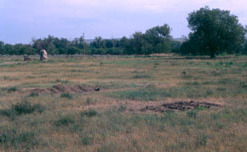
Millerton was a settlement located on the San Joaquin River and was the original county seat of Fresno County. Millerton was populated from about 1853 to the 1880s and is now inundated by the waters of Millerton Lake.

<span class="mw-page-title-main">Fort Martin Scott</span> United States historic place

Fort Martin Scott is a restored United States Army outpost near Fredericksburg in the Texas Hill Country, United States, that was active from December 5, 1848, until April, 1853. It was part of a line of frontier forts established to protect travelers and settlers within Texas.

Herndon is an unincorporated community in Fresno County, California. It is located 9 miles (14 km) northwest of downtown Fresno, at an elevation of 299 feet.

Visalia, California, commonly known in the 1850s as Four Creeks, is the oldest continuously inhabited inland European settlement between Stockton and Los Angeles. The city played an important role in the American colonization of the San Joaquin Valley as the county seat of Old Tulare County, an expansive region comprising most if not all of modern-day Fresno, Kings, and Kern counties.

Pacific Division of the U. S. Army was one of its superior administrative organizations that existed during the early 19th century and for a short time in the early 20th century.

The Stockton–Los Angeles Road, also known as the Millerton Road, Stockton–Mariposa Road, Stockton–Fort Miller Road or the Stockton–Visalia Road, was established about 1853 following the discovery of gold on the Kern River in Old Tulare County. This route between Stockton and Los Angeles followed by the Stockton–Los Angeles Road is described in "Itinerary XXI. From Fort Yuma to Benicia, California", in The Prairie Traveler: A Hand-book for Overland Expeditions by Randolph Barnes Marcy. The Itinerary was derived from the report of Lieutenant R. S. Williamson on his topographical survey party in 1853, that was in search of a railroad route through the interior of California.

Tejon Creek, originally in Spanish Arroyo de Tejon, is a stream in Kern County, California. Its headwaters are located on the western slopes of the Tehachapi Mountains, and it flows northwest into the southern San Joaquin Valley.

<span class="mw-page-title-main">Temperance Flat Dam</span> Dam in near Auberry, California

Temperance Flat Dam is a proposed dam project on the San Joaquin River west of Auberry, California. Construction of the dam is on hold. The dam's main purpose would be to supplement storage capacity in the upper San Joaquin River basin. Under the current proposal, Temperance Flat would slightly more than double water storage on the San Joaquin River from below Friant Dam. The project is highly controversial because it would flood scenic canyons and historic sites along the San Joaquin River, and impact upstream hydroelectricity generation. The Bureau of Reclamation estimates the construction costs will be between US$2.5 billion and $2.6 billion, while other estimates range from $2.96 billion up to $3.35 billion. At 665 feet (203 m), Temperance Flat Dam would be the second highest dam in California, and the fifth tallest dam in the United States.

The following is a timeline of the history of the city of Fresno, California, USA.

<span class="mw-page-title-main">Fresno County Superior Court</span> Branch of California superior court with jurisdiction over Fresno Country

The Superior Court of California, County of Fresno, also known as the Fresno County Superior Court, is the branch of the California superior court with jurisdiction over Fresno County.

<span class="mw-page-title-main">Blockhouse on Signal Mountain (Oklahoma)</span> Blockhouse on Signal Mountain in Southwest Oklahoma

Blockhouse on Signal Mountain is within the Fort Sill Military Reservation, north of Lawton, Oklahoma. The rock architecture is located along Mackenzie Hill Road within the Fort Sill West Range being the Oklahoma administrative division of Comanche County.

References

  1. 1 2 3 U.S. Geological Survey Geographic Names Information System: Fort Miller, California
  2. "Fort Miller". Office of Historic Preservation, California State Parks. Retrieved October 7, 2012.
  3. 1 2 Giffen, Helen S. (April 1, 1963). "Fort Miller - A Memory of the San Joaquin". Journal of the West. 2 (2): 205–212.
  4. "Pioneer Days in Fresno County". The Fresno Bee The Republican. October 3, 1937. p. 48. Retrieved November 17, 2014 via Newspapers.com. Open Access logo PLoS transparent.svg
  5. Frazer, Robert Walter (1965). Forts of the West: Military Forts and Presidios, and Posts Commonly Called Forts West of the Mississippi River to 1898. University of Oklahoma Press. pp. 26–27. ISBN   9780806112503.
  6. Patterson, William K. (October 22, 1978). "Rough-hewn log building all that's left of old Fort Miller". Fresno Bee. p. B6. Retrieved January 3, 2023 via Newspapers.com.
  7. 1 2 3 Clough, Charles W.; Secrest, William B.; Temple, Bobbye Sisk (1984). Fresno County: The pioneer years, from the beginning to 1900. Fresno, California: Panorama West Books. ISBN   9780914330707. OCLC   11661147.
  8. 1 2 "Historic California Posts: Fort Miller (including Camp Barbour, Camp Miller)". The California State Military Museum. 1965. Archived from the original on July 2, 2022. Retrieved January 3, 2023.
  9. McCarthy, Charles (December 22, 1997). "Fort Miller to rise again". Fresno Bee. p. A1. Retrieved January 3, 2023 via Newspapers.com.