Bridgeport, California | |
|---|---|
 Main Street | |
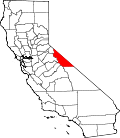
 Location in Mono County and the state of California | |
 Bridgeport  Bridgeport | |
| Coordinates: 38°15′02″N119°13′53″W / 38.25056°N 119.23139°W | |
| Country | United States |
| State | California |
| County | Mono |
| Area | |
• Total | 21.75 sq mi (56.33 km2) |
| • Land | 21.74 sq mi (56.31 km2) |
| • Water | 0.0077 sq mi (0.02 km2) 0.04% |
| Elevation | 6,598 ft (2,011 m) |
| Population | |
• Total | 553 |
| • Density | 25.4/sq mi (9.8/km2) |
| Time zone | UTC-8 (Pacific) |
| • Summer (DST) | UTC-7 (PDT) |
| ZIP code | 93517 |
| Area codes | 760/442 |
| GNIS feature IDs | 2582950 [2] |
Bridgeport is an unincorporated community and census-designated place (CDP) [2] in Mono County, California, United States. [4] It is the county seat of Mono County. The population was 553 at the 2020 census. [3]
Contents
- Geography
- Demographics
- 2020 census
- Tourism
- Climate
- Politics
- State
- Federal
- Native Americans
- Education
- Appearances in popular culture
- References
- External links
The first post office at Bridgeport opened in 1864. [5] The ZIP code is 93517, and the community is in area codes 760 and 442.