Wheeler Crest, California

Last updated

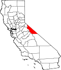
Wheeler Crest is a small residential unincorporated community in southwestern Mono County, California. It functions as a bedroom community for workers in Bishop and Mammoth Lakes, and as a home for retirees. [1] Geographically, it sits on the Sherwin Grade, which divides Round Valley in Inyo County from Long Valley in Mono County. [1]

Unincorporated area Region of land not governed by own local government

In law, an unincorporated area is a region of land that is not governed by a local municipal corporation; similarly an unincorporated community is a settlement that is not governed by its own local municipal corporation, but rather is administered as part of larger administrative divisions, such as a township, parish, borough, county, city, canton, state, province or country. Occasionally, municipalities dissolve or disincorporate, which may happen if they become fiscally insolvent, and services become the responsibility of a higher administration. Widespread unincorporated communities and areas are a distinguishing feature of the United States and Canada. In most other countries of the world, there are either no unincorporated areas at all, or these are very rare; typically remote, outlying, sparsely populated or uninhabited areas.

Mono County, California County in California, United States

Mono County (MOH-noh) is a county located in the east central portion of the U.S. state of California. As of the 2010 census, the population was 14,202. making it the fifth-least populous county in California. The county seat is Bridgeport. The county is located east of the Sierra Nevada between Yosemite National Park and Nevada.

Bishop, California City in California, United States

Bishop is a city in Inyo County, California, United States. Though Bishop is the only incorporated city and the largest populated place in Inyo County, the county seat is located in Independence. Bishop is located near the northern end of the Owens Valley, at an elevation of 4,150 feet (1,260 m). The town was named after Bishop Creek, flowing out of the Sierra Nevada; the creek was named after Samuel Addison Bishop, a settler in the Owens Valley. Located near numerous tourist attractions, Bishop is a major resort town; the town is a commercial and residential center, while many vacation destinations in the Sierra Nevada are located nearby.

Contents

Demographics

The 2000 United States Census reported the population of Wheeler Crest to be 196. [1] For 2003, the California Department of Finance estimated the population to be 200. [1] In 2000, 6% of the population was under 5 years old, 70% were from 18 to 64, and 11% were over 65. [1] The median age was 51. [1] Ninety-five percent of the households were owner occupied and 5% were rented. [1] Under the current Mono County General Plan, the 116 developed parcels could be augmented by another 391 housing units. [1]

Fire Protection District

Wheeler Crest is the seat of the Wheeler Crest Fire Protection District, which was established in 1982. [1] This District covers an area of approximately 4 square miles (10 km2). [1]

Related Research Articles

Calaveras County, California County in California

Calaveras County, officially the County of Calaveras, is a county in the northern portion of the U.S. state, California. As of the 2010 census, the population was 40,171. The county seat is San Andreas. Angels Camp is the only incorporated city in the county. Calaveras is the Spanish word for skulls; the county was reportedly named for the remains of Native Americans discovered by the Spanish explorer Captain Gabriel Moraga.

San Bernardino County, California County in California, United States

San Bernardino County, officially the County of San Bernardino, is a county located in the southern portion of the U.S. state of California, and is located within the Inland Empire area. As of the 2010 U.S. Census, the population was 2,035,210, making it the fifth-most populous county in California and the 14th-most populous in the United States. The county seat is San Bernardino.

Madera County, California County in California, United States

Madera County, officially the County of Madera, is a county at the geographic center of the U.S. state of California. As of the 2010 census, the population was 150,865. The county seat is Madera.

Tuolumne County, California County in California, United States

Tuolumne County, officially the County of Tuolumne, is a county in the U.S. state of California. As of the 2010 census, the population was 53,226. The county seat and only incorporated city is Sonora.

La Palma, California City in California, United States

La Palma is a city in Orange County, California, United States. The population was 15,568 at the 2010 Census, up from 15,408 at the 2000 census.

Wheeler Peak may refer to the following United States summits:

Sherwin Range

The Sherwin Range is a mountain range that is a sub-range of the Sierra Nevada system, in Mono County, eastern California. The range is also known locally as The Sherwins.

Coleville, California Census-designated place in California, United States

Coleville is a census-designated place in Mono County, California. It is located in the Antelope Valley on the West Walker River 26 miles (42 km) northwest of Bridgeport, at an elevation of 5141 feet (1567 m). The population was 495 at the 2010 census.

Central California Place in California, United States

Central California is a subregion of Northern California, generally thought of as the middle third of the state, north of Southern California. It includes the northern portion of the San Joaquin Valley, the Central Coast, the central hills of the California Coast Ranges, and the foothills and mountain areas of the central Sierra Nevada.

San Ramon Valley Fire Protection District

The San Ramon Valley Fire Protection District provides fire protection and emergency medical services for cities of Alamo, Blackhawk, Danville, Diablo and San Ramon as well as southern areas of the Morgan Territory in California, United States. In all, the district is responsible for 155 square miles (400 km2) with a population of approximately 169,900.

Havilah, California Unincorporated community in California, United States

Havilah is an unincorporated community in Kern County, California. It is located in the mountains between Walker Basin and the Kern River Valley, 5 miles (8.0 km) south-southwest of Bodfish at an elevation of 3,136 feet (956 m).

Mono City, California census-designated place in California, United States

Mono City is a census-designated place in Mono County, California. It lies north of Mono Lake at the base of the Sierra Nevada mountains at the junction of U.S. Route 395 and California State Route 167, at an elevation of 6768 feet. The ZIP Code is 93541, mail to Mono City should be addressed Lee Vining. The population was 172 at the 2010 census, down from 177 as of 2000 as reported by Mono County.

Topaz, California census-designated place in California, United States

Topaz is a census-designated place in Mono County, California. It is located 3 miles (5 km) north of Coleville, at an elevation of 5033 feet. Topaz's ZIP Code is 96133. The population was 50 at the 2010 census.

Walker, Mono County, California census-designated place in California, United States

Walker is a census-designated place in Mono County, California. It is located 3 miles (4.8 km) south of Coleville, at an elevation of 5403 feet. The ZIP Code is 96107, and mail to Walker should be addressed Coleville. The town was likely named for pioneer Joseph R. Walker, who started his ascension of the Sierra Nevada range in nearby Bridgeport. The population was 721 at the 2010 census, up from 558 as of 2000, according to the Mono County's government website.

Wheeler Crest

The Wheeler Crest or Wheeler Ridge is a ridge in Mono and Inyo Counties, California. The crest is 8 miles (13 km) long, and partially lies in the John Muir Wilderness. The ridge is bound on the west by Rock Creek, on the north by the community of Toms Place, on the east by Round Valley, on the southeast by Gable Creek, and on the southwest by Morgan Creek.

Paradise, Mono County, California Census-designated place in California, United States

Paradise is a census-designated place that is the southernmost community in Mono County, California. Located in the southwest part of the county, Paradise functions as a bedroom community for workers in Bishop and Mammoth Lakes, and as a home for retirees. Geographically, it sits near the bottom of the Sherwin Grade, which divides Round Valley in Inyo County from Long Valley in Mono County. Neighboring communities include Wheeler Crest to the west, Swall Meadows and Pinon Ranch to the north. The population was 153 at the 2010 census.

Antelope Valley (California-Nevada) valley in Nevada, United States of America

The Antelope Valley is a high valley in the eastern Sierra Nevada stretching from Mono County, California to Douglas County, Nevada.

Bishop Paiute Tribe

The Bishop Paiute Tribe, formerly known as the Paiute-Shoshone Indians of the Bishop Community of the Bishop Colony is a federally recognized tribe of Mono and Timbisha Indians of the Owens Valley, in Inyo County of eastern California. As of the 2010 Census the population was 1,588.

The Paiute-Shoshone Indians of the Lone Pine Community of the Lone Pine Reservation is a federally recognized tribe of Mono and Timbisha Native American Indians near Lone Pine in Inyo County, California. They are related to the Owens Valley Paiute.

Owens River course river in United States of America

The Owens River course includes headwaters points near the Upper San Joaquin Watershed, reservoirs and diversion points, and the river's mouth at Owens Lake. The river drains the Crowley Lake Watershed of 1,900 sq mi (4,900 km2) and the north portion of the Owens Lake Watershed of 1,340 sq mi (3,500 km2).

References

  1. 1 2 3 4 5 6 7 8 9 10 "Report of the Mono County Planning Department regarding the Wheeler Crest Fire Protection District" (PDF). Archived from the original (PDF) on 2009-06-21. Retrieved 2009-06-25.

Coordinates: 37°30′35″N118°38′18″W / 37.50972°N 118.63833°W / 37.50972; -118.63833

Geographic coordinate system Coordinate system

A geographic coordinate system is a coordinate system that enables every location on Earth to be specified by a set of numbers, letters or symbols. The coordinates are often chosen such that one of the numbers represents a vertical position and two or three of the numbers represent a horizontal position; alternatively, a geographic position may be expressed in a combined three-dimensional Cartesian vector. A common choice of coordinates is latitude, longitude and elevation. To specify a location on a plane requires a map projection.