Twin Lakes | |
|---|---|
 Twin Lakes  Twin Lakes | |
| Coordinates: 38°9′56″N119°19′36″W / 38.16556°N 119.32667°W | |
| Country | United States |
| State | California |
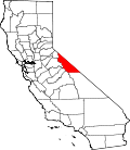
| County | Mono |
| Area | |
• Total | 5.22 sq mi (13.52 km2) |
| • Land | 4.17 sq mi (10.80 km2) |
| • Water | 1.05 sq mi (2.72 km2) 20.1% |
| Elevation | 7,090 ft (2,160 m) |
| Population (2020) [3] | |
• Total | 45 |
| • Density | 11/sq mi (4.2/km2) |
| Time zone | UTC-8 (Pacific (PST)) |
| • Summer (DST) | UTC-7 (PDT) |
| ZIP Code | 93517 (Bridgeport) |
| Area codes | 442/760 |
| FIPS code | 06-81048 |
| GNIS feature ID | 2804105 [2] |
Twin Lakes is an unincorporated community and census-designated place (CDP) in Mono County, California, United States. It is located on the east side of the Sierra Nevada, encompassing the lakes of the same name and extending north down the outlet valley of Robinson Creek. The area is part of Toiyabe National Forest and is 10 miles (16 km) southwest of Bridgeport. It was first listed as a CDP for the 2020 census, with a population of 45. [3]
Contents
Mono Village Resort is part of the community. The resort attracts hundreds of fishermen and outdoor enthusiasts every year. [4]
The main tourist attraction of the settlement is the two lakes known as Twin Lakes. Both of these lakes are filled with water from Robinson's Creek which flows down from the top of the mountains and ends at the Bridgeport Reservoir. Both lakes have boat access and the Upper Twin allows for water sports. The area has trailheads for many backcountry hiking trails. The settlement is on the back side of Yosemite which makes it attractive to expert backpackers and horseback tours.