Mono City, California

Last updated

Mono City, California
Mono City, California.jpg
Mono City from a distance
Mono County California Incorporated and Unincorporated areas Mono City Highlighted 0648602.svg
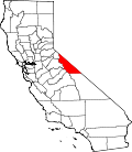
Location in Mono County and the state of California
USA California location map.svg
Red pog.svg
Mono City
Usa edcp location map.svg
Red pog.svg
Mono City
Coordinates: 38°02′27″N119°08′41″W / 38.04083°N 119.14472°W / 38.04083; -119.14472
Country United States
State California
County Mono
Area
[1]
  Total7.84 sq mi (20.30 km2)
  Land7.84 sq mi (20.30 km2)
  Water0 sq mi (0 km2)
Elevation
[2]
6,762 ft (2,061 m)
Population
 (2020) [3]
  Total224
  Density29/sq mi (11/km2)
Time zone UTC-8 (Pacific (PST))
  Summer (DST) UTC-7 (PDT)
ZIP Code
93541 (Lee Vining)
Area code(s) 760; 442
GNIS feature ID2583083 [2]

Mono City is an unincorporated community and census-designated place (CDP) [2] in Mono County, California, United States. It lies north of Mono Lake at the base of the Sierra Nevada at the junction of U.S. Route 395 and California State Route 167. [4] The ZIP Code is 93541; mail to Mono City should be addressed Lee Vining. [5] The population was 224 at the 2020 census, [6] up from 172 at the 2010 census.

Contents

Geography

Mono City is in western Mono County. US 395 leads north 19 miles (31 km) to Bridgeport, the county seat, and south 32 miles (51 km) to Mammoth Lakes. State Route 167 leads east across the Mono Valley 21 miles (34 km) to the Nevada border.

According to the United States Census Bureau, the CDP covers an area of 7.8 square miles (20 km2), of it land. [1]

Demographics

2010

The 2010 United States Census [7] reported that Mono City had a population of 172. The population density was 31.7 inhabitants per square mile (12.2/km2). The racial makeup of Mono City was 156 (90.7%) White, 0 (0.0%) African American, 1 (0.6%) Native American, 2 (1.2%) Asian, 0 (0.0%) Pacific Islander, 2 (1.2%) from other races, and 11 (6.4%) from two or more races. Hispanic or Latino of any race were 37 persons (21.5%).

The Census reported that 172 people (100% of the population) lived in households, 0 (0%) lived in non-institutionalized group quarters, and 0 (0%) were institutionalized.

There were 63 households, out of which 21 (33.3%) had children under the age of 18 living in them, 44 (69.8%) were opposite-sex married couples living together, 1 (1.6%) had a female householder with no husband present, 3 (4.8%) had a male householder with no wife present. There were 6 (9.5%) unmarried opposite-sex partnerships, and 0 (0%) same-sex married couples or partnerships. 8 households (12.7%) were made up of individuals, and 2 (3.2%) had someone living alone who was 65 years of age or older. The average household size was 2.73. There were 48 families (76.2% of all households); the average family size was 2.94.

The population was spread out, with 41 people (23.8%) under the age of 18, 7 people (4.1%) aged 18 to 24, 48 people (27.9%) aged 25 to 44, 61 people (35.5%) aged 45 to 64, and 15 people (8.7%) who were 65 years of age or older. The median age was 41.0 years. For every 100 females, there were 91.1 males. For every 100 females age 18 and over, there were 95.5 males.

There were 94 housing units at an average density of 17.3 per square mile (6.7/km2), of which 45 (71.4%) were owner-occupied, and 18 (28.6%) were occupied by renters. The homeowner vacancy rate was 0%; the rental vacancy rate was 0%. 126 people (73.3% of the population) lived in owner-occupied housing units and 46 people (26.7%) lived in rental housing units.

2000

The 2000 United States Census reported the population of Mono City to be 126. [4] In 2000, 8.7% of the population was under 5 years old, 13% were from 5 to 17, 68% were from 18 to 64, and 8.7% were over 65. [4] Seventy-nine percent of the households were owner occupied and 21% were rented. [4] The California Department of Finance projects the population to increase to 159 by 2020 and to 171 in 2030. [4]

Fire protection district

Mono City is the seat of the Mono City Fire Protection District, which was established in 1972. [4] The fire protection district covers an area of approximately 0.7 square miles (1.8 km2). [4]

Related Research Articles

<span class="mw-page-title-main">Auberry, California</span> Census-designated place in California, United States

Auberry is a census-designated place (CDP) in Fresno County, California, United States. The population was 2,369 at the 2010 census, up from 2,053 at the 2000 census. Auberry is located on Little Sandy Creek 9.5 miles (15 km) west of Shaver Lake Heights, at an elevation of 2,018 feet (615 m).

<span class="mw-page-title-main">Raisin City, California</span> Census-designated place in California, United States

Raisin City is a census-designated place (CDP) in Fresno County, California, United States. The population was 380 at the 2010 census, up from 165 at the 2000 census. Raisin City is located 13 miles (21 km) south-southwest of downtown Fresno, at an elevation of 236 feet.

<span class="mw-page-title-main">Golden Hills, California</span> Census-designated place in California, United States

Golden Hills is a census-designated place (CDP) in the Tehachapi Mountains, in Kern County, California, United States. The population was 8,656 at the 2010 census, up from 7,434 at the 2000 census. Golden Hills adjoins the city of Tehachapi on the west.

<span class="mw-page-title-main">Johannesburg, California</span> Census-designated place in California, United States

Johannesburg is a census-designated place (CDP) in Kern County, California, in a mining district of the Rand Mountains. Johannesburg is located 1 mile (1.6 km) east-northeast of Randsburg, at an elevation of 3,517 feet (1,072 m). The terminus of the Randsburg Railway was here from 1897 to 1933. The population was 172 at the 2010 census, down from 176 at the 2000 census. Johannesburg is divided from the neighboring community of Randsburg by a ridge. The town is frequently referred to as "Jo-burg" by locals and frequent visitors to the northwest Mojave.

<span class="mw-page-title-main">East San Gabriel, California</span> Census-designated place in California, United States

East San Gabriel is a census-designated place (CDP) in Los Angeles County, California, United States. The population was 14,874 at the 2010 census, up from 14,512 at the 2000 census.

<span class="mw-page-title-main">West Rancho Dominguez, California</span> Unincorporated community in California, United States

West Rancho Dominguez, formerly known as West Compton and also known as East Gardena, is an unincorporated census-designated place (CDP) located in southern Los Angeles County, California. Per the 2020 census, the population was 24,347. The community lies to the west of the city of Compton. The ZIP Codes encompassing the CDP area are 90220 & 90248.

<span class="mw-page-title-main">North Auburn, California</span> Census-designated place in California, United States

North Auburn is a census-designated place (CDP) in Placer County, California, United States. It is part of the Sacramento–Arden-Arcade–Roseville Metropolitan Statistical Area. The population was 13,452 at the 2020 census.

<span class="mw-page-title-main">Lake Nacimiento, California</span> Census-designated place in California, United States

Lake Nacimiento is a census-designated place (CDP) in northern San Luis Obispo County, California, United States.

<span class="mw-page-title-main">Mono Vista, California</span> Census-designated place in California, United States

Mono Vista is a census-designated place (CDP) in Tuolumne County, California, United States. The population was 3,127 at the 2010 census, up from 3,072 at the 2000 census.

<span class="mw-page-title-main">Coleville, California</span> Census-designated place in California, United States

Coleville is an unincorporated community and census-designated place (CDP) in Mono County, California, United States. It is located at an elevation of 5,141 feet (1,567 m) in the Antelope Valley on the West Walker River. The population was 419 at the 2020 census, down from 495 at the 2010 census.

<span class="mw-page-title-main">Swall Meadows, California</span> Census-designated place in California, United States

Swall Meadows is an unincorporated community and census-designated place (CDP) in southern Mono County, California, United States. The population was 178 as of the 2020 census. The community is residential, including second homes and a volunteer fire department, but no commercial development. The ZIP Code is 93514. The community is inside area code 760.

<span class="mw-page-title-main">La Vina, California</span> Census-designated place in California, United States

La Vina is a census-designated place in Madera County, California, United States. It is located 8 miles (13 km) by road south-southwest of Madera, at an elevation of 230 feet (70 m). The population was 637 at the 2020 census, up from 279 in 2010.

<span class="mw-page-title-main">Aspen Springs, California</span> Census-designated place in California, United States

Aspen Springs is an unincorporated community and census-designated place (CDP) in Mono County, California, United States. It lies at an elevation of 7,109 feet (2,167 m). The population was 70 at the 2020 census.

<span class="mw-page-title-main">Topaz, California</span> Census-designated place in California, United States

Topaz is an unincorporated community and census-designated place (CDP) in Mono County, California, United States. It is located 3 miles (5 km) north of Coleville. Topaz's ZIP Code is 96133. The population was 150 at the 2020 census.

<span class="mw-page-title-main">Walker, Mono County, California</span> Census-designated place in California, United States

Walker is an unincorporated community and census-designated place (CDP) in Mono County, California, United States. It is located 3 miles (5 km) south of Coleville. The ZIP Code is 96107, and mail to Walker should be addressed Coleville.

<span class="mw-page-title-main">Paradise, Mono County, California</span> Census-designated place in California, United States

Paradise is an unincorporated community and census-designated place (CDP) that is the southernmost community in Mono County, California, United States. The population was 174 at the 2020 census.

McSwain is an unincorporated community and census-designated place (CDP) in Merced County, California, United States. McSwain sits at an elevation of 144 feet (44 m). As of the 2020 census, the population was 4,480, up from 4,171 in 2010.

<span class="mw-page-title-main">Sunny Slopes, California</span> Census-designated place in California, United States

Sunny Slopes is an unincorporated community and census-designated place (CDP) in Mono County, California, United States. It sits at an elevation of 7,198 feet (2,194 m). As of the 2020 census, the population was 139, down from 182 in 2010.

<span class="mw-page-title-main">McGee Creek, California</span> Census-designated place in California, United States

McGee Creek is an unincorporated community and census-designated place (CDP) in Mono County, California, United States. The community as of the 2020 census the population was 45.

Pine Canyon is an unincorporated community and census-designated place (CDP) in Monterey County, California, just south of King City. Pine Canyon sits at an elevation of 515 feet (157 m). As of the 2020 census, the population was 1,871.

References

  1. 1 2 "2022 U.S. Gazetteer Files: California". United States Census Bureau. Retrieved November 3, 2022.
  2. 1 2 3 U.S. Geological Survey Geographic Names Information System: Mono City, California
  3. "US Census Bureau". www.census.gov. Retrieved August 21, 2024.
  4. 1 2 3 4 5 6 7 Report of the Mono County Planning Department regarding the Mono City Fire Protection District Archived 2009-06-21 at the Wayback Machine
  5. USPS online look up Archived 2008-01-01 at the Wayback Machine
  6. "P1. Race – Mono City CDP, California: 2020 DEC Redistricting Data (PL 94-171)". U.S. Census Bureau. Retrieved November 3, 2022.
  7. "2010 Census Interactive Population Search: CA - Mono City CDP". U.S. Census Bureau. Archived from the original on July 15, 2014. Retrieved July 12, 2014.