Auburn, California

Last updated

Auburn, California
City of Auburn
2009-0724-CA-OldTownAuburn.jpg
Auburn
Placer County California Incorporated and Unincorporated areas Auburn Highlighted 0603204.svg
Location of Auburn in Placer County, California
USA California location map.svg
Red pog.svg
Auburn
Location in California
Usa edcp location map.svg
Red pog.svg
Auburn
Auburn (the United States)
North America laea location map.svg
Red pog.svg
Auburn
Auburn (North America)
Coordinates: 38°53′55″N121°4′28″W / 38.89861°N 121.07444°W / 38.89861; -121.07444
Country United States
State California
County Placer
Incorporated May 2, 1888 [1]
Government
  Type Council–manager [2]
   Mayor Alice Dowdin Calvillo [3]
   State Senator Brian Dahle (R) [4]
   State Assembly [5] Megan Dahle (R) and
Joe Patterson (R)
   House of Representatives [6] Doug LaMalfa (R) and
Mike Thompson (D) [7]
Area
[8]
   City 7.20 sq mi (18.66 km2)
  Land7.18 sq mi (18.59 km2)
  Water0.03 sq mi (0.07 km2)  0.38%
Elevation
[9]
1,227 ft (374 m)
Population
 (2020)
   City 13,776
  Density1,919.46/sq mi (741.10/km2)
   Metro
est. ~19,500 (including Foresthill Applegate and Meadow Vista)
Time zone UTC−8 (Pacific Time Zone)
  Summer (DST) UTC−7 (PDT)
ZIP codes
95602-95604
Area code 530
FIPS code 06-03204
GNIS feature IDs 1657964, 2409754
Website auburn.ca.gov
U.S. Geological Survey Geographic Names Information System: Auburn, California

Auburn is a city in and the county seat of Placer County, California, United States. [10] Its population was 13,776 during the 2020 census. Auburn is known for its California Gold Rush history and is registered as a California Historical Landmark. [11]

Contents

Auburn is part of the Sacramento metropolitan area.

History

Placer County Courthouse was constructed between 1894 and 1898. Auburn California courthouse.jpg
Placer County Courthouse was constructed between 1894 and 1898.

Archaeological finds place the southwestern border for the prehistoric Martis people in the Auburn area. [12] The indigenous Nisenan, an offshoot of the Maidu, were the first to establish a permanent settlement in the Auburn area.

In the spring of 1848, a group of French gold miners arrived and camped in what would later be known as the Auburn Ravine. This group was on its way to the gold fields in Coloma, California, and it included Francois Gendron, Philibert Courteau, and Claude Chana. The young Chana discovered gold on May 16, 1848. After finding the gold deposits in the soil, the trio decided to stay for more prospecting and mining.

Placer mining in the Auburn area was very good, with the camp first becoming known as the North Fork Dry Diggings. This name was changed to the Woods Dry Diggings, after John S. Wood settled down, built a cabin, and started to mine in the ravine. The area soon developed into a mining camp, and it was officially named Auburn in August 1849, by miners from Auburn, New York. [13] By 1850, the town's population had grown to about 1,500 people, and in 1851, Auburn was chosen as the seat of Placer County. Gold mining operations moved up the ravine to the site of present-day Auburn. In 1865, the Central Pacific Railroad, the western leg of the First transcontinental railroad, reached Auburn, as it was being built east from Sacramento toward Ogden, Utah.

The restored Old Town has houses and retail buildings from the middle of the 19th century. The oldest fire station and the Post Office date from the Gold Rush years. Casual gold-mining accessories, as well as American Indian and Chinese artifacts, can also be viewed by visitors at the Placer County Museum. Auburn was the home and birthplace of noted science fiction and fantasy poet and writer Clark Ashton Smith. A memorial to him is located near Old Town.
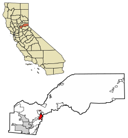
Geography

Rolling hills of Auburn, taken near Indian Hill Road Auburn-ca-geography.jpg
Rolling hills of Auburn, taken near Indian Hill Road

Auburn is located at 38°53′55″N121°04′28″W / 38.898671°N 121.074399°W / 38.898671; -121.074399 . [14]

According to the United States Census Bureau, the city has a total area of 7.2 square miles (19 km2), of which 0.03 square miles (0.078 km2), or 0.38%, is water.

Auburn is situated in the Northern California foothills of the Sierra Nevada range, approximately 800 vertical feet above the confluence of the North Fork and Middle Fork of the American River. It is located between Sacramento and Reno, Nevada, along Interstate 80. Mountainous wilderness canyons and the western slope of the Sierra Nevada lie adjacent eastward, while gentle rolling foothills well-suited for agriculture lie to the west. The crest of the Sierra Nevada lies approximately 45 miles (72 km) eastward, and the Central Valley lies approximately ten miles to the west.

Climate

Auburn has a hot-summer Mediterranean climate (Köppen Csa) that is characterized by cool, moist winters and hot, dry summers. Average December temperatures are a maximum of 55.8 °F (13.2 °C) and a minimum of 37.2 °F (2.9 °C). Average July temperatures are a maximum of 92.7 °F (33.7 °C) and a minimum of 63.4 °F (17.4 °C). Annually, there are an average of 62.9 days with highs of 90 °F (32 °C) or higher, an average of 7.3 days with 100 °F (38 °C) or higher, and an average of 19.6 days with 32 °F (0 °C) or lower. [15] The record high temperature was 113 °F (45 °C) on July 15, 1972. The record low temperature was 5 °F (−15 °C) on December 9, 2013. [16]

Average annual precipitation is 36.12 inches (917 mm). There are an average of 67 days with measurable precipitation. The wettest year was 1983 with 64.87 inches (1,648 mm) and the driest year was 1976 with 11.76 inches (299 mm). The most precipitation in one month was 23.08 inches (586 mm) in January 1909. The most precipitation in 24 hours was 5.41 inches (137 mm) on October 13, 1962, [16] during the Columbus Day Storm. Snow rarely falls in Auburn; the most snowfall in one year was 10.7 inches (27 cm) in 1972, including 6.5 inches (17 cm) in January of that year. [17]

Auburn's Köppen classification and climate similarities to locations such as Napa, California, and parts of Italy make it a suitable region for growing wine grapes. Auburn and the surrounding areas of Placer County are home to over 20 wineries. [18]

Climate data for Auburn, California, 1991–2020 normals, extremes 1905–present
MonthJanFebMarAprMayJunJulAugSepOctNovDecYear
Record high °F (°C)81
(27)
78
(26)
93
(34)
92
(33)
102
(39)
110
(43)
113
(45)
111
(44)
109
(43)
104
(40)
89
(32)
80
(27)
113
(45)
Mean maximum °F (°C)65.3
(18.5)
69.5
(20.8)
75.3
(24.1)
82.0
(27.8)
89.8
(32.1)
97.8
(36.6)
100.9
(38.3)
100.7
(38.2)
96.4
(35.8)
88.2
(31.2)
75.8
(24.3)
65.0
(18.3)
102.8
(39.3)
Mean daily maximum °F (°C)56.3
(13.5)
59.4
(15.2)
63.1
(17.3)
68.1
(20.1)
76.9
(24.9)
85.7
(29.8)
92.7
(33.7)
92.0
(33.3)
86.8
(30.4)
76.9
(24.9)
63.8
(17.7)
55.8
(13.2)
73.1
(22.8)
Daily mean °F (°C)47.1
(8.4)
49.7
(9.8)
52.7
(11.5)
56.4
(13.6)
64.2
(17.9)
71.6
(22.0)
78.1
(25.6)
77.4
(25.2)
73.2
(22.9)
64.3
(17.9)
53.4
(11.9)
46.5
(8.1)
61.2
(16.2)
Mean daily minimum °F (°C)37.8
(3.2)
40.0
(4.4)
42.3
(5.7)
44.8
(7.1)
51.5
(10.8)
57.5
(14.2)
63.4
(17.4)
62.8
(17.1)
59.5
(15.3)
51.6
(10.9)
43.1
(6.2)
37.2
(2.9)
49.3
(9.6)
Mean minimum °F (°C)28.7
(−1.8)
31.6
(−0.2)
33.9
(1.1)
35.8
(2.1)
42.1
(5.6)
47.4
(8.6)
53.8
(12.1)
53.7
(12.1)
49.0
(9.4)
41.4
(5.2)
33.9
(1.1)
27.4
(−2.6)
25.6
(−3.6)
Record low °F (°C)17
(−8)
20
(−7)
20
(−7)
24
(−4)
25
(−4)
30
(−1)
36
(2)
41
(5)
34
(1)
26
(−3)
25
(−4)
5
(−15)
5
(−15)
Average precipitation inches (mm)7.01
(178)
6.50
(165)
6.12
(155)
2.84
(72)
1.65
(42)
0.41
(10)
0.01
(0.25)
0.07
(1.8)
0.24
(6.1)
1.42
(36)
3.05
(77)
6.80
(173)
36.12
(917)
Average snowfall inches (cm)0.4
(1.0)
0.2
(0.51)
0.2
(0.51)
0.0
(0.0)
0.0
(0.0)
0.0
(0.0)
0.0
(0.0)
0.0
(0.0)
0.0
(0.0)
0.0
(0.0)
0.1
(0.25)
0.2
(0.51)
1.1
(2.78)
Average precipitation days (≥ 0.01 in)10.710.39.26.65.02.00.20.41.43.27.011.067.0
Source: NOAA [16] [15]

Demographics

Historical population
CensusPop.Note
1860 814
1870 800−1.7%
1880 1,22953.6%
1890 1,59529.8%
1900 2,05028.5%
1910 2,37615.9%
1920 2,289−3.7%
1930 2,66116.3%
1940 5,01388.4%
1950 4,653−7.2%
1960 5,58620.1%
1970 6,57017.6%
1980 7,54014.8%
1990 10,59240.5%
2000 12,46217.7%
2010 13,3307.0%
2020 13,7763.3%
U.S. Decennial Census [19]

The 2010 United States Census [20] reported that Auburn had a population of 13,330. The population density was 1,860.2 inhabitants per square mile (718.2/km2). The racial makeup of Auburn was 11,863 (89.0%) White, 100 (0.8%) African American, 129 (1.0%) Native American, 240 (1.8%) Asian, 9 (0.1%) Pacific Islander, 405 (3.0%) from other races, and 584 (4.4%) from two or more races. Hispanic or Latino of any race were 1,331 persons (10.0%).

The Census reported that 13,052 people (97.9% of the population) lived in households, 145 (1.1%) lived in non-institutionalized group quarters, and 133 (1.0%) were institutionalized.

There were 5,759 households, out of which 1,502 (26.1%) had children under the age of 18 living in them, 2,613 (45.4%) were opposite-sex married couples living together, 604 (10.5%) had a female householder with no husband present, 257 (4.5%) had a male householder with no wife present. There were 352 (6.1%) unmarried opposite-sex partnerships, and 33 (0.6%) same-sex married couples or partnerships. 1,845 households (32.0%) were made up of individuals, and 801 (13.9%) had someone living alone who was 65 years of age or older. The average household size was 2.27. There were 3,474 families (60.3% of all households); the average family size was 2.85.

The population was spread out, with 2,645 people (19.8%) under the age of 18, 1,031 people (7.7%) aged 18 to 24, 2,898 people (21.7%) aged 25 to 44, 4,224 people (31.7%) aged 45 to 64, and 2,532 people (19.0%) who were 65 years of age or older. The median age was 45.4 years. For every 100 females, there were 89.5 males. For every 100 females age 18 and over, there were 86.1 males.

There were 6,139 housing units at an average density of 856.7 per square mile (330.8/km2), of which 3,388 (58.8%) were owner-occupied, and 2,371 (41.2%) were occupied by renters. The homeowner vacancy rate was 2.0%; the rental vacancy rate was 6.5%. 8,017 people (60.1% of the population) lived in owner-occupied housing units and 5,035 people (37.8%) lived in rental housing units.

Arts and culture

Landmarks

Auburn is home to Placer High School, which is one of the oldest high schools in California. [21]

Local dentist Kenneth H. Fox's colossal sculptures are located throughout the town. The statues chronicle Auburn's history, such as a middle-aged Claude Chana gold panning in the nearby American River, and a Chinese laborer building the Transcontinental Railroad.

Hidden Falls Regional Park is located in nearby woodlands and contains 30-miles of multi-use trails. [22]

Infrastructure

Transportation

Auburn is served by Amtrak passenger rail service a few times a day, and its railroad station is the eastern terminus of AMTRAK's Californian Capitol Corridor train. Interstate 80 is the main east–west highway through this area, connecting Sacramento to the west and the Lake Tahoe/Reno areas to the east. This town can be reached through several interchanges on Interstate 80, three of which (exits 118, 119 A through C, and 120) are somewhat within the town limits. California Highway 49 is the main north–south highway through this area. Highway 49 connects Auburn with the towns of Grass Valley and Nevada City to its north, and Placerville to the south.

The Auburn Municipal Airport is located three miles (5 km) north of town, and it is solely a general aviation airport. Auburn owns and operates this airport and an industrial site. The airport site covers 285 acres (1.15 km2) including an 80-acre (320,000 m2) industrial site. This airport has a single 3,700 ft (1,128 m)-long runway. [23] [24] General aviation services are available. [25]

Notable people

The Queen Anne-style Old Town Firehouse is a landmark. It originally adjoined a row of commercial buildings (now demolished). It was home to the Auburn Volunteer Fire Department. 2009-0724-CA-OldFirehouseAuburn.jpg
The Queen Anne-style Old Town Firehouse is a landmark. It originally adjoined a row of commercial buildings (now demolished). It was home to the Auburn Volunteer Fire Department.

Literature

Film and television

The following films were, at least in part, shot in Auburn:

See also

Related Research Articles

<span class="mw-page-title-main">Winters, California</span> City in California, United States

Winters is a city in rural Yolo County, and the western Sacramento Valley, in northern California.

<span class="mw-page-title-main">Nevada County, California</span> County in California, United States

Nevada County is a county located in the U.S. state of California, in the Sierra Nevada. As of the 2020 census, its population was 102,241. The county seat is Nevada City. Nevada County comprises the Truckee-Grass Valley micropolitan statistical area, which is also included in the Sacramento-Roseville combined statistical area, part of the Mother Lode Country.

<span class="mw-page-title-main">Placer County, California</span> County in California, United States

Placer County, officially the County of Placer, is a county located in the U.S. state of California. As of the 2020 census, the population was 404,739. The county seat is Auburn.

<span class="mw-page-title-main">Cameron Park, California</span> CDP in California, United States

Cameron Park is a census-designated place (CDP) in El Dorado County, California, United States and is part of the Greater Sacramento Area. The population was 19,171 in the 2020 census, up from 18,228 in 2010. Cameron Park is a community located in the Northern California Gold Country of the Sierra Nevada foothills, approximately 30 miles (50 km) east of Sacramento and 70 miles (110 km) west of South Lake Tahoe.

<span class="mw-page-title-main">Placerville, California</span> City in California, United States

Placerville is a city in and the county seat of El Dorado County, California. The population was 10,747 as of the 2020 census, up from 10,389 as of the 2010 census. It is part of the Sacramento–Arden-Arcade–Roseville Metropolitan Statistical Area.

<span class="mw-page-title-main">Inyokern, California</span> Census designated place in California, United States

Inyokern is a census-designated place (CDP) in Kern County, California, United States. Its name derives from its location near the border between Inyo and Kern Counties. Inyokern is located 8 miles (13 km) west of Ridgecrest, at an elevation of 2,434 feet (742 m). It is on the western side of the Indian Wells Valley. The population was 988 in the 2020 census, down from 1,099 in the 2010 census. It was a railroad town established along the Southern Pacific railroad's Lone Pine Branch and with WWII became site of the Naval Air Weapons Station China Lake.

<span class="mw-page-title-main">Mojave, California</span> Unincorporated community in California, United States

Mojave is an unincorporated community in Kern County, California, United States. Mojave is located 50 miles (80 km) east of Bakersfield, and 100 miles (161 km) north of Los Angeles, at an elevation of 2,762 feet (842 m). The town is located in the western region of the Mojave Desert, below and east of Oak Creek Pass and the Tehachapi Mountains. Mojave is on the Pacific Crest Trail.

<span class="mw-page-title-main">Susanville, California</span> City in California, United States

Susanville is a town in and is the county seat of Lassen County, California, United States. Susanville is located on the Susan River in the southern part of the county, at an elevation of 4,186 feet (1,276 m). Its population is 16,728 as of the 2020 census, down from 17,947 from the 2010 census. The Susanville urban area contains 8,995 people and 4,233 households.

<span class="mw-page-title-main">Grass Valley, California</span> City in California, United States

Grass Valley is a city in Nevada County, California, United States. As of the 2010 United States Census, its population was 12,860. Situated at roughly 2,500 feet (760 m) in elevation in the western foothills of the Sierra Nevada mountain range, this northern Gold Country city is 57 miles (92 km) by car from Sacramento and 88 miles (142 km) west of Reno.

<span class="mw-page-title-main">Nevada City, California</span> City in California, United States

Nevada City is the county seat of Nevada County, California, United States, 60 miles (97 km) northeast of Sacramento, 84 miles (135 km) southwest of Reno and 147 miles (237 km) northeast of San Francisco. The population was 3,068 as of the 2010 Census.

<span class="mw-page-title-main">Truckee, California</span> Town in Nevada County, California, United States

Truckee is an incorporated town in Nevada County, California, United States. As of the 2010 United States Census, the population was 16,180, reflecting an increase of 2,316 from the 13,864 counted in the 2000 Census and having the 316th highest population in California and 2114th in the United States.

<span class="mw-page-title-main">Colfax, California</span> City in California, United States

Colfax is a city in Placer County, California, at the crossroads of Interstate 80 and State Route 174. The population was 1,963 at the 2010 census. The town is named in honor of U.S. Vice President Schuyler Colfax (1869–73), a bronze statue of whom stands at Railroad Street and Grass Valley Street.

<span class="mw-page-title-main">Lincoln, California</span> City in California, United States

Lincoln is a city in Placer County, California, United States, part of the Sacramento metropolitan area. Located ten miles north of Roseville in an area of rapid suburban development, it grew 282 percent between 2000 and 2010, making it the fastest-growing city over 10,000 people in the U.S. Its 2019 population was estimated to be 48,275.

<span class="mw-page-title-main">Redding, California</span> City in California, United States

Redding is the economic and cultural capital of the Shasta Cascade region of Northern California and the county seat of Shasta County. Redding lies along the Sacramento River, 162 miles (261 km) north of Sacramento, and 120 miles (190 km) south of California's northern border with Oregon. Its population is 95,542 as of 2022, up from 89,861 from the 2010 census.

<span class="mw-page-title-main">Red Bluff, California</span> City in California, United States

Red Bluff is a city in and the county seat of Tehama County, California, United States. The population was 14,710 at the 2020 census, up from 14,076 at the 2010 census.

<span class="mw-page-title-main">Sonora, California</span> City in California, United States

Sonora is the county seat of Tuolumne County, California, United States. Founded during the California Gold Rush by Mexican miners from Sonora, the city population was 5,121 during the 2020 Census, an increase of 91 from the 4,903 counted during the 2010 Census.

<span class="mw-page-title-main">South Lake Tahoe, California</span> City in California, United States

South Lake Tahoe is the most populous city in El Dorado County, California, United States, in the Sierra Nevada mountains. The city's population was 21,330 at the 2020 census, down from 21,403 at the 2010 census. The city, along the southern edge of Lake Tahoe, extends about 5 miles (8 km) west-southwest along U.S. Route 50, also known as Lake Tahoe Boulevard. The east end of the city, on the California–Nevada state line right next to the town of Stateline, Nevada, is mainly geared towards tourism, restaurants, hotels, and Heavenly Mountain Resort with the Nevada casinos just across the state line in Stateline. The western end of town is mainly residential, and clusters around "The Y", the X-shaped intersection of US 50, State Route 89, and the continuation of Lake Tahoe Boulevard after it loses its federal highway designation.

<span class="mw-page-title-main">Elko, Nevada</span> City in Nevada, United States

Elko is the largest city in and county seat of Elko County, Nevada, United States. With a 2020 population of 20,564, Elko is currently growing at a rate of 0.31% annually and its population has increased by 11.86% since the 2010 Census, which recorded a population of 18,297. Elko serves as the economic hub of the Ruby Valley, a region with a population of over 55,000. Elko is 21 miles (34 km) from Lamoille Canyon and the Ruby Mountains, dubbed the Swiss Alps of Nevada, providing year round access to recreation including hiking, skiing, hunting, and more than 20 alpine lakes. The city straddles the Humboldt River. Spring Creek, Nevada, serves as a bedroom community 6 miles (9.7 km) from the city with a population of 13,805.

<span class="mw-page-title-main">Bridgeport, California</span> Census designated place and county seat in California, United States

Bridgeport is an unincorporated community and census-designated place (CDP) in Mono County, California, United States. It is the Mono county seat. The population was 553 at the 2020 census.

<span class="mw-page-title-main">Sacramento metropolitan area</span> Metropolitan area in California, United States

The Greater Sacramento area refers to a metropolitan region in Northern California comprising either the U.S. Census Bureau defined Sacramento–Roseville–Arden-Arcade metropolitan statistical area or the larger Sacramento–Roseville combined statistical area, the latter of which consists of seven counties, namely Sacramento, Yolo, Placer, El Dorado, Sutter, Yuba, and Nevada counties.

References

  1. "California Cities by Incorporation Date". California Association of Local Agency Formation Commissions. Archived from the original (Word) on November 3, 2014. Retrieved August 25, 2014.
  2. "City Council - Auburn, CA". City of Auburn, CA. Retrieved December 18, 2019.
  3. "City Council Auburn, CA" . Retrieved May 8, 2019.
  4. "Statewide Database". UC Regents. Archived from the original on February 1, 2015. Retrieved November 29, 2014.
  5. "Communities of Interest - City". California Citizens Redistricting Commission. Archived from the original on October 23, 2015. Retrieved November 4, 2014.
  6. "Communities of Interest - City". California Citizens Redistricting Commission. Archived from the original on September 30, 2013. Retrieved September 24, 2014.
  7. "California's 4th Congressional District - Representatives & District Map". Civic Impulse, LLC. Retrieved March 2, 2013.
  8. "2020 U.S. Gazetteer Files". United States Census Bureau. Retrieved October 30, 2021.
  9. "Auburn". Geographic Names Information System . United States Geological Survey, United States Department of the Interior . Retrieved October 20, 2014.
  10. "Find a County". National Association of Counties. Archived from the original on May 31, 2011. Retrieved June 7, 2011.
  11. "Auburn". Office of Historic Preservation, California State Parks. Retrieved October 11, 2012.
  12. Brauman, Sharon K. (October 6, 2004). "NORTH FORK PETROGLYPHS". ucnrs.org. Archived from the original on July 24, 2008. Retrieved August 15, 2008.
  13. Bright, William (1998). 1500 California Place Names: Their Origin and Meaning. Berkeley, CA: University of California Press.
  14. "US Gazetteer files: 2010, 2000, and 1990". United States Census Bureau. February 12, 2011. Retrieved April 8, 2018.
  15. 1 2 "Summary of Monthly Normals 19912020". National Oceanic and Atmospheric Administration. Retrieved August 26, 2022.
  16. 1 2 3 "NOWData – NOAA Online Weather Data". National Oceanic and Atmospheric Administration . Retrieved August 26, 2022.
  17. "AUBURN, CALIFORNIA - Climate Summary". Wrcc.dri.edu. Retrieved April 8, 2018.
  18. "Wineries and Tours in Gold Country". www.visitplacer.com. Retrieved April 8, 2018.
  19. "Census of Population and Housing". Census.gov. Retrieved June 4, 2015.
  20. "2010 Census Interactive Population Search: CA - Auburn city". U.S. Census Bureau. Archived from the original on July 15, 2014. Retrieved July 12, 2014.
  21. "Our History - Placer High: Home of the Hillmen". placer.puhsd.k12.ca.us. Retrieved April 12, 2020.
  22. "Hidden Falls Regional Park | Placer County, CA". www.placer.ca.gov. Retrieved November 23, 2020.
  23. City of Auburn. "City of Auburn: Airport and Industrial Park". Archived from the original on September 9, 2009.
  24. City of Auburn. "City of Auburn: About the Airport". Archived from the original on September 9, 2009.
  25. City of Auburn. "City of Auburn: Airport Services". Archived from the original on September 9, 2009.
  26. "Death of a California Pioneer". The Placer herald. Auburn, California. July 7, 1866. Retrieved July 3, 2022.
  27. "Auburn Police Officer alleged serial killer". May 3, 2018.
  28. History of Placer County, California, page 320, 1887, Thompson & West, Placer County, California
  29. Blake, Janet (2012). ""In Love with Painting": The Life and Art of Clarence Hinkle". www.tfaoi.com. Retrieved July 21, 2020.
  30. "Brothers". Auburn Journal. December 27, 1987. pp. 19, C1. Retrieved July 24, 2020. George, a native of Los Angeles, lived with his family in Auburn intermittently between 1971 and 1975.
  31. "Kings Sign Isaiah Pineiro". NBA. July 30, 2019. Retrieved November 4, 2020.
  32. Thomson, Gus (February 1, 2019). "New film for Auburn's "Poet Smith'". Gold Country Media. Retrieved July 24, 2020.
  33. Ikeda, Tom (March 16, 2011). "Paul Takagi Interview". Densho Digital Archive, Densho Visual History Collection. Retrieved July 24, 2020.
  34. Miller, Hope (September 13, 2021). "Meet the Sacramento native joining President Biden on his California trip". KCRA. Retrieved August 20, 2023.
  35. Old Town Firehouse, Auburn Chamber of Commerce, Accessed August 1, 2009. Archived August 22, 2009, at the Wayback Machine
  36. Heavilin, Barbara A. (2005). John Steinbeck's Of Mice and Men: A Reference Guide. Praeger Publishers. p. 15. ISBN   978-0-313-33056-8.
  37. 1 2 3 4 5 6 7 "Placer Tahoe Film Office - Shot in Placer County". Archived from the original on February 25, 2011. Retrieved February 14, 2009.
  38. Staff (January 6, 2019). "Movies Filmed in Placer County". Rocklin and Roseville Today. Retrieved May 10, 2019.

Further reading