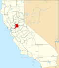
Galt, California

Last updated

Galt, California
Aerial view of Galt, August 2018.JPG
Aerial view of Galt
Sacramento County California Incorporated and Unincorporated areas Galt Highlighted 0628112.svg
Location of Galt in Sacramento County, California
Usa edcp relief location map.png
Red pog.svg
Galt, California
Location in the contiguous United States
Coordinates: 38°15′39″N121°18′11″W / 38.26083°N 121.30306°W / 38.26083; -121.30306
Country Flag of the United States.svg United States
State Flag of California.svg California
County Sacramento
Incorporated August 16, 1946 [1]
Government
   Mayor Shawn Farmer [2]
   Vice Mayor Paul Sandhu [2]
   Chief of Police Brian Kalinowski
   City Treasurer Shaun L. Farrell
  Fire Chief (Cosumnes CSD)Felipe Rodriguez [3]
Area
[4]
  Total
7.16 sq mi (18.54 km2)
  Land7.15 sq mi (18.51 km2)
  Water0.01 sq mi (0.03 km2)  0.18%
Elevation
47 ft (16 m)
Population
 (2020)
  Total
25,383
  Estimate 
(2024) [5]
26,589
  Density3,552.1/sq mi (1,371.5/km2)
Time zone UTC-8 (PST)
  Summer (DST) UTC-7 (PDT)
ZIP code
95632
Area code 209
FIPS code 06-28112
GNIS feature ID0277522
Website http://www.ci.galt.ca.us

Galt is a city in Sacramento County, California, United States. It is part of the Sacramento metropolitan area. The population was 25,383 at the 2020 census, up from 23,647 at the 2010 census. [5]

Contents

History

Galt was founded in 1869 by the Central Pacific Railroad as part of the first transcontinental railroad. [6] The town is named after Galt, Ontario, the hometown of local rancher John McFarland. [7]

Geography

According to the United States Census Bureau, the city has a total area of 5.9 square miles (15 km2), of which 5.9 square miles (15 km2) of it is land and 0.23% is water.

The city is bordered entirely by unincorporated areas of both Sacramento and San Joaquin Counties.

Climate

According to the Köppen Climate Classification system, Galt has a warm-summer Mediterranean climate, abbreviated "Csa" on climate maps. [8]

Demographics

Historical population
CensusPop.Note
1950 1,333
1960 1,86840.1%
1970 3,20071.3%
1980 5,51472.3%
1990 8,88961.2%
2000 19,472119.1%
2010 23,64721.4%
2020 25,3837.3%
2024 (est.)26,589 [5] 4.8%
U.S. Decennial Census [9]

2020

The 2020 United States census reported that Galt had a population of 25,383. The population density was 3,552.1 inhabitants per square mile (1,371.5/km2). The racial makeup of Galt was 50.7% White, 1.9% African American, 1.7% Native American, 4.1% Asian, 0.4% Pacific Islander, 22.8% from other races, and 18.4% from two or more races. Hispanic or Latino of any race were 45.7% of the population. [10]

The census reported that 99.4% of the population lived in households, 0.2% lived in non-institutionalized group quarters, and 0.4% were institutionalized. [10]

There were 8,131 households, out of which 41.7% included children under the age of 18, 58.7% were married-couple households, 6.3% were cohabiting couple households, 22.4% had a female householder with no partner present, and 12.6% had a male householder with no partner present. 16.2% of households were one person, and 8.8% were one person aged 65 or older. The average household size was 3.1. [10] There were 6,424 families (79.0% of all households). [11]

The age distribution was 25.9% under the age of 18, 9.3% aged 18 to 24, 25.8% aged 25 to 44, 25.0% aged 45 to 64, and 14.0% who were 65 years of age or older. The median age was 36.4 years. For every 100 females, there were 95.2 males. [10]

There were 8,304 housing units at an average density of 1,162.0 units per square mile (448.7 units/km2), of which 8,131 (97.9%) were occupied. Of these, 74.3% were owner-occupied, and 25.7% were occupied by renters. [10]

In 2023, the US Census Bureau estimated that 19.7% of the population were foreign-born. Of all people aged 5 or older, 63.0% spoke only English at home, 31.6% spoke Spanish, 2.6% spoke other Indo-European languages, 2.7% spoke Asian or Pacific Islander languages, and 0.1% spoke other languages. Of those aged 25 or older, 84.0% were high school graduates and 21.1% had a bachelor's degree. [12]

The median household income was $86,327, and the per capita income was $36,124. About 4.4% of families and 7.3% of the population were below the poverty line. [13]

2010

At the 2010 census Galt had a population of 23,647. The population density was 3,977.8 inhabitants per square mile (1,535.8/km2). The racial makeup of Galt was 15,639 (66.1%) White, 430 (1.8%) African American, 361 (1.5%) Native American, 815 (3.4%) Asian, 108 (0.5%) Pacific Islander, 4,834 (20.4%) from other races, and 1,460 (6.2%) from two or more races. Hispanic or Latino of any race were 10,113 persons (42.8%). [14]

The census reported that 23,498 people (99.4% of the population) lived in households, 32 (0.1%) lived in non-institutionalized group quarters, and 117 (0.5%) were institutionalized.

There were 7,262 households, 3,516 (48.4%) had children under the age of 18 living in them, 4,431 (61.0%) were opposite-sex married couples living together, 895 (12.3%) had a female householder with no husband present, 465 (6.4%) had a male householder with no wife present. There were 431 (5.9%) unmarried opposite-sex partnerships, and 32 (0.4%) same-sex married couples or partnerships. 1,171 households (16.1%) were one person and 547 (7.5%) had someone living alone who was 65 or older. The average household size was 3.24. There were 5,791 families (79.7% of households); the average family size was 3.62.

The age distribution was 7,347 people (31.1%) under the age of 18, 2,262 people (9.6%) aged 18 to 24, 6,344 people (26.8%) aged 25 to 44, 5,414 people (22.9%) aged 45 to 64, and 2,280 people (9.6%) who were 65 or older. The median age was 32.4 years. For every 100 females, there were 97.4 males. For every 100 females age 18 and over, there were 94.3 males.

There were 7,678 housing units at an average density of 1,291.6 per square mile, of the occupied units 5,344 (73.6%) were owner-occupied and 1,918 (26.4%) were rented. The homeowner vacancy rate was 2.3%; the rental vacancy rate was 5.2%. 17,034 people (72.0% of the population) lived in owner-occupied housing units and 6,464 people (27.3%) lived in rental housing units.

Arts and culture

Civic groups and clubs include:

The city hosts an annual winter bird festival, in conjunction with the Cosumnes River Preserve. [17]

Brewster House is listed on the National Register of Historic Places.

The California Department of Corrections "Boot Camp" School is located in Galt.

Government

Galt operates under an elected council form of government. The Mayor of Galt is peer elected by the entire City Council. Currently, the council members (with end of term in parentheses) are: Mayor Shawn Farmer (2026), Vice Mayor Paul Sandhu (2026), Council Member Bonny Rodriguez (2026), Council Member Tim Reed (2028) and Council Member Mathew Pratton (2028). [18]

In the California State Legislature, Galt is in the 5th senatorial district , represented by Democrat Jerry McNerney, and the 9th Assembly district , represented by Republican Heath Flora. [19]

In the United States House of Representatives, Galt is in California's 9th congressional district , represented by Democrat Josh Harder. [20]

Education

Galt Joint Union Elementary School District operates the city's public elementary and intermediate schools, and Galt Joint Union High School District operates the city's public high schools.

Media

Galt has had a weekly newspaper, The Galt Herald , since 1904.

Infrastructure

The local fire department is owned and operated by the Cosumnes Community Services District. [21]

Notable people

References

  1. "California Cities by Incorporation Date". California Association of Local Agency Formation Commissions. Archived from the original (Word) on November 3, 2014. Retrieved August 25, 2014.
  2. 1 2 "City Council". City of Galt, California. Archived from the original on October 12, 2017. Retrieved January 4, 2015.
  3. Macdonald, Cameron. "Rodriguez becomes Cosumnes fire chief". Elk Grove Citizen. Archived from the original on January 26, 2021. Retrieved March 24, 2021.
  4. "2020 U.S. Gazetteer Files". United States Census Bureau. Retrieved October 30, 2021.
  5. 1 2 3 "QuickFacts: Galt city, California". US Census Bureau. Retrieved May 21, 2025.
  6. "Galt History | Galt, CA".
  7. Gudde, Edwin G. (2004). California place names: The origin and etymology of current geographical names. Berkeley and Los Angeles, California: University of California Press. p. 140. ISBN   978-0-520-24217-3.
  8. "Galt, California Köppen Climate Classification (Weatherbase)". Weatherbase.
  9. "Census of Population and Housing". Census.gov. Retrieved June 4, 2015.
  10. 1 2 3 4 5 "Galt city, California; DP1: Profile of General Population and Housing Characteristics - 2020 Census of Population and Housing". US Census Bureau. Retrieved May 21, 2025.
  11. "Galt city, California; P16: Household Type - 2020 Census of Population and Housing". US Census Bureau. Retrieved May 21, 2025.
  12. "Galt city, California; CP02: Comparative Social Characteristics in the United States - 2023 ACS 5-Year Estimates Comparison Profiles". US Census Bureau. Retrieved May 21, 2025.
  13. "Galt city, California; DP03: Selected Economic Characteristics - 2023 ACS 5-Year Estimates Comparison Profiles". US Census Bureau. Retrieved May 21, 2025.
  14. "2010 Census Interactive Population Search: CA - Galt city". U.S. Census Bureau. Archived from the original on July 15, 2014. Retrieved July 12, 2014.
  15. http://galthistory.org/
  16. http://pawsweb.org/
  17. "12TH Annual Winter Bird Festival | Galt, CA".
  18. "City Council | Galt, CA". www.cityofgalt.org.
  19. "Statewide Database". UC Regents. Archived from the original on February 1, 2015. Retrieved January 4, 2015.
  20. "California's 9th Congressional District - Representatives & District Map". Civic Impulse, LLC. Retrieved March 9, 2013.
  21. "Fire Department History - CSD Fire". Archived from the original on December 19, 2011. Retrieved November 17, 2011.