
Leadville is a statutory city that is the county seat, the most populous community, and the only incorporated municipality in Lake County, Colorado, United States. The city population was 2,633 at the 2020 census. It is situated at an elevation of 10,158 feet (3,096 m). Leadville is the highest incorporated city in the United States and is surrounded by two of the tallest peaks in the state.

Butte County is a county located in the northern central part of the U.S. state of California. In the 2020 census, its population was 211,632. The county seat is Oroville.
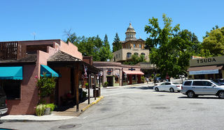
Auburn is a city in and the county seat of Placer County, California, United States. Its population was 13,776 during the 2020 census. Auburn is known for its California Gold Rush history and is registered as a California Historical Landmark.

Calico is a ghost town and former mining town in San Bernardino County, California, United States. Located in the Calico Mountains of the Mojave Desert region of Southern California, it was founded in 1881 as a silver mining town, and was later converted into a county park named Calico Ghost Town. Located off Interstate 15, it lies 3 miles (4.8 km) from Barstow and 3 miles from Yermo. Giant letters spelling CALICO are visible, from the highway, on the Calico Peaks behind it. Walter Knott purchased Calico in the 1950s, and rebuilt all but the five remaining original buildings to look as they did in the 1880s. Calico received California Historical Landmark #782, and in 2005 was proclaimed by then-Governor Arnold Schwarzenegger to be California's Silver Rush Ghost Town.

Bodie is a ghost town in the Bodie Hills east of the Sierra Nevada mountain range in Mono County, California, United States. It is about 75 miles (121 km) southeast of Lake Tahoe, and 12 mi (19 km) east-southeast of Bridgeport, at an elevation of 8,379 feet (2554 m). Bodie became a boom town in 1876 after the discovery of a profitable vein of gold; by 1879 it had established 2,000 structures with a population of roughly 8,000 people.

Robert Takeo Matsui was an American politician from the state of California. Matsui was a member of the Democratic Party and served in the U.S. House of Representatives as the congressman for California's 5th congressional district from 1979 until his death at the end of his 13th term.

The Folsom Lake State Recreation Area surrounds Folsom Lake in the foothills of the Sierra Nevada. The majority of it is owned by the U.S. Bureau of Reclamation and is managed by the California Department of Parks and Recreation. It is located near the city of Folsom, California, about 25 miles (40 km) east of Sacramento.
Genoa is an unincorporated town in Douglas County, Nevada, United States. Founded in 1851, it was the first settlement in what became the Nevada Territory. It is situated within Carson River Valley and is approximately 42 miles (68 km) south of Reno. The population was 939 at the 2010 census. It is home to the oldest bar in the state of Nevada which opened in 1853.

State Route 49 is a north–south state highway in the U.S. state of California that passes through many historic mining communities of the 1849 California gold rush and it is known as the Golden Chain Highway. The highway's creation was lobbied by the Mother Lode Highway Association, a group of locals and historians seeking a single highway to connect many relevant locations along the Gold Rush to honor the 49ers. One of the bridges along SR 49 is named for the leader of the association, Archie Stevenot.

New Idria was an unincorporated town in San Benito County, California. It was named after the New Idria Mercury Mine, which closed in 1972, resulting in a ghost town.

Shasta is a census-designated place (CDP) in Shasta County, California, United States. Shasta sits at an elevation of 843 feet (257 m). Its population is 1,043 as of the 2020 census, down from 1,771 from the 2010 census.
The Black Diamond Mines Regional Preserve is a 6,000-acre (2,400 ha) park located north of Mount Diablo in Contra Costa County, California under the administration of the East Bay Regional Park District (EBRPD). The district acquired the property in 1973. The preserve contains relics of 3 mining towns, former coal and sand mines, and offers guided tours of a former sand mine. The 60 miles (97 km) of trails in the Preserve cross rolling foothill terrain covered with grassland, California oak woodland, California mixed evergreen forest, and chaparral.
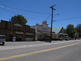
French Corral is an unincorporated community approximately five miles west of California State Highway 49 in Nevada County, California, United States.

Stege, founded in 1876, was an unincorporated community in western Contra Costa County, California, United States. The town has now been annexed and absorbed by the cities of Richmond and El Cerrito, California. It was located on the Southern Pacific Railroad 1.5 miles (2.4 km) south-southeast of downtown Richmond, at an elevation of 23 feet. The site is now located in the area known as the Richmond Annex, at coordinates: 37°55′00″N122°19′38″W.
North Bloomfield is a small unincorporated community located in Nevada County, California.
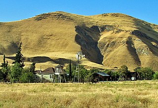
Blue Mountain City is a former settlement in Calaveras County, California, along Licking Fork, approximately 20 miles (32 km) northeast of Mountain Ranch. The town was built on a flat bench of land above the mining camp which perched on a steep canyon slope on the west side of Licking Fork, just over a mile downstream from the headwaters. The town was first announced in January, 1863. The Heckendorn Gold and Silver Mining Company was organized by July, with C. C. Bowman as its secretary. A post office operated in Blue Mountain from 1863 to 1864.
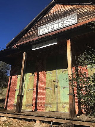
Red Dog was a California gold rush mining town located in the Gold Country in south-central Nevada County, California, United States, 6 mi (9.7 km) northeast of Chicago Park. Red Dog Hill, a mine and campsite, was founded by three men all under the age of 22, and was named by their youngest, a 15-year-old prospector. As mining operations grew, the campsite became a settlement, and then a town with a population of 2,000 residents, before it was eventually abandoned. Still considered important today, Red Dog Townsite is listed on the National Register of Historic Places.
Poeville, also known as Peavine until 1863, is the site of a historical mining town, established in 1864. John Poe, a professional promoter from Michigan allegedly related to Edgar Allan Poe, discovered rich gold and silver veins in 1862 on the slopes of Peavine Mountain. After the discovery of ore, Poe announced that the veins comprised the next Comstock Lode; he presented extracted ore at the state fair of 1864 as rich in content. As a result, the former mining camp, called Poe City (Poeville) or Podunk (Poedunk), grew to 200 people by 1864. Ore production in the mining district and population peaked around 1873-1874 with several hundred people living in town, supported by three hotels and a post office. The post office, named "Poeville", operated between September 1, 1874, and March 24, 1878. As of 2010 the population of the community is 0.

Kirwin is a ghost town in Park County, Wyoming, United States. Its post office has been closed.

Tower House, California was a mining town in Shasta County. The mining District of Tower House was placed on the National Register of Historic Places on July 2, 1973, as #73000257 as the Tower House Historic District. The Tower House Historic District is located just west of the Whiskeytown National Recreation Area. The town started as a California Gold Rush camp. The town is named after Levi Tower, who built the Tower House Hotel and helped establish the town.

