
Foothill Farms is a census-designated place (CDP) and unincorporated community in Sacramento County, California, USA. It is part of the Sacramento–Arden-Arcade–Roseville Metropolitan Statistical Area. The population was 33,121 at the 2010 census, up from 17,426 at the 2000 census. Foothill Farms is part of the greater North Highlands-Foothill Farms community, and comprises the zip codes 95841 and 95842. Susan Ual services as President of the New Foothill Farms Community Association while Michael Baker services as the President of the Old Foothill Farms Community Association
www.oldfoothillfarms.org

Dunnigan is a census-designated place in Yolo County, California on Interstate 5. The population was 1,416 at the 2010 census. Dunnigan's ZIP code is 95937 and its area code 530. It lies at an elevation of 69 feet.
Newcastle is an unincorporated community and census-designated place (CDP) in Placer County, California. Nestled in the Sierra Nevada foothills, Newcastle is located 8 miles (12.9 km) northeast of Rocklin and 31 miles northeast of Sacramento. Newcastle generally has moderate winters and warm summers.
Yolo is an unincorporated community and census-designated place in Yolo County, California. It is located 4.9 miles northwest of the county seat, Woodland and 24 miles northwest of the state capital of Sacramento. Yolo's ZIP Code is 95697 and its area code 530. It lies at an elevation of 82 feet. The population was 421 at the 2020 census.

Herald is a census-designated place in Sacramento County, California. Herald sits at an elevation of 79 feet (24 m). It is located east of the city of Galt along State Route 104. The ZIP Code is 95638, and the community is inside area code 209. The 2010 United States census reported that Herald's population was 1,184.
Woodbridge is a census-designated place in San Joaquin County, California. Woodbridge sits at an elevation of 43 feet (13 m). The 2010 United States census reported Woodbridge's population was 3,984. Founded in the 1850s, the town is listed as a California Historical Landmark.

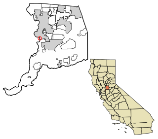
Gerber is a census-designated place (CDP) in Tehama County, California. Gerber sits at an elevation of 226 feet (69 m). The 2010 United States census reported Gerber's population was 1,060.

Courtland is a census-designated place in Sacramento County, California, United States. Courtland is located along the Sacramento River 17 miles (27 km) south-southwest of Sacramento. Courtland has a post office with ZIP code 95615, which was established in 1872. Courtland was named after Courtland Sims, son of James V. Sims, a landowner who opened a steamer landing in the community in 1870.
Elverta is a census-designated place in Sacramento County, California. It is part of the Sacramento metropolitan area, which includes Sacramento, Arden-Arcade, and Roseville. It is about 20 miles (32 km) from Sacramento, 2.5 miles (4.0 km) from Rio Linda, 6 miles (9.7 km) from Roseville, and 8.0 miles (12.9 km) from Antelope. The population was 5,492 as of the 2010 census.
Sultana is a census-designated place in Tulare County, California, United States. Sultana is 2.5 miles (4.0 km) east of Dinuba. Sultana has a post office with ZIP code 93666. The population was 775 at the 2010 census.
Waukena is a census-designated place in Tulare County, California, United States. Waukena is located on California State Route 137 4 miles (6.4 km) northeast of Corcoran. Waukena has a post office with ZIP code 93282. The population was 108 at the 2010 census. Its name is possible derived from an archaic English interpretation of the Spanish name Joaquina.
Thornton is a census-designated place (CDP) in San Joaquin County, California, United States. Thornton is located along Interstate 5 7 miles (11 km) west-southwest of Galt. Thornton has a post office with ZIP code 95686.
Freeport, California is a census-designated place located approximately 7.5 miles (12.1 km) south of downtown Sacramento on California State Route 160. Freeport lies on the eastern banks of the Sacramento River in Sacramento County. The population was 58 at the 2020 census.
McClellan Park is a census-designated place (CDP) in Sacramento County, California. McClellan Park sits at an elevation of 69 feet (21 m). The 2010 United States Census reported that McClellan Park's population was 743. It is the site of the former McClellan Air Force Base, closed by the federal government in 2003. McClellan Air Force Base was named in honor of test pilot Hezekiah McClellan. According to the United States Census Bureau, the CDP covers an area of 4.1 square miles (10.5 km2), all of it land. Its closest neighbor is North Highlands.

Fruitridge Pocket is a census-designated place in Sacramento County, California. Fruitridge Pocket sits at an elevation of 33 feet (10 m). The 2010 United States census reported Fruitridge Pocket's population was 5,800.

Lemon Hill is a census-designated place in an unincorporated area of Sacramento County, California, south of the city of Sacramento. Lemon Hill sits at an elevation of 30 feet (9.1 m). The 2010 United States census reported Lemon Hill's population was 13,729.
Parkway is a Census-designated place in Sacramento County, California. Parkway sits at an elevation of 20 feet (6.1 m). The 2010 United States census reported Parkway's population was 14,670.

Terminous is a census-designated place in San Joaquin County, California. Terminous sits at an elevation of 7 feet (2.1 m) below sea level. It is located on the Terminous Tract, an island of the Sacramento–San Joaquin River Delta. The 2010 United States census reported Terminous's population as 381.
Plainview is a census-designated place (CDP) in Tulare County, California. Plainview sits at an elevation of 354 feet (108 m). The 2010 United States census reported Plainview's population was 945.
West Goshen is a census-designated place (CDP) in Tulare County, California. West Goshen sits at an elevation of 272 feet (83 m). The 2010 United States census reported West Goshen's population was 511.


